Prescribed burns
The benefits of prescribed burning and how you can get approval to carry out a burn in Ontario’s forests.
Prescribed burns – 2024
Prescribed burns are carefully planned and conducted to minimize the chance of wildland fires.
We have plans for prescribed burns in the following areas:
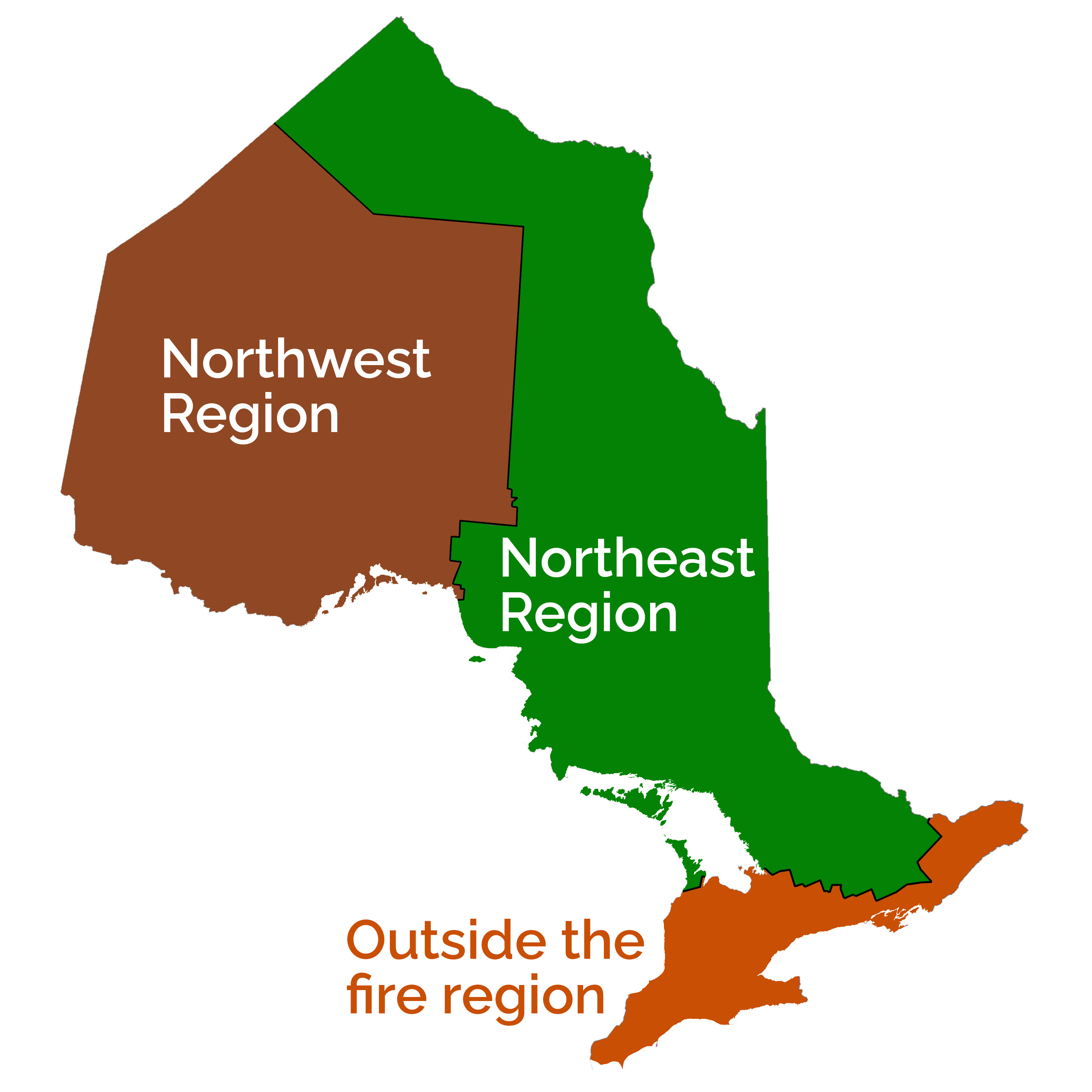
Outside Fire Region
Northeast Region
- Beaton Lake – Wawa District
- Whitefish Lake – Algonquin Provincial Park – Haliburton District
- Sinton Creek – Sudbury District
Northwest Region
- Fort William First Nation – Thunder Bay District
- Nelson Lake Blowdown – Fort Frances District
- Lawrence Lake Blowdown – Fort Frances District
- Mishkeegogamaang Independent First Nation – Sioux Lookout District
- Hooker Lake - St. Raphael Provincial Park – Sioux Lookout District
- Wabaseemoong Independent First Nation – Kenora District
Outside Fire Region
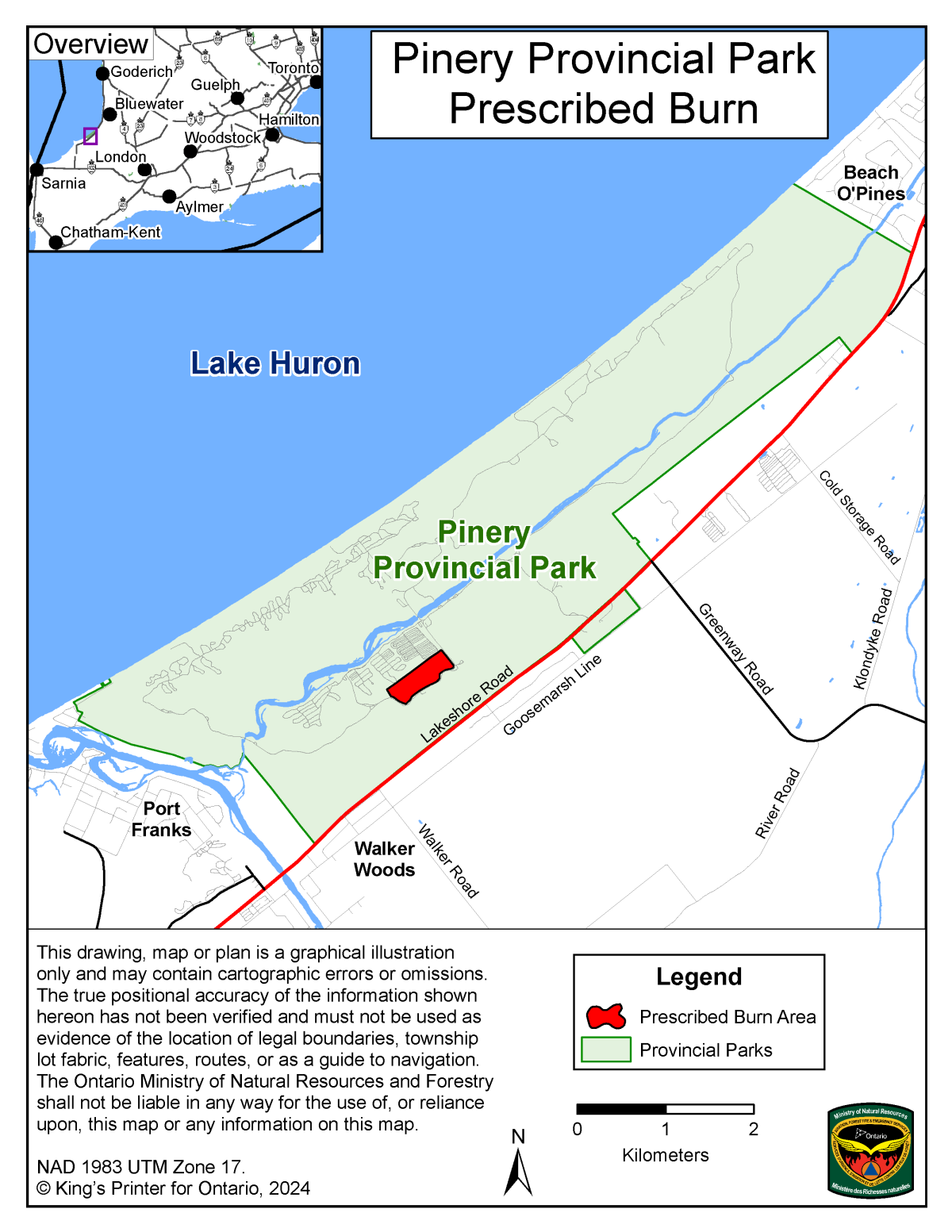
Pinery Provincial Park
This burn will create 21 burn plots, between 0.3 and 0.5 hectares in size, for fire investigation field training. The prescribed fire is needed to create fire direction indicators on existing vegetation and other onsite items.
These burn plots help the park apply prescribed fire to the ecosystem, which helps maintain forest health.
Northeast Region
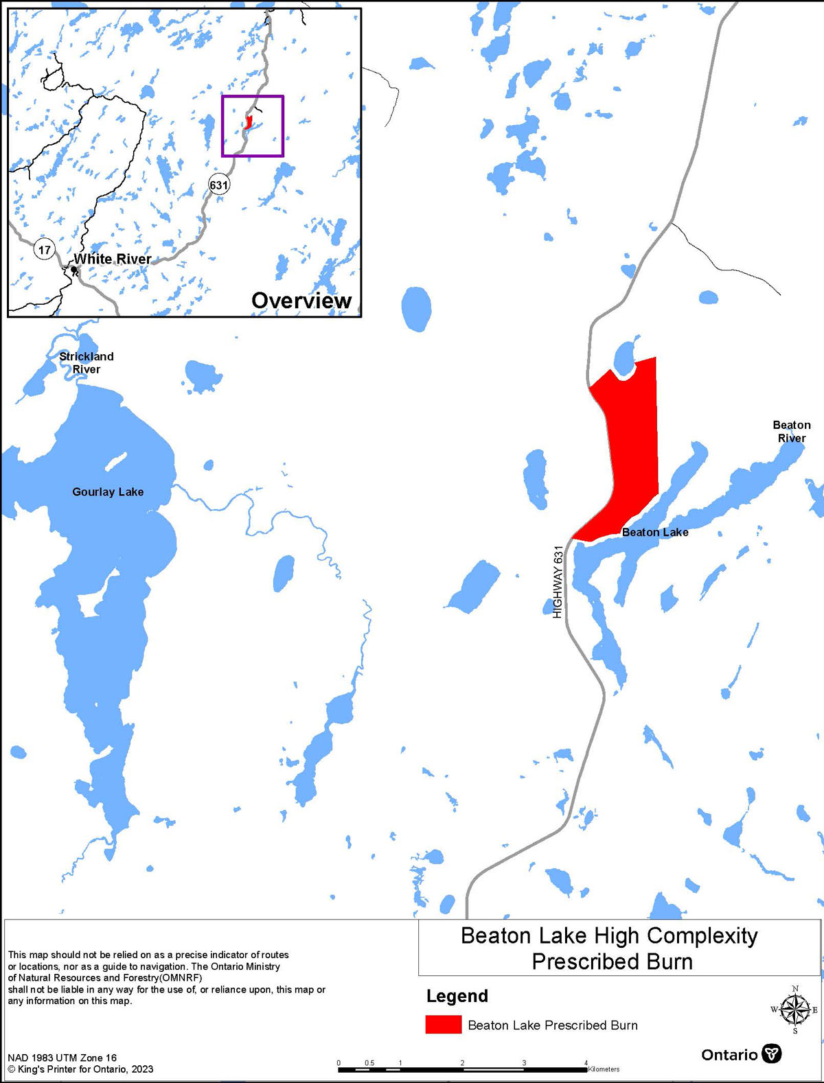
Beaton Lake – Wawa District
This prescribed burn will remove duff and young balsam fir from a previously harvested area. This will create suitable microsites for the regeneration of other conifer and hardwood species. This burn is planned for fall of 2024.
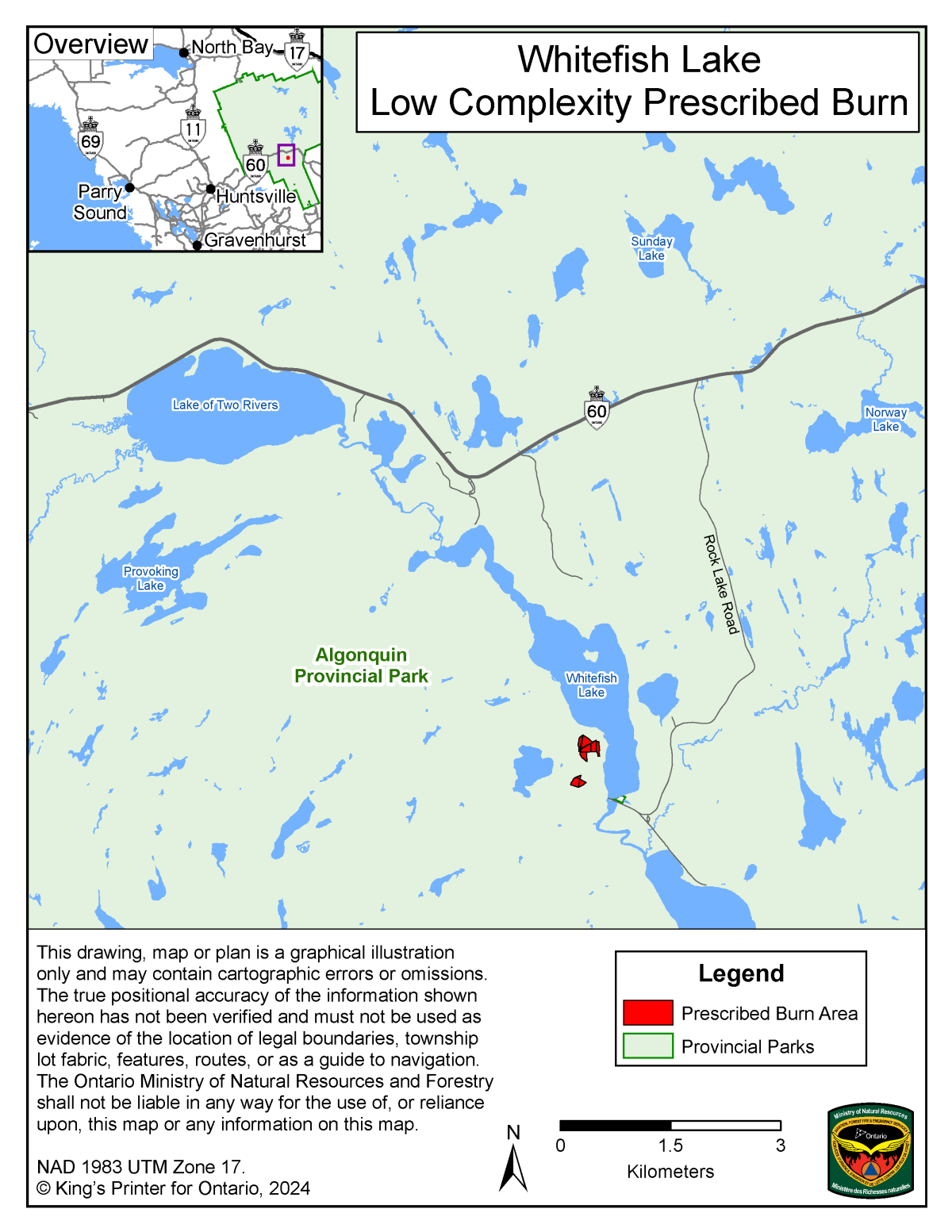
Whitefish Lake – Algonquin Provincial Park – Haliburton District
Prescribed fire will be introduced to maintain a cultural site. The site was the location of the former McRae Lumber Mill, established in 1957 and relocated to Whitney in 1979. Most evidence of the mill was removed.
Since the mill was relocated, forbs and grasses have grown in the area, with some conifer encroaching. The Old Railway Bike Trail, which is adjacent to the mill site, provides interpretation of this area and history of the mill. A prescribed burn would contribute to public awareness, understanding and appreciation of this cultural feature.
The Whitefish Mills site also hosts a notable population of milkweed in Algonquin Park. Monarch caterpillars feed on milkweed plants, so habitat for this special concern species is limited by milkweed plant availability. The prescribed burn would remove encroaching woody species and continue to provide open habitats for milkweed.
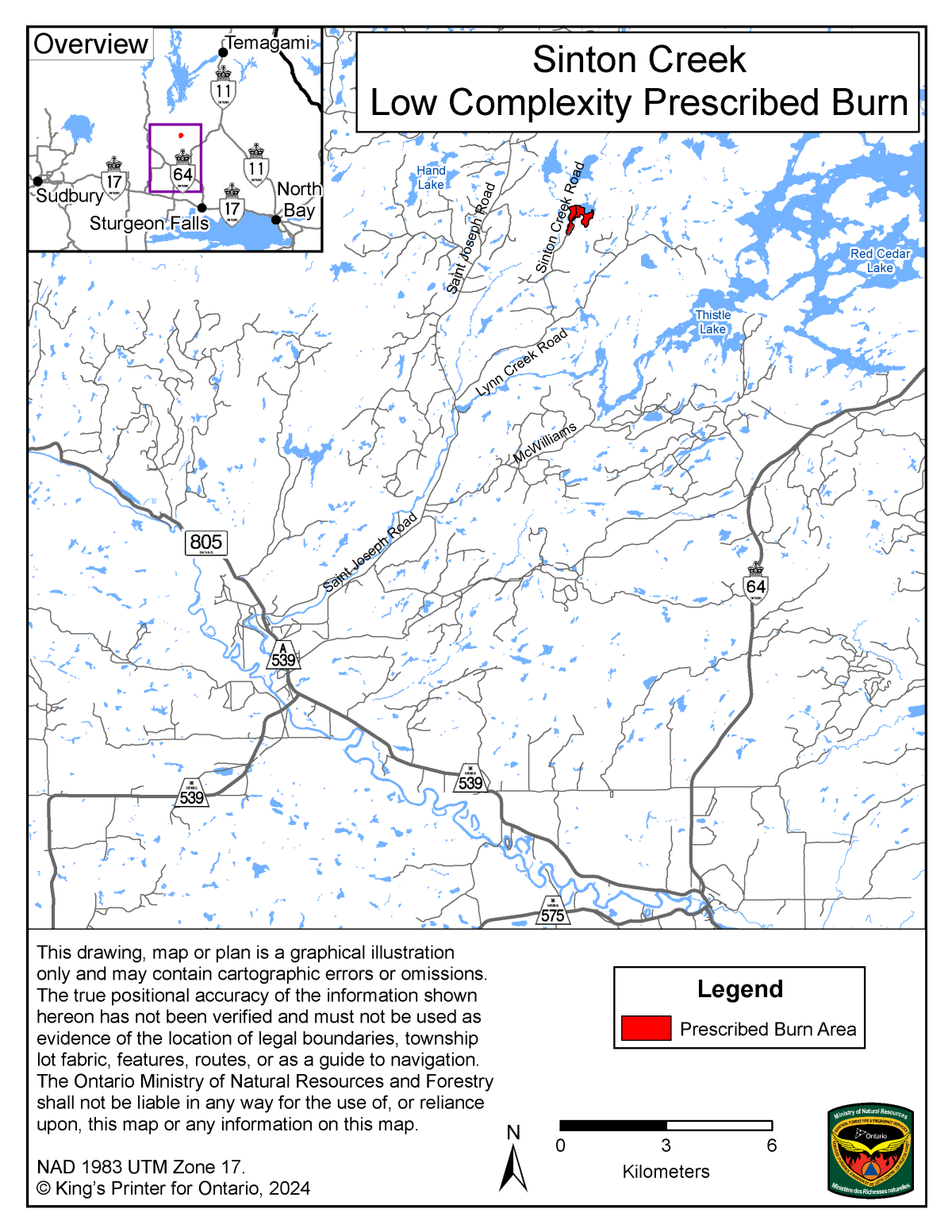
Sinton Creek – Sudbury District
This prescribed burn will provide a forest management treatment by applying fire to 26 hectares.
The goal is consumption of the needle litter layer and a reduction of the duff layer. This will prepare and improve the seedbed for natural White Pine regeneration.
Northwest Region
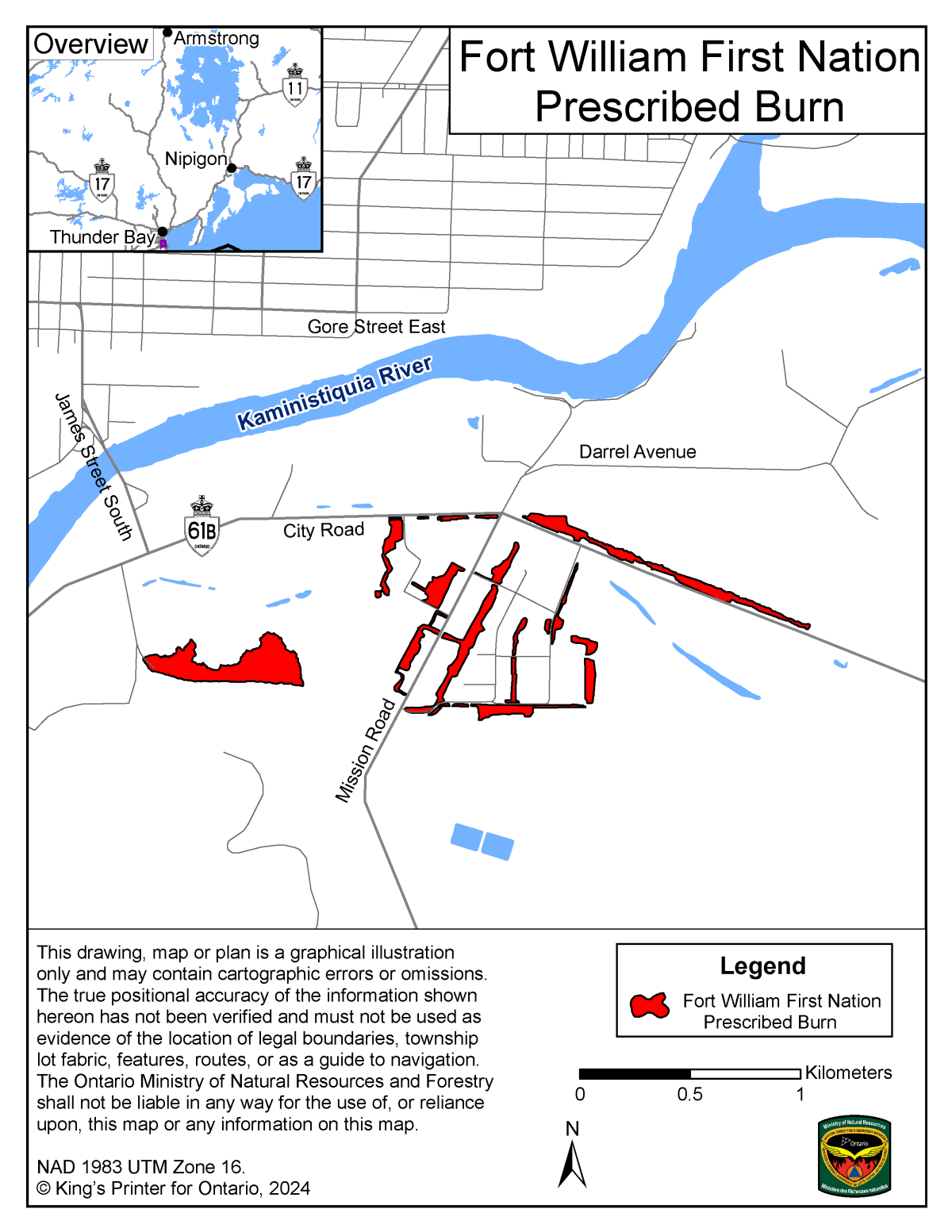
Fort William First Nation – Thunder Bay District
This is the seventh year of conducting this Low Complexity Hazard Reduction Burn to remove accumulated dried grasses and help provide for community safety. Aviation, Forest Fire and Emergency Services (AFFES) crews will use hand ignition to ignite a variety of small plots throughout the community. Community members, AFFES staff and fire engines will be used to provided suppression support. Smoke in the community will be managed by monitoring weather and using appropriate ignition tactics.
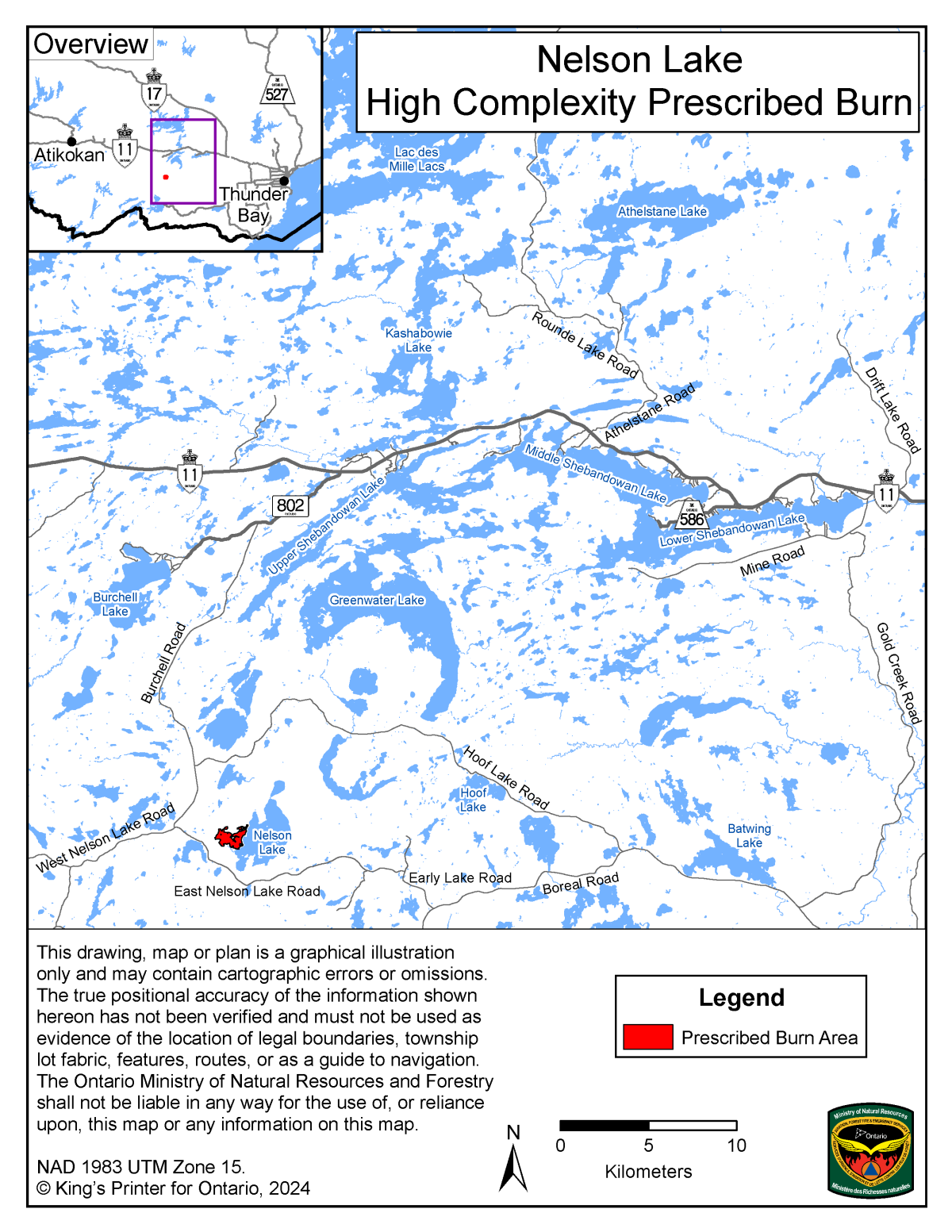
Nelson Lake Blowdown – Thunder Bay District
Prescribed fire will be introduced to this site to prepare the naturally and mechanically disturbed areas. This will ensure a productive even-aged conifer stand.
This site will be planted with Red and Jack Pine to assist in meeting the forest management goals.
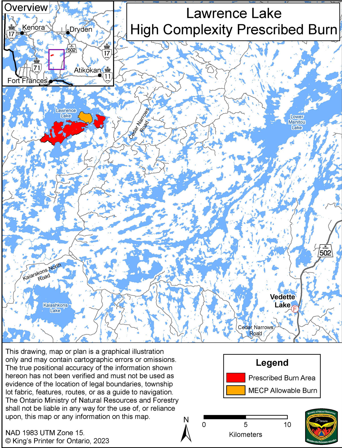
Lawrence Lake high complexity prescribed burn – Fort Frances District
This prescribed burn will provide a forest management treatment by applying fire to 683 hectares of mixed-species and conifer forest. This forest was heavily damaged by a tornado that touched down in the area in the year 2020. The strong tornado winds levelled much of the forest area here, causing blowdown and snapped off stems. Prescribed fire will help this forest return to a healthier state more quickly. Significant water boundaries will enable a safe burn to be done with a low risk of escape. This burn is planned for late summer or fall of 2024.
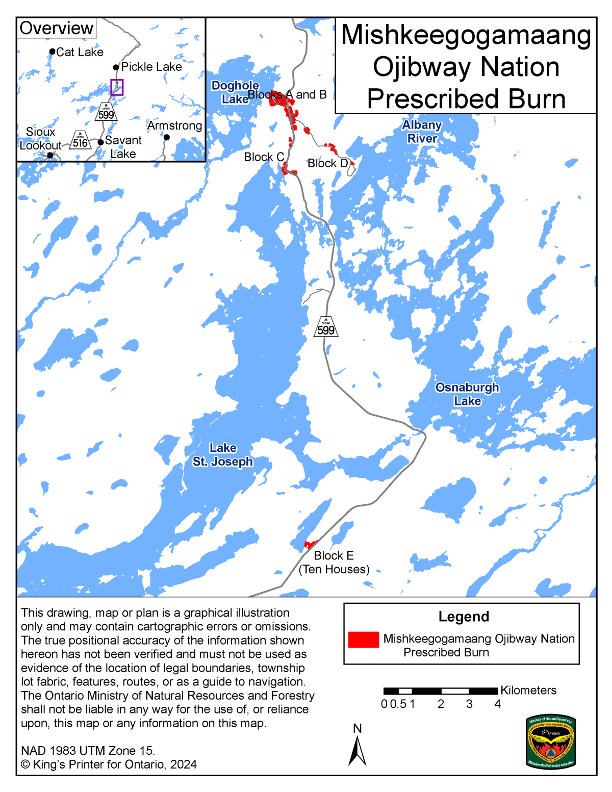
Mishkeegogamaang Independent First Nation – Sioux Lookout District
This spring hazard reduction burn will remove dry grass fuels to enhance community safety. Trained community members will work with AFFES staff to ignite and monitor selected areas. Community involvement will foster a partnership which will work towards a strategy of prevention, fuels awareness and fire safety. Smoke amounts in the area of Highway 599 will be managed by appropriate ignition. A fall burn may also occur in 2024.
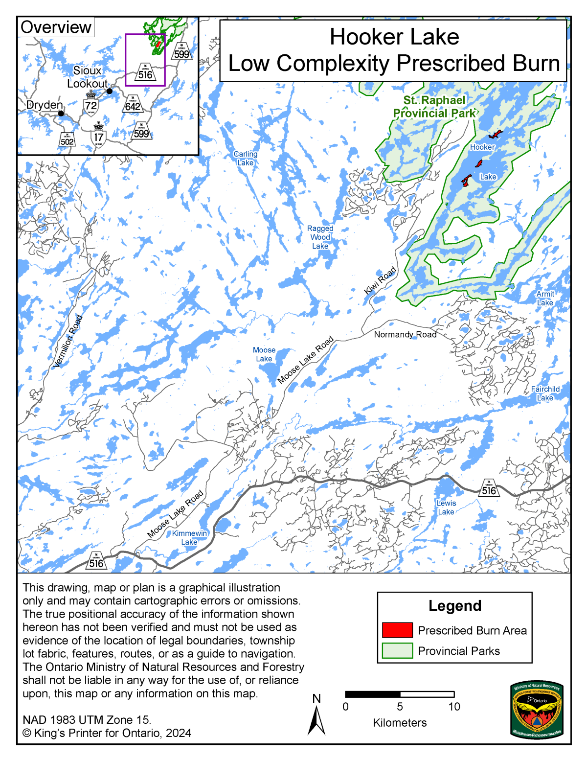
Hooker Lake – St. Raphael Provincial Park – Sioux Lookout District
Prescribed burning at this site will reintroduce fire to the landscape. The primary purpose is to promote the health of naturally occurring Red Pine, in a stand which is of provincial significance due to its age, purity and location north of the normal range limit for Red Pine.
Stand and ecosystem health will be positively affected through:
- managing the population of competitive species (primarily Balsam Fir)
- reduction of downed woody material
- partial removal of the needle (litter) layer and other duff
This will open up a receptive seedbed to promote Red Pine seedling regeneration.
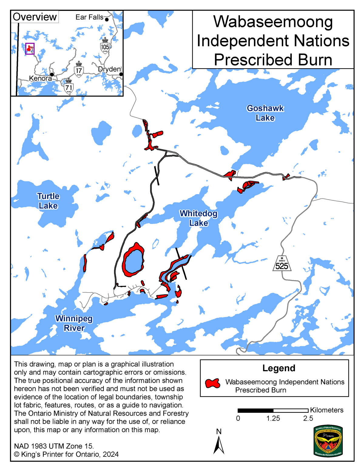
Wabaseemoong Independent First Nation – Kenora District
This spring hazard reduction burn removed dry grass fuels to enhance community safety. Trained community members worked with AFFES staff to ignite and monitor selected areas. Community involvement will continue through a partnership which will work towards a strategy of prevention, fuels awareness and fire safety.
Wind conditions were evaluated prior to ignition to limit any smoke impacts to the community and residents.
Accessibility
The benefits
A prescribed burn deliberately uses fire in a specific area under certain conditions to accomplish:
- forest management
- wildlife management
- hazard reduction
- other land and resource management objectives
Prescribed burns can:
- clear forest areas to prepare for planting
- remove undesirable plants that compete with wanted species for nutrients
- remove undergrowth and allow sunlight to reach the forest floor, encouraging the growth of selected species
- control insect pests and diseases
- make nutrients more readily available to the ecosystem
- develop and enhance wildlife habitat (for example, new nesting sites for birds in standing trees, habitat for small mammals where trees have fallen to the ground and where new growth has been stimulated from nutrient release from decaying trees)
- manage and maintain ecosystems in wilderness areas to conduct research
Law/rules
By law, you need approval from the ministry to carry out a prescribed burn:
- in Ontario’s fire regions
- on land managed by the ministry
- when the ministry is involved in the planning or delivery of the burn
If you prepare a burn, you and your partners are responsible for the full cost of planning and delivery.
Prescribed burn operators must ensure that controls are in place to protect staff, partners, property and the public.
These controls include the following:
- trained and qualified staff are required at all levels of the prescribed burn organization
- people involved in prescribed burn operations must receive an operational briefing and fully understand their roles and responsibilities before the burn occurs
- effective communications must be maintained at all stages of the prescribed burn operation
You must also ensure the appropriate public liability insurance for the type of prescribed burns is in place in the event of damage to third parties. You should contact an insurance professional to ensure that your liability insurance coverage is adequate.
Rules for the application of fire on a small scale (for example, for cooking or warmth, to burn debris or to burn small areas of grass < 1 ha.) are covered by the Forest Fires Prevention Act, Outdoor Fires Reg. 207/96 and are not considered to be prescribed burns.
How to apply
If you want to conduct a prescribed burn, follow these steps:
Step 1: contact us to receive the appropriate forms.
Northwest Region
Ian Staley
Prescribed Fire and Behaviour Specialist
Office:
Cell:
ian.staley@ontario.ca
Northeast and Outside Fire Region
Derek Lemke
Prescribed Fire and Behaviour Specialist
Cell:
derek.lemke@ontario.ca
If you need any of this information in an alternate format, please let us know.
Step 2: complete a complexity assessment to determine the type of prescribed burn.
Step 3: complete the appropriate application form to carry out one of four types of prescribed burns:
- low complexity
- high complexity
- rail way right-of-way
- slash pile burning
Step 4: submit completed application form and complexity assessment for approval to your local fire management office. Low complexity burns should be submitted six months prior to intended ignition date, while high complexity prescribed burns should be submitted nine months prior to intended ignition date.
Step 5: the ministry will review the application and complexity assessment to ensure that the prescribed burn will:
- meet the proponent’s objectives and will be conducted in a safe and efficient way
- be operationally feasible
- comply with ministry management strategies and regulations
- serve and protect the needs and concerns of the public
Step 6: if your application is approved, you need to submit a burn plan at least 60 days in advance for low complexity and 75 days in advance for high complexity prescribed burns before the intended ignition date and have it fully approved 30 days before ignition.
Step 7: if your burn plan is approved, you cannot undergo any major revisions later than 14 days prior to the burn