Wildlife Management Unit Map 3 – Northern Ontario
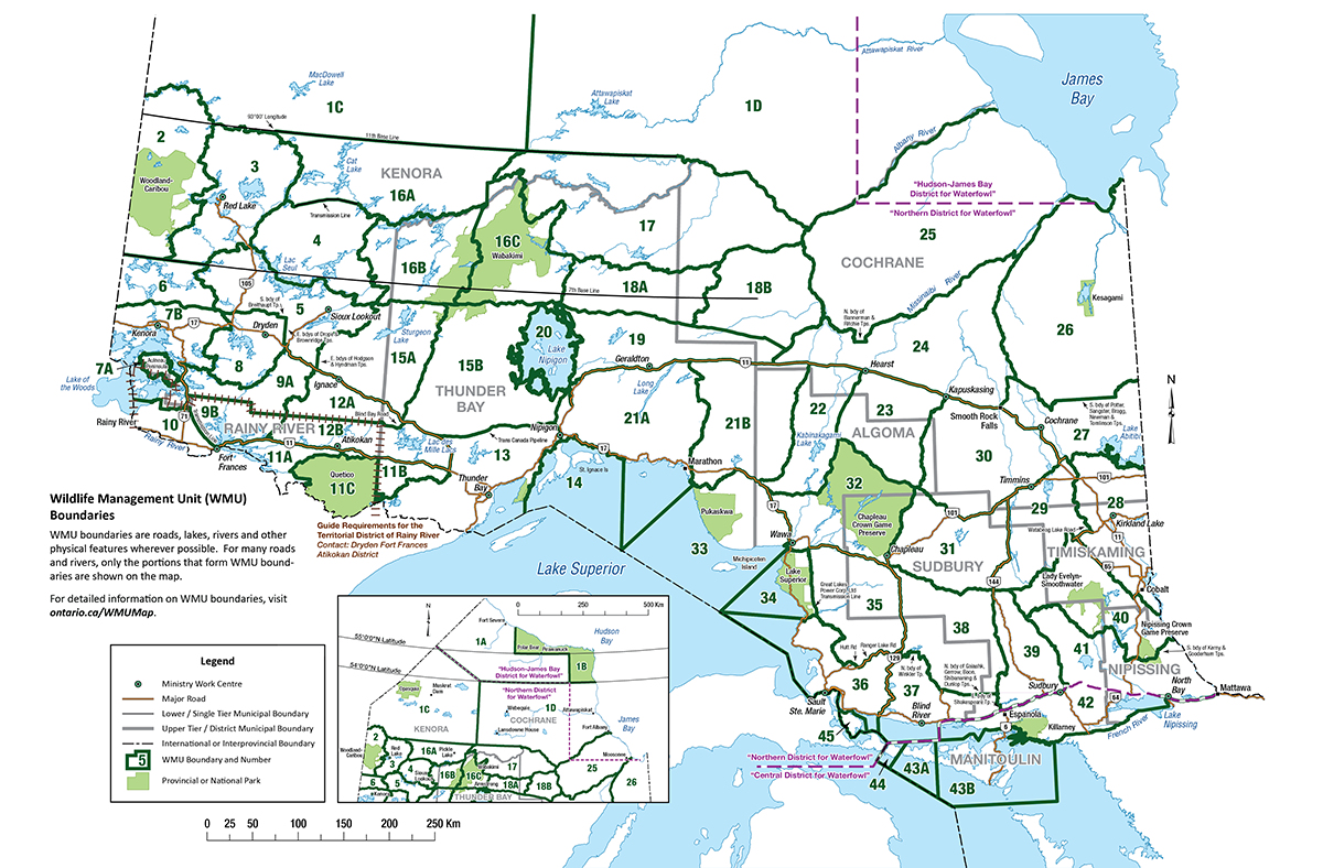
Wildlife Management Unit (WMU) boundaries
WMU boundaries are roads, lakes, rivers and other physical features wherever possible. For many roads and rivers, only the portions that form WMU boundaries are shown on the map.
For detailed map information on WMU boundaries, visit find a wildlife management unit (WMU) map.
Guide requirements for the territorial district of Rainy River contact: Fort Frances District.
Updated: March 31, 2025
Published: August 02, 2019