Nagagami Lake Provincial Park Management Statement
This document provides policy direction for the protection, development and management of Nagagami Lake Provincial Park and its resources.
January, 1985
Regional Director’s approval statement
I am pleased to approve this Interim Management Statement for Nagagami Lake Provincial Park.
This statement will provide direction for the management of Nagagami Lake Provincial Park until a Park Management Plan is completed. It will also set the general direction for the preparation of the more detailed management policies that the Management Plan will contain.
R. A. Riley
Regional Director
Northern Region
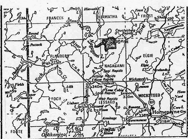
Location of reduced Survey Plan upon approval of regulation
- Name: Nagagami Lake Provincial Park
- Proposed class: Nature Reserve
- M.N.R. District: Hearst
- M.N.R. Region: Northern
- Area (ha.): 1481
- Site Region: 3e (Lake Abitibi)
- Date in Regulation: [no information provided]
Life science target
- Site type/landscape unit: Medium Shoreline
- Species/communities: Good representation of the medium lake shoreline including floristically significant species
- Site type/landscape unit: Riparian
- Species/communities: River riparian features at Nagami have greatest potential for preservation in the site region
Earth science target
- Geological theme: N/A
- Feature: Record of postglacial evolution of lacustrine shoreline on sandy segments within the basin of glacial Lake Barlow-Ojibway
Cultural resource target
- Theme: N/A
- Theme segment: N/A
Recreation opportunities target
- Day use: N/A
- Car camping: N/A
- Wilderness back country: Foch/Nagami Canoe Route passes through the park
Inventories
| Level type | Earth Science | Life science | Cultural | Recreational |
|---|---|---|---|---|
| Reconnaissance completed | Yes | Yes | Yes | N/A |
| Detailed completed | No | Yes | Yes | N/A |
| Required | Yes | No | No | No |
Potential resource target
[no information provided]
Material appended
- DLUG extract - [appended]
- Checksheet
- Other
1.0 Issues
There are no relevant management issues for the park.
2.0 Resource management guidelines
2.1 Aquatic resources
Analysis
The area provides the opportunity to observe vegetative communities and successional sequences associated with natural changes in water levels.
Guidelines
No means of artificially controlling water levels, such as dams, will be permitted downstream on the Nagagami River.
Recommendation
That the guidelines be implemented with the approval of the plan.
2.2 Vegetation
Analysis
A variety of medium shoreline and riparian features are recommended for preservation within this nature reserve class park.
Guidelines
Significant sites will be protected with sufficient buffer to protect the features within them.
Recommendation
That the guidelines be implemented with the approval of the plan.
Analysis
Nagagami Park has already been excluded from the Forest Management Agreement with Ontario Paper.
Guidelines
Commercial forest operations will not be permitted.
Recommendation
The guidelines are already in effect.
Analysis
Human impact on the site is negligible. Consequently the greatest potential threats to park values are natural forces.
Guidelines
Natural fires, diseases and native insects will be left unchecked unless they threaten human life, significant park features or values outside the park.
Recommendation
That the guidelines be implemented with the approval of the plan.
2.3 Wildlife
Analysis
Four commercial tourist camps on Nagagami Lake use the park area, in addition to the remainder of the lake, for sport hunting and sport and bait fishing. The park falls within trapline HE-55.
Guidelines
Since hunting and sport and bait fishing pose no threat to park values, these activities will be permitted.
Since trapping poses no threat to park values, this activity will be permitted.
Recommendation
That the guidelines be implemented with the approval of the plan and following appropriate changes to regulations under the Game and Fish Act.
2.4 Recreation
Analysis
Motorized boating and snowmobiling are associated with current sport hunting sport fishing and trapping.
Guidelines
Since current hunting, fishing and trapping activities rely on motorized transport, motorized boating and snowmobiling will be permitted.
Recommendation
That the guidelines be implemented with the approval of the plan.
4.0 Mineral resources
Analysis
The Nagagami area has moderate mineral potential. The park’s mineral and surface rights have been withdrawn from prospecting staking, sale or lease under the Mining Act.
Guidelines
Exploration and extraction of minerals will not be permitted.
Recommendation
That the guidelines be implemented with the approval of the plan.
5.0 Client services management guidelines
Information: Since Nagagami is not readily accessible to the public, a low-key information package will be developed which will describe access and the significant features. Since the Foch/Nagagami Canoe Route passes through the park, this package should be incorporated with the canoe route description.
Scientific Research: An excellent opportunity for detailed research is provided which pertains to landscape evolution associated with post glacial lacustrine and riparian processes.
This fact will be communicated to those interested in earth and life science features in Nature Reserves. Research will be subject to the conditions outlined in approved pol icy regarding research in Provincial Parks.
Education: The information package for the park will make special note of the values to be protected.
Development: Public forest access roads are not expected to be constructed in the Nagagami Lake area until 1992-96 (estimated). All road proposals in the vicinity of this park will be reviewed in terms of the park objectives and will be managed to maintain low density recreational use.
No development will occur within the park. Trail s are not required since all significant features are adjacent to water access. No campsites will be developed and camping will be discouraged along the canoe route.
Bibliography
Conway, T., 1978 Archaeological Survey of Nagagami Park Reserve.
Frey, E.D., 1 977 Earth Science Survey of Nagagami Park Reserve.
Mcdonald, I., 1 977 Checklist of Vascular plants - Nagagami Park Reserve.
Noble, T.W ., 1980 Life Science Survey of Medium Lake Shoreline Nagagami Lake Park Reserve - and - Comparative Analysis of Riparian and Peatland/Wetland Communities in Various Park Properties.
Ontario Ministry of Natural Resources, Hearst District Land Use Guidelines, 1983.
Ontario Ministry of Natural Resources, Ontario Provincial Parks Planning and Management Policies (Blue Book) 1978.
1. Natural resource: Inventory and evaluation
Life science features
- Nagagami has two types of significant features which make it a candidate for a Nature Reserve class of park (Noble, 1 980). The area fulfills functional considerations required for this park category such as minimal ecosystem modification by man, adequate size and shape for management purposes, and biophysiographic integrity.
These two types of features are medium lake shoreline and riparian plant communities.
- The medium lake shoreline features form a representative landscape unit in the site region. Representation is provided at the following levels - site region, site district, biophysical systems, site type, plant community and plant species. A few plants occurring here are floristically significant, being rare or uncommon in the Clay Belt. They are butterwort, bird’s-eye primrose, fleabane, false asphodel and rattlesnake-root.
- The riparian features are considered to have the greatest potential for preservation within any nature reserve in the site region. Nagagami offers, in addition to site region and site district representation, excellent undisturbed representation of:
- small river riparian biophysical system category
- wet mesic to open water site types
- wetland plant communities
- plant species
Of note are excellent stands of black ash. This small area provides an excellent opportunity for detailed research pertaining to landscape evolution associated with post glacial lacustrine and riparian processes.
- Nagagami’s Peatland Plan/Wetland Communities, although not the best representation in the site region, do occur in a different terrain as an integral secondary feature. Their inclusion in a nature reserve serves to represent two distinct biophysiographic landscape units in the site region. In addition, these communities also serve as a buffer to help protect the other significant features from activities occurring beyond the park boundary.
Earth science features
- Nagagami preserves a mappable record of the post glacial evolution of lacustrine shorelines on sandy sediments within the basin of glacial Lake Barlow-Ojioway, south of the limit of the overriding Late Wisconsinian Cochrane Till of the North Driftwood formation. Al though this pattern is similarly developed in other parks and reserves, the areal extent is greatest in Nagagami (Frey, 1977).
2. Cultural resources: Inventory and evaluation
Archaeological sites
Nagagami contains three achaeological sites which are considered to be of local significance (Conway, 197d). The Chert Beach site is the most notable since it is one of a limited number of sites in the Albany drainage basin which provided flint cobble which was used to make stone tools.
Land use activity for area No. 5: The Nagagami site
| Activity | Acceptable - yes | Acceptable - no | Recommended guidelines |
|---|---|---|---|
| Aggregate Extraction | x | ||
| Agriculture | x | ||
| Bait Fishing | x | It is recommended that existing bait fishing operations be permitted to continue. | |
| Commercial Fishing | x | ||
| Cottaging | x | ||
| Crown Land Recreation | x | N/A | |
| Forestry | x | ||
| Hunting | x | It is recommended that hunting be permitted to continue. | |
| Mining | x | This area is recommended for park status. | |
| Provincial Parks | x | ||
| Roads | x | No roads will be permitted in this area. | |
| Rural Residential | x | ||
| Sport Fishing | x | It is recommended that sport fishing be permitted to continue. | |
| Tourism | x |
No structural developments or dispositions of Crown. Land will be permitted in this area. |
|
| Trapping | x | It is recommended that existing trapping activity be permitted to continue. | |
| Wild life Viewing | x | ||
| Wild Rice Harvesting | x | There are no harvestable stands in the area. | |
| Urban Development | x |
I have read this statement and weighted its recommendations in regards to my area of assigned responsibility. I have made my views known and have participated in the District decision and choice of action.
District approval and signed by:
District Manager
Date: April 27, 1984
Fish & Wildlife Supervisor
Date: April 27, 1984
Field Service Supervisor
Date: April 27, 1984
Forest Management Supervisor
Date: April 26, 1984
Lands & Parks Supervisor
Date: April 26, 1984
District Planner
Date: April 26, 1984