Nakina Moraine Provincial Park Management Statement
This document provides policy direction for the protection, development and management of Nakina Moraine Provincial Park and its resources.
Interim Management Statement
©1999, Queen’s Printer for Ontario
Additional copies of this publication can be obtained only from:
Park Superintendent
Ontario Parks, Ministry of Natural Resources
Nipigon District
5 Wadsworth
P.O. Box 970
Nipigon, ON
P0T 2J0
Telephone: (807) 887-5010
Approval statement
This Interim Management Statement will provide interim direction for the management of Nakina Moraine Provincial Park until a comprehensive Park Management Plan is prepared.
This statement will provide the basis for the subsequent preparation of the Park Management Plan.
I am pleased to approve this Interim Management Statement for Nakina Moraine Provincial Park.
Signed by:
Tim P. Sullivan
Zone Manager, Ontario Parks
North West Zone
Introduction
The purpose of this Interim Management Statement is to identify:
- park values which are to be protected
- resource management prescriptions necessary to protect these values; and
- restrictions on use of natural resources within the park
This Interim Management Statement is not intended to replace a Park Management Plan. Rather it is intended to guide the use of natural resources and related activities within the park until such a time as a Park Management Plan is prepared.
Background information - February 1999
| Name: | Nakina Moraine Provincial Park |
|---|---|
| Proposed Class: | Natural Environment |
| MNR District: | Nipigon |
| MNR Region: | North West |
| Total Area (ha): | 5,319 |
| Land: | 5,269 |
| Water: | 50 |
| Site Region: | 3W |
| Site District: | 4 |
| Date in Regulation: | December 8, 1994 |
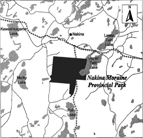
Map: Nakina Moraine Provincial Park Regional Setting
Targets
Life science representation
| site type / landscape unit | species / communities |
|---|---|
Three major landscape types and associated vegetation:
|
|
Earth science representation
| geological theme | feature |
|---|---|
| Temiskaming Interstadial Period (9000-8500 BP) Nakina Moraines / Glacial Lake Nakina Complex | Nakina end moraine with esker complexes, and associated outwash fan marked by drainage channels, eskers, kettles holes, and lacustrine clay and silt deposits |
Cultural resource representation
| theme | theme segment |
|---|---|
| unknown | N/A |
Recreational opportunities
| day use | car camping | wilderness / back country |
|---|---|---|
| N/A | N/A | N/A |
Inventories
| level / type | reconnaissance / completion date | detailed / completion date | required? |
|---|---|---|---|
| earth science | 1980 | 1994 | |
| life science | 1980 | 1994 | |
| cultural | Yes | ||
| recreational | Yes | ||
| other |
I Land tenure
All land within the Park is Crown Land. Approximately 2/3 of the park lies within the Municipality of the Township of Nakina. The CNR mainline runs through the park but is not park land. There are portions of two Bear Management Areas (BMA) located in the park.
Guideline:
The granting of additional tenure will not be considered for any land within the Park.
II Land acquisition / disposition
There is no patented land within the Park area.
Guideline:
No consideration will be given to acquiring additional land or disposing of land within the Park until a Management Plan is completed.
III Existing / proposed development
There is no existing or proposed development at the present time.
Guideline:
Development (excluding that related to public health and safety) will not be undertaken prior to the completion of a Management Plan.
The boundaries for this Park will be surveyed and cut and appropriate signage provided, if funding permits.
IV Recreation activities
The recreation activities presently taking place in the Park include wildlife viewing and hunting for moose and bear. Hunting in the Park is permitted by regulation in the Game and Fish Act as of February 1995. Sport fishing occurs on Upper Twin Lake whose shoreline forms the north east boundary of the park. Camping associated with hunting and fishing occurs along the shores of Upper Twin Lake. No data is available on levels of use of the Park.
Guideline:
The above activities will be permitted to continue.
Mechanized travel will be addressed in the Park Management Plan.
V Commercial activities
Trapping and BMA are the only commercial activities which take place in the Park area. There are two traplines licensed to local residents (GE 1 is registered to a Native trapper and GE 124 is registered to a Non-native trapper). The park comprises approximately 8°/o of trapline GE1 and 20°/o of trapline GE124. Additional information on the BMAs and traplines are on file at the Geraldton Area Office.
Guideline:
Trapping will be phased out except trapping by Status Indians. The phase out will occur by January 1, 2010 or when the trapper retires or dies, which ever is sooner. At that time, those portions of the license within the Park will be removed. Where a trapper’s license lapses, the license will not be renewed. Only Status Indians enjoying treaty rights will be permitted to continue trapping in the Park. Transferring of existing traplines will only be allowed between or to Status Indians. The transfer of traplines must be approved by MNR. No new licenses will be issued.
Forestry, mining, and aggregate extraction will not be permitted in the park. No other commercial activities will be allowed in the Park.
VI Native interests
The park is situated within the Traditional Area of the Aroland First Nation, Nishnawbe Aski Nation, James Bay Treaty No. 9.
Guideline:
Any management guidelines will reflect the Ontario government’s approach to aboriginal rights:
- All decisions related to the identification, planning or disposition of provincial park lands, or other lands set aside to protect significant natural or cultural heritage values, will be the subject of public consultation. Aboriginal peoples who identify traditional ties to those lands will be integral to the consultation and decision making processes. In some cases there may be a need for separate consultation or negotiation processes to address Aboriginal interest in park lands. If required, some issues regarding how a park is used may also be the subject of negotiation with Aboriginal people
- The Government of Ontario will consider all the available options when seeking to determine the land component, if any, during negotiations involving land claim settlements with First Nations. Options for use that involve lands which are not to be considered for provincial park purposes will be preferred
- As described in the Province’s Interim Enforcement policy (1991), aboriginal people hunting or fishing [pursuing any / all treaty rights] in provincial parks will be subject to all relevant treaties and laws. However, an agreement reached between the Province and a First Nation may modify the application of those treaties and laws.
VII Natural resources
Nakina Moraine is classified as a Natural Environment Provincial Park. The Park is located in the Intensive Protection Zone for Fire Management.
Guideline:
Should any unforeseen conflicts or threats to significant resources / features arise, appropriate measures and / or restrictions will be implemented.
Normal forest fire suppression prescriptions associated with an Intensive Protection Zone will take place in the Park area.
Until appropriate measures are identified in a Management Plan, insects and diseases will be controlled as is deemed necessary.
VIII Cultural resources
There are no known archeological sites within the Park.
Guideline:
Sensitive areas will be recorded and appropriately managed as they are identified.
IX Client services
No park literature is presently available.
Guideline:
Client services will not be provided, except as required by legislation / MNR policy or when a Management Plan for the park is developed and the Park becomes operational.
X Research and inventories
A detailed earth and life science inventory has been completed for Nakina Moraine Provincial Park as the Poilu-Upper Twin Study Area.
Guideline:
A detailed archeological inventory / cultural resource inventory will be undertaken prior to the completion of a Management Plan.
Additional research / inventories will be encouraged to further document Park values. These may be carried out by Ontario Parks, MNR or by outside groups / individuals. Any research must be approved by the Park Superintendent and/or the Zone Manager.
XI Marketing
Guideline:
As there will not be any development until a management plan is prepared there will be no marketing plan prepared for the park.
References/sources
Ecological Services for Planning Ltd. January 1994. Biological Inventory and Evaluation of Poilu-upper Twin Study Area.
OMNR. 1979. Geraldton Land Use Plan - Background Information.
OMNR. 1992. Ontario Provincial Parks Planning and Management Policies.
Appendix I: Land use activity for Nakina Moraine Provincial Park
| Activity | Acceptable? | Recommended Guidelines |
|---|---|---|
| Aggregate Extraction | No | |
| Agriculture | No | |
| Bait Fishing | No | |
| Commercial Fishing | No | |
| Cottaging | No | |
| Crown Land Recreation | No | Not acceptable to Parks. |
| Forestry | No | |
| Hunting | Yes | |
| Mining | No | |
| Provincial Parks | Yes | |
| Roads | No | |
| Rural Residential | No | |
| Sport Fishing | Yes | |
| Tourism | No | |
| Trapping | Yes | It is recommended that existing trapping activity be permitted to continue only for Status Indians enjoying treaty rights. |
| Mechanized Travel | Yes | |
| Wildlife Viewing | Yes | |
| Wild Rice Harvesting | No | |
| Urban Development | No |