Shorelines and natural heritage
Chapter 6: Shorelines and Natural Heritage
Context
Natural heritage refers generally to terrestrial, wetland and aquatic features (e.g., woodlands, wetlands, and streams) and their functions (e.g., wildlife habitat, shoreline stabilization).
The promotion and protection of the ecological health of the Lake Simcoe shoreline and the watershed’s natural heritage are important in order to foster a resilient, adaptable, and sustainable watershed. Natural heritage features are vital components of the ecosystem in and of themselves and are closely linked to other elements such as water quality and quantity. Healthy natural heritage features help to regulate water quality and quantity by preventing erosion, stabilizing shorelines, filtering contaminants, and retaining carbon, nutrients, and sediments. The Lake Simcoe shoreline and other natural heritage and hydrologic features in the watershed also provide many cultural, social and economic benefits through recreation and tourism, and the sustainable harvest of natural products.
Currently, the loss and/or degradation of natural heritage features present a challenge in the Lake Simcoe watershed. Threats to natural heritage features can lead to drastic and detrimental changes, potentially reducing the quality of natural heritage features and their functional role in the overall health of the watershed.
Climate change can also directly and indirectly impact natural areas and shorelines. Climate change can influence the frequency, intensity, extent and magnitude of existing problems and cause impacts to natural areas and shorelines such as:
- drought and flooding;
- change in species composition;
- interference or alteration of biological events such as migration and breeding;
- shifts or loss of biodiversity within woodlands, riparian areas and wetlands;
- unknown impacts to wetland functions; and
- changes to forest cover and ecosystem functions in the watershed.
The Lake Simcoe watershed is covered by three main provincial plans or policy statements that address some of the issues relating to the protection of the Lake Simcoe shoreline and key natural heritage and key hydrological features. Both the Greenbelt Plan and the Oak Ridges Moraine Conservation Plan have some similar objectives to the Lake Simcoe Protection Plan, but these Plans do not cover the entire watershed. The remainder of the watershed is covered by the Provincial Policy Statement (PPS); however, it is not as prescriptive in the treatment of the shoreline and natural heritage features.
Other legislation, regulations and policies govern certain activities associated with the shoreline and natural heritage features. For instance, the Public Lands Act controls activities and uses of Crown land including the bed of the lake. Through the Conservation Authorities Act Section 28 (1) Regulations (i.e. Development, Interference with Wetlands and Alterations to Shorelines and Watercourses Regulations) the conservation authorities regulate, through a permitting process, development and development-related activities in rivers, stream valleys, wetlands, shorelines and hazardous lands (associated with flooding, erosion, dynamic beaches or unstable soil or bedrock) and the straightening, changing, diverting or interfering in any way with the existing channel of a river, creek, stream, watercourse or for changing or interfering in any way with a wetland.
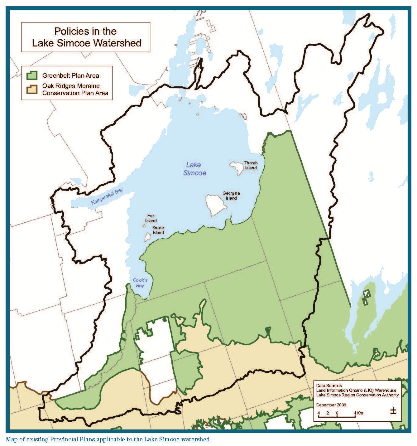
This Plan would promote a consistent approach to the protection, enhancement or restoration of the Lake Simcoe shoreline and of key natural heritage and hydrologic features throughout the watershed. It would focus on protecting, improving, or restoring those features considered most critical to the overall health of the watershed and address activities in those areas that are considered of particular concern. In this chapter, some of the policies are only applied to areas of the watershed that are outside of the Greenbelt Plan and Oak Ridges Moraine Conservation Plan. The reason for this is to avoid duplication as these plans provide similar protections to those provided by the policies in this chapter.
Protecting or restoring the Lake Simcoe shoreline, including both aquatic and terrestrial areas associated with the shoreline, is given particular importance in this Plan. The Lake Simcoe Science Advisory Committee, in their report dated October 27, 2008, summarizes the scientific literature and importance of these areas. This report indicates that natural shoreline areas perform multiple functions, including control of run-off and associated nutrients and other pollutants, stabilizing shorelines from erosion, conserving habitats for a disproportionately high number of aquatic and terrestrial species, regulating temperature and microclimate, screening noise and wind, preserving the aesthetic appeal of the landscape and providing recreational opportunities. This Plan seeks to protect or restore vegetated buffer zones along the lakes and streams. This will be achieved both through the policies identified in this chapter and through the implementation of the relevant stewardship policies in the Plan. This Plan restricts alteration of the shoreline and areas near the shore, and also restricts buildings, structures and other development in these areas.
An ecologically healthy Lake Simcoe shoreline and natural heritage system will improve water quality and will better equip the watershed to endure ongoing and future challenges such as invasive species, climate change, and land use change.
Key Facts
- Overall, 47 percent of the Lake Simcoe watershed’s land area (approximately 2800 square kilometres) is currently agricultural. Developed lands, non-agricultural lands and roads make up an estimated 18 percent.
- While approximately 35 percent of the Lake Simcoe watershed is under natural cover (woodlands and wetlands), much of it exists in a fragmented state and the quality of these as habitats for sensitive elements of biodiversity has not been assessed.
- The distribution of natural cover varies across the watershed with a low of 9 percent in the Keswick Creeks subwatershed to a high of 55 percent in the Carthew Bay Creeks subwatershed.
- Although most of the shoreline has been developed, some areas remain in a relatively natural state, mostly in the northeast sector of the lake.
- Activities such as clearing natural vegetation along the shore and building concrete docks and walls – referred to as “shoreline hardening” – have disrupted ecologically and hydrologically important linkages between the land and water.
Targets:
- No further loss of natural shorelines on Lake Simcoe
- Achieve a greater proportion of natural vegetative cover in large high quality patches
- Achieve a minimum 40 percent high quality natural vegetative cover in the watershed
- Achieve protection of wetlands
- Achieve naturalized riparian areas on Lake Simcoe and along streams
- Restore natural areas or features
- Achieve increased ecological health based on the status of indicator species and maintenance of natural biodiversity
Indicators:
- Change over time in the proportion of land in wetland, forested valleyland, natural riparian and upland forest taking into account habitat quality
- The degree of fragmentation of wetland, forested valleyland, riparian and upland forest
- The integrity of natural shoreline, i.e. the amount of shoreline that is either undeveloped or maintained in a naturalized state
- Change over time in the status of key biological indicators, including species of conservation concern
- Integrity of significant recharge areas
Policies:
Lake Simcoe Shoreline
The loss of natural shoreline areas along Lake Simcoe has impaired the shoreline’s ability to perform multiple functions, including control of run-off and associated nutrients and other pollutants, stabilizing shorelines from erosion and conserving habitats. The following policies apply to Lake Simcoe’s shoreline.
6.1-DP: Subject to the other policies of the Plan, development or site alteration outside of existing settlement areas is not permitted in Lake Simcoe and within a related vegetation protection zone referred to in policy 6.2, except in relation to the following:
- Forest, fish, and wildlife management;
- Stewardship, conservation, restoration and remediation undertakings;
- Existing uses as set out in policy 6.45;
- Flood or erosion control projects but only if they have been demonstrated to be necessary in the public interest after all alternatives have been considered;
- Retrofits of existing stormwater management works (i.e. improving the provision of stormwater services to existing development in the watershed where no feasible alternative exists) but does not include the establishment of new stormwater management works;
- Infrastructure, but only if the need for the project has been demonstrated through an Environmental Assessment or other similar environmental approval and there is no reasonable alternative; and
- Low-intensity recreational uses including access to the Lake that require very little terrain or vegetation modification and few, if any, buildings or structures, including but not limited to the following:
- non-motorized trail use;
- natural heritage appreciation;
- unserviced camping on public and institutional land; and
- accessory uses to existing buildings or structures.
6.2-DP: The minimum vegetation protection zone in ashoreline built-up area is 30 metres from the Lake Simcoe shoreline, or larger if determined appropriate by an evaluation required by policy 6.3. The vegetation protection zone for the remaining Lake Simcoe shoreline, outside of existing settlement areas and outside of shoreline built-up areas, is 100 metres from the Lake Simcoe shoreline.
6.3-DP: Within shoreline built-up areas, an application for development or site alteration within 120 metres of the Lake Simcoe shoreline shall be accompanied by a natural heritage evaluation that satisfies the requirements of policy 6.26, unless the development or site alteration is for a purpose specified by policy 6.1.
6.4-DP: Subject to the other policies in this Plan, structures shall only be permitted in a vegetation protection zone along the Lake Simcoe shoreline if:
- there is no alternative but to place the structure in this area and the area occupied by such structures is minimized;
- the ecological function of the vegetation protection zone is maintained; and
- pervious materials and designs are used to the extent feasible.
6.5-DP: Outside of existing settlement areas, a proposal for development or site alteration within 240 metres of the Lake Simcoe shoreline must demonstrate that the development or site alteration will maintain and, to the extent feasible, enhance or restore functional wildlife movement corridors between any key natural heritage feature or key hydrologic features identified in policies 6.21 and 6.22 that is located along the Lake Simcoe shoreline and from the Lake Simcoe shoreline to another key natural heritage feature or key hydrologic feature within 240 metres of the Lake Simcoe shoreline.
6.6-DP: Subject to the other policies in this Plan, a shoreline built-up area may only be expanded to provide for minor rounding out of the area, and only in accordance with provincial plans and the PPS.
6.7-DP: Significant alteration of the shore of Lake Simcoe or the shore of a fresh water estuary of a stream connected to Lake Simcoe is not permitted unless the significant alteration is for the purpose of stabilizing, protecting, restoring or rehabilitating the shore or the alteration will be undertaken by a public body and the project is consistent with the objectives of this Plan. A significant alteration of the shoreline includes any alteration that has an adverse effect on the ecological functions of the shoreline.
Policies Applying to Both Lake Simcoe and Streams
Alterations to the Lake Simcoe shoreline as well as to permanent and intermittent streams has resulted in fragmentation of natural areas, degradation of water quality and negative impacts to fish and wildlife habitat. The following policies apply to Lake Simcoe’s shoreline and to the streams within the watershed.
6.8-DP: No structures, including boathouses, shall be permitted in Lake Simcoe, other lakes or in apermanent or intermittent stream if the structure impedes the natural flow of water along the shoreline or in the stream, if the structure is intended to be used as a dwelling, or if the structure or its construction harmfully alters fish habitat. This policy does not prohibit drainage works such as those permitted under the Drainage Act, those required for infrastructure or those structures required for the purposes of stewardship, conservation, restoration or remediation undertakings.
6.9-DP: The alteration of the shore of Lake Simcoe, other lakes or any permanent or intermittent stream for the purpose of establishing or altering drainage works such as those works under the Drainage Act, infrastructure or for stabilization, erosion control or protection purposes shall only be permitted if it is demonstrated that natural shoreline treatments (e.g. planting of natural vegetation, bioengineering) that maintain the natural contour of the shoreline will be used where practical, and a vegetative riparian area will be established to the extent feasible. In relation of such works, lands used for agricultural purposes do not require the establishment of a vegetative riparian area if the land is, and will continue to be, used for agricultural purposes.
6.10-DP: Where, in accordance with the policies of the Plan, development or site alteration is permitted within 120 metres of the Lake Simcoe shoreline, other lakes in the Lake Simcoe watershed, or any permanent or intermittent stream or a wetland, the development or site alteration should be integrated with and should not constrain ongoing or planned stewardship and remediation efforts.
6.11-DP: Where, in accordance with the policies of this Plan, a proposal for development or site alteration is permitted within 30 metres of the Lake Simcoe shoreline, other lakes in the Lake Simcoe watershed, or a permanent or intermittent stream or wetland outside of settlement areas and the Greenbelt area and Oak Ridges Moraine area, the proposal for development or site alteration shall comply with the following where applicable:
- maintain, and where possible, increase or improve fish habitat in the Lake, stream or wetland, and any adjacent riparian areas;
- to the extent possible, enhance the ecological features and functions associated with the Lake, stream or wetland;
- minimize erosion, sedimentation, and the introduction of excessive nutrients or other pollutants and utilize planning, design, and construction practices that maintain and improve water quality; and
- integrate landscaping and habitat restoration into the design of the proposal to enhance the ability of native plants and animals to use the area as both wildlife habitat and a movement corridor.
6.12-SA: Within three years of the date the Plan comes into effect, the MNR, MOE and the LSRCA, in collaboration with the First Nations and Métis communities, other ministries and municipalities will develop a shoreline management strategy that, for various reaches of the shoreline, identifies ecological values, best management practices, standards, guidelines, and priority areas for restoration, securement and acquisition.
6.13-DP: Upon completion of the shoreline management strategy, municipal official plans shall be amended to ensure they are consistent with the recommendations of the strategy.
6.14-SA: Public bodies are encouraged to actively re-naturalize public areas adjacent to shorelines and streams to a minimum of 30 metres where practical and feasible.
6.15-SA: Through the implementation of the stewardship, education and outreach policies (8.5-8.11) owners of existing cottages and residences will be encouragedto re-naturalize shorelines and areas adjacent to streams up to 30 metres where practical and feasible.
Proposed Shoreline Regulation
Under the Lake Simcoe Protection Act, 2008 the government may make regulations to regulate or prohibit activities that may adversely affect the ecological health of the Lake Simcoe watershed. The following policies provide direction for proposed regulations.
6.16-SA: Within one year of the date the Plan comes into effect, the MOE, in collaboration with the MNR, other ministries and regulatory agencies will release for consultation proposed draft regulations under section 26 of the Lake Simcoe Protection Act, 2008 based on further advice from the Lake Simcoe Science Committee. These regulations will build on and are not intended to duplicate existing legislation and regulations that apply to the shoreline areas including the Conservation Authorities Act, Lakes and Rivers Improvement Act and the Public Lands Act.
6.17-SA: The area to which the shoreline regulation proposed under policy 6.16 would apply includes the littoral zone, the riparian area, on-land areas beyond riparian areas and wetlands where an activity may affect ecological functions. This regulated area must be described in the Plan once the regulation is made.
6.18-SA: The proposed regulation under policy 6.16 may address the following:
- the use of fertilizer use for non agricultural lands such that the water quality of lakes and streams is not affected;
- activities that contribute to the spread of invasive species;
- peat extraction in all wetlands in the watershed;
- the filling or draining of existing wetlands except as related to mineral aggregate operations or existing settlement areas where the regulation would only apply to those wetlands of provincial significance, and in relation to existing agricultural operations (e.g. Holland Marsh);
- removal of vegetation and coarse woody debris would not be permitted within shoreline areas, with some exceptions, to protect existing natural areas adjacent to shorelines and to retain vegetated buffers consistent with those required by development or site alteration policies (e.g. 30 metre minimum vegetation protection zone on either side of a permanent or intermittent stream); and
- other issues identified through research and consultations.
6.19-SA: Within one year of the date the Plan comes into effect, the LSRCA and MNR will delineate the areas outside of its jurisdiction, but within the Lake Simcoe watershed, for the purpose of consistently applying Ontario Regulation 179/06 (Lake Simcoe Region Conservation Authority: Regulation of Development, Interference with Wetlands and Alterations to Shorelines and Watercourses) made under section 28 of Conservation Authorities Act to development along watercourses within the Lake Simcoe Watershed. Within this same period, the LSRCA and MNR will prepare a regulation to include these areas within the regulated area.
Key Natural Heritage and Key Hydrologic Features
Key natural heritage and key hydrologic features contribute to the ecological health of the watershed. The following policies apply to key natural heritage and key hydrologic features.
6.20-DP: Policies 6.20 – 6.29 apply to those areas outside of existing settlement areas and outside of the Greenbelt area and Oak Ridges Moraine area.
6.21-DP: Key natural heritage features are wetlands, significant woodlands, significant valleylands, and natural areas abutting Lake Simcoe.
6.22-DP: Key hydrologic features are wetlands, permanent and intermittent streams, andlakes other than Lake Simcoe.
6.23-DP: Development or site alteration is not permitted within a key natural heritage feature, a key hydrologic feature and within a related vegetation protection zone referred to in policy 6.24, except in relation to the following:
- Forest, fish, and wildlife management;
- Stewardship, conservation, restoration and remediation undertakings;
- Existing uses as specified in policy 6.45;
- Flood or erosion control projects but only if the projects have been demonstrated to be necessary in the public interest after all alternatives have been considered;
- Retrofits of existing stormwater management works (i.e. improving the provision of stormwater services to existing development in the watershed where no feasible alternative exists)but not new stormwater management works;
- New mineral aggregate operations and wayside pits and quarries pursuant to policies 6.41 – 6.44;
- Infrastructure, but only if the need for the project has been demonstrated through an Environmental Assessment of other similar environmental approval and there is no reasonable alternative; and
- Low-intensity recreational uses that require very little terrain or vegetation modification and few, if any, buildings or structures, including but not limited to the following:
- non-motorized trail use;
- natural heritage appreciation;
- unserviced camping on public and institutional land; and
- accessory uses to existing buildings or structures.
6.24-DP: The minimum vegetation protection zone for all key natural heritage features and key hydrologic features is the area within 30 metres of the key natural heritage feature and key hydrologic feature, or larger if determined appropriate by an evaluation required by policy 6.25.
6.25-DP: An application for development or site alteration within 120 metres of a key natural heritage feature or key hydrologic feature shall be accompanied by a natural heritage evaluation meeting the requirements of policy 6.26, unless the development or site alteration is for a purpose specified by policy 6.23.
6.26-DP: A natural heritage evaluation referred to in policies 6.3 and 6.25 shall be carried out in accordance with guidelines developed by the MNR and shall:
- demonstrate that the development or site alteration applied for will have no adverse effects on the key natural heritage feature, key hydrologic feature, Lake Simcoe and its associated vegetation protection zone, or on the related ecological functions;
- identify planning, design and construction practices that will maintain and, where feasible, improve or restore the health, diversity and size of the key natural heritage feature or key hydrologic feature and its connectivity with other key natural heritage features or key hydrologic features as well as connectivity and linkages to natural heritage systems identified in Provincial Plans or by municipalities, the LSRCA or MNR;
- demonstrate how connectivity within and between key natural heritage features and key hydrologic features will be maintained and, where possible, improved or restored before, during and after construction to allow for the effective dispersal and movement of plants and animals;
- determine if the minimum vegetation protection zone is sufficient to protect the ecological functions of the feature and the area being evaluated, in particular where this feature or area is adjacent to a coldwater stream, headwaters, freshwater estuaries, steep slope or is acting as or has been identified as a wildlife corridor to ensure that the area will continue to effectively act and function as a wildlife corridor;
- determine if the minimum vegetation protection zone is sufficient to protect areas adjacent to existing features that would be appropriate for restoration or renaturalization to enhance the ecological functioning of that feature, such as lands that provide for rounding out or filling of gaps in significant woodlands; and
- if the minimum vegetation protection zone is not sufficient to protect the function of the feature or protect opportunities for feature enhancement, specify the dimensions of the required vegetation protection zone.
6.27-DP: A proposal for new development or site alteration within 120 metres of the Lake Simcoe shoreline, a key natural heritage feature or a key hydrologic feature shall provide for the establishment and maintenance of natural self-sustaining vegetation to the extent and width of the associated vegetation protection zone required by the policies in this Chapter, except in relation to uses and structures in the vegetation protection zone that are permitted by the policies of this Chapter.
6.28-DP: Where, through an application for development or site alteration, a buffer or vegetation protection zone is required to be established as a result of the application of the policies in this Plan, the buffer or vegetation protection zone shall be composed of and maintained as natural self-sustaining vegetation.
6.29-DP: If the natural self-sustaining vegetation is removed along the Lake Simcoe shoreline, from a key natural heritage feature, a key hydrologic feature or from any related vegetation protection zone, as a result of any development or site alteration permitted under policies 6.1, 6.23, 6.43 and 6.45, the natural self sustaining vegetation shall be re-established to the extent feasible following completion of that activity.
6.30-SA: Within one year of the date the Plan comes into effect the MNR, in collaboration with the LSRCA, MOE and other ministries will further define the key natural heritage and key hydrologic features as described in policies 6.21 and 6.22.
6.31-SA: Within one year of the date the Plan comes into effect, the MNR and the MOE, in collaboration with other ministries, the First Nations and Métis communities and the LSRCA, will map natural areas abutting Lake Simcoe as described in policy 6.21.
Settlement Areas
Settlement areas are urban areas and rural settlement areas (e.g. cities, towns, villages and hamlets) where development is concentrated and lands are designated in municipal official plans for development over the long term. The following policies apply to those settlement areas designated in official plans as they existed on the date the Plan came into effect and to settlement area expansions.
6.32-DP: Policies 6.32 - 6.34 apply to existing settlement areas and areas of Lake Simcoe adjacent to these lands, including the littoral zone, and these areas are not subject to policies 6.1 – 6.3, 6.5, 6.11 and policies 6.20 - 6.29.
6.33-DP: An application for development or site alteration shall, where applicable:
- increase or improve fish habitat in streams, lakes and wetlands, and any adjacent riparian areas;
- include landscaping and habitat restoration that increase the ability of native plants and animals to use valleylands or riparian areas as wildlife habitat and movement corridors;
- seek to avoid, minimize and/or mitigate impacts associated with the quality and quantity of urban run-off into receiving streams, lakes and wetlands; and
- establish or increase the extent and width of a vegetation protection zone adjacent to Lake Simcoe to a minimum of 30 metres where feasible.
6.34-DP: Where, through an application for development or site alteration, a buffer is required to be established as a result of the application of the PPS, the buffer shall be composed of and maintained as natural self-sustaining vegetation.
6.35-DP: For greater certainty, where lands have been incorporated into a settlement area after the effective date of the Plan, an application for development or site alteration within those lands are subject to the policies in this Chapter other than policies 6.32 to 6.34.
Recharge Areas
The following policies are intended to build on the policies and efforts associated with the PPS and drinking water source protection through the Clean Water Act, 2006 to help identify and protect significant groundwater recharge areas.
6.36-DP: A significant groundwater recharge area is an area identified,
- as a significant groundwater recharge area by any public body for the purposes of implementing the PPS;
- as a significant groundwater recharge area in the assessment report required under the Clean Water Act, 2006 for the Lake Simcoe and Couchiching/Black River Source Protection Area; or
- by the LSRCA in partnership with MOE and MNR as an ecologically significant groundwater recharge area in accordance with the guidelines developed under policy 6.37.
6.37-SA: MOE and MNR, in collaboration with LSRCA, municipalities and other ministries will develop guidance associated with protecting, improving or restoring significant groundwater recharge areas, including defining ecologically-significant groundwater recharge areas.
6.38-DP: Once identified, municipalities shall incorporate significant groundwater recharge areas into their official plans together with policies to protect, improve or restore the quality and quantity of groundwater in these areas and the function of the recharge areas.
6.39-DP: Outside of the Oak Ridges Moraine area, urban settlement area expansions should avoid significant groundwater recharge areas.
6.40-DP: Outside of the Oak Ridges Moraine area, an application for major development within a significant groundwater recharge area shall be accompanied by an environmental impact study that demonstrates that the quality and quantity of groundwater in these areas and the function of the recharge areas will be protected, improved or restored.
Mineral Aggregate Operations and Wayside Pits and Quarries
The following policies apply to applications for new mineral aggregate operations and wayside pits and quarries.
6.41-DP: Policies 6.41 - 6.44 apply to applications for new mineral aggregate operations and wayside pits and quarries that are outside of the Greenbelt area and the Oak Ridges Moraine area.
6.42-DP: No new mineral aggregate operations and no wayside pits and quarries, or any ancillary or accessory use thereto shall be permitted in the following key natural heritage features and key hydrologic features:
- significant wetlands;
- significant habitat of endangered species and threatened species; and
- significant woodlands unless the woodland is occupied by young plantation or early successional habitat (as defined by the MNR).
6.43-DP: An application for a new mineral aggregate operation or a new wayside pit or quarry may only be permitted in a key natural heritage feature, a key hydrologic feature or its related vegetation protection zone, other than a feature mentioned in policy 6.42, where the application demonstrates the following:
- the health, diversity and size of these key natural heritage features will be maintained or restored and, to the extent possible, improved to promote a net gain of ecological health; and
- any permitted extraction of mineral aggregates that occurs in a feature will be completed, and the area will be rehabilitated, as early as possible in the life of the operation.
6.44-DP: Every application for a new mineral aggregate operation must demonstrate:
- how the connectivity between key natural heritage features and key hydrologic features will be maintained before, during and after the extraction of mineral aggregates; and
- how the operator could immediately replace or restore any habitat that would be lost from the site with equivalent habitat on another part of the site or on adjacent lands.
Existing Uses
The following policies apply to existing uses, accessory uses and structures.
6.45-DP: Where a policy in this Chapter permits development or site alteration in relation to existing uses, the following policies apply:
- All existing uses lawfully used for such purposes on the day before the Lake Simcoe Protection Plan comes into force are permitted;
- The construction of a building on an existing lot of record is permitted, provided it was zoned for such as of the date the Plan comes into effect, or where an application for an amendment to a zoning by-law is required as a condition of a severance granted prior the date this Plan comes into effect;
- The development permitted in b., expansion to existing buildings or structures, accessory structures and uses, and conversions of legally existing uses which bring the use more into conformity with this Plan are permitted subject to a demonstration that the use does not expand into a key natural heritage feature, a key hydrologic feature and any minimum vegetation protection zone associated with a feature or the Lake Simcoe shoreline, unless there is no alternative in which case any expansion shall be limited in scope and kept within close geographical proximity to the existing structure;
- The expansion to existing agricultural buildings and structures, residential dwellings and accessory uses to both, may be considered within a key natural heritage feature, a key hydrologic feature, and any minimum vegetation protection zone associated with these features or the Lake Simcoe shoreline, if it is demonstrated that:
- there is no alternative to the expansion or alteration and the expansion or alteration is directed away from the feature and vegetation protection zone to the maximum extent possible, and,
- the impact of the expansion or alteration on the feature and its functions is minimized to the maximum extent possible.
- Expansion, maintenance or replacement of existing infrastructure is permitted.
Site Alteration and Tree Cutting Bylaws
The following policy provides direction for the development of a template for tree cutting and site alteration bylaws by the provincial government.
6.46-SA: Within two years of the date the Plan comes into effect, the MNR and MOE, in consultation with other ministries, municipalities and the LSRCA will lead the development of a template for municipal site alteration and tree cutting bylaws within the watershed as related to natural heritage features including wetlands and woodlands, and following development will encourage implementation of such a bylaw.
Natural Areas Protection, Improvement and Enhancement
The following policies set out direction for the provincial government to take a strategic approach to stewardship, restoration and/or enhancement of natural areas, including monitoring of these efforts using an adaptive management approach.
6.47-SA: Within two years of the date the Plan comes into effect, the MNR and the LSRCA in collaboration with MOE other Ministries, the First Nations and Métis communities and municipalities, will delineate priority areas for riparian area restoration and other areas to focus natural heritage protection, improvement, restoration, securement and enhancement efforts including the definition or delineation of important corridors and linkages. The delineation will build on existing natural heritage systems identified by the Province, the LSRCA and municipalities within the Lake Simcoe watershed and identified anchor sites (high quality connected natural features) to support the development of a comprehensive stewardship strategy throughout the watershed.
6.48-SA: Within two years of the date the Plan comes into effect, the MNR in collaboration with the LSRCA, First Nations and Métis communities, will identify and map areas of high quality natural cover that are 25 hectares or greater.
6.49-SA: Within one year of the date the Plan comes into effect, the MNR, the MOE, and the LSRCA, in collaboration with the First Nations and Métis communities, and other ministries, will identify stressed subwatersheds or portions of stressed subwatersheds.
6.50-M: Within one year of the date the Plan comes into effect, the MNR, the LSRCA and the MOE will develop a monitoring program in relation to the targets and indicators associated with natural heritage and hydrologic features and areas. The monitoring program shall be based on an adaptive management approach and may be altered from time to time to respond to changing environmental conditions (including climate change), new information and to changing management needs. The components of the monitoring program may include monitoring changes in the proportion of natural cover in the watershed, for example as a result of the implementation of the Plan policies including stewardship initiatives, and monitoring biological indicators that provide inference on the ecological health of the Lake Simcoe watershed. Once the monitoring program is developed, the MNR, LSRCA and MOE shall implement the program.