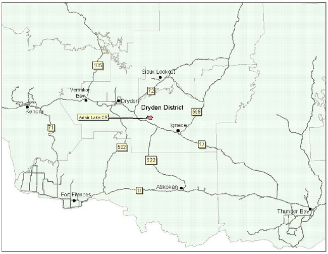
Adair Lake Conservation Reserve Management Statement
This document provides policy direction for the protection, development and management of the Adair Lake Conservation Reserve and its resources.
Statement of Conservation Interest (C2308)
June, 2003
Dryden District
Ministry of Natural Resources
Approval statement
We are pleased to approve this Statement of Conservation Interest for the Adair Lake Conservation Reserve (C2308).
This Statement of Conservation Interest will provide guidance for the management of the Conservation Reserve and form the basis for ongoing monitoring of activities. More detailed direction is not anticipated at this time. Should significant facility development be considered or complex issues arise requ iring add itional studies, more defined management direction, or special protection measures, a more detailed Conservation Reserve Management Plan will be prepared with full public consultation.
The Adair Lake Conservation Reserve will be managed under the jurisdiction of the Dryden and Wabigoon Area Supervisors, Dryden District, Ministry of Natural Resources.
Signed by:
R.G. McColm
Dryden District Manager
Ministry of Natural Resources
Date:: June 30, 2003
Signed by:
Charles Lauer
Regional Director
Northwest Region
Ministry of Natural Resources
Date: July 16, 2003
1.0 Background information
The purpose of this document is toidentify and document the natural heritage values of the Adair Lake Conservation Reserve, the activities that occur there and, through a set of management guidelines, lay out the activities that will and will not be permitted. For more information regarding this Statement of Conservation Interest (SCI) please refer to the "Conservation Reserve Policy and Procedure PL3.03.05".
Table 1.1: Background information for the Adair Lake Conversvation Reserve
| Name | Adair Lake Conservation Reserve (C2308) |
|---|---|
| Site Region / Site District | 4S3, 4S4 |
| OMNR Administrative Region / District / Area | Northwest Region / Dryden District / Dryden and Wabigoon Areas, Dryden and Wabigoon Forest |
| Total Area (ha) | 2800 |
| Regulation Date | 2003 |
| First Nations | Wabigoon Lake Ojibway Nation, Eagle Lake First Nations |
| OBM | 155500549000, 15560054900 |
| Latitude / Longitude | 49' 37 / 92' 11 |
| Basemap | 55549, 56549 |
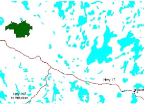
| General Location Description | The reserve is located approximately 50 km southeast of the City of Dryden (63 km by road) |
| Access | Access to the reserve can be gained approximately 6.5 km north down Basket Lake Rd. off of Hwy. 17,58 km east of Dryden. Bogg Lake forest access road also leads to the reserve |
Table 1.2: Representation Targets – A summary of Earth Science, Life Science, Cultural Resource Values and Present or Possible Recreational Opportunities
| Life Science Representation | Upland Forest/Forested Dunes: Jack pine on medium sand and on the dune formations along Bogg Lake forest access road. Black Spruce in wetter areas. Wetland: String Fen – sedges and low shrubs on low peat ridges, sundew and bladderwort in pools. Species include wire sedge, dwarf birch, Sphagnum angustifolium. Mineral rich indicators include shrubby cinquefoil, livid sedge, tufted clubrush Treed Fen – tamarack and black spruce Open bog – few–seeded sedge, dense cottongrass, ericaceous shrubs, Sphagnum angustifolium Treed bog – same as above as well as scattered small black spruce Animal Species: Sharp–shinned hawk, black back woodpecker, gray jays, ravens, warblers, Savannah sparrow, red squirrel |
|---|---|
| Earth Science Representation | Bedrock – underlain with volcanic rock (predominately massive basalt metamorphosed to amphibolite) with a narrow strip of greenstone belt (mafic with narrow felsic volcanic units). Pillow structures are present in places Surface – Ice-contact, glacial to glaciofluvial, glaciofluvial outwash and shallow water glaciolacustrine sands, gravels and bouldery material Average 1 meter thick peat; 2/3 poorly decomposed shrub-Sphagnum peat over more well decomposed shrub-sedge peat |
| Cultural Value Representation | No known cultural value is contained within this reserve |
| Recreational Opportunities | Opportunities exist for bird watching. |
Table 1.3: Survey Information – Overview of inventories completed, their level of detail and any inventories that are needed
| Survey | Life Science | Earth Science | Cultural | Recreational |
|---|---|---|---|---|
| Reconnaissance | Life Science Checklist, 2002 | Earth Science Checklist, 2002 | Not Required | Recreation Inventory Checklist, 2002 |
| Detailed | Not Required | Not Required | Not Required | Not Required |
Figure 1: General location of the Adair Lake Conservation Reserve.
2.0 Values to be protected
This section provides a description of the key natural heritage values on the site, their condition relative to past resource and management activities, and their sensitivity to future land use and management activities.
Table 2.1: Values Identified on the Adair Lake Conservation Reserve
| Life Science | Contains zig–zag darner (a provincially rare dragonfly species) May contain some Regionally rare bird species such as sandhill cranes, sharp–tailed grouse and marsh rush. (Harris et al., 2002) |
|---|---|
| Earth Science | Peatland considered Regionally significant as it is of considerable size for this part of northwest Ontario (Blackburn, 2002) |
| Cultural | N/A |
| Aboriginal | N/A |
| Tourism | N/A |
| Recreational Fishing | N/A |
| Recreational Hunting | Permitted; WMU #5 |
| Trapping | DR03N02401, IG1N03301; it is unlikely that the area within the reserve is used for trapping but the trap lines are active |
| Bear Management Area | IG–05–088; it is unlikely that the area within the reserve is used for bear hunting but the BMA is active |
| Bait Harvesting | 496921, 495921; these blocks have been harvested for baitfish in the past |
| Commercial Fishing | N/A |
2.2 Values to be protected
The intent of this SCI is to protect the following values by establishing management guidelines for existing and potential uses in this area given the level of past disturbance and the nature of the existing features.
2.2.1 Forest values
The forested areas within the reserve contain no significant value and thus require no additional protection other than that provided by this Statement of Conservation Interest.
2.2.2 Biological values
The peatland is home to the zig–zag darner, a provincially rare dragonfly species. As well, given the habitat type and their surrounding distribution, the following regionally rare bird species may nest and/or live here: sandhill crane, sharp–tailed grouse and marsh rush. (Harris et al., 2002)
2.2.3 Landform values
The Adair Lake Conservation Reserve is considered provincially rare as it consists almost entirely of a large, boreal peatland with little evidence of human impact in a relatively accessible location. The peatland itself is shallow, averaging a depth of 1 m and a maximum depth of 3 m in a few locations. (Harris et al., 2002)
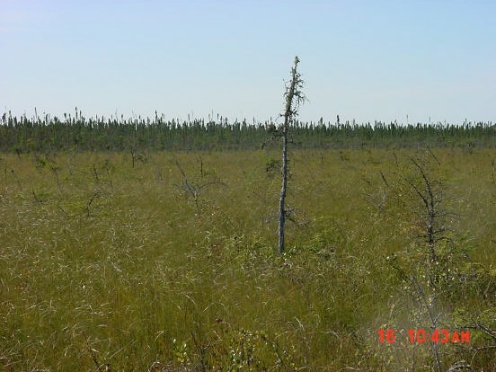
Figure 2: Open fen found within the conservation reserve.
2.2.4 Recreational values
The wetland vegetation, organic material, coniferous forest, small lake and general wildlife were deemed recreation features. One potential recreation activity was determined for this site; bird watching. Feature significance was determined to be low. The wetland vegetation was considered to be the most sensitive feature to both recreation and resource development. Its sensitivity to recreation was considered low, however, due to lack of use within the reserve. (See Appendix E)
2.2.5 Tourism values
No tourism values exist within the Conservation Reserve.
3.0 Management guidelines
3.1 Land tenure
The Adair Lake Conservation Reserve consists of and is surrounded almost entirely by Crown land. Some mining claims do exist to the south.
The reserve will remain Crown land and no further dispositions (including Land Use Permits or Licenses of Occupation) will be issued for the site.
The disposition of adjacent Crown Land will be dealt with on a case–by–case basis.
Unauthorized occupations of lands within the Conservation Reserve will be handled in accordance with approved policy, and any required structural removal will be at the owner’s expense.
3.2 Existing and proposed development
Cutover makes up less than 1% of the reserve. There is little evidence of human impact within the reserve otherwise. In the surrounding areas there exists a network of secondary and tertiary roads, gravel pits and timber harvest operations.
Facility infrastructure and development for recreational and/or educational purposes may be considered in the future if there is a demonstrated demand for such facilities. All provincial policies that guide development on Crown Land are applicable in Conservation Reserves. A more detailed management plan would be required prior to any development occurring. Such a plan would have to ensure that there would be no negative impacts to any habitat or ecosystem pertinent to the values protected in this reserve.
3.3 Recreational activities
Most recreational activities that have traditionally been enjoyed in this area can continue provided they pose no threat to the natural ecosystems and features protected by the Conservation Reserve.
Those uses that are regulated include hunting, fishing and trapping. Most other permitted activities are non–regulated (i.e. exploring, nature study). See Section 2.2.4 for the recreational uses for this Conservation Reserve as determined by the Recreation Resource Inventory.
Mechanical travel within the reserve (includes use of snowmobiles and All Terrain Vehicles), is permitted only on existing roads and trails. Off trail mechanized travel is permitted for retrieval of game only. Currently no trails exist in the Adair Lake Conservation Reserve. It is advisable that activities producing compaction of the peat within the reserve, resulting in alterations to hydrological processes and changes in associative vegetation communities be disallowed. Therefore, trail development will not be considered within this site.
3.4 Commercial activities
No new activities, such as commercial logging, hydroelectric power development, new transmission lines (e.g. power or communications), pipelines, highways or roads, and the extraction of minerals, aggregate or peat, will be permitted.
An examination of the possible impact of activities on adjacent lands should be evaluated in the Forest Management Plan.
3.5 Aboriginal interests
To date, no Aboriginal Groups have voiced any issues in regards to this Conservation Reserve. Nothing in this Statement of Conservation Interest affects in any way existing or future Aboriginal or treaty rights.
3.6 Natural Resources Stewardship
Natural Resource Stewardship involves the consideration of the following specific natural resource management categories.
3.6.1 Vegetation management
Management within the Conservation Reserve will allow for the continuation of natural ecosystem processes and functions with minimal human interference.
Forest fire suppression will be carried out in accordance with the approved Fire Management Strategy for the surrounding lands. "Light on the Land" suppression techniques which do not unduly disturb the landscape will be encouraged where feasible. Examples of "light on the land" techniques may include limiting the number of trees felled or the use of heavy equipment or foam.
Opportunities for prescribed burning to achieve ecological or resource management objectives may be considered. These management objectives will be developed with public consultation prior to any prescribed burning, and reflected in the document that provides management direction for this conservation reserve. Plans for any prescribed burning will be developed in accordance with the MNR Prescribed Burn Planning Manual, and the Class Environmental Assessment for Provincial Parks and Conservation Reserves (approval pending).
Forest insect and disease management will continue as on surrounding Crown lands.
3.6.2 Fish and wildlife management
The existing Wildlife Management Unit, sport fishing regulations and management activities will apply.
3.6.3 Landforms
None of the landforms mentioned will be altered by landform modification activities such as filling and extraction. The extraction of aggregates, peat and similar materials are not permitted.
Mineral exploration and extraction are not permitted in this CR.
3.7 Cultural Resources Stewardship
To date, there have been no surveys done to assess cultural or heritage values. However, common knowledge of the area suggests there to be no such values on this site, thus Cultural Inventories were deemed unnecessary.
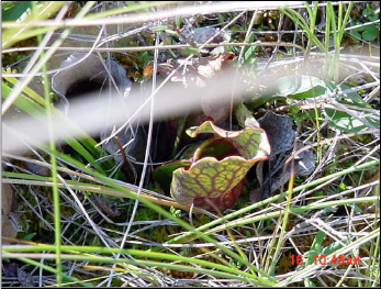
Figure 3: The pitcher plant was a common occurrence within Adair Lake CR.
3.8 Client services
Given the focus on low key management, client information will be given on an inquiry basis only and will deal with the basic level of information with respect to access, natural heritage appreciation, recommended activities and boundaries.
3.9 Research
Non–destructive research by qualified individuals will be encouraged to provide a better understanding of the natural values protected by the Conservation Reserve and to advance protection, planning and management.
In order to assist with enhancing the management guidelines for the reserve, the collection of additional earth and life science information during research is encouraged.
All research programs will require the approval of the Ministry of Natural Resources as will the removal of any natural or cultural specimen. The establishment of permanent plots, observation points or facilities must also be approved and be compatible with the Conservation Reserve protection objective. Any site disturbed by research activities must be rehabilitated as closely as possible to its previous state.
3.10 Marketing
Awareness of the Conservation Reserve is promoted through the Living Legacy web site. Intensive management activity to increase use is not required at this time.
4.0 Implementation
Implementation of this Statement of Conservation Interest will primarily involve monitoring activities to ensure adherence to the management guidelines and responding to inquiries about the site.
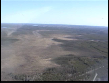
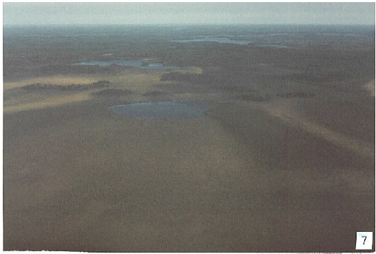
Figure 4: Aerial view of a portion of the Adair peatland and surrounding upland forest.
Implementation of this statement and management of the reserve are the responsibility of the Dryden and Wabigoon Area Supervisors. Partnerships may be pursued to address management needs.
5.0 Review and revisions
5.1 Review and revisions
This Conservation Reserve Statement of Conservation Interest will be reviewed on an ongoing basis.
If changes in management direction are needed at any time, the significance of the changes will be evaluated and further consultation a possibility. Any major amendments will require full public consultation and the approval of the District Manager and Regional Director. Affected clients will be immediately informed of proposed changes to this Statement of Conservation Interest.
5.2 Public consultation
5.2.1 Results of past consultations
Consultation on the Adair Lake Conservation Reserve was conducted as part of the consultation on the Ontario’s Living Legacy Land Use Strategy, July 1999. Subsequent consultation also took place in June 2001 to refine the boundary of the Conservation Reserve.
District Manager letters, totaling 96, were sent to the Dryden Forest Management Co., Weyerhaeuser and Ontario’s Forest Industries Association Tourist Outfitters, Advisory Committees, Trappers, Land Owners, Members of the Public, Non–Government Organizations and Government Organizations. Newspaper ads were placed in the Ignace Driftwood June 20, 2001 and Dryden Observer on June 19, 2001.
First Nation Consultation letters were also sent to ten Native communities including the Ojibway Nation of the Saugeen Band, Wabigoon Lake Ojibway Nation and Aboriginal People of Wabigoon. Direct consultation with Treaty 3 First Nations was carried out on a regional basis and concluded November of 2002.
One general response was made concerning permitted uses in Conservation Reserves. As a result of the consultation process no issue analysis was required.
5.2.2 Present and future consultation
More widespread consultation is not deemed necessary at this time.
5.2.3 Author
This Statement of Conservation Interest was prepared by Alicia H.L. Morin, OLL Intern, Information Management, Dryden District. Assistance was provided by Martin Pell (Dryden District Planner) and members of the Dryden and Wabigoon Area Teams.
6.0 References
Blackburn, C. 2002. Earth Science Inventory – Adair Lake Conservation Reserve. Unpublished report for Northwest Region, OMNR, Thunder Bay, Ont.
Harris, A. and Foster, R. 2002. Life Science Inventory – Adair Lake Conservation Reserve. Unpublished report for Northwest Region, OMNR, Thunder Bay, Ont.
Noble, T. 1995. Site Region 4S–4 Gap Analysis. Unpublished report for Northwest Region, OMNR, Thunder Bay, Ont.
Ontario Ministry of Natural Resources (OMNR). 1999. Ontario’s Living Legacy Land Use Strategy. p. 24. Queen’s Printer for Ontario.
Ontario Ministry of Natural Resources (OMNR). 2003. Adair Lake Conservation Reserve (C2308) Recreation Resource Inventory Report. Unpublished report.
Ontario Ministry of Natural Resources (OMNR), Lands & Natural Heritage, Lands & Waters. 1997. Conservation Reserve Policy and Procedure PL 3.03.05. p. 22.
Appendix A: Adair Lake Conservation Reserve (C2308) Values Map
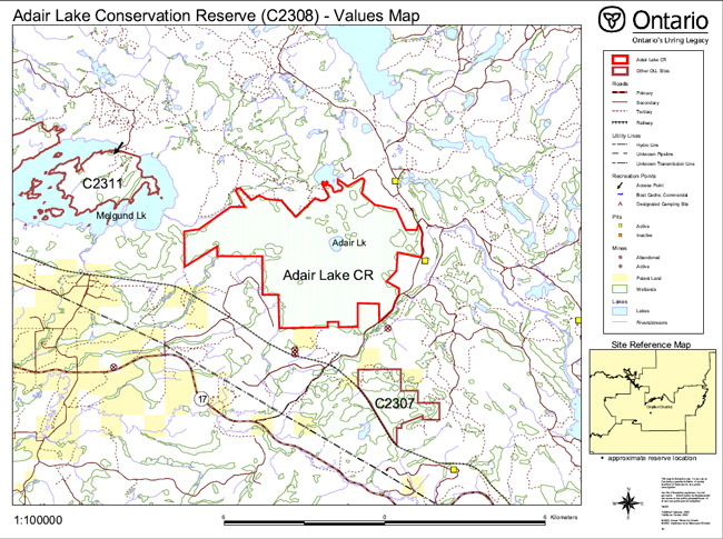
Enlarge Adair Lake Conservation Reserve (C2308) Values Map
Appendix B: Adair Lake Conservation Reserve (C2308) Aerial Photo Image
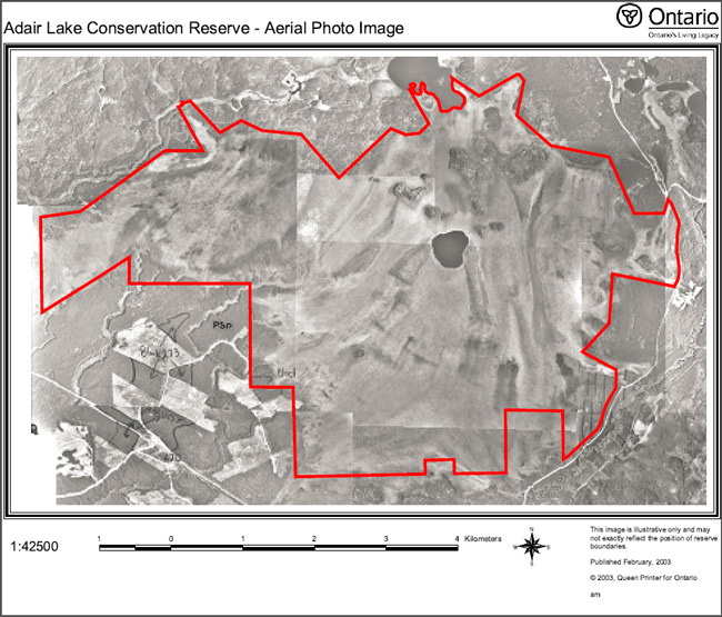
Enlarge Adair Lake Conservation Reserve (C2308) Aerial Photo Image
Appendix C: Adair Lake Conservation Reserve (C2308) Earth Science Checksheet
Detailed Information for Site C2308 Adair Lake
Protection history
The reserve was identified under the provincial Lands for Life – Ontario’s Living Legacy Program as containing "representative landform and vegetation types, including glaciofluvial sand and gravel outwash fronting the Hartman moraine, open bog and fen, treed bog and fen and swamp". (OMNR 1999).
Other earth science significance was not assigned.
Setting
The reserve comprises 2741 hectares, and is located in Dryden MNR District. Elevations range from 420m a.s.l. at Adair Lake to 440 m a.s.l. Access to the earth science features of the reserve is limited by the extensive wetland: however, the Basket Lake access road off Highway 17 via the former community of Tache on the Canadian Pacific Railway main line runs along the eastern edge and is in places the boundary of the reserve.
Earth science features
Bedrock Geology
Adair Lake Conservation Reserve is underlain entirely by volcanic rocks of the western region of the Archean age Wabigoon Subprovince (Blackburn et al 1991). It is situated in a narrow greenstone belt extension that lies between the Basket Lake batholith to the north and the Revell batholith to the south, and links the Eagle–Wabigoon–Manitou lakes greenstone belt with the Raleigh Lake greenstone belt (Blackburn et al 1991: Figure 9.2). Previous detailed geologic mapping (Satterly 1960) indicates the greenstone extension to be predominantly mafic, with very minor narrow felsic volcanic units. Only the southern half of the reserve was included in Satterly’s (1960) map, which identified all but a very small portion to be mafic: the exception is a 200 metre wide east–southeast trending band of rhyolite pyroclastic rock that enters the southeast corner but does not outcrop.
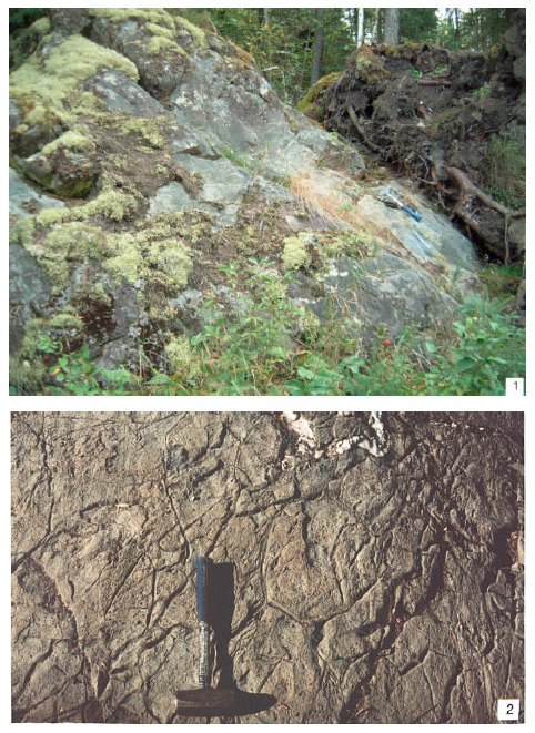
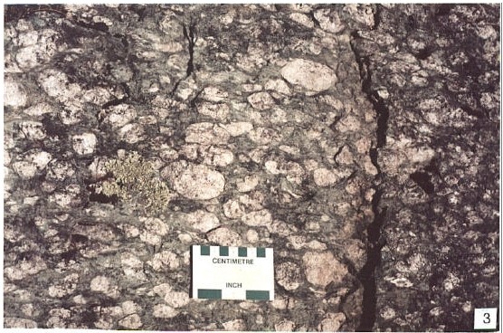
Massive basalt metamorphosed to amphibolite, in places coarse grained (station 5: photo 1), is the dominant rock type, as observed along the Basket Lake access road (stations 4, 5 and 7). However, pillow structures are present in places (station 8), though may not be well preserved (station 2: photo 2). A distinctive basaltic rock type that is probably not common in the reserve on the evidence of Satterly’s (1960) mapping, was seen in rocky outcrops close to Adair Lake in the centre of the reserve. Here porphyritic basalt contains abundant, large, phenocrysts of plagioclase feldspar, some up to 8 cm in size (station 1: photo 3). The majority of the phenocrysts are rounded, indicating resorption following crystallization. Also, their abundance indicates accumulation of the crystals by some process in the melt phase.
Surficial geology
Quaternary deposits are of both Pleistocene, glacial, and Recent, postglacial, age (Roed 1980; Cowan and Sharpe 1991). The northwest trending Hartman end moraine lies immediately to the northeast of the reserve. Ice–contact, glacial to glaciofluvial sands, gravels and bouldery material of the moraine can be observed in a gravel pit (station 3: photos 4 and 5) along the Basket Lake access road about 1 km northeast of the reserve boundary. To the southwest of the Hartman moraine sand, gravel and boulder material has been variously interpreted as glaciofluvial outwash (Roed 1980) and shallow water glaciolacustrine (Cowan and Sharpe 1991; Barnett et al 1991). Proglacial, glaciofluvial outwash material that was deposited at the edge of the retreating Wisconsinan age glacier was most likely reworked at the edge of glacial Lake Agassiz. Difficulty in distinguishing between the two types of material may account for the variability in map interpretation. On the accompanying surficial geology map to this report preference has been given to the glaciolacustrine interpretation, with the understanding that much of the material may be glaciofluvial. In a shallow gravel pit on the east side of the Basket Lake access road (station 6), the material was observed to be unsorted and unbedded, composed of cobble to pebble sized clasts in a sandy matrix.
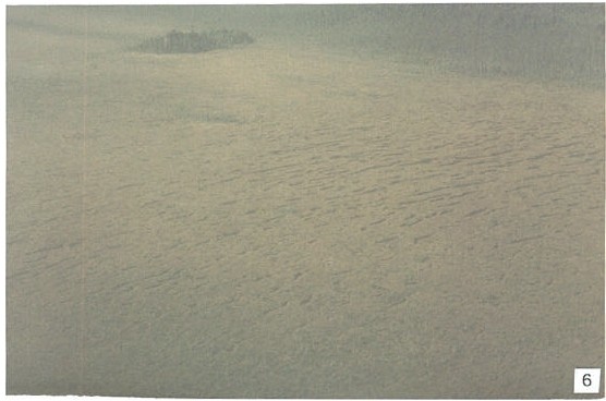
Organic deposits of Recent age occupy the majority of the reserve, as bog, fen and swamp. String bogs are conspicuous (photo 6), while Adair Lake itself lies in the centre of this area (photo 7).
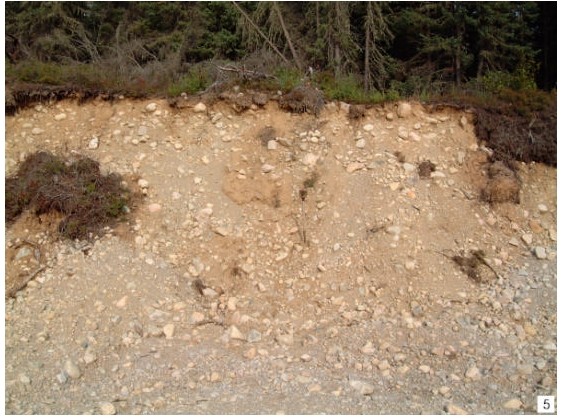
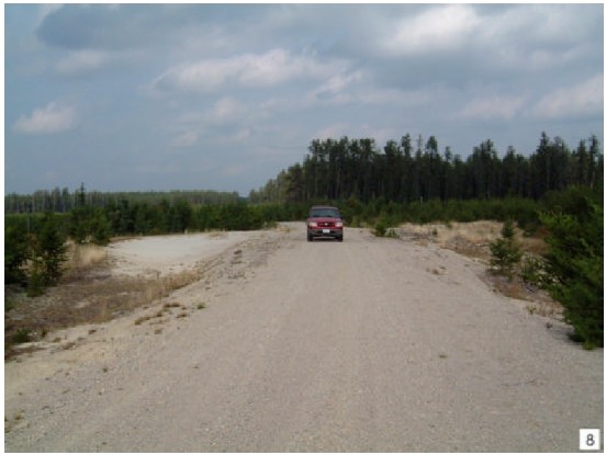
Aeolian sand deposits of postglacial or Recent age lie along the edge of and immediately outside of the reserve to the southwest. Dune formation can be observed along the Bog Lake forest access road off Highway 17 intermittently for most of its 7 km length: a particularly good example, about 4 to 5 metres high, occurs immediately south of the intersection of the forest access road and the Canadian Pacific Railway line. Closer to the reserve boundary (station 9), the road passes across a dune (photo 8) that is currently active. Fixing of the dunes has been made by forest cover (mostly jackpine), but recent logging activity including cut–over and scarification has exposed much of the fine sand to further wind erosion and transportation. Replanting in places has stabilized this to some extent.
Significance
The mafic volcanic rocks that entirely underlie the reserve are typical of large areas of greenstone belts in the Superior Province of Ontario. However, it is not well exposed, and there is little diversity in structures and textures. The porphyritic basalt is distinctive, but present in a few mostly inaccessible places only. These bedrock earth science features are considered to be not significant.
The probable glaciolacustrine features are not well exposed within the confines of the reserve, and because there is no possibility of extending the boundary to incorporate those that are seen in gravel pits along the Basket Lake access road, are considered to be not significant. Organic deposits which support the life science features for which this area was reserved, constitute the only earth science feature of note, and because they constitute most of the 2741 hectares of the Reserve, are of considerable size for this part of northwest Ontario. They are therefore considered to be of regional significance.
Aeolian sand deposits lie outside the reserve boundary. Because of the comparative rarity of such deposits in northwest Ontario, their preservation would have been advantageous, since they have the probability of at least regional significance: however, logging activity has already disturbed the deposits, so that they are no longer pristine. By their very nature, any exposure by human activity promotes further dune mobility, but artificially rather than naturally.
Sensivity
Bedrock features are not susceptible to degradation by either human activity or natural processes. The organic deposits are susceptible to disturbance of the vegetation cover by commercial exploitation.
Recommendations
Conservation reserve status adequately protects the organic deposits from disturbance and exploitation.
The present survey has adequately identified both bedrock and surficial features of the reserve. No further recommendations for inventory within the present area of the reserve are made. However, some consideration should be given to assessing further the aeolian deposits outside of the Reserve for possible integration.
References
Barnett, P.J., Henry, A.P. and Babuin, D. 1991. Quaternary Geology of Ontario, west–central sheet; Ontario Geological Survey, Map 2554, scale 1:1 000 000.
Blackburn, C.E., Johns, G.W., Ayer, J. and Davis, D.W. 1991. Wabigoon Subprovince; in Geology of Ontario, Ontario Geological Survey, Special Volume 4, Part 1, p. 303-381.
Cowan, W.R. and Sharpe, D.R. 1991. Surficial Geology, Wabigoon Lake, Ontario; Geological Survey of Canada, Map 1774A, scale 1:100 000.
Roed, M.A. 1980. Northern Ontario Engineering Geology Terrain Study, Data Base Map, Wabigoon Lake; Ontario Geological Survey, Map 5059, scale 1:100000.
Satterly, J. 1960. Dyment area; Ontario Geological Survey, Map 1960h, scale 1:31 680.
OMNR 1999. Ontario’s Living Legacy: Land Use Strategy; Ontario Ministry of Natural Resources, 136 p., accompanied by map, scale 1:1 200 000.
Photographs
1. Massive coarse grained amphibolite, beside the Basket Lake road. (Stn. 5; UTM 0561875E 5497279N)
2. Amphibolite with possible pillow The quartz vein appears to occupy a pillow rim. (Stn. 2; UTM 0558172E 5498042N)
3. Massive porphyritic basalt, with plagioclase crystals up to 8 cm (Stn. 1; UTM 0558218E 5498009N)
4. Ice contact deposits of the Hartman moraine in a gravel pit along the Basket Lake road. Bedded sand at level of upper end of shovel overlies unbedded bouldery sand deposits. (Stn. 3; UTM 0560902E 5499737N)
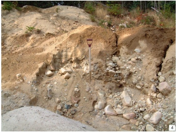
5. Unsorted, rounded to angular boulders in unbedded gravel and Same gravel pit as photo 4. (Stn. 3; UTM 0560902E 5499737N)
6. String bog, Adair Lake Reserve
7. View toward the north over Adair Lake Reserve. Adair Lake is at centre, with an unnamed lake immediately above and Suzanne lake at upper centre.
8. Sand dune intersected by the Bog Lake forest access road at 2 km from Highway 17. (Stn. 9; UTM 0556288E 5494298N)
Additional stations
Stn. 6 UTM 0561967E 5496635N
Stn. 7 UTM 0559644E 5493655N
Stn. 8 UTM 0559514E 5493290N
Earth Science Inventory Checklist
| Name | Adair Lake |
|---|---|
| OLL ID | C2308 |
| Map Name | Dyment |
| NTS Number | 52F/09 |
| UTM Reference | Z15 558000 E 5497000 N |
| OBM Number | |
| Latitude | 49° 37'N |
| Longitude | 92° 12'W |
| Elevation - Maximum | 440m |
| Elevation - Minimum | 420m |
| County | District of Kenora |
| Township | Revell and Urorga |
| Lot | 1 through 11 |
| Concession | 6 and 7 |
| Area (ha) | 2741.00 |
| Ownership | Crown |
| Air Photo (Year-Roll-Flight Line-Numbers) |
97-57-4920A-35 to 38; 97-59-4921A-28,29; 97-57- 4921A-142 to 145; 97-58-4922A-65 |
| MNR Region | Northwest |
| MNR District | Dryden |
| Park Zone | Northwest |
| Earth Sciences Features | Archean age, Wabigoon Subprovince: massive basalt (amphibolite) dominant, some pillow lavas and plagioclase-phyric basalt; minor felsic volcanic rocks underlie the reserve in southeast, but do not outcrop. <3% outcrop. Pleistocene age: glaciolacustrine and/or glaciofluvial sand, gravel, and boulders, resulting from outwash reworked at the edge of glacial Lake Agassiz. Recent age: organic deposits occupy the majority of the reserve as bog, fen and swamp; aeolian sands just outside reserve. |
| Significance | Mafic volcanic rocks typical of large areas of greenstone belts of Superior Province, but not well exposed and little diversity of structures and textures. Not significant. Glaciolacustrine materials outside reserve. Not significant. Organic deposits constitute most of the reserve, and of regional significance Aeolian sands that are just outside the reserve may be of regional significance. |
| Sensitivity | Bedrock features are not sensitive to natural or cultural impacts. The organic deposits are susceptible to commercial exploitation |
| Recommendations | Conservation reserve status adequately protects the organic deposits from exploitation. Consideration should be given to assessing the aeolian deposits for inclusion in the reserve. |
| Major References | Blackburn et al 1991, "Wabigoon Subrovince" in OGS Special Volume 4; Cowan and Sharpe 1991, GSC Map 1774A; Roed 1980, OGS Map 5059; Satterly 1960, GSC Map 1960h. |
| Date Compiled | February 15, 2003 C.E. Blackburn, Blackburn Geological Services |
Location Map for Adair Lake
Appendix D: Adair Lake Conservation Reserve (C2308) Life Science Checksheet
| Name | Adair Lake |
|---|---|
| Map Name | Dyment |
| Map Number | 52F-9 |
| UTM Ref. | Zone 15 558000 E 5497000 N |
| County | Kenora |
| Latitude | 49° 37'N |
| Longitude | 92° 12'W |
| NAD | 83 |
| Minimum Altitude | 420 m |
| Maximum Altitude | 440 m |
| Locality | 45 km SW of Dryden |
| Township | Revell, unorganized |
| Area | 2800 ha |
| Ownership | Crown |
| MNR Region | Northwest |
| Ecoregion and Ecodistrict | 4S-3 |
| Landform Unit | See Table 3 |
| MNR District | Dryden |
| Aerial Photographs (Year-Roll-Flight Line-Numbers) |
97-4290-A-57-35 to 38 97-4921-A-59-28 to 29 97-4921-A-57-142 to 145 97-7922-A-58-65 |
Location Map for Adair Lake
Physical and biological features
The Adair Lake Conservation Reserve consists of a large peatland with a mosaic of bog and fen vegetation in a shallow glaciolacustrine basin. Peatland makes up 97% of the Conservation Reserve. The area is bordered on the north and south by sandy outwash plains and shallow ground moraine. Adair Lake (20 ha) is enclosed by the peatland.
The Adair Lake peatland developed on a sandy deposit on the southwest edge of the Hartmann Moraine. The sand is probably glacial outwash that was subsequently reworked by Lake Agassiz. Topography is flat with less than 10 m of elevational difference, and gradually slopes downward toward the southwest. The peatland is drained to the south by a number of small streams and by Melgund Creek into Melgund Lake.
The peat is shallow with an average depth of 1 m, underlain by medium to very fine sands. Most (60%) of the peatland has less than 1 m of peat, with a maximum depth over 3 m in a few locations. The top two–thirds is poorly decomposed (fibric) shrub–Sphagnum peat over more well decomposed (fibric–mesic) shrub–sedge peat. Surface water pH ranges from 3.7 in bogs to 5.4 in fens (Monenco Ontario Inc 1986).
The vegetation is a complex pattern of bog (70% of the area) and fen (25%) communities (Table 1). The pattern is related to the shallow peat and influence of the underlying mineral soil on groundwater flow.
Open fens are found in the drainage channels where there is substantial groundwater flow. Bogs develop where groundwater flow is disrupted by mineral soil islands and at the periphery of the drainage ways. Most of the peatland has a open canopy (>10% cover) of small black spruce and tamarack. Some of the area designated as "bog" in Ontario Peatland Inventory mapping (Monenco Ontario Inc 1986) is better described as poor fen due to the presence of minerotrophic indicator plants.
"String fen" communities with distinctive linear ridges and pools occupy the drainage ways in the eastern part of the peatland. Vegetation consists of open extremely rich fen (ES43) with sedges and low shrubs on the low peat ridges and sundew and intermediate bladderwort in the pools. The dominant plant species are wire sedge, dwarf birch, and Sphagnum angustifolium. Indicators of mineral–rich conditions include, shrubby cinquefoil, livid sedge and tufted clubrush. Treed fen (ES40), with small widely spaced tamarack and black spruce, lines the edges of the main groundwater flow where it is slightly drier. In general, the fens of the Adair Lake peatland have fewer rich fen indicators than those of the Pyatt Lake peatland.
Bog and poor fen (ES39 and ES41) are found on the stagnant edges of the basin where there is less groundwater flow. Open bogs (ES39) are dominated by few-seeded sedge, dense cottongrass, ericaceous shrubs and Sphagnum angustifolium. Treed bog (ES34) has similar vegetation, but with scattered small black spruce trees. A small area of conifer swamp (ES36) is on the west end of the reserve.
Upland forests are dominated by jack pine on medium sand (ES13). Black spruce forests are found in moister areas. Forests are relatively nutrient poor with a species poor shrub and herb layer.
Table 1. Wetland communities of Adair Lake Conservation Reserve (from Monenco Ontario Inc 1986)
| Wetland Class | Physiognomic Type | Map Code | Area (ha) | % |
|---|---|---|---|---|
| Open Bog / Poor Fen | Open Graminoid Bog | OgB | 205.2 | 8 |
| Open Bog / Poor Fen | Open Low Shrub Bog | OlsB | 481.4 | 19 |
| Open Fen | Open Graminoid Fen | OgF | 357.8 | 14 |
| Open Fen | Open Low Shrub Fen | OlsF | 6.8 | <1 |
| Treed Bog / Poor Fen | Treed Graminoid Bog | TgB | 198.5 | 8 |
| Treed Bog / Poor Fen | Treed Low Shrub Bog | TlsB | 911.6 | 36 |
| Treed Fen | Treed Low Shrub Fen | TlsF | 117.8 | 4 |
| Treed Fen | Treed Shrub Rich Fen | TsrF | 13.5 | 1 |
| Treed Fen | Treed Graminoid Fen | TgF | 137.9 | 6 |
| Conifer Swamp | cS | 0.6 | <1 | |
| Upland | U | 55.1 | 2 | |
| Lake | 20.0 | 1 | ||
| Grand Total | 2506.4 | 100 |
* note different total area from Table 4 due to mapping differences
Representation
Table 4 summarizes the representation of landform vegetation (LV) classes of Adair Lake Conservation
Reserve for Ecodistrict 4S–3 as recently refined by Ontario Parks (Steve Kingston pers. comm.). An older version of the landform vegetation representation matrix based on the original Ontario Living Legacy gap analysis is included for comparison (Table 5).
Table 4 accurately reflects that LV types on organic deposits (about 80% by area) and glaciolacustrine deposits (20%) dominate the reserve. Distinctions between the two landforms are subtle. Most of these LV types were confirmed during fieldwork in approximately the proportions given in Table 4, although about 500 ha of treed bog was misclassified as coniferous forest and/or open bog. In total, 14 out of 21 LV types were confirmed in the field (95% of the area). LV types not confirmed in the field are mostly deciduous forests on organic deposits. These LV types are probably mapping errors, since deciduous forest typically does not occur on organic soils.
The Conservation Reserve achieves representation targets for Ecodistrict 4S–3 for four LV types on organic deposits and makes significant contributions (>80% of target) to two LV types on glaciolacustine deposits (Table 4).
Elsewhere in Ecoregion 4S, similar vegetation is represented in Lola Lake Provincial Nature Reserve, Pyatt Lake Conservation Reserve and Airport Road Conservation Reserve. About 3.5% of the area roughly corresponding to 4S–2, 4S–3 and 4S–4 consists of peatland (Riley and Michaud 1989).
Condition
The Conservation Reserve is mostly pristine with very little evidence of human impacts. The Basket Lake Road forms part of the eastern boundary and there are tertiary roads along the northern perimeter of the peatland. The tertiary roads are apparently impassible now.
The area surrounding the Conservation Reserve is under active forest management. Parts of the upland areas in the west end and southeast edge of the Conservation Reserve have been logged over, but cutover makes up less than 1% of the reserve area.
The main CNR line passes about 600 m from the southern boundary of the reserve but does not appear to have affected the hydrology of the peatland. Two traplines and one bear management areas overlap the Conservation Reserve, but human activity in the peatland is probably negligible.
The Ontario Peatland Inventory assessment concluded that this site is not viable for commercial peat extraction due to insufficient peat depth (Monenco Ontario Inc 1986). Peat extraction is not permitted in Conservation Reserves.
Diversity
The Adair Lake Conservation Reserve has relatively low diversity on the landscape scale, being dominated by glaciolacustrine and organic landforms. Wetlands contribute to the diversity with a range of peatland communities.
A total of 14 LV types are represented in the reserve, although bog and fen LV types make up almost 90% of the area (Table 4).
Ecological function
Adair Lake Conservation Reserve includes excellent examples of patterned rich fen, treed fen, open bog and treed bog. With over 2000 ha of contiguous open peatland, it should provide adequate habitat for most area sensitive peatland species. The large size, relatively little external edge, and inclusion of almost all of the peatland landform in the Conservation Reserve contribute to maintaining its ecological integrity.
The patterned fen community depends on groundwater flow from north of the Conservation Reserve. Land practices outside the Reserve that disrupt groundwater movement could impair hydrological processes.
This peatland is one of a series of similar landforms following the south edge of the Hartmann Moraine, facilitating dispersal of plants and animals between patches of habitat.
Special features
The rich patterned fen is a globally rare community type according to Nature Conservancy rankings (G2). This ranking may underestimate the abundance of the peatlands in northwestern Ontario and in the Hudson Bay Lowlands.
Marsh rush inhabits large boreal peatlands. It is perhaps regionally rare, although its distribution in northwestern Ontario is not well known (FNA 2000).
A provincially rare dragonfly, zigzag darner (S1S3), was relatively common in eastern part of the peatland in September 2002. Its habitat consists of large peatlands in boreal areas. Although not observed during fieldwork, sandhill cranes sharp–tailed grouse and other regionally rare peatland birds probably nest here, given their distribution in the surrounding area.
Recommendations
Surveys for sharp–tailed grouse, sandhill cranes, and other regionally rare nesting birds should be conducted.
Significance level and summary of major representative values
Adair Lake Conservation Reserve is provincially significant. It is a large, pristine example of a boreal peatland in a relatively accessible location. The patterned peatland is a distinctive landform with a diversity of bog and fen communities. The Conservation Reserve provides habitat for representative boreal peatland species, including the provincially rare zigzag darner.
Major information sources
Flora of North America Editorial Committee (editors) (FNA). 2000. Flora of North America. Volume 22. Alismatidae, Arecidae, Commelinidae (in part) and Zingiberidae. Oxford University Press, New York. 352
Harris, A.G., S.C.McMurray, P.W.C.Uhlig, J.K.Jeglum, R.F.Foster and G.D. Racey. 1996. Field guide to the wetland ecosystem classification for northwestern Ontario. Ont. Min. Natur. Resour., Northwest Sci. & Technol. Thunder Bay, Ont. Field Guide FG–01. 74 pp. + Append.
OMNR. 1999. Ontario’s Living Legacy – Land Use Strategy. Queen’s Printer, Toronto.
Monenco Ontario Ltd. 1986. Peat and peatland evaluation of the Dryden – Lac Seul area. 7 Volumes. Ontario Geological Survey. Open File Report 5544.
Noble, T. 1995. Site Region 4S–4 Gap Analysis. Unpublished report for Ontario Parks, Ont. Min. Natur. Resour. Thunder Bay, Ont.
Racey, G.D., A.G. Harris, J.K.Jeglum, R.F.Foster and G.M.Wickware. 1996. Terrestrial and wetland ecosites of northwestern Ontario. Ont. Min. Natur. Resour., Northwest Sci. & Technol. Thunder Bay, Ont. Field Guide FG–02. 88 pp. + Append.
Riley, J.L. and L. Michaud. 1989. Peat and peatland resources of northwestern Ontario; Ontario Geological Survey, Miscellaneous Paper 144, 175 pp.
Sims, R.A., W.D. Towill, K.A. Baldwin, P. Uhlig and G.M. Wickware. 1997. Field guide to the forested ecosystem classification for northwestern Ontario. Ont. Min. Natur. Resour., Northwest Sci. & Technol. Thunder Bay, Ont. Field Guide FG–03. 176 pp.
Date Compiled:
February 21, 2003
Compilers:
Allan Harris and Robert Foster, Northern Bioscience
Figure 1. Wetland communities of Adair Lake Conservation Reserve (based on Monenco Ontario Inc. 1986). Refer to Table 1 for community codes.
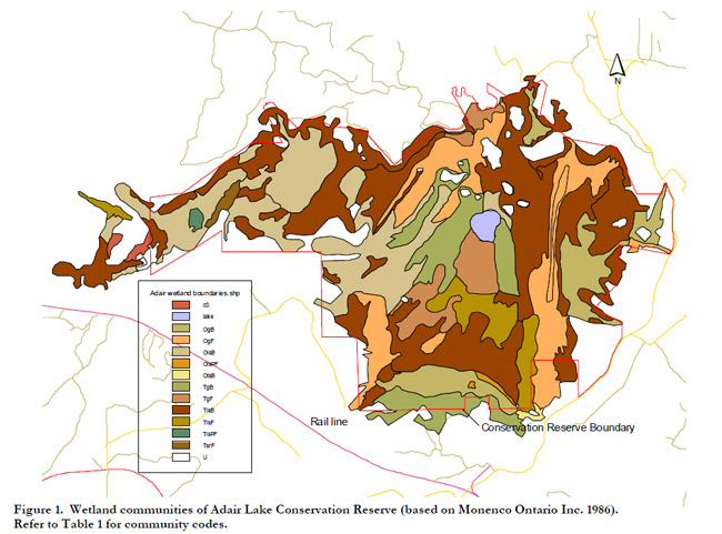
Enlarge Wetland communities of Adair Lake Conservation Reserve (based on Monenco Ontario Inc. 1986).
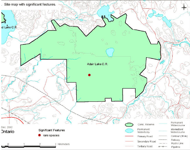
Site map with significant features
Photographs
Photo 1. Open fen makes up about 15% of the Conservation Reserve (photo by Alicia Morin).
Photo 2. Treed fen is found at the edges of the drainage ways (photo by Alicia Morin).
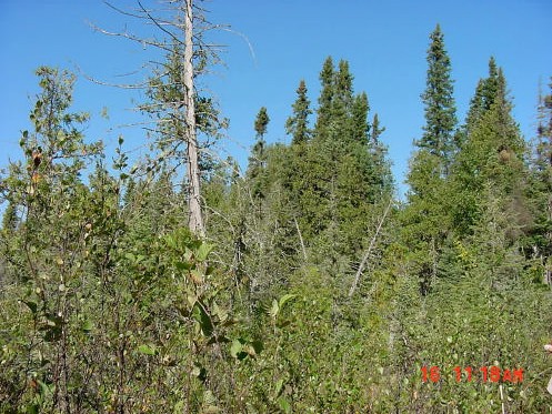
Photo 3. String fen in the main drainage way.
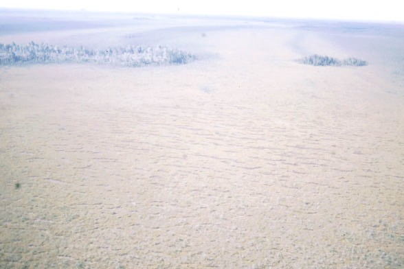
Photo 4. Pools in the string fen are perpendicular to the direction of water flow (photo by Alicia Morin).
Photo 5. Zigzag darner, a provincially rare dragonfly, is common in the open fen.
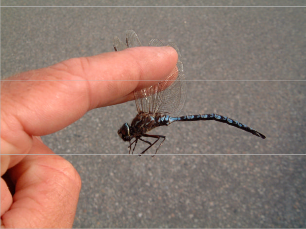
Table 2. Rapid Assessment Plot Summary from Adair Lake
| Plot Number | V / W Type | ES Type | Date |
|---|---|---|---|
| 1 | W17 | ES43 | September 16, 2002 |
| 2 | W18 | ES40 | September 16, 2002 |
| 3 | W24/W21 | ES39 | September 18, 2002 |
| 4 | W22/W28 | ES40 | September 18, 2002 |
| 5 | W26 | ES34 | September 18, 2002 |
| 6 | V20 | ES13 | September 18, 2002 |
Table 3. Landform – Vegetation (LV) Type Representation for Adair Lake in Ecodistrict 4S–3 (Analysis by Ontario Parks; Steve Kingston pers. comm.).*
| LV_Description | Ecodistrict 4S3 Area (ha) | Ecodistrict 4S3 Representation Target (%) | Ecodistrict 4S3 Representation Target (ha) | Ecodistrict 4S3 Protected Areas (ha) | Adair Lake Area (ha) | Adair Lake Contribution to Ecodistrict Target (%) | Adair Lake Contribution to Existing Protection (%) | Adair Lake Confirmed in Field** |
|---|---|---|---|---|---|---|---|---|
| Bedrock–Mixed Forest – mainly Coniferous | 49,571 | 12 | 5,949 | 1,794 | <1 | <1 | <1 | X |
| Bedrock–Dense Deciduous Forest | 31,139 | 12 | 3,737 | 989 | <1 | <1 | <1 | – |
| Glaciolacustrine deposits–Dense Coniferous Forest | 21,279 | 12 | 2,553 | 728 | 91 | 4 | 13 | X |
| Glaciolacustrine deposits–Mixed Forest – mainly Coniferous | 17,484 | 12 | 2,098 | 606 | 43 | 2 | 7 | X |
| Glaciolacustrine deposits–Dense Deciduous Forest | 17,256 | 12 | 2,071 | 254 | 1 | <1 | 1 | – |
| Glaciolacustrine deposits–Sparse Coniferous Forest | 12,134 | 12 | 1,456 | 272 | 27 | 2 | 10 | X |
| Glaciolacustrine deposits–Mixed Forest – mainly Deciduous | 5,259 | 12 | 631 | 69 | 6 | 1 | 8 | – |
| Organic deposits–Dense Coniferous Forest | 3,389 | 12 | 409 | 677 | 110 | 27 | 16 | X |
| Organic deposits–Mixed Forest – mainly Coniferous | 2,572 | 12 | 317 | 633 | 69 | 22 | 11 | – |
| Organic deposits–Dense Deciduous Forest | 1,414 | 16 | 227 | 166 | 22 | 10 | 13 | – |
| Glaciolacustrine deposits–Treed Bog | 1,263 | 18 | 223 | 155 | 95 | 43 | 61 | X |
| Organic deposits–Treed Bog | 1,108 | 20 | 221 | 646 | 615 | 278 | 95 | X |
| Organic deposits–Sparse Coniferous Forest | 1,107 | 20 | 221 | 167 | 84 | 38 | 50 | X |
| Organic deposits–Open Bog | 736 | 30 | 219 | 704 | 713 | 325 | 101 | X |
| Organic deposits–Treed Fen | 563 | 38 | 213 | 454 | 334 | 156 | 74 | X |
| Organic deposits–Mixed Forest – mainly Deciduous | 318 | 56 | 178 | 45 | 26 | 15 | 59 | – |
| Glaciolacustrine deposits–Open Bog | 298 | 58 | 173 | 157 | 160 | 93 | 102 | X |
| Organic deposits–Open Fen | 274 | 61 | 166 | 267 | 274 | 165 | 103 | X |
| Organic deposits–Open Fen | 178 | 72 | 128 | 23 | 36 | 29 | 156 | X |
| Organic deposits–Open Fen | 70 | 88 | 61 | 6 | 4 | 7 | 65 | – |
| Organic deposits–Open Fen | 60 | 89 | 54 | 42 | 44 | 81 | 104 | X |
* The LV matrix was recently refined by Ontario Parks in several ways: 1) revised Ecodistrict boundaries; 2) increased resolution of Landcover28 data (25 m vs. 100 m); 3) terrain is no longer used as a modifier; 4) more accurate surficial geology data; and 5) updated approach to representation targets.
** "X" observed in field; "–" not observed in field
X observed in field;
- not observed in field
Table 4. Original Version of landform – Vegetation (LV) Type Representation for Adair Lake Conservation Reserve Used in Ontario Living Legacy Gap Analysis.
| Site District | Landform | Surface Expression | Burn | Conifer | Conifer Mixed | Deciduous | Deciduous Mixed | Open Wetland | Sparse Forest | Grand Total |
|---|---|---|---|---|---|---|---|---|---|---|
| 4S–3 | End Moraine | Weakly Broken | 1 | 1 | ||||||
| 4S–3 | Lacustrine Deposit | 29 | 25 | 57 | 3 | 1 | 688 | 4 | 807 | |
| 4S–3 | Sum | 29 | 25 | 57 | 3 | 1 | 688 | 5 | 808 | |
| 4S–4 | Lacustrine Deposit | 1 | 8 | 75 | 19 | 4 | 1045 | 1152 | ||
| Grand Total | 30 | 33 | 132 | 22 | 5 | 1733 | 5 | 1960 |
Table 5. Site Type Matrix for Adair Lake
| Type | Arid | Very Dry | Dry | Dry Mesic | Mesic | Wet Mesic | Wet | Very Wet | Saturated | Open Water |
|---|---|---|---|---|---|---|---|---|---|---|
| Colder Rock | ||||||||||
| Colder Sand | ES13, ES19 | ES13, ES19 | ||||||||
| Colder Loam | ||||||||||
| Colder Clay | ||||||||||
| Colder Organic | ES34, ES39, ES40-43 | ES34, ES39, ES40-43 | ES49 | |||||||
| Normal Rock | ||||||||||
| Normal Sand | ES13, ES19-20 | ES13, ES19-20 | ||||||||
| Normal Loam | ES19 | ES19 | ES19 | |||||||
| Normal Clay | ||||||||||
| Normal Organic | ES34, ES39, ES40-43 | ES34, ES39, ES40-43 | ||||||||
| Warmer Rock | ||||||||||
| Warmer Sand | ||||||||||
| Warmer Loam | ||||||||||
| Warmer Clay | ||||||||||
| Warmer Organic |
Adair Lake Species Lists
Vascular Plants
The following plants were observed in Adair Lake Conservation Reserve in 2002. Taxonomic order and species names generally follow Morton and Venn (1990). Introduced species are marked "I". Voucher specimens were collected for species marked "*".
| Family Equisetaceae | Horsetail Family |
|---|---|
| Equisetum fluviatile L | Water Horsetail |
| Equisetum palustre L. | Marsh Horsetail |
| Family Thelypteridaceae | Marsh Fern Family |
|---|---|
| Thelypteris palustris (Salisb.) Schott | Marsh Fern |
| Family Cupressaceae | Juniper Family |
|---|---|
| Thuja occidentalis L | Eastern White Cedar |
| Family Pinaceae | Pine Family |
|---|---|
| Larix laricina (Duroi) K.Koch | Tamarack |
| Picea mariana (Miller) BSP | Black Spruce |
| Pinus banksiana Lambert | Jack Pine |
| Pinus strobus L. | White Pine |
| Family Araceae | Arum Family |
|---|---|
| Calla palustris L | Water Calla |
| Family Cyperaceae | Sedge Family |
|---|---|
| Carex aquatilis Wahlenb | Water Sedge |
| Carex chordorrhiza Ehrh. ex L.f. | Creeping Sedge |
| Carex lacustris Willd. | Lake Sedge |
| Carex lasiocarpa Ehrh. | Wire Sedge |
| Carex limosa L. | Mud Sedge |
| Carex livida (Wahlenb.) Willd. | Livid Sedge |
| Carex magellanica ssp. irrigua Lam. | Quaking Sedge |
| Carex oligosperma Michaux | Few–seeded Sedge |
| Carex pauciflora Light. | Few–flowered Sedge |
| Carex rostrata Stokes | Beaked Sedge |
| Eriophorum vaginatum (Fern.) Hulten | Dense Cottongrass |
| Rhynchospora alba (L.) M.Vahl | White Beakrush |
| Scirpus cespitosus L. | Tufted Club Rush |
| Scirpus cyperinus(L.) Kunth | Black–sheathed Blurush |
| Scirpus hudsonianus | Hudsonian Club Rush |
| Family Iridaceae | Iris Family |
|---|---|
| Iris versicolor L. | Wild Iris |
| Family Juncaceae | Rush Family |
|---|---|
| * Juncus filiformis L. | Thread Rush |
| * Juncus stygius L. | Marsh Rush |
| Family Juncaginaceae | Arrow Grass Family |
|---|---|
| Triglochin maritimum L. | Greater Arrow Grass |
| Family Liliaceae | Lily Family |
|---|---|
| Maianthemum trifolium (L.) Sloboda | Three–leaved Solomon’s Seal |
| Family Orchidaceae | Orchid Family |
|---|---|
| Platanthera clavellata (Michaux) Luer | Green Woodland Orchis |
| Family Poaceae | Grass Family |
|---|---|
| Calamagrostis canadensis (Michaux ) P.Beauv. | Bluejoint Grass |
| Glyceria canadensis (Michaux) Trin. | Rattlesnake Manna Grass |
| Muhlenbergia glomerata (Willd.) Trin. | Marsh Muhly |
| Family Scheuchzeriaceae | Pod–Grass Family |
|---|---|
| Scheuchzeria palustris L. | Pod–grass |
| Family Asteraceae | Sunflower Family |
|---|---|
| Aster borealis (Torrey & A.Gray) Prov. | Rush–leaved Aster |
| Aster lanceolatus Willd. | Panicled Western Aster |
| Betula papyrifera Marshall | Flat–topped Aster |
| Betula pumila L. | Marsh Goldenrod |
| Family Betulaceae | Birch Family |
|---|---|
| Alnus incana (L.) Moench | Speckled Alder |
| Alnus viridis (Chaix) DC. | Green Alder |
| Betula papyrifera Marshall | White Birch |
| Betula pumila L. | Dwarf Birch |
| Family Caprifoliaceae | Honeysuckle Family |
|---|---|
| Lonicera oblongifolia (Goldie) Hook. | Swamp Fly Honeysuckle |
| Lonicera villosa (Michaux) Roemer & Schultes | Mountain Fly Honeysuckle |
| Family Cornaceae | Dogwood Family |
|---|---|
| Cornus canadensis L. | Bunchberry |
| Cornus stolonifera Michaux | Red Osier Dogwood |
| Family Droseraceae | Sundew Family |
|---|---|
| Drosera rotundifolia L. | Round–leaved Sundew |
| Family Ericaceae | Heath Family |
|---|---|
| Andromeda polifolia L. | Bog Rosemary |
| Chamaedaphne calyculata (L.) Moench | Leatherleaf |
| Epigaea repens L. | Trailing Arbutus |
| Gaultheria hispidula (L.) Muhlenb . ex Bigelow | Creeping Snowberry |
| Kalmia polifolia Wangenh. | Bog Laurel |
| Ledum groenlandicum Oeder | Labrador Tea |
| Vaccinium myrtilloides Michaux | Velvet–leaved Blueberry |
| Vaccinium oxycoccos L. | Small Cranberry |
| Vaccinium vitis–idaea L. | Rock Cranberry |
| Family Lentibulariaceae | Bladderwort Family |
|---|---|
| Utricularia intermedia Hayne | Flat–leaved Bladderwort |
| Family Menyanthaceae | Bogbean Family |
|---|---|
| Menyanthes trifoliata L. | Buckbean, Bogbean |
| Family Onagraceae | Evening–primrose |
|---|---|
| Epilobium angustifolium L. | Fireweed |
| Epilobium palustre L. | Marsh Willow Herb |
| Family Primulaceae | Primrose Family |
|---|---|
| Lysimachia thyrsiflora L. | Tufted Loosestrife |
| Family Pyrolaceae | Wintergreen Family |
|---|---|
| Orthilia secunda (L.) House | One–sided Wintergreen |
| Family Ranunculaceae | Buckthorn Family |
|---|---|
| Rhamnus alnifolia L'Her. | Alder–leaved Buckthorn |
| Family Rosaceae | Rose Family |
|---|---|
| * Potentilla fruticosa L. | Shrubby Cinquefoil |
| Potentilla palustris (L.) Scop. | Marsh Cinquefoil |
| Prunus pensylvanica L.f. | Pincherry |
| Rubus acaulis Michaux | Arctic Bramble |
| Rubus pubescens Raf. | Dwarf Raspberry |
| Family Salicaceae | Willow Family |
|---|---|
| Populus tremuloides Michaux | Trembling Aspen |
| Salix bebbiana Sarg. | Bebb’s Willow |
| Salix pedicellaris Pursh | Bog Willow |
| Salix petiolaris Smith | Slender Willow |
| Salix pyrifolia Andersson | Balsam Willow |
| Family Sarraceniaceae | Pitcher Plant Family |
|---|---|
| Sarracenia purpurea L. | Pitcher Plant |
| Family Scrophulariaceae | Figwort Family |
|---|---|
| Melampyrum lineare Desr. | Cow Wheat |
Lichens and mosses
The following lichens and mosses were recorded during fieldwork by the Ontario Peatland Inventory Monenco Ontario Inc 1986).
Lichens
- Cladina mitis (Sandst.) Hustich
- Cladina rangiferina (L.) Hoffm.
Mosses
- Aulacomnium palustre (Hedw.) Schwaegr.
- Pleurozium schreberi (Brid.) Mitt.
- Polytrichum commune Hedw.
- Polytrichum longisetum Brid.
- Sphagnum angustifolium (C. Jens. ex Russ.) C. Jens. in Tolf
- Sphagnum fallax (Klinggr.) Klinggr.
- Sphagnum fuscum (Schimp.) Klinggr.
- Sphagnum magellanicum Brid.
- Sphagnum palustre L.
- Sphagnum papillosum Lindb.
- Sphagnum rubellum Wils.
Adair Lake animal species list
The following animals were observed in Adair Lake Conservation Reserve in 2002. Taxonomic order and nomenclature follow AOU (1998) for birds and Banfield (1974) for mammals.
Birds
Nesting evidence codes follow the Ontario Breeding Bird Atlas:
Possible nesting
H – Species observed in breeding season in suitable habitat.
S – Singing male present or breeding calls heard observed in breeding season in suitable habitat.
Probable nesting
P – Pair observed in their breeding season in suitable habitat.
Confirmed nesting
NU – Used nest or eggshell found (occupied / laid during the atlas period)
FY – Recently fledged young or downy young
| Kites, Eagles and Hawks |
Family Accipitridae |
|---|---|
| Sharp-shinned Hawk | Accipiter striatus |
| Woodpeckers |
Family Picidae |
|---|---|
| H- Black-backed Woodpecker | Picoides arcticus |
| Jays, Crows and Ravens |
Family Corvidae |
|---|---|
| H- Gray Jay | Perisoreus canadensis |
| Common Raven | Corvus corax |
| Wood-warblers |
Family Parulidae |
|---|---|
| Yellow-rumped Warbler | Dendroica coronata |
| Palm Warbler | Dendroica palmarum |
| Woodpeckers |
Family Emberizidae |
|---|---|
| Savannah Sparrow | Passerculus sandwichensis |
Mammals
| Squirrels | Family Sciuridae |
|---|---|
| Red Squirrel | Tamiasciurus hudsonicus |
Dragonflies
Provincially rare species (Oldham et al. 1999) are marked "P". Voucher specimens were collected for species marked "*".
|
Family Aeshnidae |
Darners |
|---|---|
| P- * Zigzag Darner | Aeshna sitchensis |
| Common Green Darner | Anax junius |
|
Family Libellulidae |
Skimmers |
|---|---|
| * White-faced Meadowfly | Sympetrum obtrusum |
| * Ruby Meadowfly | Sympetrum rubicundulum |
Appendix E: Recreation Inventory Checksheet
| Name | Adair Lake Conservation Reserve – C2308 |
|---|---|
| Map Name | Dyment |
| NTS Number | 52 F/09 |
| UTM Reference | 15557989549685 |
| OBM Number | 15550054900, 15560054900 |
| Latitude | 49° 37' |
| Longitude | 92° 11' |
| Area (ha) | 2800 |
| Ownership | Crown |
| MNR Region | Northwest |
| MNR District | Dryden |
| Park Zone | Northwest |
| County | N/A |
| Township | Revell |
| Recreation Features | Recreation Activities |
|---|---|
| 1. E03 – Wetland Vegetation | 1. Q10 - Bird Watching |
| 2. J05 – Organic | 2. |
| 3. E03 – Coniferous | 3. |
| 4. M02 - Lake, Small | 4. |
| 5. W00 - Wildlife, General | 5. |
| 6. | 6. |
| 7. | 7. |
| 8. | 8. |
| Recreation Factors | Features | Rating Very High | Rating High | Rating Moderate | Rating Low | Rating N/A |
|---|---|---|---|---|---|---|
| Most Scarce Feature: | N/A | |||||
| Feature Scarcity: | N/A | |||||
| Most Unique Feature: | N/A | |||||
| Activity Attraction Capability: | Low | |||||
| Scenic Attractiveness: | Moderate | |||||
| Geographic Significance: | N/A | |||||
| Feature Significance: | N/A | |||||
| Most Sensitive Feature to Recreation Use: | 1 | |||||
| Feature Sensitivity to Recreation Use: | Low | |||||
| Most Sensitive Feature to Resource Development: | 1 | |||||
| Feature Sensitivity to Resource Development: | Low | |||||
| Cultural/Historic and Archaelogical Features | N/A |
| Comments: | |
|---|---|
| Date Compiled | September 16, 2002 |
| Compiler | Alicia Morin |
Appendix F: Permitted Uses Table
Summary of Generic Permitted Uses in Conservation Reserves Within the Planning Area
| Use | Existing Conservation Reserves | New Conservation Reserves in the Planning Area |
|---|---|---|
| Commercial timber harvest, commercial hydro development | Not permitted | Not permitted |
| Mineral exploration and mining | Not permitted | There will be no new exploration permitted |
| Bait fishing, commercial fishing, commercial fur harvesting, wild rice harvesting | Existing use permitted to continue, unless there are significant demonstrated conflicts. New operations can be considered, subject to the "test of compatibility". | Existing use permitted to continue unless there are significant demonstrated conflicts. New operations can be considered, subject to the "test of compatibility". |
| Sport hunting | Permitted | Permitted |
| Sport fishing | Permitted, except in specific fish sanctuaries | Permitted, except in specific fish sanctuaries |
| Seasonal recreation camps ("hunt camps") | Existing camps permitted to continue, and may be eligible for enhanced tenure, but not purchase of land (see 6.1.8) | Existing camps permitted to continue, and may be eligible for enhanced tenure, but not purchase of land (see 6.1.8) |
| Commercial Bear Hunting | Existing use permitted to continue. New operations not permitted | Existing use permitted to continue. New operations not permitted |
| Tourism facilities (for resource–based tourism) and recreational trails | Existing authorized facilities and trails can continue, unless there are significant demonstrated conflicts. No new tourism facilities permitted. New trails can be considered as part of planning for an individual reserve | Existing authorized facilities and trails (motorized and non–motorized) can continue, unless there are significant demonstrated conflicts. Tourism facilities can apply to upgrade tenure from LUP to lease. New tourism and trail facilities can be considered as part of planning for an individual reserve |
| Land Disposition | Sale of lands is not permitted. Renewals of existing leases or land use permits are permitted; requests for transfer of tenure will be considered in the context of the Statement of Conservation Interest or Resource Management Plan. New leases or land use permits permitted for approved activities | Sale of lands is not permitted. Renewals of existing leases or land use permits are permitted; requests for transfer of tenure will be considered in the context of the Statement of Conservation Interest or Resource Management Plan. New leases or land use permits permitted for approved activities |
| Roads | Existing roads can continue to be used, but new roads for resource extraction will not be permitted | Existing roads can continue to be used, but new roads for resource extraction will not be permitted, with the exception of necessary access for mineral exploration and development |