Canadian Urban Institute: Innovative Water Mapping
Information on a drinking water project through the Showcasing Water Innovation program.
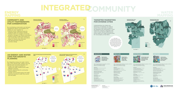
Project overview
Identify, integrate and visualize datasets to enhance water planning and management using Geographic Information Systems.
A model for integrated water mapping will be applicable to municipal water sustainability planning by helping municipalities identify and evaluate water supply, collection and treatment needs.
Expected outcomes
- better information for informed decision making
- improved water management
Organization website
Photos
Translating datasets into integrated water mapping
Contact
Jeff Evenson
Principal, Connector
jevenson@canurb.org
416-365-0816 ext. 281
Updated: March 09, 2023
Published: March 20, 2014