D-6-3 Separation Distances
A guide for land use planning authorities on how to measure recommended distances between industrial areas and sensitive land uses to protect people and the environment.
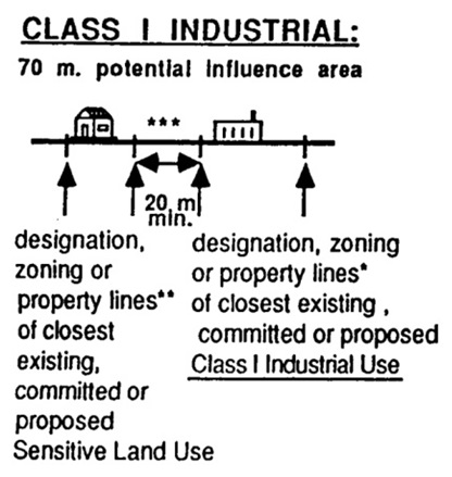
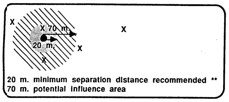
Class I industrial
- 70 metre potential influence area
- 20 metre recommended minimum in which incompatible development should not normally take place
Section view
This diagram shows the designation, zoning or property lines of an existing, committed or proposed sensitive land use in relation to the designation, zoning or property lines of the closest existing, committed or proposed Class I industrial use.
Plan view
This diagram shows an overhead view of the recommended minimum separation distance (20 metres), potential or actual influence area distance (70 metres), and acceptable range (greater than 70 metres) between sensitive land use and Class I industrial use.
The solid black dot indicates an existing land use, and the Xs indicate a proposed land use.
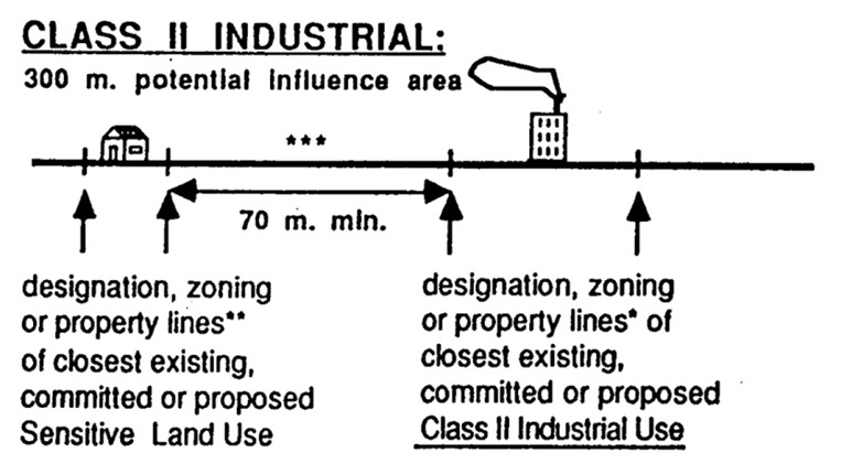
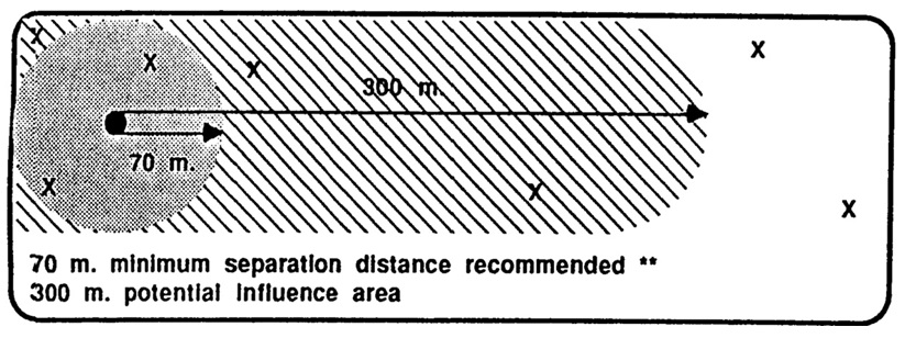
Class II industrial
- 300 metre potential influence area
- 70 metre recommended minimum in which incompatible development should not normally take place
Section view
This diagram shows the designation, zoning or property lines of an existing, committed or proposed sensitive land use in relation to the designation, zoning or property lines of the closest existing, committed or proposed Class II Industrial Use.
Plan view
This diagram shows an overhead view of the recommended minimum separation distance (70 metres), potential or actual influence area (300 metres), and acceptable range (greater than 300 metres) between sensitive land use and Class II industrial use.
The solid black dot indicates an existing land use, and the Xs indicate a proposed land use.
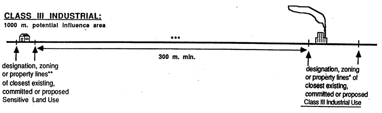
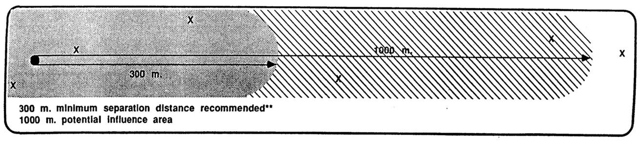
Class III industrial
- 1000 metre potential influence area
- 300 metre recommended minimum in which incompatible development should not normally take place
Section view
This diagram shows the designation, zoning or property lines of an existing, committed or proposed Sensitive Land Use in relation to the designation, zoning or property lines of the closest existing, committed or proposed Class III Industrial Use.
Plan view
This diagram shows an overhead view of the recommended minimum separation distance (300 metres), potential or actual influence area (1000 metres), and acceptable range (greater than 1000 metres) between sensitive land use and Class III industrial use.
The solid black dot indicates an existing land use, and the Xs indicate a proposed land use.
References
Recommended minimum separation distance
Incompatible development should not normally be permitted within the recommended minimum.
See the following Sections:
- Section 4.3 Recommended Minimum
- Section 4.10 Redevelopment, Infilling and Mixed Use Areas
- Section 4.2.5 Off-Site Separation Distances
Recommended potential area of influence or actual area of influence
“Adverse effects” need to be identified, mitigation proposed and an assessment made on the acceptability of the proposal. See “Section 4.1 Influence of Area Concept”.
Acceptable range
Beyond the potential area of influence, therefore normally development in this range should not pose a compatibility problem. See “Section 4.5.2 Separation Distances Greater than the Potential Area of Influence” for exceptions.
Measuring separation distance
See Section 4.4 Measuring Separation Distances.
The set backs established in zoning by-law can be included in the separation distance measurement if the by-law or site plan control precludes the use of the set back for activities that could create an adverse effect. See “Section 4.4.3, Zoning/Site Plan Control (Industrial Land Uses)”.
Where the established use on-site and ancillary lands associated with a sensitive land use are not of a sensitive nature (e.g., parking lot or roadway), measurement may be taken to where the sensitive activities actually begin.
See the following Sections:
- Section 4.4.2 Site Specific Plans
- Section 4.4.4 Ancillary use (Sensitive Land Use)
This approach may be particularly appropriate for redevelopment/infill proposals. “See Section 4.10 Redevelopment, Infilling and Mixed Use Areas.”
If the existing land use is industrial, then the proposed land use is sensitive, and vice versa.