Lake of the Woods Provincial Park Management Statement
This document provides policy direction for the protection, development and management of Lake of the Woods Provincial Park and its resources.
May, 1985
Regional Director’s approval statement
This Interim Management Statement will provide interim direction for the management of the Lake of the Woods Provincial Park. Addition until a comprehensive Park Management Plan is prepared.
This statement will provide the basis for the subsequent preparation of the Park Management Plan.
I am pleased to approve this Interim Management Statement for the Lake of the Woods Provincial Park Addition.
D. R. Johnston
Regional Director
Northwestern Region
Introduction
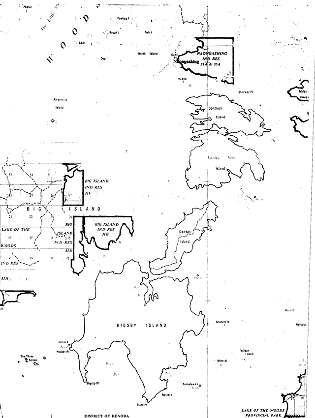
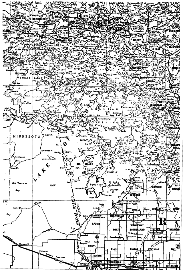
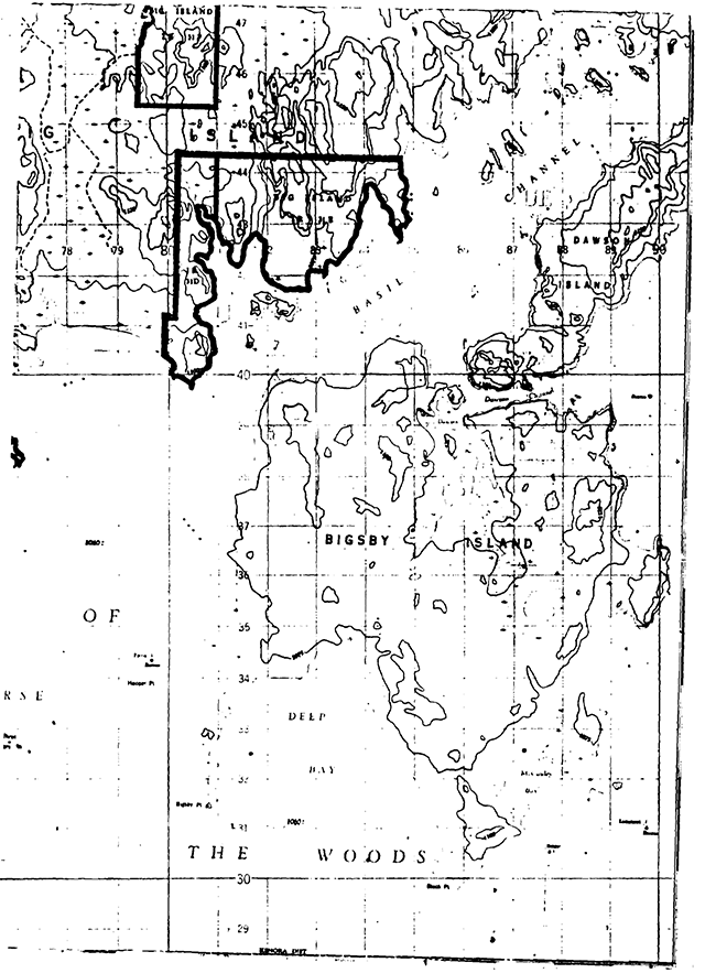
The addition of the Lake of the Woods Provincial Park includes Bigsby, Dawson, Painted Rock and Splitrock Islands and The Three Sisters Islands. These islands are included as a nature reserve zone to the existing provincial park.
Generally, traditional local uses of these islands (with the exception of timber harvesting) will be permitted to continue provided they do not jeopardize long-term park objectives or adversely impact known park values. The park management plan will further address the specific management of these islands.
Background information
- Name: Lake of the Woods Provincial Park Addition
- Proposed class: Nature Reserve Zone
- M.N.R district: Kenora
- M.N.R region: Northwestern
- TotaL area (ha): 11,800
- Land:
- Water:
- Site region: 55
- Site district: 1 and 2
- Date in regulation: January 24, 1984
Regional setting map
Targets
-
Life science representation
site type/landscape unit
- Landscape Unit 28-Manitou-Kenora Drift Complex
species/communities
White Pelican nesting site.
- Landscape Unit 31-Rainy River Clay Plain
species/communities
Black Cormorant nesting site.
Two biophysiographic units.
- Landscape Unit 28-Manitou-Kenora Drift Complex
-
Earth science representation
geological theme
- Lake Archean Tectonic
Feature
Acid instrusions, Aulneau batholith
- North Bay Interstadial
Feature
Clay, littoral sand features
- Lake Archean Tectonic
-
Cultural resource representation
theme:
Unknown
theme segment:
Unknown
-
Recreation opportunities
- day use: unstructured
- car camping: n/a
- Wilderness/back country: n/a
Inventories
| level/type | earth science | life science | cultural | recreational | other |
|---|---|---|---|---|---|
| reconnaissance completion date | 1979, 1980 | 1978, 1980 | 1982 | 1982 | |
| detailed completion date | not completed | not completed | not completed | not completed |
Management guidelines
-
Land tenure
3 Land use permits issued for commercial fish camps
1 Land use permit issued for sawmill site
1 Land use permit issued for barbage disposal siteGuideline
Existing land tenure will be permitted to continue and will be addressed during the preparation of the park management plan.
-
Land acquisition/disposition
5 patented locations - GW-4, 1.17 acres; EB-796, 4.83 acres; EB-1610, 1.0 acre; EB-1700, 2.84 acres; EB-1738, 0.73 acres
Guidelines
Existing patented properties will remain. Future status will be addressed during the preparation of the park management plan.
The further disposition of Crown-owned lands will not be considered.
-
Existing/proposed development
No existing park development
Guideline
The islands are included as a nature reserve zone to the existing park and as such, future development will be limited to trails, and minimal interpretive facilities for research and educational purposes. Park development will only occur under the guidance of an approved park management plan.
-
Recreation activities
The islands presently experience low intensity, dispersed recreational activity including day-use recreation (swimming/picnicking, shore lunches, etc.) camping, and waterfowl hunting. While there are no sport fishery waters located on the islands, the waters surrounding the islands are angled by local residents and guests of tourist operators.
Guideline
Existing recreational activities will be permitted to continue and will be further addressed durin6 the preparation of the park management plan.
-
Commercial activities
Traplines in the park area:
- KE 142 - part Splitrock Island and part Painted Rock Island
- KE 143 - part Splitrock Island
- KE 150 - Dawson Island
- KE 151 - Part of Painted Rock Island
- KE 152 - Part of Painted Rock Island
- KE 159 - Part of Bigsby Island
- KE 160 - Part of Bigsby Island
Mineral exploration/extraction has been recommended to continue as a permitted use.
The local commercial tourism industry utilizes the islands for sport fishing in adjacent waters and waterfowl hunting from the shoreline.
Guideline
Trapping will be permitted to continue and will be further addressed during the preparation of the park management plan.
No other new commercial activities will be allowed.
Mineral exploration may be permitted through the Exploratory Licence of Occupation procedure, under Section 190, R.S.O. of the Mining Act.
Mineral exploration may be permitted in such a way that it does not conflict with the future management options of the provincial park or protection of identified park values.
Aggregate extraction will not be permitted within the park.
The present level of commercial tourism activity will be permitted to continue.
-
Native interests
3 licenced Native trappers
Guideline
Trapping will be permitted to continue and will be further addressed during the preparation of the park management plan.
-
Natural resources
Some natural resource values have been identified to date (earth and life science, cultural, etc.) in preliminary inventories.
One natural resource management concern regarding personal use fuelwood cutting has been identified.
Guideline
Personal use fuelwood cutting on the islands will be permitted to continue for those individuals with land tenure (ie. LUP, lease, patented property). A district fuelwood permit is required. This activity will be further addressed during the preparation of the park manabement plan.
-
Cultural resources
2 pictgraph sites
1 graveyard siteGuideline
Known cultural/historical resources will continue to be managed and protected through the co-operation of the Ministry of Citizenship and Culture.
-
Client services
Information on the earth and life science features of the islands should be made available to the public in order to gain an appreciation of their biological and geological significance.
-
Research
Earth and Life Sciences reconnaissance inventories have been completed.
Detailed inventories are required for earth and life sciences, as well as cultural and recreational resources.
Guideline
Research will be encouraged to further document park values by the Ministry of Natural Resources and other outside interests.
-
Marketing
Not applicable
List of sources and references
Kor, P. - Earth Science Inventory Checklist - Bigsby, Dawson, Painted Rock and Splitrock Islands. Ontario Ministry of Natural Resources, 1979, 1980.
Noble, T. - Life Science Inventory Check-Sheet - The Three Sisters, Bigsby, Dawson, Painted Rock and Splitrock Islands. Ontario Ministry of Natural Resources; 1978, 1980.
Ontario Ministry of Natural Resources, Kenora District Land Use Guidelines, 1983
Ontario Ministry of Natural Resources, White Pelican Position Paper, April 1977.
Ranford, Barry, “Ontario’s Pelican Islands” Ontario Naturalist, June, 1971
22. Bigsby Island
- Area description
This area is made up of four large islands in south Lake of the Woods. These islands include Painted Rock, Splitrock, Dawson and Bigsby as well as nature reserve zone to form an addition to the the smaller Three Sisters Islands. The islands are relatively undisturbed and provide good examples of local vegetative communities and are also representative of Landscape Unit 28; the Manitou-Kenora Drift Complex, characterized by large, relatively homogeneous terrain of rolling, bedrock-controlled uplands interspersed with numerous lakes and wetlands. It should be noted, however, that Bigsby Island itself represents Landscape 31, The Rainy River Clay Plain. - Land Use Intent
The islands are recommended for park status as a nature reserve zone to form an addition to the existing Lake of the Woods Provincial Park. An outline of the ongoing activities which are recommended for continuation is given in the Land Use Activity section, however, it must be realized that in some instances further refinement may be required. - Land Use Activity for area No. 3-Lola Lake area
| Activity | Acceptable | Recommended Guidelines |
|---|---|---|
| Aggregate Extraction | No | |
| Agriculture | No | |
| Bait Fishing | No | |
| Commercial Fishing | No | |
| Cottaging | No | |
| Forestry | No | |
| Hunting | Yes | It is recommended that waterfowl hunting from shorelines be permitted to continue. |
| Mining | Yes | It is recommended that mineral exploration/extraction be permitted to continue. |
| Provincial Parks | Yes | This area is recommended for park status as an addition to Lake of the Woods Natural Environment Park. |
| Roads | No | |
| Rural Residential | No | |
| Sport Fishing | No | It is recommended that sport fishing be permitted to continue. |
| Tourism | No | |
| Trapping | Yes | It is recommended that existing trapping activity be permitted to continue. |
| Wildlife Viewing | Yes | |
| Wild Rice Harvesting | No | |
| Urban Development | No |
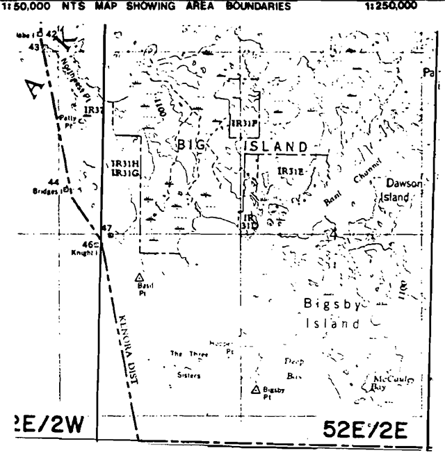
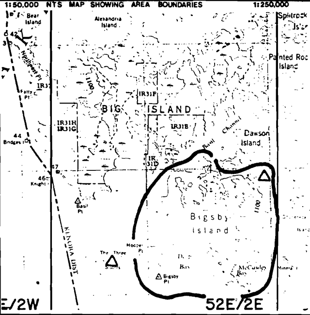
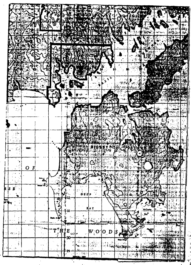
Map of Bigsby Island
Ontario nature reserves program - Life science inventory check-sheet
- Name: The Three Sisters - White Pelicans
- Map name: Big Island
- Map number: 52E/2E
- UTM ref.: 770330
- County, district or regional municipality: District of Kenora
- Lat: 49°02'N
- Long.: 94°41'W
- Alt. min: ±1060
- Alt. max: ±1070
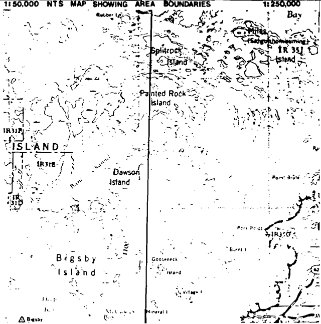
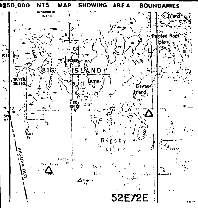
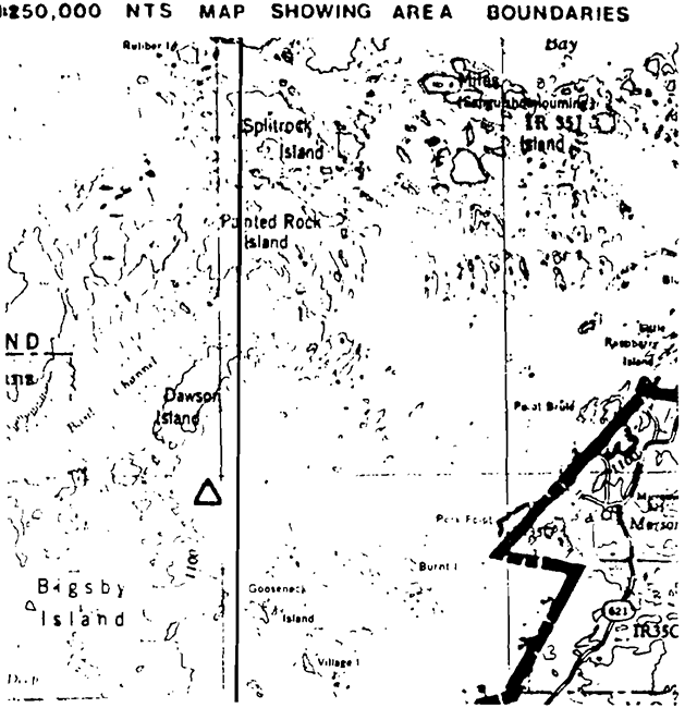
- NTS map showing area boundaries
- Locality: Lake of the Woods
- Township
- Lots
- Concessions
- Area: about 10 acres, about 4 ha
- Ownership: Crown
- Administration: Ministry of Natural Resources
- Forest region and district: L.11 Rainy River
- Site district: 5S – 2
- Map region and district: NWR – Kenora
- Conservation Authority
- Aerial photographs
- Base map:
- Year
- Roll
- Flight line
- Numbers
- Base map:
Map of Big Island
Physical and biological features
The Three Sisters consist of a few small rock islands off the much larger Bigsby and Big Islands in Lake of the Woods. These small islands support Ontario’s only colony of white pelicans (Pelicanus erythrorhynchos) who share their domain with doublecrested cormorants (Phalacrocorax auritus). There is very little vegetation remaining on these islands as much of it has been killed off through defecation by the colony. When the island has been completely denuded the pelicans will move on to a new nesting location (Ranford, 1971). The waters of these and adjacent islands are used as feeding areas.
These islands should receive some form of protection. As the pelicans could move on to a new area in a few years, the area designated for protection should incorporate their normal feeding grounds such as the shorelines of Big & Bigsby Islands. If they do leave, the protection of their habitat would allow for its natural rehabilitation and their possible return.
Data sheets attached
- Physical description
- Vegetation summary
- Evaluation sheet
- Community description
- Community company lists
- Summary species lists
- Physical features map
- Vegetation map
- Bibliography
- Photographs
Major information sources
Ranford, B., 1971. Ontario’s Pelican Islands Ontario Naturalist, June, p.4-9.
Evaluation and priorities
This area has potential as a candidate Nature Reserve (see above).
Ontario nature reserves program - Life science inventory check-sheet
- Name: Bigsby Island
- Map name: Big Island
- Map number: 52E/2E
- UTM ref.: 77035036030
- County, district or regional municipality: District of Kenora
- Lat: 49°04'N
- Long.: 94°34'W
- Alt. min: ±1060
- Alt. max: ±1125
- Locality: Lake of the Woods
- NTS map showing area boundaries
- Township
- Lots
- Concessions
- Area: about 10 acres, about 4 ha
- Ownership: Crown
- Administration: Ministry of Natural Resources
- Forest region and district: L.11 Rainy River
- Site district: 5S – 2
- Map region and district: NWR – Kenora
- Conservation Authority
- Aerial photographs
- Base map:
- Year
- Roll
- Flight line
- Numbers
- Base map:
Map of Big Island
Physical and biological features
Bigsby Island, located in Lake of the Woods immediately south of Big Island, is similar to its neighbour in that they both have value for representing the same two biophysiographic units, namely:
- very weakly broken lacustrine clay plain with clay till and peatlands being a significant part of this landscape - closed deciduous forest is prevalent on the mineral soil sites while black spruce dominated swamp and bog vegetation types are wide spread on organic soils. Two excellent marshes are found in Dawson & McCauley Bays. Littoral features include extensive sand beaches with occasional sand beaches and shoreline marshes, Some aeolian sands were noted blowing off some of these sand beaches into lagoons & swamps;
- weakly broken wave-washed bedrock plain with pockets of lacustrine clay. The low bedrock knolls support relatively open coniferous forest with closed deciduous forest on the clay sites. It does not appear that this bedrock area was burnt at the same time as the fire on Big Island as the forest here is more mature and not as open. This bedrock unit is quite small compared to that on Big Island. This island has excellent representational value to the Nature Reserve system as its two major biophysiographic units are representative of the site region. The line dividing the site region into two site districts conceivably passes between these two
Data sheets attached
- Physical description
- Vegetation summary
- Evaluation sheet
- Community description
- Community company lists
- Summary species lists
- Physical features map
- Vegetation map
- Bibliography
- Photographs
Major information sources
Evaluation and priorities
Bigsby Island is relatively undisturbed and consequently has excellent potential as a candidate Nature Reserve for the representation of terrain characteristic of the units. According to the OLI maps, clay, rock, peat and sand (silty) substrates are found here.
The waters off this island are used as feeding areas by white pelicans and doublebreasted cormorants from the nearby Three Sisters islands (52E/2E U.T.M. 770327).
Map of Bigsby Island
Field notes
- Field No. : 9-6 NWR
- Date: 1980.09.11
- Area name: Bigsby Island
- Location: 52E/2 (Big Island), 797341
- Feature: Mature Deciduous Forest
- Abiotic components:
- Microclimate - Normal to warmer than normal
- Slope - Level
- Drainage - Good, internal
- Substrate - Stony sand
- Aspect –
- Biotic components - Vegetation composition by stratum:
- Tree - Mature Forest - White Elm, Black Ash, Bur Oak
- Shrub - Black Ash, Rubus idaeaus
- Herb - Polygonum spp., Parthenocissus vitacea, *Caulephyllum thalictroides, Aralia nudicaulis, Smilacina racemosa
- Bryoid -
- Faunal notes - Red Squirrel, Blue Jay, Black Bear, Yellow-shafted Flicker
- Incidental notes: Ground flora somewhat sparse.
- Note: Change on Painted Rock Island to (white?) spruce on rock.
- fish camp on NW shore, Bigsby Is.
Field notes
- Field No. : 9-7 NWR
- Date: 1980.09.11
- Area name: Bigsby Island
- Location: 52E/2 (Big Island), 797341
- Feature: Bedrock Outcrop
- Abiotic components:
- Microclimate - Warmer than normal
- Slope - Level
- Drainage - Severe, External Except for Pockets
- Substrate - Granitic Bedrock
- Aspect –
- Biotic components - Vegetation composition by stratum:
- Tree - Bur oak - Scrub
- Shrub - Juniperus communis, Ribes triste, Amelanchier sp.
- Herb - Convolvulus sp., Corydalis sempervirens, Rubus idaeaus, Spirea alba, Athyrium filix-femia, Vaccinium myrtiloides
- Bryoid - Polytrichum cushions, fruticose lichens
- Faunal notes
- Incidental notes
Ontario nature reserves program - Life science inventory check-sheet
- Name: Splitrock Is., Dawson Is., Printed Rock Is.
- Map name: Big Island, Morson
- Map number: 52E/2, 52E/1
- UTM ref.:
- County, district or regional municipality: District of Kenora
- Lat: 49°11'N
- Long.: 94°30'W
- Alt. min: 340m; 1060'
- Alt. max: 390m; 1200'
- Locality: Lake of the Woods
- NTS map showing area boundaries
- Township / Lots / Concessions
- Area: acres, ha
- Ownership: Crown, 3 small private parcels
- Administration: Ministry of Natural Resources
- Forest region and district: Great Lakes - St. Lawrence Quetico
- Site district: 5S – 1
- Map region and district: NWR – Kenora
- Conservation Authority
- Aerial photographs
- Base map: Year / Federal Series / Roll / Flight line: A13559 / Numbers: 64-66
Map of Big Island, Morson
Physical and biological features
Within the N-S extent of these islands occurs a widely recognized dividing line between site districts (Site Region 55, Hills, 1959), Forest Districts (Great Lakes St. Lawrence, Rowe, 1972) and Biophysiographic Units (Noble, 1979). While the islands give a limited sample area they provide an opportunity to study the changes associated with these divisions and give representation to the two 1anscape units (Manitou Kenora Drift Complex and Rainy River Clay Plain) that have their boundary here.
The potential variety provided by this boundary area is greater than that of the Aulneau Peninsula. There has been some disturbance on Dawson Island (limited cutting but islands provide ideal situations for maintenance of ecosystem integrity.
Data sheets attached
- Physical description
- Vegetation summary
- Evaluation sheet
- Community description
- Community company lists
- Summary species lists
- Physical features map
- Vegetation map
- Bibliography
- Photographs
Major information sources
Hills, G.A. 1959. A Ready Reference to the Description of the Land of Ontario.
Rowe, J.S. 1972. Forest Regions of Canada.
Noble, T.W. 1979. Life Science Rep't, Site Region 5S.
Evaluation and priorities
Recommended for Nature Reserve status in lieu of Aulneau Peninsula
Earth science inventory checklist
- Name: Bigsby Island
- Map name: Big Island
- Map number: 52E/2
- UTM reference: 850360
- County:
- Township:
- Lat: 49°04'N
- Long.: 94°35'W
- Alt. min: 340m; (1060')
- Alt. max: 365m; (1200')
- Township: Brownridge, Zealand, Laval, Hartman
- Lot Concession: Directly S. of Big Islands 75 km S. of Kenora, 45 km W. of Nestor Falls, in Lake of the Woods.
- Area: 14630 acres; 5820 ha
- Ownership: Crown
- Administration
- Map region and district: NWR – Fort Frances
- Conservation Auth.:
- Aerial photographs - Basemaps
- Year: Federal Series
- Roll
- Flight line: A13559
- Numbers: 30-32
Map of Big Island
Earth science features
- wave-washed granitic bedrocks Wabigoon Subprovinces with pockets of lacustrine clays and stony sand till
- weakly broken lacustrine clay plain with major peatlands
- west shore has extensive littoral features of sand (beachess spits, tombolo, backshore marshes)
Sensitivity
- bedrock areas have low sensitivity; sand and marsh areas have high sensitivity
Significance
- good representation of wave-washed bedrock terrain
- lacustrine deposits of glacial Lake Agassiz well-represented
- excellent littoral features, present-day processes
Major references:
Date compiled:
Compiler:
Physical features:
brief field visitation 11 Sept. 1980.
Bigsby Island lies within a granitic terrain of the Wabigoon Subprovince, Superior Structural Province, Canadian Precambrian Shield. The eastern portion of the island is characterized by wave-washed bedrock knolls with wetland pockets of lacustrine clay, silt and probably some sand. The bedrock consists of undifferentiated granitic intrusive rocks believed to be part of a large intrusive event associated with the emplacement of the Aulneau Batholith to the north (Ziehlke,1974). Age of the bedrock is probably in the range of 2500 m.y., the date of the culmination of the Kenoran Orogeny which closed the Archean System. Large inclusions of mafic host rock were observed in the field, and the granitic bedrock proved to be somewhat foliated.
The greater portion of the island consists of a very weakly broken lacustrine clay plain with major peatlands and probably minor clay till. The west shore of Bigsby Island is dominated by extensive littoral features of sand, predominantly sand beaches, backshore marshes and sand spit development. Notable features include: 1) sand spit on the west side of Deep Bay (UTM 812332); 2) double sand spit complex which culminates in Bigsby Point (UTM 807330); 3) sand spit development in the NE portion of Deep Bay (UTM 842333 and 830341); 4) tombolo bar at Black Point (UTM 854302); 5) double spit/lagoon development on the NW shore of the island (UTM 821400). Though these littoral features are probably of recent origin, the sand deposits originated in the shallow waters of glacial Lake Agassiz, possibly as littoral or near-shore features. This lake is also responsible for the wave-washing of the higher bedrock knolls which occur on the island.
A small sand beach on the west side of the island (52E/2, UTM B00345) consists of fine-medium grained immature yellow sand with some coarser material. Boulders and cobbles occur near the bedrock exposures. The dry beach is relatively wide (7-10 m) and is backed by a 0.6-1.0 m high storm berm and a wetland backshore. Freshwater shells are a common component of the beach material, as well as Paleozoic carbonate rock fragments, probably introduced by the Keewatin glaciers from Manitoba. Clay probably underlies much of the islands' wetland areas, though this could not be substantiated by field observations. Glacial striae and an excellent set of chattermarks (noted at UTM 800345) indicate a north to south ice movement.
Significance:
Bigsby Island represents the following earth science features: wave-washed bedrock; granitic terrain of the Wabigoon belt, Superior Structural Province; glacial Lake Agassiz lacustrine deposits; littoral features of sand. Representation of these elements is probably better achieved on Big Island but the features on Bigsby Island are nonetheless of educational and scientific significance. Generally, the boundary between the Manitou-Kenora Drift Complex and the Rainy River Clay Plain crosses through the island; the former is represented by the high eastern wave-washed bedrock knolls, the latter by the remainder of the island - low, wet and clay dominated.
Recommendations:
It is recommended that Bigsby Island be considered a candidate wilderness area. On-site evaluation of the features described above should be made. In conjunction with Splitrock, Painted Rock and Dawson Islands, Bigsby Island would contribute significantly to representing the transition between the clay plain to the south and the bedrock uplands to the north. The islands could serve as an alternate to the Aulneau Peninsula wilderness proposals; similar features are represented in [text unavailable]
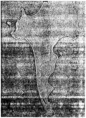
Topographic map of Bigsby Island
Tepographic map showing location and physiography of Bigsby Island
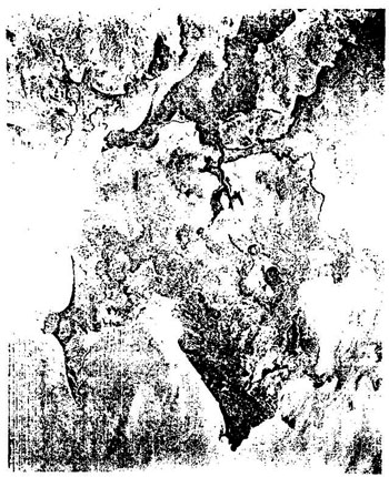
Airphoto (A 13559-31) showing physiography of Bigsby Island
Photo
65.4902
13.5
Scale: 1 inch = ¼ mile
Earth science inventory checklist
- Name: Split Rock, Painted Rock, Dawson Is.
- Map name: Morson Big Island
- Map number: 52E 1 / 52E 2
- UTM reference: see map
- County:
- Township:
- Lat: 49°11'N
- Long.: 94°30'W
- Alt. min: 340m; (1060')
- Alt. max: 390m; (1200')
- Township:
- Lot Concession: in Lake of the Woods. in a northsouth line south of the Aulneau Peninsula and north of Bigsby Is.
- Area: Splitrock - 1100 ha (2720 ac.)
- Painted Rock - 1650 ha (4080 ac.)
- Dawson - 1250 ha (3090 ac.)
- Ownership: Crown
- Administration
- Map region and district: NWR – Fort Frances
- Conservation Auth.:
- Aerial photographs - Basemaps
- Year: Federal Series
- Roll
- Flight line: A13559
- Numbers: 64-66
Map of Big Island
Earth science features
- granitic terrain in the Wabigoon Subprovince, Superior Province, Canadian Precambrian Shield.
- southern edge of the Aulneau Batholith exposed on Split Rock Is.; contemporaneous granitic stock exposed on Painted Rock and Dawson Is.
- wave-washing by glacial Lake Agassiz extensive on Painted Rock and Dawson Is.; a thin mantle of till remains on Split Rock Island.
- minor pockets of lake clays in bedrock depressions.
Sensitivity
- low to most uses.
Significance
- adequate representation of: Manitou-Kenora Drift Complex, granitic terrain of Wabigoon Subprovince, wave-washed bedrock of glacial Lake Agassiz.
Major references
Zoltai, 1961.
Date compiled
Compiler
Physical features:
brief field visitation 11 Sept. 1980.
Split Rock, Painted Rock and Dawson Islands occur in a north-south line between the Aulneau Peninsula and Bigsby Island in the southern portion of Lake of the Woods. All three islands consist of undifferentiated granitic intrusive rocks of the Wabigoon Subprovince, Superior Province, Canadian Precambrian Shield. Split Rock Island lies within the southern portion of the Aulneau Batholith, a huge complex of granitic terrain which underlies most of the Aulneau Peninsula (Zieklke, 1975, p.6). An east-west lineation in the bedrock is evident on air photographs, an effect common to the edges of large plutonic intrusions. Painted Rock and Dawson Islands also exhibit a very evident lineation on the air photographs, in a distinct circular pattern roughly 8 km (5 mi.) in diameter. The islands represent the exposed portions of a small circular (50 sq. km or 5000 ha stock probably intruded into the surrounding country rock at about the same time as the Aulneau Batholith. The centre of the stock lies between Painted Rock and Dawson Islands. Detailed studies on the rocks of the islands have as yet not been attempted.
Zoltai (1965, Map S165) indicates that the degree of till cover changes appreciably from Split Rock Island, where the bedrock is essentially mantled by a thin veneer of stony sand till, to Painted Rock Island, where large areas of bare bedrock attest to the wave-washing action of glacial Lake Agassiz. These observations were substantiated by an air photo review and a brief aerial reconnaissance of the islands by the writer. Dawson Island is also wave-washed, with very little surficial aggregate apparent from the air photographs or the brief aerial survey. Low1ying wetlands occur commonly in the numerous bedrock depressions, particularly between the elongate bedrock ridges.
Significance:
Split Rock, Painted Rock and Dawson Islands represent virtually the same type of terrain as the Aulneau Peninsula, but do so in a much smaller surface area. The plutonism which closed the Early Precambrian about 2500 m.y. ago is well-represented by a small portion of the Aulneau Batholith (on Split Rock Island), and a distinct, contemporaneous granitic stock (on Painted Rock and Dawson Islands). The Painted Rock stock probably contains a wealth of granitic textures and associations in a relatively small geographic area, as an almost unbroken section is exposed from the centre to the edge of the intrusion. Representation of wave-washed bedrock knolls (due to high water levels in glacial Lake Agassiz) and the “thin till over bedrock” component of the landscape is also excellent within the group of islands. Like the Aulneau Peninsula Candidate Wilderness Area, the islands described in this checksheet adequately represent a portion of Site District 1, Site Region 5S (as described by Hills; see Life Science Framework) and the Manitou-Kenora Drift Complex, a large, relatively homogenous terrain of rolling, bedrock-controlled uplands interspersed with numerous lakes and wetlands (see Landscape Unit Descriptions in final report, Earth Science Systems Plan, 1981).
Recommendations:
The features which occur on Split Rock, Painted Rock and Dawson Islands essentially duplicate those found on the Aulneau Peninsula. It is recommended that the islands be considered as a viable alternative to the Aulneau Peninsula in representing the earth science elements which they share.
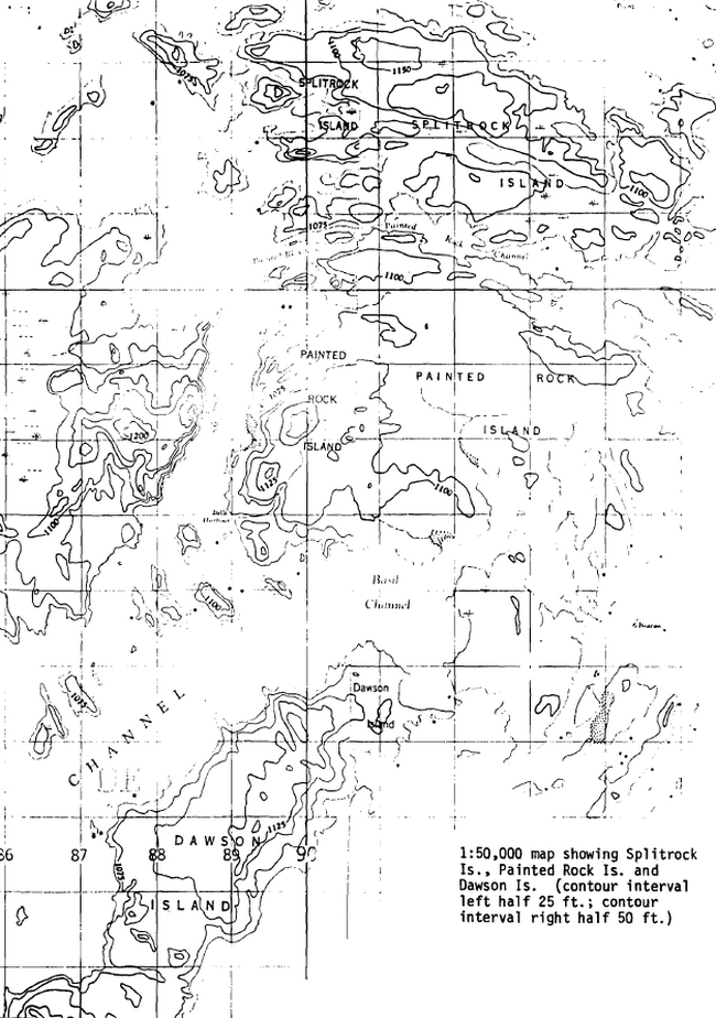
1:50,000 map showing Splitrock Is., Painted Rock Is. and Dawson Is.
(contour interval left half 25 ft.; contour interval right half 50 ft.)
Airphoto (scale 1 in.=1 mi.) showing Splitrock, Painted Rock and Dawson Islands
Note very distinct circular bedrock pattern on Painted Rock and Dawson Islands, the effect of a foliated plutonic intrusion.