Map of Matachewan First Nation candidate lands
Created during treaty land entitlement negotiations between Matachewan First Nation, Canada and Ontario, this map shows the proposed Matachewan First Nation candidate lands, which are about 150 km south of Timmins.
The Matachewan First Nation is located north of the Township of Matachewan, about 60 kilometres west of Kirkland Lake, and about 150 km south of Timmins.
This sketch was created during treaty land entitlement negotiations between Matachewan First Nation, Canada and Ontario. The proposed Candidate Lands have been identified and selected in collaboration with Ontario. It is for discussion purposes only.
The map includes a legend with Candidate Lands, Disposition, Private, Unpatented, Tenure Pending, Mining Claim, First Nation’s Reserve, Provincial Park, Conservation Reserve, Unorganized Area, Municipality, Geographic Township, Lot Fabric, Waterbody, Wetland, Watercourse, Utility Line, Roads, Dam, Aggregate Site.
It was published in November 2016.
Click the image below to download a PDF of the map.
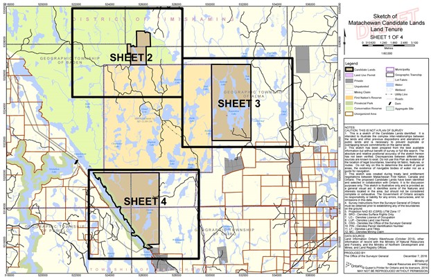
Map Datum: NAD 83 (CSRS) UTM Zone 17
Disclaimer:
This map is a graphic representation. The information has been completed from various sources and the accuracy is not guaranteed. Do not rely on this map as a precise indicator of routes, locations of features or as a guide for navigation. This map may contain cartographic errors or omissions.