Monteith Forest Conservation Reserve Management Statement
This document provides policy direction for the protection, development and management of the Monteith Forest Conservation Reserve and its resources.
Monteith Forest Conservation Reserve (C88)
Statement of Conservation Interest
Ministry of Natural Resources
Parry Sound District
Prepared with the assistance of:
Meteek & Company
Huntsville, Ontario
March, 2003
Approval statement
We are pleased to approve this Statement of Conservation Interest for Monteith Forest Conservation Reserve (C88).
Monteith Forest Conservation Reserve is a 185 hectare area of Crown land located in the Township of McMurrich/Monteith in the Territorial District of Parry Sound. It is located about 5 kilometres south of the hamlet of Bear Lake (which is on Highway 518) and immediately to the northeast of Horn Lake.
Monteith Forest Conservation Reserve, located in Hill’s ecological Site District 5E-8, is significant for its hemlock stands. While in many locations hemlock grows in dense stands on ridges and north slopes, in the Monteith Forest Conservation Reserve, it dominates sections of gently rolling hills with shallow soils and flat sandy patches.
Monteith Forest Conservation Reserve is one of 378 new protected areas approved through Ontario’s Living Legacy Land Use Strategy, aimed, in part, at completing Ontario’s system of parks and protected areas. Originally identified as Cashen Lake Conservation Reserve, the name of this site was changed to more accurately reflect its location.
During the "Lands for Life" planning process, the public was widely consulted and provided valuable input into what became Ontario’s Living Legacy Land Use Strategy. Comments received during that time, and during consultation related to the formal Public Lands Act (Ontario Regulation 805/94) regulation of the boundaries of this conservation reserve, were generally supportive of the protection of this area. Stakeholders who provided comment during the earlier consultation for this site were subsequently consulted regarding the draft Statement of Conservation Interest and their comments were considered in the finalization of this document.
This Statement of Conservation Interest provides guidance for the management of the conservation reserve and provides the basis for the ongoing monitoring of activities. More detailed direction is not anticipated at this time. Should more complex resource management or conservation issues arise or significant facility development be considered, then a detailed Resource Management Plan will be prepared with full public consultation.
Monteith Forest Conservation Reserve is managed under the direction of the District Manager and the Parry Sound Area Supervisor of the Ministry of Natural Resources, Parry Sound District.
Approved by:
R. Griffiths
District Manager
Parry Sound District
Approved by:
Ron Running
Regional Director
Southcentral Region
1.0 Introduction
Ontario’s Living Legacy, the result of an extensive planning process that began in early 1997, culminated in the approval in July 1999 of a Land Use Strategy that identifies the intended strategic direction for Crown land, including the completion of Ontario’s system of parks and protected areas. This process, which included extensive public consultation, resulted in the recommendation for regulation of 378 new protected areas, including Monteith Forest Conservation Reserve (C88).
Monteith Forest Conservation Reserve is located in the Township of McMurrich/Monteith (Monteith Ward) in the Territorial District of Parry Sound. It lies about 4 kilometres south of the hamlet of Bear Lake (which is on Highway 518), about a kilometre south of Bear Lake and immediately to the northeast of Horn Lake.
The conservation reserve, in Hill’s ecological Site District 5E-8, was identified during the Lands for Life selection process for its landform and vegetation features. In particular, there is a large forest of eastern hemlock (Tsuga canadensis) growing on gently rolling hills of deep glacially deposited sand.
Conservation reserves are established under the authority of the Public Lands Act, Ontario Regulation 805/94. The Monteith Forest Conservation Reserve was established by Ontario Regulation 148/02, an amendment of the Public Lands Act, on May 8, 2002.
A Statement of Conservation Interest (SCI) is prepared under the authority of Procedural Guideline A – Resource Management Planning (PL. Procedure 3.03.05). The purpose of this SCI is to identify and describe the values of the Monteith Forest Conservation Reserve. The SCI also outlines the activities that currently occur within the conservation reserve and provides guidelines for the management of current and future activities in the context of protecting the natural, recreational and cultural values.
1.1 Background information:
| Name | Monteith Forest Conservation Reserve (C88) |
|---|---|
| Site Region/District | Georgian Bay 5E-8 |
| OMNR Administrative Region/District/Area | Southcentral Region/Parry Sound District/ Parry Sound Area |
| Total Area (ha.) | 185 hectares |
| Regulation Date First Nations | May 8, 2002 (O. Reg. 148/02) Robinson-Huron Treaty |
| OBM map sheets | 10 17 6100 50250, 10 17 6100 50300 |
| Topographic Map | Orrville 31 E/5 |
| UTM co-ordinates | 17T 61200 503290 (Centroid) |
1.2 Representation
Earth science representation:
Bedrock:
- Seguin Domain, Parry Sound Terrane in the northwestern part of the Proterozoic Central Gneiss Belt of the Grenville Province
- Dominant exposed rock types are gneissic monzogranite and subordinate mafic gneiss
Surficial:
- A variety of till and ice-contact glaciofluvial deposits, evidence of glacial scouring followed by erosion and reworking by receding waters of post-glacial Lake Algonquin
Life science representation:
- Mature eastern hemlock stands on glacial outwash sands
- Sugar maple (Acer saccharum ), red maple (Acer rubrum), American beech (Fagus grandifolia) forest on stony glacial tills
- Coniferous swamps and fens
Cultural resources representation:
Neither detailed cultural research nor inventory has been carried out for this conservation reserve. However, the presence of old large stumps indicates that this area was logged for white pine in mid to late 19th century. There is little other evidence of historic use or development. Recent regional evaluation (OMNR 2003) shows that there are areas near (but not within) this conservation reserve that have a high potential for cultural heritage sites, specifically on nearby Horn lake and Bear lake. There is a registered cultural heritage site on Bear Lake.
Recreational opportunities:
A recreational inventory report was prepared for this site based on existing knowledge and data sources of MNR staff, and reflecting the field observations made during the preparation of the life science report. Currently, it is used for hunting and snowmobiling.
1.3 Survey work
| Survey Level | Earth Science | Life Science | Cultural | Recreational | Other |
|---|---|---|---|---|---|
| Reconnaissance | Duba & Frey, 2001 | Blythe & Assoc., 2002 | OMNR, 2003 | Brown, 2002 | None |
| Detailed | None | None | None | None | None |
| Requirement | None | Monitor the status/presence of significant species and associations. | Research to be encouraged | Monitor use impacts | None |
2.0 Values to be protected
The conservation reserve is located entirely within Hills' (1959) ecological Site District 5E -8. Values include earth science, life science and recreational/aesthetic values, with an emphasis on the life sciences.
2.1 Earth science:
(Earth science information, unless otherwise noted, is taken from Duba & Frey, 2001)
Bedrock:
Monteith Forest Conservation Reserve is a small area of low relief gently rolling hills. The bedrock of this conservation reserve is in the south-central portion of the Proterozoic Central Gneiss Belt of the Grenville Province and within the northern part of the Seguin Domain, Parry Sound Terrane. The area is underlain by a heterogeneous laminated grey gneiss and the Parry Sound Intrusive Complex pink gneissic monzogranite.
The Grenville Province is the product of thrusting and imbrication of the earth’s crust to the northwest as it collided with a continental landmass to the southeast. The Grenville Orogeny, circa 1140 to 1070 million years ago, culminated more than 500 million years of crustal evolution. The eroded rocks of the products of these events are displayed in the complexly metamorphosed and deformed rocks of the region (Easton, 1992b).
The Parry Sound Terrane is one of the four lithotectonic terranes of the Central Gneiss Belt. The Seguin Domain is one of three structural domains of the Parry Sound Terrane. This geological environment is part of the modern organization of the complex products of the mid-Proterozoic orogenic events (Easton 1992a & b). As such, their representation in the Monteith Forest Conservation Reserve contributes to the conservation of the Grenville Province continental accretion theme (Davidson, 1981).
The geological features of the conservation reserve are of regional significance in the representation of felsic plutonic components of the Seguin Domain, Parry Sound Terrane.
Surficial:
Monteith Forest Conservation Reserve lies mostly in an area of relatively low relief with well-rounded bedrock hills with deep glacially deposited sand. The granite hills have been heavily influenced by glacial scouring, followed by erosion and reworking by the receding waters of post-glacial Lake Algonquin. (Hoffman et al, 1962) The distribution and thickness of glacial drift is extremely variable, from large tracts of bedrock with only pockets of thin sediment of thicker till over bedrock in the northwest corner, and ice-contact glaciofluvial deposits over much of the central area. Surficial geology of the conservation reserve is locally significant.
2.2 Life science:
The conservation reserve is located within Hills' (1959) ecological Si te District 5E-8. Life science significance is determined on the basis of the following criteria: representation, diversity, condition, ecological considerations and special features (Crins and Kor 1998).
Representation:
(Life science information, unless otherwise noted, is taken from Blythe & Associates, 2002)
Monteith Forest Conservation Reserve encompasses 185 hectares of primarily forested land on a gently rolling terrain with sandy soils. The soils are generally Wendigo loamy sands and Wendigo sands (Hoffman et al, 1962), which have developed from glacial outwash sands, and represent some of the most acidic, drought prone and infertile soils of the Parry Sound District.
The predominant forest is composed of mature large diameter eastern hemlock with a co-dominant representation of red maple. The eastern hemlock forest has a high dense canopy with a deeply shaded open understory. Typical species found in this acidic shaded understory include partridge berry (Mitchella repens), yellow clintonia (Clintonia borealis), gold thread (Coptis trifolia spp. borealis), bunchberry (Cornus canadensis), and moccasin flower (Cypripedium acaule). Understory regeneration in this climax forest is almost exclusively eastern hemlock, usually occurring coincidentally with natural disturbances.
A second forest type occurs in areas with coarser textured stony glacial till. Sugar maple, red maple, and an unusually high representation of American beech dominate this forest type. These mature hardwoods have a relatively open canopy, with a dense understory, which shows heavy browsing by moose (Alces alces). The understory herbaceous and shrub species include Indian cucumber root (Medecia virginiana), white grass (Oryzopsis asperifolia), assorted club mosses (Lycopodium spp.), hay scented fern (Dennstaedtia punctilobula), beech drops (Epifagus virginiana), and fly honeysuckle (Lonicera canidensis).
The lowland areas in the eastern portion of the conservation reserve are dominated by a third forest type: treed coniferous swamps or fens. There is a large forest complex comprised of eastern white cedar (Thuja occidentalis), black spruce (Picea mariana), and tamarack (Larix laricina).
In the northern part of the conservation reserve there is a small section of forest, which has grown up in the abandoned fields of a pioneer farm. Several large diameter open grown white pine (Pinus strobus) are now surrounded by an early successional stage of intolerant hardwood forest.
There are also a few examples of graminoid/sedge meadows within the reserve.
The area offers a suitable range of habitats for wildlife species typical to the region, such as: white-tailed deer (Odocoileus virginianus), moose (Alces alces), black bear (Ursus americanus), coyote (Canis latrans), eastern gray wolf (Canis lupus lycaon), beaver (Castor canadensis) and racoon (Procyon lotor). The northwest part of the conservation reserve lies within the Bear Lake deer yard.
Condition:
Most of this area shows little evidence of logging, with the exception of some scattered white pine and hemlock stumps. There is evidence of an extensive axe-girdling stand improvement operation carried out in the early 1980s.
The remains of a pioneer homestead in the north part of the conservation reserve, namely rock piles and old fields, are being colonized by pioneer tree species.
There are no public access roads that cross or about the reserve. A snowmobile trail (OFSC #700) follows the road allowance along the between Lots 10 and 11, Concession 6.
Diversity:
Botanical diversity of this site is limited by the nature of the predominant mature hemlock forest, combined with the acidic, nutrient poor soil conditions.
The mature dense coniferous forest provides breeding habitat for a number of warbler species, such as magnolia warble r (Dendoica magnolia), Cape May warbler (Dendroica tigrina) and the black throated green warbler (Dendroica virens ).
The tolerant hardwood stands of the area show significant levels of browsing by moose. Large mature beech trees, a component of the tolerant hardwood forest show signs of feeding activity by bears. Beech mast crops are a significant food resource for several wildlife species.
Ecological considerations
Part of the Monteith Forest Conservation Reserve lies within the Bear Lake deer yard.
The conservation reserve is roughly 5 kilometres south of the Bear Lake Peatlands Conservation Reserve (C85), the same distance north-west of Axe Lake Wetlands Conservation Reserve (C92), with numerous other adjoining wetlands to the south and west. In combination with the evidence of moose browsing in the hardwood understories of this conservation reserve, this represents significant elements of the habitat requirements of moose.
The abundant concentration of mature American beech in the conservation reserve provides a food source for several wildlife species.
Special features:
- Part of the Bear Lake deer yard
- Significant moose habitat
- The presence of beech and its potential as a wildlife food source
2.3 Cultural values:
While no specific cultural studies or inventories have been undertaken within the conservation reserve, and no major cultural resource values have been evaluated or identified to date, there is physical evidence of an early (late 19th century) pioneer homestead in the north part of this conservation reserve (Blythe & Associates, 2002). Recent regional evaluation (OMNR 2003) shows that there are areas near (but not within) this conservation reserve that have a high potential for cultural heritage sites, specifically on nearby Horn lake and Bear lake. There is a registered cultural heritage site on Bear Lake.
2.4 Recreational/aesthetic values:
Hunting appears to be the primary recreational activity that has traditionally occurred within the conservation reserve’s boundaries.
The site supports the usual populations of large and small game. Most hunting activity within the site is focused on white-tailed deer, moose and black bear. While there are no recreation camps within the conservation reserve, there are known to be several private land hunt camps in the vicinity.
The Magnetawan Ridge Runners Trail #700 runs just north of the conservation reserve (Brown, 2002), and it, or a feeder trail, appears to run north/south along the concession road allowance between lots 10 and 11 Concession 6. It is not apparent that snowmobiles go off this trail to access the conservation reserve.
There is little evidence of all-terrain vehicle use of the snowmobile trails or within the conservation reserve. It is expected that there is some use of all-terrain vehicles associated with hunting activity.
The biophysical attributes of the conservation reserve lend themselves to nature related activities such as bird-watching, hiking, cross-country skiing and snowshoeing, but the degree of use for these activities is, for the most part, unknown since they have a relatively low impact on the landscape, and tend not to be represented by organized user-group associations.
3.0 Management guidelines
3.1 Land tenure:
Background:
Monteith Forest Conservation Reserve comprises 185 hectares of Crown land. Private lands abut its boundaries on its south half. It is adjacent to Crown lots on its north half. Concession road allowances which cross or about the conservation reserve remain under the authority of the municipality wherein they lie, and are not included as part of the conservation reserve. There is no intent to acquire adjacent private lands for addition to the conservation reserve.
The north half of the conservation reserve lies within Bear Management Area PS-49-09. It also lies within one assigned Bait Fish Block (Monteith 3). There is one registered trapline that includes the conservation reserve (PS-178). There are no authorized recreation camps within the boundaries of the conservation reserve.
The Magnetawan Ridge Runners snowmobile trail that runs near the conservation reserve does not run through the conservation reserve. Where it appears to run north/south between lots 10 and 11, Concession 6, it apparently lies within the municipal road allowance, which is not part of the conservation reserve.
Guideline:
The sale of Crown lands within the conservation reserve is not permitted. While the Ontario’s Living Legacy Land Use Strategy provides minor flexibility in this policy, there are no sites adjacent to this conservation reserve which would meet the stipulated criteria.
There are no plans by the MNR to acquire private lands to add to the conservation reserve.
The commercial bear hunting service associated with the current Bear Management Area is allowed to continue. Fur harvest is permitted to continue in the registered trapline area. The Bait Fish Blocks, currently assigned, are permitted to continue (although there are no waterbodies within the conservation reserve).
New recreation camps are not permitted.
3.2 Development:
Background:
The conservation reserve lies about 4 kilometres south of Highway 518, and is located between municipal roads. However, there is no public road access into the site.
There are no Crown owned buildings or other facilities within the conservation reserve.
Guideline:
New roads for resource extraction and/or private use will not be permitted. There is no intention to develop roads outside of the conservation reserve to improve access to this site.
No mineral exploration is permitted within this conservation reserve. This policy decision is based on a commitment made by the Ministry of Natural Resources and the Ministry of Northern Development and Mines in March 2002. This policy direction replaces that identified in the 1999 Ontario’s Living Legacy Land Use Strategy (OMNR 1999), which stated that controlled mineral exploration would be permitted in new conservation reserves which were identified as having provincially significant mineral potential.
In general, existing authorized recreational trails may be permitted to continue in conservation reserves as long as they do not impair the natural features and values for which the area is identified and as long as there are no significant environmental impacts. Accordingly, the authorized nearby snowmobile trail will continue to be authorized where it is on Crown land, but its use will be monitored to ensure that that conservation reserve values are not being adversely impacted. Additional recreational trails are not encouraged, but may be considered on a case by case basis. Public consultation will be an important part of the consideration of any new trails, and they would also be required to comply with Procedural Guideline B – Land Uses – Test of Compatibility (Appendix 1).
While there is no intent at present to provide or permit any new development in this conservation reserve that would require lighting, should this be considered at some point in the future the MNR will not allow unnecessary, undirected light pollution. This commitment recognizes the wilderness values provided by a pristine night sky.
3.3 Recreational activities:
Background:
Existing recreational uses include hunting, and snowmobiling. Most hunting activity in the conservation reserve focuses on white-tailed deer, moose and black bear. A number of private hunt camps are located in the vicinity.
An authorized recreational trail borders the conservation reserve (See Section 2.4). In addition to snowmobiling, all-terrain vehicle use likely occurs on that trail, but this was not evident in recent field surveys. There may be unauthorized all-terrain vehicle trails used in association with hunting activity.
There is little evidence of the use of the conservation reserve by hikers, birdwatchers, canoeists, mountain bikers, skiers, or snowshoers.
Guideline:
Hunting is permitted to continue within the conservation reserve.
Recreational use such as hiking, wildlife viewing, snowshoeing, and cross-country skiing, while currently very limited in extent and therefore not managed, will be allowed to occur in the conservation reserve.
The existing authorized snowmobile trail will continue to be authorized. It is not expected to have much impact on the conservation reserve, unless off-trail use accesses the conservation reserve from that trail. Trail and off trail use will be monitored to ensure that the conservation reserve values are not being adversely impacted. Off-trail use of snowmobiles and all-terrain vehicles is only permitted for the direct retrieval of game.
New recreational trails or changes to the existing route are not permitted without prior MNR authorization. New trails are not encouraged, but, may be considered on a case by case basis provided they meet the Procedural Guideline B - Land Uses - Test of Compatibility (Appendix 1) and the MNR's Environmental Assessment Act requirements.
The use of pre-existing unauthorized recreational trails, and any increase in use of all-terrain vehicles, will be monitored to ensure that conservation reserve values are not being adversely impacted. Depending on the results of monitoring, some trails may need to be redirected from sensitive areas or eliminated completely. Otherwise, there is no intent to mark or upgrade such trails.
New recreational activities will be considered on a case by case basis provided they are consistent with maintaining the values of the conservation reserve and comply with Procedural Guideline B - Land Uses - Test of Compatibility (Appendix 1). Emphasis will be placed on activities that have a low impact on the environment of the conservation reserve.
3.4 Commercial activities:
Background:
There has been no recent commercial forest harvesting or mining activity within the conservation reserve.
There is currently one registered trapline covering this conservation reserve. The guiding of non-resident bear hunters is authorized through the Bear Management Area covering the north half of the reserve, and bait fish harvesting is authorized through one Bait Fish Block licence which covers the conservation reserve.
Guideline:
Fur harvesting, bear hunting services and bait fish harvesting operations are allowed to continue within the conservation reserve.
Mineral exploration is not allowed in this conservation reserve, as discussed in Section 3.2.
Conservation reserve regulations do not permit mining, commercial forest harvesting, hydroelectric power development, the extraction of aggregate and peat or other industrial uses (Public Lands Act, Ontario Regulation 805/ 94). Other new commercial activities must meet the requirements of Procedural Guideline B (see Appendix 1).
3.5 Aboriginal interests:
Background:
This site is located within the area of the Robinson – Huron Treaty of 1850, and as such the general area of this conservation reserve is known to be of interest to various First Nations.
Guideline:
The regulation and management of this conservation reserve will not impede the exercise of existing aboriginal or treaty rights. These rights include hunting, fishing, fur harvesting, gathering of plants for a variety of purposes, and the use of ceremonial sites. It is recognized that the manner in which these rights are carried out is not limited to the manner in which they were carried out in the past, but has evolved over time with changes in technology.
While there are no existing First Nation land claims that extend to this site, it is recognized that at some point in the future there is a possibility of a land claim in this area. If such a land claim is determined to be valid, the Conservation Reserve designation is not irreversible and does not preclude consideration of these lands in the settlement of a claim.
3.6 Natural resource stewardship:
Vegetation management for specific purposes (other than historic logging, and some stand improvement work in the early 1980s) is not known to have occurred in the past. Wildlife and fisheries management has been occurring according to the prevailing policies and legislation.
The emphasis will be on ensuring that the natural values of the conservation reserve are not negatively affected by current and future activities. Therefore, applications for new specific uses will be carefully studied and reviewed. Necessary studies may be undertaken by proponents, the Ministry, and/or partner organizations.
Guideline – vegetation:
The intent of this site is to allow the existing vegetation communities to evolve naturally.
An exception to the above may occur in portions of Monteith Forest Conservation Reserve that are located within the Bear Lake deer yard. The Ontario’s Living Legacy Land Use Strategy (Appendix A - Land Use Intent) provides direction that "Vegetation management (deer habitat) to be provided for and addressed in Statements of Conservation Interest". Such land use and resource management policy direction for vegetation management and featured species management (deer in this case) is consistent with Conservation Reserve Policy PL 3.03.05.
The purpose of habitat management would be preservation and in some cases regeneration of the conifer trees, especially hemlocks, which provide cover from winter conditions, along with the creation of areas of browse in close proximity to conifer cover. It is anticipated that this habitat management would occur during the winter, thereby alleviating the need for any new/upgraded roads to undertake this activity.
Prior to work of this nature being done, a vegetation management plan would be completed by MNR and approved by the MNR District Manager. This vegetation management plan would be directed by local MNR specialists (e.g. area forester, area wildlife biologist) and reviewed with life science specialists/ecologists of Ontario Parks, to ensure that the habitat management would not adversely affect the natural heritage and ecological representation values of this conservation reserve. The habitat management prescriptions would generally be consistent with the approved Area of Concern provisions used for forestry operations in identified deer yards in the French -Severn Forest Management Plan, which in turn is derived from Forest Management Guidelines for the Provision of White-Tailed Deer Habitat OMNR 1997, except where modifications are needed to protect certain heritage values or features of this site.
The vegetation management plan could be implemented in several ways; for example, volunteer labour can be used if available, or a commercial operator could be contracted by the MNR. In either case, it is expected that harvested forest products could be marketed commercially to offset the costs of the work.
The OMNR recognizes fire as an essential process fundamental to the ecological integrity of this conservation reserve. In accordance with existing conservation reserve policy and the Forest Management Strategy for Ontario, forest fire protection will endeavour to use "light on the land" techniques, which do not unduly disturb the landscape, in this conservation reserve. Examples of light on the land techniques may include limiting the use of heavy equipment, and limiting the number of trees felled during fire response efforts. Input from the local MNR Area Supervisor would be solicited if a forest fire threatens the area. Opportunities for prescribed burning to achieve resource management objectives may be considered. Plans for any prescribed burning will be developed in accordance with the OMNR Prescribed Burn Planning Manual.
Programs may be developed to control forest insects and diseases in the conservation reserve where these threaten significant values in or adjacent to the site. Where insects or disease threaten significant values, in or adjacent to the site, control will be directed as narrowly as possible to the specific insect or disease. Biological control will be used wherever possible. In all cases, regard shall be had for Procedural Guideline B (see Appendix 1).
Guideline – wildlife and fisheries:
The relevant Ontario hunting regulations will guide hunting within Monteith Forest Conservation Reserve. Fur harvesting and bait fish harvesting will be managed through the maintenance of the current licensing system.
The Ministry will monitor the impacts of activities of snowmobile trails and increasing use of all-terrain vehicles on the natural values of the conservation reserve.
3.7 Cultural resource stewardship:
Background:
There is evidence of early pioneer activity within this conservation reserve. However, no specific studies or inventories have been undertaken within the conservation reserve, and no specific significant cultural resource values have been evaluated or identified to date.
Recent regional evaluation (OMNR 2003) shows that there are areas near (but not within) this conservation reserve that have a high potential for cultural heritage sites, specifically on nearby Horn lake and Bear lake. There is a registered cultural heritage site on Bear Lake.
Guideline:
Should the MNR consider either carrying out or permitting new structural development, significant clearing of vegetation or altering of land within this conservation reserve, the MNR will adhere to the cultural heritage resource screening process as is identified in its Memorandum of Understanding (MOU) with the Ministry of Tourism, Culture and Recreation (MTCR). While the purpose of this MOU is to provide a process to identify and protect cultural heritage resources when the MNR is reviewing work permits or disposing of Crown rights under the authority of the Public Lands Act, Ontario Regulation 805/94, the considerations and criteria would also enable the MNR to identify high potential cultural heritage areas for other purposes within conservation reserves. If the screening process indicates that the site of a proposed activity is within an area of high cultural heritage potential, the MNR will consult with the MTCR to determine the appropriate cultural heritage assessment requirements and will undertake a preliminary archaeological assessment if appropriate.
Interested partners will be encouraged to undertake inventories, studies, and research to document the First Nations, resource harvest/management and recreation history in the area. The MNR will discuss the appropriateness of archaeological assessment with local First Nations and the Ministry of Tourism, Culture and Recreation.
3.8 Client services:
Background:
Access to the conservation reserve has generally been confined to traditional uses for the current commercial and recreational activities. There are no Crown facilities or services developed on or adjacent to the conservation reserve. The information fact sheet for this conservation reserve is currently available to the public through the Parry Sound District Office, Bracebridge Area Office, or via the internet at /page/crown-land-use-policy-atlas.
Guideline:
The focus will remain on low key information and self-interpretation of conservation reserve values and features. Consideration will be given to the preparation of an information brochure (with map) to highlight the features for which the area was identified and appropriate uses to ensure the protection of those features.
Consideration will be given to the strategic location of identity signs where trails approach or cross the conservation reserve boundary. There are no other plans for structural development within this conservation reserve.
3.9 Research:
Background:
Research to date has included a number of reconnaissance surveys to document earth science, life science and recreation values.
Guideline:
Research focussing on the assessment of use/activity impacts on wildlife species and habitats will be encouraged.
All research will be carried out in a non-destructive manner. Research proposals must follow Procedural Guideline C – Research Activities in Conservation Reserves (Appendix 3).
3.10 Marketing:
Background:
There has been no marketing of this conservation reserve to date. Promotion and information about this site has been primarily through the Ontario’s Living Legacy planning process and recent MNR Parry Sound District public consultation regarding the boundaries of this site.
Guideline:
Marketing activities of this conservation reserve will be kept to a minimum.
4.0 Implementation
Administrative responsibility for this conservation reserve belongs to the Parry Sound Area Office of the Parry Sound District of the Ministry of Natural Resources. The Area Office will continue to have the custodial care of Monteith Forest Conservation Reserve. Emphasis will be placed on awareness information highlighting reserve values, and monitoring and managing the current approved uses.
Priorities will include:
- Ensure compliance to prescribed management policies of the approved SCI
- GPS location of existing trails and classify their status and condition
- Monitor and evaluate recreational and commercial use levels and impacts
- Encourage further inventory and research of the significant life science resources of the conservation reserve
- Encourage research about use/activity impacts on wildlife species and habitats
- Support cooperative ongoing education of resource users with respect to resource and land stewardship values, in order to maintain the ecological integrity of the site and to provide long term recreational opportunities; and
- Provide client services (e.g. brochure or fact sheet) at nearby MNR offices
5.0 Review and revision of the Statement of Conservation Interest
This Statement of Conservation Interest will be amended through a standard process of minor and major amendments. Minor amendments will be processed in a relatively informal manner and will require the approval of the Area Supervisor. These amendments will deal with uses and activities that do not affect any of the policies in this SCI (e.g. new uses and/or activities that are consistent with existing permitted uses).
Uses and/or activities that were not anticipated in the approved SCI and which may have an impact on the values of the reserve will require a major amendment. This will include an opportunity for public comment and input, will require the approval of the District Manager and Regional Director.
6.0 References
Blythe, C. and Associates. 2002. Natural Heritage Area – Life Science Checksheet Monteith Forest Conservation Reserve. OMNR, Parry Sound.
Brown, B. 2002 Recreation Resource Inventory Report. Monteith Forest Conservation Reserve. OMNR Parry Sound.
Brunton, D. F. 1992. Life Science Areas of Natural and Scientific Interest in Site District 5E-8. OMNR, Algonquin Region, Huntsville.
Chapman, L. J. 1975. The Physiography of the Georgian Bay-Ottawa Valley Area of Southern Ontario. Ontario Division of Mines, GR 128, 35p. Accompanied by Map 2228, scale 1 inch to 4 miles or 1:253,440.
Chapman, L. J. and Putman, D. F. 1984. Ontario Geological Survey, Special Volume 2. The Physiography of Southern Ontario. Ontario Ministry of Natural Resources.
Chapman, L. J. 1984. Ontario Geological Survey, Special Volume 2, The Physiography of Southern Ontario, Third Edition. OMNR.
Crins, W. J. and Kor, P. S. G. 1998. Natural Heritage Gap Analysis Methodologies Used by the Ontario Ministry of Natural Resources. Unpublished Paper. Peterborough: OMNR.
Davidson, R. J. 1981. A framework for the conservation of Ontario’s earth science features. Ontario Ministry of Natural Resources, Toronto, 262 p.
Duba, D. and Frey, E. D. 2001. C99 Monteith Forest Conservation Reserve. Earth Science Report, OMNR Peterborough.
Easton, R. M. 1992a. The Grenville Province and the Proterozoic history of central and southern Ontario; in Geology of Ontario, Ontario Geological Survey, Special Volume. 4, Part 2, p.715-904.
Easton, R. M. 1992b. Tectonic evolution of Ontario. Part 3: Mesoproterozoic evolution of the southeast margin of Laurentia; in Geology of Ontario, Ontario Geological Survey, Special Volume 4, Part 2, p.1302-1314.
Hills, G. A. 1959. A Ready Reference to the Description of the Land of Ontario and its Productivity. Ont. Dept. of Lands and Forests, Division of Research, Maple, Ontario.
Hoffman, D. W., Wicklund R. E. and Richards N. R. 1962. Soil Survey of Parry Sound District. Report No. 31 of the Ontario Soil Survey. Research Branch, Canadian Department of Agriculture and the Ontario Agricultural College.
Kor, P. S. G. and Delorme, R J. 1989. Quaternary Geology of the Magnetawan Area, Southern Ontario: Ontario Geological Survey, Preliminary Map P. 3134, Scale 1:50,000
Noble, T. W 1983. Biophysiographic Analysis, Site Region 5E, Algonquin Region, Ministry of Natural Resources. Algonquin Region, Huntsville.
Ontario Ministry of Natural Resources. 1999. Ontario’s Living Legacy: Land Use Strategy. Queen’s Printer for Ontario.
Ontario Ministry of Natural Resources. 2003. Cultural Heritage Registered Site Reserves and Areas of High Potential, Parry Sound District, Scale 1:150000.
Appendices
Appendix 1 Procedural guideline B – Land Uses – Test of Compatibility (PL procedure 3.03.05)
The conservation reserve policy provides broad direction with regard to the permitted uses. The policy provides only an indication of the variety of uses that will be considered acceptable in conservation reserves. The only caution is that "any new uses, and commercial activities associated with them, will be considered on a case by case basis, and, they must pass a test of compatibility to be acceptable." What does a 'test of compatibility' mean?
An examination of this must start from the premise of why an area is set aside – specifically, its representative natural heritage values. Criteria are then identified to guide compatibility considerations. These criteria apply to the long-term acceptability of both existing uses and new uses.
-
Conformity to SCI/RMP: SCI describe values for which an area has been set aside and the range of appropriate uses that will be permitted in the area. SCI may also speak to the acceptability of other 'new' uses currently not occurring in the area.
The first 'test' is: "do proposed new land uses and/or commercial activities conform to the direction of the SCI/RMP for the conservation reserve? Would the new use(s) depart from the spirit of appropriate indicator land uses in the SCI/RMP?"
- Impact Assessment: If the proposed use(s) pass test 1 it is important to determine their impact on the area before they are approved. This should include the following:
- Impact on natural heritage values: "will the new use(s) impact any natural values in the area? If so how and to what degree? Is it tolerable?"
- Impact on cultural values: "will the new use(s) impact an historical or archaeological values in the area?"
- Impact on research activities: "will the new use(s) affect research activities in the area?"
- Impact on current uses: "will the new use(s) have any negative impact on the array of current uses?"
- Impact on area administration: "will the new use(s) increase administrative costs and/or complexity?" (For example, the cost of area monitoring, security and enforcement).
- Impact on accommodating the use outside the conservation reserve: "Could the use(s) be accommodated as well or better outside the conservation reserve?"
- Impact on socio-economics of the area: "will the new use(s) affect the community(ies) surrounding the area in a positive or negative way?" (For example, will the new use make an area less remote thereby affecting a local tourism industry that is dependent on the area’s remoteness for its appeal?"
- Impact on area accessibility: "does the new use(s) give someone exclusive rights to the area or a portion of the area to the exclusion of other existing uses?"
The following table (Appendix 2) provides a guide of indicator uses for the consideration of uses that may be permitted within conservation reserves. For any specific conservation reserve that test of compatibility should be applied to determine which specific uses are acceptable.
Appendix 2 Indicator uses for Conservation Reserves:
Generic and specific
Recreation
| Activities | Generic Policy Permitted? Existing |
Generic Policy Permitted? New |
Specific Application in Monteith Forest Conservation Reserve |
|---|---|---|---|
| Sport fishing | Yes | Yes | Yes |
| Sport hunting | Yes | Yes | Yes |
| Food gathering | Yes | Yes | YesA |
| Facility infrastructure | Maybe | Maybe | Maybe |
| Non-trail snowmobiling | No1 | No1 | No1 |
| Non-trail all -terrain vehicle use | No1 | No1 | No1 |
| Rock climbing/caving | Maybe | Maybe | N/A |
| Canoeing/kayaking | Yes | Yes | N/A |
| Motorized boating | Yes | Yes | N/A |
| Picnicking | Yes | Yes | Yes |
| Camping | Maybe | Maybe | Yes |
| Trails: Hiking | Yes | Maybe | MaybeB |
| Trails: X country skiing | Yes | Maybe | MaybeB |
| Trails: Cycling | Yes | Maybe | MaybeB |
| Trails: Horse riding | Yes | Maybe | MaybeB |
| Trails: Snowmobiling | Yes | Maybe | MaybeB |
| Trails: All-Terrain Vehicles | Yes | Maybe | MaybeB |
Science, education & heritage appreciation
| Activities | Generic Policy Permitted? Existing |
Generic Policy Permitted? New |
Specific Application in Monteith Forest Conservation Reserve |
|---|---|---|---|
| Research | Yes | Yes | Yes |
| General walking | Yes | Yes | Yes |
| Photography & Painting | Yes | Yes | Yes |
| Wildlife viewing | Yes | Yes | Yes |
| Outdoor Education/Interpretation | Yes | Yes | Yes |
| Collecting | No | Maybe2 | Maybe2 |
Commercial activities
| Activities | Generic Policy Permitted? Existing |
Generic Policy Permitted? New |
Specific Application in Monteith Forest Conservation Reserve |
|---|---|---|---|
| Food harvesting | Maybe | Maybe | No |
| Fishing | Maybe | Maybe | No |
| Baitfish harvesting | Yes | Maybe | Yes3,E |
| Fur harvesting | Yes | Maybe | Yes3 |
| Trap cabins | Yes | No | MaybeC |
| Resort – outpost camp | Yes | No | NoC |
| Outfitting – bear management | Yes | No | Yes3 |
| Wild rice harvesting | Yes | Maybe | N/A |
Resource management
| Activities | Generic Policy Permitted? Existing |
Generic Policy Permitted? New |
Specific Application in Monteith Forest Conservation Reserve |
|---|---|---|---|
| Inventory monitoring | Yes | Yes | Yes |
| Featured species management | Maybe | Maybe | Maybe |
| Natural systems management | Maybe | Maybe | Maybe |
Industrial activities
| Activities | Generic Policy Permitted? Existing |
Generic Policy Permitted? New |
Specific Application in Monteith Forest Conservation Reserve |
|---|---|---|---|
| Timber harvesting | No | No | No |
| Mineral exploration | No | No | No |
| Mining | No | No | No |
| Hydro generation | No | No | No |
| Energy transmission corridors | Yes | No4 | No4 |
| Communications corridors | Yes | No4 | No4 |
| Public transportation corridors | Yes | No4 | Maybe4 |
| Resource access roads | Maybe | No | No |
| Private access roads | Maybe | No5 | No5 |
Other activities
| Activities | Generic Policy Permitted? Existing |
Generic Policy Permitted? New |
Specific Application in Monteith Forest Conservation Reserve |
|---|---|---|---|
| Land Disposition | Maybe6 | No6 | No6 |
| Recreation Camps | YesC | No | YesC,D |
Notes:
On generic policy application in conservation reserves:
1For direct retrieval of game only
2Only as a part of an approved research project
3Transfer requests will be considered in the context of the Statement of Conservation Interest or Resource Management Plan for each conservation reserve
4Existing use is permitted to continue. New transportation corridors, communications lines, and transmission lines are discouraged in conservation reserves except under unusual circumstances where there are no other viable alternatives
5New private roads, including additions to existing roads, will not be permitted except where there are existing commitments
6Sale of Crown lands in conservation reserves is not permitted, except for certain minor dispositions (e.g. sale of small parcel of land where adjacent private lot is too small to enable installation of a septic system, or to facilitate legal title to lands where there has been a long-standing encroachment of a dwelling on Crown land) where they do not detrimentally affect the values an area is intended to protect
On specific policy application in Monteith Forest Conservation Reserve:
AFood gathering is permitted for personal consumption only and must be conducted in a sustainable manner, and such that it does not harm the values of the conservation reserve
BExisting authorized recreational trails are permitted to continue in conservation reserves as long as there are no significant environmental impacts and they do not impair the natural features and values for which the area is identified. Additional high impact recreational trails are discouraged, but new trails may be considered on a case by case basis, provided they comply with Procedural Guideline B – Land Uses – Test of Compatibility (Appendix 1)
CExisting authorized uses can continue. New cabins, outpost camps and private recreation camps are not permitted
DExisting authorized recreation camps are eligible for enhanced tenure, but not for the purchase of lands. A decision to grant enhanced tenure or to transfer recreation camps will be addressed through a screening process
EWhile a Bait Fish Licence includes this area, there are no waterbodies within the conservation reserve
Appendix 3 procedural guideline C research activities in Conservation Reserves (PL procedure 3.03.05)
Purpose
To encourage contributions to the goal of conservation reserves by:
- Providing direction for research activities associated with conservation reserves; and
- Establishing a process for the review and approval of proposals by researchers, which could have an impact on the values protected by the conservation reserve
Definition
Research means any investigation or study of the natural, cultural, economic, management or other features or characteristics of conservation reserves.
Guidelines
Research will be encouraged to provide a better understanding of the natural values protected by a conservation reserve and to advance their protection, planning and management. The Statement of Conservation Interest will define, for each conservation reserve, the key research issues, set out the parameters within which research may occur and identify research needs.
Applications and approvals
Researchers must apply in writing to the Area Supervisor for permission to conduct research. The request letter must contain a statement explaining why the proposed research should be undertaken in the particular conservation reserve in preference to another location.
Proposals will be reviewed and approved by the Area Supervisor, guided by the SCI prepared for each reserve (see Guideline A – Resource Management Planning) and using Guideline B – Land Uses – Test of Compatibility. Permission must be granted in writing, including any conditions to be met in conducting the research, prior to the undertaking of any research project.
Term and conditions
Permission to conduct research under this policy will be valid for a period of 12 consecutive months from the date of issue. Permission to continue a research project for an additional period of 12 months or less may be granted upon submission of a written request and a progress report. The Ministry may require the posting of collateral to assure that the terms and conditions of granting permission are met.
The Area Supervisor may suspend or revoke permission at any time for failure on the part of the researcher to meet:
- The intent of this policy
- The requirements under the Public Lands Act, Ontario Regulation 805/94 including all amendments, where applicable
- The requirements under any other Act or regulations of Ontario or Canada, including those governing the taking, handling, storing, confining, fur harvesting, excavating and marketing any specimen, artifact, information or action (for example, scientific collector’s permit)
- The conditions and agreements specified in granting permission
Final report
The researcher will submit copies of reports, publications and theses following the results of the project to the Area Supervisor.
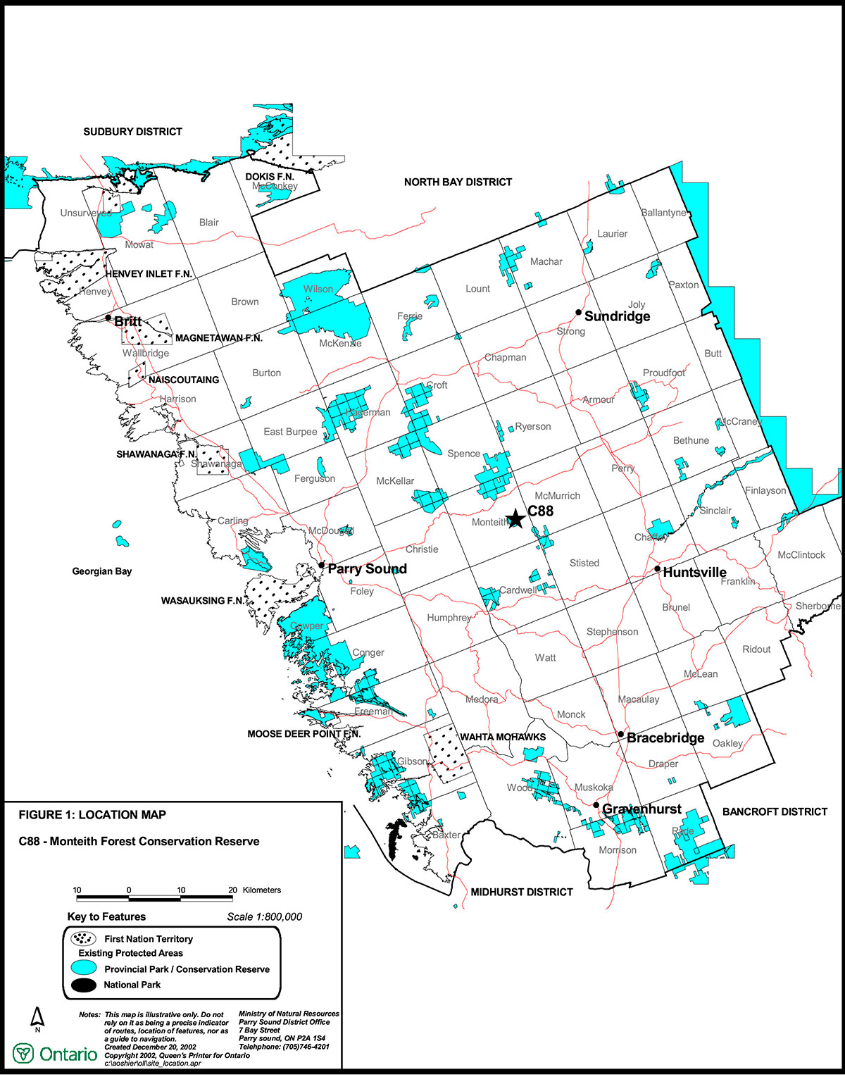
Figure 1: Location of Monteith Forest Conservation Reserve

Enlarge Figure 1: Location of Monteith Forest Conservation Reserve
Figure 2: Site Map – Monteith Forest Conservation Reserve
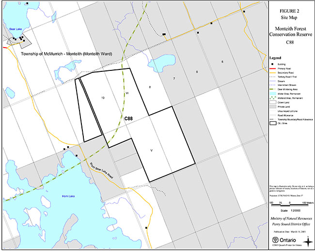
Enlarge Figure 2: Site Map – Monteith Forest Conservation Reserve