Pipestone Conservation Reserve Management Statement
This document provides policy direction for the protection, development and management of the Pipestone Conservation Reserve and its resources.
Statement of Conservation Interest
Ministry of Natural Resources
Rainy River/Manitou Area
Fort Frances District
September, 2006
John Munroe
District Planner
Approval statement
This Statement of Conservation Interest for the Pipestone Conservation Reserve (C2348), provides guidance for the management of the conservation reserve and the basis for the ongoing monitoring activities. More detailed direction at this time is not anticipated. Should significant development be considered or complicated issues arise which require additional studies, more defined management direction, or special protection measures, a more detailed Resource Management Plan will be prepared with full public consultation.
The public was consulted during the original regulation process and further consideration is not required at this time.
The conservation reserve will be managed under the jurisdiction of the Area Supervisor, Fort Frances District, Ministry of Natural Resources.
Signed by:
W.R. Darby
Fort Frances District Manager
Ministry of Natural Resources
Date: June 11, 2007
Signed by:
Allan Willcocks
Regional Director, Northwest Region
Ministry of Natural Resources
Date: June 11, 2007
1.0 Introduction
On July 16, 1999, the Ontario Government released the Ontario’s Living Legacy Land Use Strategy (OMNR, 1999) to guide the planning and management of Crown lands in central and parts of northern Ontario. A major part of the Ontario’s Living Legacy Land Use Strategy was a government intent to establish 378 new protected areas. This commitment marks the biggest expansion of provincial parks and conservation reserves in Ontario’s history.
The Pipestone Conservation Reserve is part of this significant expansion of Ontario’s protected areas system.
Conservation reserves are areas of Crown land set aside by regulation under the Public Lands Act, complementing provincial parks in protecting representative natural areas and special landscapes. Most recreational (e.g. hiking, skiing, tourism related uses, nature appreciation) and non-industrial (e.g. fur harvesting, commercial fishing and hunting and bait harvesting) activities that have traditionally been enjoyed in the area will continue, provided that these uses do not impact on the natural features needing protection. Hunting and fishing is permitted within all new conservation reserves proposed through Ontario’s Living Legacy.
Commercial timber harvesting, mining, aggregate extraction and commercial hydroelectric development are prohibited in conservation reserves.
Pipestone Conservation Reserve is located in northwestern Ontario in the Fort Frances Administrative District of the Ontario Ministry of Natural Resources, 50 kilometres northwest of the Town of Fort Frances, and approximately 20 kilometres northwest of Naicatchewenin First Nation. Comprised primarily of the waters and adjacent lands of Pipestone Lake, Yoke Lake, Slender Lake, Campbell Lake, Crossroute Lake and the southern portion of Asheigamo Lake, this site is 10,855 hectares in size. There is more than 400 km of shoreline included within the reserve, including mainland and islands, of which there are over 300, ranging in size from less than a hectare to approximately 75 hectares. This picturesque waterway with high recreational and tourism use is especially favoured by boaters, cottagers and anglers. The conservation reserve and surrounding area is largely undeveloped Crown land and the dominant land uses are resource-based tourism, recreation and forestry. Forest access roads surround the conservation reserve, but access is limited to water access via a mechanical portage from Burditt (Clearwater) Lake, or from Straw Lake via the Cedar Narrows Road to the east. Access may also be gained by floatplane or, via one of the non-maintained canoe routes that pass through the area.
Pipestone Conservation Reserve is located within Ecoregion 4S and Ecodistrict 4S-6 . Pipestone Lake contains connecting waters that locally are known as Quill (Feather), Weld, Slender and Shistose Lakes. Reference to connecting waters in this report means these waters. The area occupies an upland of moderately to steeply rolling and broken bedrock terrain within the west central Wabigoon geological subprovince, situated primarily on the mafic to felsic metavolcanic, metamorphosed mafic and untramafic intrusive rocks and clastic metasedimentary rocks of the southernmost portion of the Kakagi-Rowan greenstone belt. The exception to this is in the vicinity of Dash Lake on the west side of the reserve that overlaps a portion of the felsic igneous rocks of the Dash Lake Stock. Gabbro sills characteristically form high hills and cliffs along the length of the main southwest trending portion of Pipestone Lake (Blackburn, 2002). The site occupies zones representing the conjunction of two significant faults: the Pipestone-Cameron fault and the Helena-Pipestone Lakes fault, running northwesterly and southwesterly, respectively. Surficial geological features are dominantly ground moraine, representing shallow tills forming a discontinuous cover over the Precambrian bedrock. Localized deposits of Glaciolacustrine and possibly glaciofluvial origin occur sporadically. Exposed rock outcrops are frequent throughout. Mineral potential is rated as high to medium across most of the area, associated with the greenstone belt (Springer, 1978). The steeply rolling to broken topography varies from a maximum elevation of approximately 460 metres on the hilltops near the northern end of the conservation reserve, to approximately 350 metres along the shoreline at the southern end. Steep cliffs occur frequently, especially along the western side of the main arm of Pipestone Lake, rising abruptly from the water to heights of up to 40 metres. Organic deposits occur sporadically throughout the area, in small depressions between the surrounding uplands and on the margins of watercourses.
The upland forests and wetlands captured by the Pipestone Conservation Reserve include predominate areas of conifer forest, conifer mixed forest, deciduous forest, and deciduous mixed forest and cliff, rock barren moderately to steeply broken ground moraine. Open wetland over weakly broken ground moraine account for approximately 7% of the area of the reserve. Older red and white pine and eastern white cedar which is abundant within the conservation reserve contribute to its distinctive character.
Rare and unusual plant species and communities have been identified within the conservation reserve during reconnaissance surveys, however detailed life science surveys are required to define such occurrences more completely. The forests and waters of the conservation reserve provide habitat for species such as moose, beaver, red squirrel, black bear, porcupine, snowshoe hare and common loons. Bald eagles frequent the area and several nesting sites have been identified within the conservation reserve. A great blue heron rookery has also been identified within the boundaries. Shallow bays of adjacent lakes provide abundant nesting and foraging habitat for waterfowl, although the area lies outside of major flyways. Pipestone, Crossroute, Helena, Schistose, Slender and Yoke Lakes are deep, coldwater lakes that contain lake trout and lake whitefish. These and the other lakes of the conservation reserve support coolwater sport fish species such as walleye, smallmouth bass and northern pike, as well as less common species such as sunfish, largemouth bass and muskellunge.
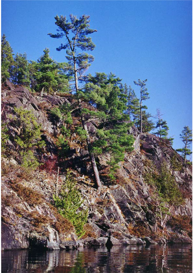
Figure 2: Pine on Steep, rocky shoreline, Pipestone Lake.
The site contributes to a high level of outdoor recreational activities, particularly those associated with cottaging, boating, camping, canoeing, hunting and fishing. Direct road access to the area does not exist. Access may be gained by water from Burditt Lake via a mechanical portage, or from Straw Lake off the Cedar Narrows Road. Very few sand beaches suitable for swimming exist within the conservation reserve, with a notable exception being Sand Point on Pipestone Lake itself. Most of the shoreline is rocky or boulder talus. Numerous sites suitable for camping exist, and camping opportunity is not limited to designated sites. However the conservation reserve is within a restricted camping zone which allows camping to residents only. Non-residents campers are required to stay at privately owned commercial facilities in this zone.
The purpose of this Statement of Conservation Interest is to identify the natural heritage and other values of the Pipestone Conservation Reserve, the activities which occur there and, through a set of management guidelines, outline the activities which will and will not be permitted, as well as the management direction for the area (MNR, 1997).
2.0 Background information
The Pipestone Conservation Reserve is an area protected as representative of natural heritage values and old growth white pine. The area represents a crossroads of historical and present-day water routes, and represents high recreational and tourism values. The site is a large expanse of shoreline, islands and peninsulas containing representative landform and vegetation types. The Pipestone site is located in an area of traditional use by First Nations peoples and has significant cultural and spiritual value for them. Access may be gained from secondary highway 622 at Burditt Lake immediately to the south or from Straw Lake via the Cedar Narrows Road to the east. This involves a number of portages. The conservation reserve encompasses more than 300 islands and the shoreline, in whole or in part, along Pipestone and connecting waters which include Quill, Weld, Slender, Maw, Dad, Darrow, Dash, Helena, Schistose, Straw, Yoke, Crossroute, Holstein, the southern portion of Asheigamo Lake and other small, unnamed lakes. Of particular significance are the extensive bedrock uplands on the northwest shore of Pipestone Lake and the concentrations of mature white and red pine, which add to the scenic appeal. The islands within the reserve vary in size, from less than a hectare to approximately 75 hectares. Semi-remote, resource-based tourism and wilderness recreation are the two dominant land uses within the conservation reserve, and comparatively little development has occurred. Water levels on the system are controlled by a dam at the outlet to Burditt (Clearwater) Lake, which is also the location of a mechanical boat lift/marine railway. The boat lift provides access for watercraft to the waters of the conservation reserve, for a fee.
Table 1. Background information
| Name | Pipestone Conservation Reserve |
|---|---|
| Ecosite Class | ES 4, 7, 11, 12, 14, 15, 16, 17, 18, 19, 20, 21, 23, 24, 27, 28, 29, 33, 34, 36, 37, 38, 39, 40, 41, 42, 44, 45, 46, 47 and 48. |
| OMNR Administrative Region / District / Area | Northwest / Fort Frances / Rainy River-Manitou Area |
| Total Area (ha) | 10,855 ha |
| Regulation Date | 2006 |
| First Nations with Interest in Area | Treaty Three: Rainy River and Naicatchewenin First Nations. Other First Nations and Metis peoples may also have an interest. |
| OBM | 15U 0461355/ 5435255 |
| Latitude/Longitude | 49°06'30"N; 93°32'00"W |
| OBM Basemap | 2015 440054200, 440054300, 450054200, 450054300, 450054400, 460054300, 460054400, 460054500. |
| Forest Cover | Mixed forest: red pine, white pine, jack pine, black spruce, eastern white cedar, trembling aspen, balsam poplar, black ash and white birch. Predominantly upland, but also contains examples of treed and open lowlands. (Refer to Appendix D) |
| General Location Description | The Pipestone Conservation Reserve is situated approximately 50 kilometres north of the Town of Fort Frances, encompassing most of the islands, major peninsulas and adjacent shorelands of Quill Lake, Weld Lake, Slender Lake, Pipestone Lake, Yoke Lake and Crossroute Lake. Parts of the shorelands of Maw, Dad, Darrow, Helena, Schistose, Straw, Ashiegamo, Holstein and other unnamed lakes are also included. The conservation reserve is comprised entirely of Crown land within unorganized territory (refer to Map 1.) |
| Access | Access can be gained via floatplane, through the canoe routes/waterways from the south and west, via the boat lift between Burditt Lake and Footprint Lake or via Straw Lake off the Cedar Narrows Road. A fee is charged for the use of the mechanized boat lift. Access points on Burditt Lake at the end of Highway #615 are either private, commercial establishments, or maintained by the local cottager’s association. Numerous forest access roads approach the conservation reserve from all sides, but do not afford direct access. |
2.1 Targets
This section provides a summary of the earth and life science system and values, cultural resources represented and recreational opportunities available or possible.
Summary of social, economic and environmental opportunities
Life science representation
The Pipestone Conservation Reserve contains representative examples of conifer forest, conifer mixed forest, deciduous forest, deciduous mixed forest and open wetland over weakly broken ground moraine account for approximately 7% of the land area of the reserve. Examples of conifer forest, conifer mixed forest, deciduous forest, deciduous mixed forest and open wetland over moderately broken ground moraine account for approximately 47%, while conifer forest, conifer mixed forest, deciduous forest, deciduous mixed forest and open wetland over moderately to steeply broken ground moraine account for approximately 46%, within Ecodistrict 4S-6. The conservation reserve is critical for achieving representation targets for mixed conifer-dominated forest on weakly broken ground moraine, and contributes to representation targets for other vegetation types on ground moraine (Harris and Foster, 2002).
Amongst the most distinctive features of the conservation reserve are the steep rock cliffs along the western shores of Pipestone Lake, which represent the best examples in the site district.
Dispersed areas of older red pine, white pine and eastern white cedar are found throughout the conservation reserve, including an old growth red pine stand at the north end of the reserve proposed for protection earlier as part of MNR's Keep It Wild initiative (Noble, 1995).
Small patches of prairie habitat are found on south-facing shorelines where there is sufficient soil to support herbs and graminoids (Harris and Foster, 2002).
Bald eagles, a provincially endangered species and six documented nesting sites occur within the conservation reserve (NHIC, 2003; OMNR, 2002; Harris and Foster, 2002). This not considered as high as other areas but likely reflects the low productive fisheries. A reconnaissance life science survey of the site identified five provincially rare plant species, and two regionally rare species occurring within the conservation reserve (Foster and Harris, 2002).
The larger lakes within and adjacent to the reserve are notable for being consistently deep, coldwater lakes supporting lake trout. Muskellunge are found in the waters of Pipestone and all connecting waters as well as Yoke Lake, which is considered of regional significance.
Detailed life science surveys have not been conducted on the site.
Earth science representation
The dominant landforms within the reserve are moderately to steeply broken rock ridge with subordinate ground moraine and moderately broken rock knob with subordinate ground moraine (Roed, 1980). Lesser occurrences of Moderately broken hummocky moraine, weakly broken lacustrine plain, weakly broken rock knob with subordinate lacustrine plain and organic terrain may also be found. A thin, discontinuous, sandy glacial till covers the rolling bedrock topography.
The site encompasses a significant portion of the Kakagi-Rowan greenstone belt and bedrock is well exposed, and it is considered of regional significance in terms of representation (Blackburn, 2002).
The Pipestone-Cameron fault is typical of numerous long, linear faults and deformation zones within the central portions of greenstone belts in northwest Ontario. It is considered of regional significance in terms of representation. (Blackburn, 2002).
The diabase dike cutting across all rock types through the southcentral portion of the conservation reserve in the vicinity of Dash Lake. It is considered of regional significance in conjunction with other such features within protected areas including portions of the Rainy Lake arm (Blackburn, 2002).
Evidence would suggest the long linear valley occupied by Pipestone Lake might once have been a glaciofluvial channel. The probable glaciofluvial deposits at Sand Point, if the assumption is correct, are of at least local significance (Blackburn, 2002).
Cultural resource representation
The site is known to represent an area of First Nation cultural significance. Located along a travel route used by native peoples historically, and containing a crossroads for such routes running north/south and east/west, specific sites as yet unidentified may exist within the area.
Historically, the lands surrounding the Pipestone system have seen use for trapping, mineral exploration and logging. Pipestone Lake and the connected waters are controlled by the Feather Lake Dam at the outlet to Burditt Lake. A mechanical portage or "marine railway" is operated in this location to provide access for larger pleasure craft to the waters above the dam. The purpose of the dam was to raise water for navigation. A small channel has been blasted through the rock at the entrance to Stonedam Lake, although it may not be navigable during low water levels.
More recent uses have largely been associated with tourism, cottaging and recreation. Although cottages, outpost cabins and lodges exist throughout the conservation reserve, development has been controlled as previously outlined in the lake management plan.
Recreational opportunities
The recreational potential of the conservation reserve is primarily ranked as moderate, although approximately 13% is ranked moderately high to high (CCRS, 2002). Of the potential recreational features identified, those that are associated with the distinctive, scenic topography of the area, and larger lakes are considered most consistently important. Angling and boating are the most prevalent current activities, while other potential activities include backcountry camping and canoeing, hunting, swimming, nature study, bird and wildlife viewing and photography.
The size and number of waterbodies associated with the conservation reserve and relatively limited access enhances the quality of hunting and fishing opportunities. Opportunities for hunting and fishing are considered excellent for those wishing to make the effort to reach the more remote parts of the conservation reserve.
The conservation reserve lies on a junction of un-maintained canoe routes from Rainy Lake to Eagle Lake, and to Rowan Lake/Lake of the Woods. There are only three established campsites that have been identified within the conservation reserve, although other suitable locations are plentiful. The size and orientation of Pipestone Lake makes it susceptible to the effects of the prevailing westerly and southwesterly winds, lending it not suitable for canoeing. Large swells are not uncommon, particularly in the more open sections of northwest and south arms.
A limited number of sand beaches exist, with the largest and best example being on Pipestone Lake at Sand Point, a popular spot for boaters.
2.2 Survey information
This section provides an overview of the inventories completed, their level of detail and any further inventories required.
Table 3. Level of survey performed
| Survey Level | Life Science | Earth Science | Cultural | Recreational |
|---|---|---|---|---|
| Reconnaissance | Yes |
Yes |
No | Yes |
| Detailed | No | No | No | No |
| Requirement | No | No | No | No |
The reconnaissance surveys which have been completed, in conjunction with other values and earth/life science records for the area (OMNR, 2002) are deemed sufficient in scope and detail to determine management direction for the conservation reserve. More detailed surveys may be undertaken at a later time if circumstances change.
3.0 Values to be protected
This section provides a description of the key natural heritage values on the site (Appendices) and their condition relative to past resource use and management activities. It also addresses the values' sensitivity to future land use and management activities.
3.1 Values identified in the Conservation Reserve
Life science
Identified ecosites classified in accordance with the Northwestern Ontario Forest Ecosystem Classification (Racey et al, 1996) within the conservation reserve include:
- ES4 Cliff
- ES7 Rock Barren
- ES11 Red Pine - White Pine - Jack Pine: Very Shallow Soil
- ES12 Black Spruce - Jack Pine: Very Shallow Soil
- ES14 Pine - Spruce Mixedwood: Sandy Soil
- ES15 Red Pine - White Pine: Sandy Soil
- ES16 Hardwood - Fir - Spruce Mixedwood: Sandy Soil
- ES17 White Cedar: Fresh - Moist, Coarse - Fine Loamy Soil
- ES18 Red Pine - White Pine: Fresh, Coarse Loamy Soil
- ES19 Hardwood-Fir-Spruce Mixedwood: Fresh, Sandy - Coarse Loamy Soil
- ES 20 Spruce-Pine / Feathermoss: Fresh, Sandy- Coarse Loamy Soil
- ES21 Fir - Spruce Mixedwood: Fresh, Coarse Loamy Soil
- ES23 Hardwood-Fir-Spruce Mixedwood: Moist, Sandy-Coarse Loamy Soil
- ES24 Red Pine - White Pine: Fresh, Fine Loamy Soil
- ES27 Fir - Spruce Mixedwood: Fresh, Silty - Fine Loamy Soil
- ES28 Hardwood-Fir-Spruce Mixedwood: Fresh, Silty Soil
- ES29 Hardwood-Fir-Spruce Mixedwood: Fresh, Fine Loamy Soil
- ES33 Hardwood-Fir-Spruce Mixedwood: Moist, Silty - Clayey Soil
- ES34 Treed Bog: Black Spruce / Sphagnum: Organic Soil
- ES36 Intermediate Swamp: Black Spruce (Tamarack): Organic Soil
- ES37 Rich Swamp: Cedar: Organic Soil
- ES38 Rich Swamp: Black Ash: Organic-Mineral Soil
- ES39 Open Bog: Ericaceous Shrub/Sedge/Sphagnum: Organic Soil
- ES40 Treed Fen: Tamarack - Black Spruce/Sphagnum: Organic Soil
- ES41 Open Poor Fen: Ericaceous Shrub - Sedge/Sphagnum: Organic Soil
- ES42 Open Moderately Rich Fen: Ericaceous Shrub/Sedge: Organic Soil
- ES44 Thicket Swamp: Organic-Mineral Soil
- ES45 Shore Fen: Organic Soil
- ES46 Meadow Marsh: Organic - Mineral Soil
- ES47 Sheltered Marsh: Emergent: Mineral Substrate
- ES48 Exposed Marsh: Emergent: Mineral Substrate
Relatively little wetland area is included within the conservation reserve, amounting to less than 7% of the total area. Only a little more than 2% represents untreed wetland types. Small patches of prairie habitat (ES10) are found on south-facing shorelines where there is sufficient soil to support herbs and graminoids (Harris and Foster, 2002).
A map displaying the distribution of the represented ecosites is contained in Appendix F.
Those parts of the conservation reserve supporting tree growth include areas dominated by aspen, eastern white cedar, red pine, white pine, jack pine, white birch, black spruce, balsam fir and black ash. Approximately 47% of the forested area of the conservation reserve is dominated by poplar, consisting of both hardwood and mixedwood forest. The presence of carbonates in the glacial tills and underlying greenstone bedrock may explain the dominance of upland cedar throughout the site, which follows poplar in occurrence at 14% by area. Lowland forests are relatively uncommon, occurring as small isolated pockets of black spruce and black ash, together comprising only 3% of the forested area. White and red pine stands dominate approximately 22% of the area, and occur frequently in stands dominated by other species throughout the conservation reserve.
The age of the white and red pine in the conservation reserve ranges from approximately 70 to 165 years of age. The white pine is slightly older on average than the red pine, with average ages of 115 and 102, respectively, although the oldest stand recorded is red pine dominated. Eastern white cedar also occurs as very old stands, ranging from 65 to 160 years of age, with an average age of 114 years across the conservation reserve. Old stands dominated by other species commonly occurring within the conservation reserve also exist, although average ages for these other species are more consistent with regional averages for undisturbed stands.
Other tree species found within the conservation reserve include small, localized occurrences of Hills oak and bur oak (Harris and Foster, 2002). Hills oak is considered a rare species in the NHIC data base.
Appendix F contains a forest cover map and Appendix D contains stand listings for the conservation reserve.
Five provincially rare plant species have been identified within the conservation reserve during reconnaissance surveys, including prairie buttercup, prairie onion, inland rush and upland wild muhly (Harris and Foster, 2002). Regionally rare maidenhair spleenwort and ivory sedge, associated with cliffs commonly occurring within the conservation reserve, were also found.
Six eagle nesting sites have been identified within the conservation reserve and bald eagles are commonly observed throughout the area. A great blue heron rookery has also been identified on the northeast shores of Pipestone Lake. Although untreed wetlands comprise only a small portion of the conservation reserve, forty-two identified moose aquatic feeding areas exist within the reserve.
Pipestone, Schistose, Crossroute, Yoke, Helena and Slender Lakes are deep, coldwater lakes which contain lake trout and lake whitefish, as well as coolwater species such as smallmouth bass and walleye. Muskellunge are found in the waters of Pipestone and connecting waters, Schistose, and Yoke Lakes. Other sportfish common within and adjacent to the waters of the conservation reserve include northern pike and walleye. Less common fish species for the region also occur within the conservation reserve and include rock bass, pumpkinseed and largemouth bass.
Earth science
Located within the west central portion of the Wabigoon subprovince, the Pipestone Conservation Reserve lies predominately atop the mafic to felsic metavolcanic, metamorphosed mafic and untramafic intrusive rocks and clastic metasedimentary rocks of the southern portion of the Kagaki-Rowan Lakes greenstone belt (Map 4 in appendices). A portion of the Dash Lake Stock is also captured on the eastern side of the conservation reserve. The site straddles the west to northwest trending Pipestone-Cameron fault, which divides the reserve into two sections following the line of Northwest Arm of Pipestone Lake. Pipestone Lake also straddles the northeast trending Helena-Pipestone Lakes fault, and an occurrence of a diabase dike cuts across all rock types, the fault zone and the conservation reserve near Dash Lake. Felsic dikes intrude the metavolcanic and metasedimentary rocks along the Northwest Arm.
Gabbro sills characteristically form high hills and cliffs along the length of the main southwest trending portion of Pipestone Lake. The less resistant basaltic rocks less commonly forms high hills and cliffs in these locations.
Surficial geological features are dominantly ground moraine, representing shallow tills forming a discontinuous cover over the Precambrian bedrock. The topography is moderately to steeply broken, combining rising from an elevation of approximately 350 metres along the shoreline at the southern end of the conservation reserve, to 460 metres on some of the hilltops to the north. Deeper surficial deposits are small and localized. At Sand Point in Pipestone Lake bedded sand and gravel believed to be of glaciofluvial origin Blackburn, 2002), in conjunction with the presence other suspected glaciofluvial remnant features within the reserve, would suggest the valley occupied by Pipestone Lake was once a glaciofluvial channel. Recent organic deposits occupy depressions between the bedrock knolls and ridges, and tend to be limited in extent.
Much of the shoreline within the conservation reserve consists of exposed bedrock that ranges from relatively flat to steeply sloping or near-vertical cliff faces, or talus. Exposed sand beaches are relatively uncommon within the conservation reserve.
Bedrock shoals and reefs are common throughout the larger waterbodies associated with the reserve, and represent potential boating hazards to users unfamiliar with these lakes.
The abundance of eastern white cedar, that tends to favour more alkaline soils, would seem to indicate the presence of carbonates within the glacial tills. The source of the carbonates may be the metamorphic rocks of the greenstone belt that dominates the conservation reserve.
The geology of much of this area has been studied intensively in the past, and the current understanding of the earth science features of the reserve is considered adequate. However, further investigation of the hypothesis that the site includes a previously unidentified glaciofluvial channel is recommended (Blackburn, 2002).
Cultural
The conservation reserve contains one identified cultural heritage site. Other such sites and values may exist, as yet unidentified.
Aboriginal
The area is considered culturally significant by surrounding First Nations. The specific locations of aboriginal cultural sites is considered sensitive information and therefore not presented in this document.
Tourism
The Pipestone Conservation Reserve area is ranked high for remote, resource-based tourism values. Although forest access roads surround the site, direct road access does not exist. Access may be gained by the mechanical portage from Burditt Lake to the south, or via portage from Straw Lake, off the Cedar Narrows Road, to the east.
The conservation reserve contains four main base lodges located on private land, and seven outpost cabins, as well as several commercial boat caches. Pipestone Lake serves as a central base from which tourist establishments access surrounding lakes. The mechanical boat lift between Burditt and Pipestone Lake (Quill Lake) is operated commercially under authority of a Land Use Permit on Burditt Lake, providing access to the conservation reserve.
Opportunities exist for hunting and fishing based on the fish and wildlife resources of the area. Lakes within and surrounding the conservation reserve contain popular local sportfish such as lake trout, lake whitefish, northern pike, walleye, and smallmouth bass. Several lakes contain species less-commonly found within the region, such as muskellunge and largemouth bass. Black bear, moose, and upland game birds are present owing to the semi-remote nature of the area. Access limitations can limit hunting and fishing pressure on the resources.
The conservation reserve lies at the junction of two historically significant canoe routes. The conservation reserve is connected to Rainy Lake to the southeast through the Manomin River system via Burditt Lake, Lake Despair and Footprint Lake, or alternatively south through Stonedam, Loonhaunt, Jackfish and Footprint Lakes. A route runs from Pipestone Lake westerly from the Northwest Arm through Schistose Lake to connect with the Kakagi Lake route. A northern route runs north through Yoke, Crossroute and Ashiegamo Lakes, connecting to Lawrence Lake Conservation Reserve through Upper Lawrence and Lawrence Lakes, and continuing on to Rowan/Atikwa routes. A small one to two day circle route exists within the conservation reserve itself, from Slender Bay, to Maw, Dad, Darrow Lakes and back to Pipestone Lake. Portages that are not maintained exist into several of the lakes adjacent to the larger waterbodies. Although not part of the Provincial trail network, several well-used snowmobile routes across the frozen surfaces of the lakes within the conservation reserve were observed during reconnaissance surveys (refer to Map 2 in appendices). Associated activities such as wildlife viewing, photography and wilderness camping may also be promoted.
Recreational fishing
The conservation reserve includes six lakes completely within its boundaries, as well as portions of the shorelines of 13 adjacent lakes. These waterbodies contain a wide variety of sportfish, representing almost all of the most popular species: walleye, lake trout, northern pike, muskellunge, smallmouth bass, largemouth bass and whitefish. Additionally, several species of panfish are common in many of the lakes, including rock bass, sunfish and yellow perch. The quality of the fishery is considered high, although fishing pressure is similarly high due to the large number of cottages on Burditt Lake and others who have relatively easy access to the waters of the reserve over the mechanical portage. Boat counts on the larger lakes conducted throughout the summer indicate highest use on Pipestone, averaging 10 to 12 boats per day, followed by Yoke Lake, with use remaining high through both weekdays and weekends. Use is highest in late spring and early fall (Baycroft, 2001).
Recreational/ commercial hunting
Hunting potential, particularly for moose and bear is considered to be high, although access is a restriction, being limited to the water. Hunting for upland game birds presents opportunities, although in the latter case the area is off major flyways and may be limited primarily to early-season hunting of locally nesting birds, and staging flocks. The area contains portions of five Bear Management Areas (BMA's): FF 09B-006, FF 09B-005, FF 09A-030, FF 09A-029 and FF 09A-028 (Refer to Map 2).
Mining
The conservation reserve contains no active mining claims, nor mines. Patented mining claims do exist between Dash and Pipestone Lakes and exploration is active on this property. Mineral exploration and mining are not permitted within the conservation reserve itself.
Aggregate
The area is generally low potential for aggregate extraction, with deposits tending to be shallow tills over bedrock. (Roed, 1980) No aggregate pits currently exist within the conservation reserve.
Forest harvest
Apart from some periodic logging of surrounding Crown lands, and one small cutover area between Schistose and the Northwest Arm of Pipestone Lake, no other past forest harvesting has been documented in the area comprising the conservation reserve. Logging is not a permitted use within conservation reserves. However there are significant allocations scheduled for harvest within the next 10 years adjacent to the conservation reserve.
Trapping
The conservation reserve contains portions of four traplines: FF10, FF17, FF18 and FF22. Two trapper cabins lie within the conservation reserve.
Wild rice
Commercial wild rice harvesting currently does not occur within this conservation reserve, nor have significant stands been identified.
Wildlife
Although a detailed life science survey is required to document and substantiate all the flora and fauna occurring within the conservation reserve, the variety of upland, wetland and aquatic habitat would suggest that the area supports a wide variety of local species, either as resident or nesting populations, or occasional visitors. Wildlife species or signs observed in the area during reconnaissance surveys include moose, black bear, beaver, red squirrel, least chipmunk, porcupine, snowshoe hare, snapping turtle, grey treefrog, Bald Eagle, Common Loon, Common Raven and Belted Kingfisher, as well as others. A Common Tern nesting site exists on Pipestone Lake which is considered significant. Nesting sites of the Common Tern in the district are uncommon and restricted to larger, deeper water bodies such as Pipestone Lake. Six Bald Eagle nesting sites have been identified within the conservation reserve, as well as a Great Blue Heron rookery. Forty-two moose aquatic feeding areas occur within the site, despite the relative lack of large wetland features (MNR values data).
Commercial fish
Commercial baitfishing does occur, with the conservation reserve forming parts of five baitfish blocks: FF-06, FF-07, FF-137, FF-142 and FF-147. Baitfish harvesting will be permitted to continue. No commercial food fishery exists on lakes within or adjacent to the conservation reserve.
3.2 Values protection
The intent of this Statement of Conservation Interest is to protect the identified values by establishing management guidelines for existing and potential uses in this area, given the nature of the existing features. Uses and activities that are permitted, not permitted or conditionally permitted are governed by the policies applying to conservation reserves as stated in the Land Use Strategy and existing conservation reserve policy. Any new uses, and commercial activities that are permitted uses, will be considered on a case by case basis, and must pass a test of compatibility to be acceptable. Compatibility is normally determined through a planning process. The policies outlined in this Statement of Conservation Interest do not supersede any Aboriginal or treaty rights that may exist, or other legal obligations.
A consideration that potentially affects all the values of the conservation reserve in proximity to water on Pipestone Lake and connecting waters, is the status and operation of the dam. This structure, at the outlet into Burditt Lake, controls water levels in these lakes and allows navigation through Quill and Weld Lakes and possibly Gates Ajar narrows on Pipestone Lake.
Forest values
The upland forest types and ecosites identified will continue undergoing natural successional changes. In the absence of fire, the mixed wood and intolerant hardwood forest communities which comprise approximately 47% of the conservation reserve, will succeed to a spruce-fir forest The Eastern white cedar forest ecosites are not expected to change significantly over time, given the autecology of the primary species. The pine forests of the conservation reserve may succeed to other forest communities over time, in the absence of fire, as they depend more heavily on wildfire for regeneration. Human activities that represent the greatest potential impacts on forest structure, such as logging, mining and hydroelectric development, are not permitted. Therefore, sustaining the current forest values in the long-term may require development of a vegetation management plan and natural disturbance strategy.
There are timber allocations scheduled for harvest in the 2007-2017 Forest Management Plan for the Crossroute Forest. These areas include sites around Helena, Dash, Holstein, and Watson lakes. These lakes border the Conservation reserve. Forest harvesting is not expected to have a significant impact on the ecology of the conservation reserve, beyond localized effects. However, forest access roads can increase access to private property. The area of old logging disturbance within the Conservation Reserve between the Northwest Arm of Pipestone Lake and Schistose Lake is approximately 12 hectares and confined to two small areas with undisturbed buffer zones between them and the waters of the lakes. This harvest took place between 1992 and 1997. Other logging adjacent to the conservation reserve took place between 1987 and 1992. These disturbance areas are regenerating.
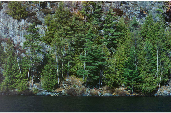
Figure 3: Eastern white pine and cedar on Pipestone Lake.
Recreational and commercial values
The Pipestone Conservation Reserve contains features that may hold interest for amateur and professional naturalists, particularly the older stands of eastern white cedar, white pine and red pine common in the area. There is the potential for a number of low impact, non-consumptive recreational activities such as canoeing, camping, wildlife viewing and photography. The cliffs common along the western shores of Pipestone Lake, considered amongst the best examples within the ecoregion, contribute significantly to the scenic qualities of the reserve.
There are only a few established campsites that have been identified within the conservation reserve, although numerous other suitable locations exist throughout. The implementation of the restricted camping zone limits campsite use and development. Residents are less active which may be due to the fee that is required to go over the mechanical portage. Also, the orientation of Pipestone Lake, along the northeast-trending southern arm and the Northwest Arm, makes waters susceptible to prevailing westerly/southwesterly winds. Large swells are not uncommon, particularly in the more open sections of the lake, and may represent potential difficulties for smaller watercraft such as canoes during times of strong winds. Numerous uncharted rocky shoals and reefs commonly occur in the shallower waters of bays and island groups in all the lakes, which pose navigational hazards for users unfamiliar with these waters. Portages connecting the lakes within and surrounding the conservation reserve are not formally maintained.
A limited number of sand beaches exist, with the largest and best example being at Sand Point on Pipestone Lake, a popular swimming and picnicking spot for boaters.
The existing traplines, baitfish harvest areas and bear management areas within the conservation reserve will remain and existing uses associated with them will be allowed to continue. Normal application of controls such as quotas and seasons are designed to ensure that affected wildlife populations remain sustainable.
Use of existing trails will be allowed to continue. Proposals for the development of new trails will be considered carefully to ensure that the values of the conservation reserve are protected. Recreational hunting and fishing will be permitted, although it is expected that access limitations will continue to apply to the surrounding lands. Use management strategies for existing and proposed forest access roads surrounding the reserve will be addressed in the corresponding forest management plans for those areas.
The conservation reserve lies along canoe routes that run from Rainy Lake to the south, to Lake of the Woods to the west and Eagle Lake to the north. Snowmachine trails along the frozen waters of the lakes follow the same route from Fort Frances through the reserve, although these are not formally designated as part of the Provincial trail network. Use of snowmachines on upland areas appears to be confined primarily to existing portage trails between lakes.
Traditional recreational hunting and fishing will continue to be a significant activity, with access limitations somewhat moderating the numbers of users, which in turn will help to maintain the quality of the resources.
Tourism values
The area in which the conservation reserve is located is considered high to very high for tourism values. Access to this area is relatively limited, with no direct road access, but water access is provided via the mechanical portage at the dam at the north end of Burditt Lake, and off the Cedar Narrows Road through Straw Lake to the east. Surrounding forest access roads do not provide direct access to the conservation reserve. Four commercial tourist lodges and seven outpost cabins are located within the conservation reserve. Commercial boat caches are also located at portages within the conservation reserve. Portages within the conservation reserve tend to be maintained by the tourist operator for the use of their guests and local cottagers for personal use. Hunting and fishing represent the traditional tourism activities for the area, but other non-consumptive activities associated with the earth and life science features are possible. The conservation reserve also lies along major un-maintained canoe and snowmobile routes between Rainy Lake, Lake of the Woods, Eagle Lake and associated waters. Scenic values, particularly those associated with cliff features and the abundant mature red and white pine, are also significant.
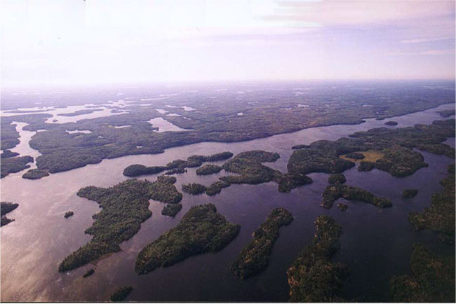
Figure 4: Aerial view looking southeasterly across islands on Pipestone Lake.
4.0 Management guidelines
4.1 Land Tenure
The Pipestone Conservation Reserve consists entirely of Crown land and no disposition of Crown land by sale is permitted within the conservation reserve. The surrounding and adjacent lands consist largely of Crown lands, although private holdings occur adjacent to the conservation reserve, notably between Dash Lake and Pipestone Lake where a significant block of patented mining lands occurs. Access to this property through the conservation reserve must be permitted in accordance with the provisions of the Land Use Strategy, but efforts will be made to seek the co-operation of the owner in ensuring any potential impacts are minimized or mitigated. Smaller private parcels consist primarily of cottage lots and the sites of tourist lodges which occur throughout the conservation reserve, on both the islands and mainland. No expropriation or purchasing of private land for inclusion in the conservation reserve is planned. Eight existing land use permits exist within the conservation reserve, seven of which represent outpost cabins and one for the mechanized portage at the north end of Burdit Lake. These permits will be permitted to continue unless incompatibility is demonstrated over time. Tenure for outpost cabins may be upgraded from land use permit to a lease upon approval of application and compatibility with the Lake Management Plan. New leases or land use permits may be considered for approved activities, subject to the "test of compatibility", but will generally be discouraged within the conservation reserve.
4.2 Existing and proposed development
No mineral exploration or mining development will be permitted in the conservation reserve.
Only isolated and rudimentary tertiary roads currently exist within the area and these will not be maintained, but allowed to deteriorate naturally over time. No new roads will be permitted, with the exception of permitting access to the patented property at Dash Lake for mineral exploration and development.
No commercial aggregate permits exist for the area of the conservation reserve and no new permits will be issued. Aggregate extraction will not be permitted.
No logging operations or facilities, nor hydro-electric facilities or structures exist within the area and no new development will be permitted. The values of the conservation reserve must be taken into consideration in the operation and maintenance of the dam, which controls the water levels in the Pipestone system. The maintenance and operation of the mechanical boat lift/portage at Feather Lake will be allowed to continue to serve the needs of local users and provide access to the conservation reserve.
No cabins or other facilities for the purpose of commercial bear hunting or baitfish harvesting on the site exist, and no new facilities will be permitted. Two trapper’s cabins currently exist within the conservation reserve and may remain in accordance with existing policy, but no new cabins associated with this activity will be permitted. Existing trails used in conjunction with these activities may continue to be used, but new trails will only be considered subject to the "test of compatibility".
No upland trails suitable for recreational purposes, such as hiking, skiing, snowmobiling or horseback riding, exist within the conservation reserve. The development of new trails will be subject to further planning, if considered desirable.
No private recreational camps under land use permits currently exist within the conservation reserve and no new camps will be permitted.
Short portage trails do exist in several locations within the reserve, connecting adjacent lakes, and these will be permitted to continue. Identified portages include: between Burditt and Pipestone Lakes; between Slender and Maw Lakes; between Maw and Dad Lakes; between Darrow and Pipestone Lakes; between Pipestone and Dash Lakes; between Helena and Pipestone Lakes; between Watson and Pipestone Lakes; between Yoke and Pipestone Lakes; between Straw and Yoke Lakes; between Yoke and Sullivan Lakes; and between Yoke and Crossroute Lakes (refer to Map 2 in appendices). Any proposals to improve existing portages or create new ones within the area of the conservation reserve will be subject to the "test of compatibility".
4.3 Recreational activities
Recreational hunting will be allowed to continue within the conservation reserve, subject to applicable regulations. The use of motorized and non-motorized means of transport will be permitted, but ATV's will be limited to existing trails. New trails may be permitted, subject to the "test of compatibility", and will be discouraged within wetland features and other sensitive areas of the reserve. Low impact activities and non-motorized recreational travel such as skiing, canoeing and hiking are permitted.
The use of mechanized means of transport such as snowmachines and all-terrain vehicles off of existing trails will not be permitted, except for direct retrieval of game in accordance with existing conservation reserve policy. Evidence of existing snowmachine use is limited to the waters of the larger lakes and connecting portages (Refer to Map 2).
Existing Ministry policies and regulations relating to Crown land camping will apply. The conservation reserve is within a restricted camping zone which restricts non resident camping. Non resident campers are required to stay at privately owned commercial facilities.
Traditional use of motor boats is permitted. Existing boat cache authority (commercial tourism, resource user and recreation purposes) is permitted to continue, unless there are demonstrated conflicts. New applications are subject to review to ensure compatibility with the fishery resource.
Sport fishing is a permitted use within the conservation reserve, subject to applicable regulations.
Low-impact recreational activities such as nature appreciation, photography and wildlife viewing are permitted and will be encouraged.
Figure 5: Dash Lake Portage
4.4 Commercial activities
Activities associated with current traplines and baitfish harvesting areas in the conservation reserve will be permitted to continue in accordance with existing policies and regulations. New operations may be considered, subject to a test of compatibility.
Existing bear management areas will be permitted to continue in accordance with existing policies and regulations and can be re-allocated. No new operations are permitted.
There are a total of four commercial tourist lodges located on private land within the boundaries of the conservation reserve. Additionally, there are seven outpost cabins within the conservation reserve. Applications for new or expansions to commercial tourism facilities within the Pipestone Conservation Reserve are subject to review through the planning process as set out in the Class Environmental Assessment for Ontario’s Provincial Parks and Conservation Reserves. Existing Ministry policies and regulations relating to Crown land camping will apply.
Existing authority for boat caches for commercial, recreational and resource user purposes is permitted to continue, subject to continued review to ensure compatibility with the fishery resource. New boat cache authority will be considered during subsequent planning and subject to compatibility with the fishery resource.
The commercial boat lift/mechanical portage at the north end of Burditt Lake will be allowed to continue to operate, to serve the needs of existing users, unless future planning identifies significant demonstrated conflicts.
No commercial food fisheries operations exist within the conservation reserve. New operations may be considered subject to the "test of compatibility".
Commercial wild rice harvesting does not occur within the conservation reserve, nor have any significant occurrences of wild rice been identified. No other commercial food harvesting (i.e, blueberries) activities have been identified. Any new activities will require the written authorization of the District Manager, and be subject to a test of compatibility. Alternative locations are preferred and should be addressed in the authorization.
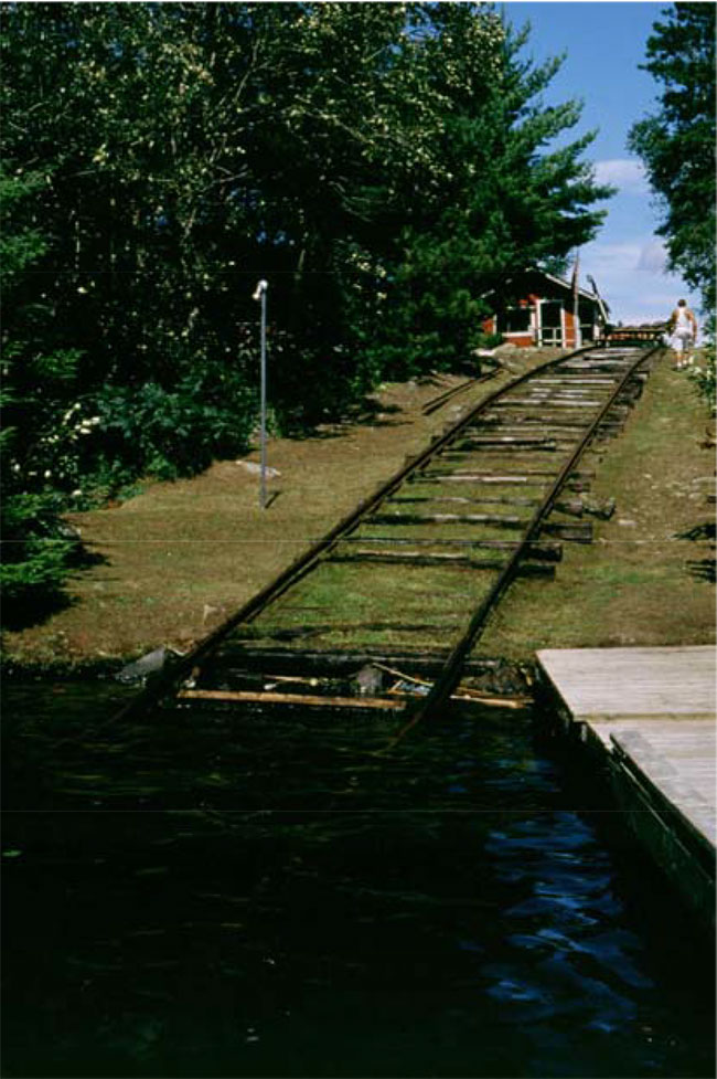
Figure 6: Mechanized portage between Burditt and Feather Lakes (Harris and Foster, 2002).
4.5 Aboriginal interests
The creation of this conservation reserve will not affect any Aboriginal or treaty rights. Consultation with interested First Nations towards identifying cultural and spiritual values within the area will continue. Native cultural heritage information will be respected and any information collected will be kept confidential.
4.6 Natural Resources Stewardship
4.6.1 Vegetation management
The Pipestone Conservation Reserve may be managed to allow natural processes to continue to the extent that is practically possible. The MNR recognizes fire as an essential process fundamental to the ecological integrity of conservation reserves. In accordance with existing Conservation Reserve Policy and the Forest Fire Management Strategy for Ontario, forest fire protection will be carried out as on surrounding lands.
Whenever feasible, the MNR fire program will endeavour to use "light on the land" techniques, which do not unduly disturb the landscape, in this conservation reserve. Examples of light on the land techniques may include limiting the use of heavy equipment or limiting the number of trees felled during fire response efforts. If wildfire occurs and geographic topography provides natural containment, the MNR fire program may choose to not action the fire.
Opportunities for prescribed burning to achieve ecological or resource management objectives may be considered. These management objectives will be developed with public consultation prior to any prescribed burning, and reflected in the document that provides management direction for this conservation reserve. Plans for any prescribed burning will be developed in accordance with the MNR Prescribed Burn Planning Manual, and the Class Environmental Assessment for Provincial Parks and Conservation Reserves. Suppression of fire will occur in accordance with existing MNR fire suppression strategies. Prescribed burning may be carried out to simulate natural fire, subject to a planning process. The development of a vegetation management plan for the area in the context of regional fire strategies is recommended over time.
Control of insects and diseases within the conservation reserve may be carried out, if required, in accordance with existing Provincial programs and policies. All such proposed activities will be reviewed carefully to ensure that the values of the conservation reserve are protected. Control of non-native species will be considered a priority.
The use of pesticides and other control agents within the conservation reserve, should such measures be considered desirable, will favour biological controls.
4.6.2 Fish and wildlife management
Current Acts, Regulations and Policies will apply. The lands and waters of the conservation reserve will be included in scheduled fish and wildlife management programs and activities. The terrestrial and wetland ecosites of the conservation reserve will be considered in other resource management planning as a component of the wildlife habitat in the broader landscape. The introduction of non-native species will not be permitted.
4.6.3 Landforms
Activities that tend to impact landforms, such as aggregate extraction and road construction, will not be permitted.
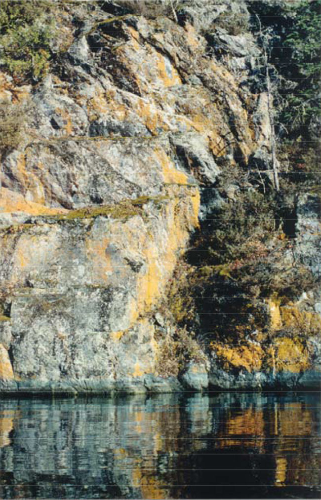
Figure 7: Steep bedrock cliff on west shore of Pipestone Lake.
4.7 Non-commercial consumptive uses
The consumptive uses of fish and wildlife resources within the conservation reserve are discussed under Section 4.3, and commercial consumptive uses under Section 4.4.
Non-commercial food gathering activities such as berry picking for personal use will be permitted to continue. Plant collection except for approved research or inventory purposes will not be permitted.
Non-commercial harvesting of traditional forest products such as fuelwood for personal use may be permitted within the conservation reserve under a Forest Resource License, subject to existing Provincial legislation and policy and only if other viable alternatives do not exist outside the Reserve boundaries. The location of any areas where such activities may be permitted will be determined subject to the test of compatibility.
4.8 Cultural Resources Stewardship
The location and specific details regarding cultural heritage resources will be kept confidential in order to ensure protection of such values and sites.
4.9 Client services
No on-site facilities or services exist within the conservation reserve, nor are any proposed at this time.
The permitted uses and recognized values of this conservation area will be made known to the public through public consultation associated with the Land Use Strategy, the site regulation process, and materials, including this Statement of Conservation Interest, available through Government Information Centres. No advertising campaigns for the Pipestone Conservation Reserve are planned at this time.
Future planning for the conservation reserve will be in accordance with the Class Environmental Assessment for Provincial Parks and Conservation Reserves, which may involve formal public consultation.
4.10 Research
Research activities which do not negatively affect the values which the conservation reserve is designed to protect will be encouraged, but will require the written authority of the District Manager. Such research projects may include monitoring of the effects of the edge or interface between the Conservation Reserve and surrounding lands.
4.11 Marketing
No marketing associated specifically with this conservation reserve for tourism and recreational purposes is planned at this time.
5.0 Implementation
The Pipestone site is expected to be regulated as a conservation reserve under the Public Lands Act, in 2006, following the process set out in the Ontario’s Living Legacy Protected Areas Regulation Implementation Manual (MNR, 2000).
The Fort Frances District, Rainy River/Manitou Area of the Ministry of Natural Resources will be responsible for implementing the management policies and guidelines for the area. All MNR Resource Management Plans or Land Use Plans have been revised as necessary to exclude timber harvesting and other non-permitted activities from this area. All stakeholders and clients have been informed through mail and other consultation of the changes that will take affect. The Rainy River/Manitou Area will have primary responsibility in administering the policies and guidelines. The primary role is providing public information and monitoring of compliance to the policies and guidelines.
6.0 Review and revisions
6.1 Review and revision process
The Pipestone Conservation Reserve Statement of Conservation Interest will be reviewed on an ongoing basis and revised as needed.
Revisions to the Pipestone Statement of Conservation Interest will be subject to the requirements as specified in the Draft Class Environmental Assessment for Provincial Parks and Conservation Reserves. Significant changes as defined under the Class EA will involve a public consultation process and approval from the District Manager and Regional Director of the Ministry of Natural Resources.
6.2 Public consultation
6.2.1 Past consultation
The Pipestone site was part of the consultation process in the land use planning exercise. Consultation associated with the land use planning initiative occurred at a number of stages in the process:
- Lands For Life round table consultation June 1997- July 1998
- Ontario Forest Accord 1999
- Ontario’s Living Legacy round table discussions 1999
- Ontario’s Living Legacy Land Use Strategy 1999
- OLL Site Regulation Public Consultation Process 2000.
6.2.2 Present and future consultation
Summary of the 2000 Site Regulation Process:
- Mailouts were sent to adjacent property owners and other affected and interested parties and agencies by the District Manager, and newspaper adds placed in local and regional media, informing of the regulation process and inviting comments on the proposed boundaries
- A tourist outfitter with property located adjacent to the proposed conservation reserve expressed interest in obtaining additional property to install a septic field. The land required would be within the protected area. Although such dispositions could be allowed under the Land Use Strategy, the situation is complicated due to the fact that the septic field requested would be to accommodate a proposed expansion of the tourism operation
- An individual expressed concern about the potential use of personal watercraft within the waters adjacent to the proposed CR, indicating he would like to see their use restricted or banned
- A tourist outfitter expressed concerns about the potential for commercial fisheries on Pipestone Lake, indicating that he would not be in favour of any such activity. He indicated that he was also in favour of conservation measures such as catch-and-release on these waters
- An issue arose during the consultation period relating to a proposal on the part of a mining exploration company that wished to access their patented mining claims adjacent to the proposed protected area south of Dash Lake. The access, although permitted under the Land Use Strategy, was somewhat problematic in that it involved the crossing of Dash Creek and the portage between Dash Lake and Pipestone Lake. This route receives significant use by the public
MNR Response to Issues Raised During Consultation:
- Limitations on any expansion of tourism facilities in this particular location tends to negate the need for any additional property on the part of the applicant, as the rationale for this development is based upon the expansion. It is therefore a fisheries management issue first and foremost, and not a Living Legacy implementation issue at this time. The District Fisheries Management Plan states explicitly that no such expansion would be permitted due to pressure on the fisheries resource, and therefore no disposition is recommended at this time
- The use of personal watercraft within the conservation reserve could be limited if it were determined that this was a use incompatible with the values the CR was designed to protect. Although some users may object to such conveyances for personal reasons, no clear evidence currently exists to justify limiting the legal use of such craft within the waters of the conservation reserve. Such issues could be subject to future planning for the protected area, if further evidence emerges over time
- Management of the fisheries resource within the waters of the conservation reserve is undertaken as part of the broader strategies found within the District Fisheries Management Plan. Specific conservation measures designed to protect fisheries could be part of future planning
- Under the Land Use Strategy, access to existing mining claims is allowed and cannot be denied where legitimate mining exploration is taking place. However, appropriate conditions should be applied, particularly in the case of water crossings where a Work Permit is required. Authorization should be granted based on the ability to mitigate environmental and social impacts on both the stream and the adjacent trail
Based on the input received, no revisions to the boundaries of the site were deemed necessary. No expansion of the protected area based upon the values represented was recommended.
The policies that form the basis of this Statement of Conservation Interest are specified in the approved Ontario’s Living Legacy Land Use Strategy and Conservation Reserves Policy and Procedure (MNR, 1997). A policy statement defining the land use intent and specific policies applicable to this conservation reserve may also be found posted on the internet as part of the Land Use Atlas (under preparation, expected completion summer, 2003). Should revisions to the policies applying to this conservation reserve be required over time, such revisions will be subject to the provisions of the Land Use Strategy regarding amendments.
7.0 References
Barnett, P.J., Henry, A.P. and Babuin, D. (1991): Quaternary geology of Ontario, west central sheet. Ontario Geological Survey. Map 2554. scale 1:1,000,000.
Baycroft, R. 2001. Recreation Inventory Checksheet – Pipestone Conservation Reserve. Ministry of Natural Resources, Fort Frances District.
Blackburn, C. 2002. Earth Science Reconnaissance: C2348 Pipestone C.R. Northern Bioscience. OMNR unpublished report. 4 p.
Blackburn, C. E. 1981. Kenora-Fort Frances sheet. Ontario Geological Survey. Geological compilation series. Map 2443. scale 1:253,440.
CCRS. 2002. Canada Land Inventory Classification for Recreation. The Canadian Centre for Remote Sensing, Natural Resources Canada. Ottawa. GIS coverages & Manual; Internal Document.
Harris, A. and Foster, R. 2002. Life Science Reconnaissance: C2348 Pipestone C.R. Northern Bioscience. OMNR unpublished report. 20 p.
Hills, G.A. 1961. The Ecological Basis for Land-Use Planning. Ont. Dept. Lands and Forests. Toronto, Ont. Res. Rep. No. 42. 63 pp.
Ministry of Natural Resources (MNR). 1997. Conservation Reserves Policy and Procedure. PL 3.03.05.
Ministry of Natural Resources (MNR). 2000. Protected Areas Regulation Implementation Manual; Internal Document.
NHIC. 2003. Natural Heritage Information Centre Database. Ontario Ministry of Natural Resources. Page.<http://mnrweb.mnr.gov.on.ca/nhic/nhic.cfm> (link no longer active). Accessed 2003, Feb. 3.
Noble, T. 1995. Preliminary Report: Pipestone Lake Bedrock Uplands. Ontario Ministry of Natural Resources, Northwest Region. 3 pp.
Ontario Ministry of Natural Resources (OMNR). 1975. Pipestone Lake Management Plan – J. Thomas/D. Kaufman
Ontario Ministry of Natural Resources (OMNR). 1996. Forest Resources Inventory - Highrock Forest. Ontario Ministry of Natural Resources Digital G.I.S. database, updated to year 2000.
Ontario Ministry of Natural Resources (OMNR). 1999. Ontario’s Living Legacy - Land Use Strategy. Ontario Ministry of Natural Resources Toronto, Ont. 136 pp.
Ontario Ministry of Natural Resources (OMNR). 2002. Natural Resources Values Information System (NRVIS). Fort Frances District.
Ontario Ministry of Natural Resources (OMNR). 2003. Open Water Creel Survey of Pipestone/Burditt/Despair Chain of Lakes. J. Van den Broeck
Racey, G.D., Harris, A.G., Jeglum, J.K., Foster, R.F. and Wickware, G.M. 1996. Terrestrial and Wetland Ecosites of Northwestern Ontario. Ont. Min. Natur. Resour., Northwest Sci. & Technol. Field Guide FG-02. 94 pp. + Append.
Roed, M.A. 1980. Rowan Lake Area (NTS 52F/SW). Districts of Kenora and Rainy River, Ontario. Geological Survey, Northern Ontario Engineering Geology Terrain Study 37. 13 p. Accompanied by Map 5060, scale 1:100,000.
Springer, J. 1978. Ontario Mineral Potential, Dryden Sheet, Districts of Kenora and Rainy River. Ontario Geological Survey Prelim. Map P.1530, Mineral Deposits Ser., Scale 1:250,000
Appendix A Permitted Uses table
Land Use activity for Pipestone Conservation Reserve
Those uses and management activities not listed in the following table are governed by existing Conservation Reserve policy. Management direction is elaborated in the Statement of Conservation Interest. Any new uses, and commercial activities associated with them, will be considered on a case by case basis, and must pass a test of compatibility to be acceptable. Compatibility is normally determined through a planning process.
Commercial activities:
| Activity | Permitted | Guidelines |
|---|---|---|
| Aggregate Extraction | No | |
| Bait Fishing Existing: | Yes | Existing use permitted to continue, unless there are significant demonstrated conflicts. |
| Bait Fishing New: | Maybe | New operations can be considered, subject to the "test of compatibility" |
| Commercial Fishing Existing: | N/A |
Existing use permitted to continue, unless there are significant demonstrated conflicts. |
| Commercial Fishing New: | Maybe | New operations can be considered, subject to the "test of compatibility". |
| Commercial Hydro Development | No | |
| Commercial Timber Harvest |
No | |
| Commercial Tourism Existing: | Yes | Existing authorized facilities can continue, unless there are significant demonstrated conflicts. |
| Commercial Tourism New: | Maybe | New tourism facilities can be considered during the planning for an individual reserve. |
| Bear Hunting by Non residents (guided) Existing: | Yes | Existing authorized operations permitted to continue. |
| Bear Hunting by Non residents (guided) New: | No | New operations not permitted. |
| Outfitting Services Existing: | Yes | Existing authorized operations permitted to continue. |
| Outfitting Services New: | Maybe | New operations can be considered during the planning for an individual reserve. |
| Outpost Camps Existing: | Yes | Existing authorized facilities permitted to continue. |
| Outpost Camps New: | Maybe | New facilities can be considered during the planning for an individual reserve. |
| Resorts/lodges Existing: | N/A |
Existing authorized facilities permitted to continue. |
| Resorts/lodges New: | Maybe | New facilities can be considered during the planning for an individual reserve. |
| Energy Transmission and Communications Corridors Existing: | N/A |
None exist on the site. These facilities should avoid conservation reserve lands wherever possible. |
| Energy Transmission and Communications Corridors New: | No | |
| Food Harvesting (Commercial) Existing: | Maybe | Written authority required. |
| Food Harvesting (Commercial) New: | Maybe | |
| Mineral Exploration and Development | No | |
| Peat Extraction | No | |
| Wild Rice Harvesting Existing: | Yes | No significant stands have been identified within the conservation reserve. Existing subsistence harvesting unknown. |
| Wild Rice Harvesting New: | Maybe |
Land and resource management activities
| Activity | Permitted | Guidelines |
|---|---|---|
| Crown Land Disposition Private Use: | Maybe | Sale of lands is not permitted, except for minor dispositions in support of existing uses (e.g. reconstruction of a septic system). Renewals of existing leases and land use permits are permitted. Requests for transfer of tenure will be considered in the context of the Statement of Conservation Interest or Resource Management Plan. |
| Crown Land Disposition Commercial Use: | Maybe | New leases or land use permits permitted for approved activities. Tourism facilities can apply to upgrade tenure from LUP to lease. |
| Fire Suppression | Yes | Fire suppression policies are similar to adjacent Crown lands, unless alternative fire policies have been developed through a planning process. Whenever feasible, the MNR fire program will endeavour to use “light on the land” techniques, which do not unduly disturb the landscape. |
| Fish Habitat Management | Maybe | |
| Fish Stocking | Maybe | Existing authorized operations permitted to continue. New operations not permitted. |
| Inventory/disease Suppersion | Maybe | |
| Inventory/Monitoring | Yes | |
| Prescribed Burning | Maybe | Opportunities for prescribed burning to achieve ecological or resource management objectives may be considered. These management objectives will be developed with public consultation prior to any prescribed burning, and reflected in the document that provides management direction for this conservation reserve. Plans for any prescribed burning will be developed in accordance with the MNR Prescribed Burn Planning Manual, and the Class Environmental Assessment for Provincial Parks and Conservation Reserves (approval pending). |
| Roads (Resource Access) Existing: | Yes | Few roads currently exist within the site, and consist of rudimentary tertiary roads. No road maintenance will be undertaken on such roads within the conservation reserve. |
| Roads (Resource Access) New: | Maybe | Existing roads can continue to be used. Continued use will include maintenance and may include future upgrading. New roads for resource extraction will not be permitted, with the exception of necessary access to existing forest reserves for mineral exploration and development. |
| Vegetation Management | Maybe | Conservation Reserves policy indicates that Featured Species Management and Natural Systems Management may be permitted. Vegetation management can be considered in a planning process. |
| Wildlife Population Management | Maybe |
Science, education and heritage appreciation
| Activity | Permitted | Guidelines |
|---|---|---|
| Collecting | No | |
| Historical Appreciation | Yes | |
| Nature Appreciation | Yes | |
| Photography and Painting | Yes | |
| Research | Yes | |
| Wildlife Viewing | Yes |
Recreation activities and facilities
| Activity | Permitted | Guidelines |
|---|---|---|
| All Terrain Vehicle Use On Trails: | Yes | Existing use permitted to continue where it does not adversely affect the values being protected. ATV use off trails is not permitted except for direct retrieval of game. |
| All Terrain Vehicle Use Off Trails: | No | |
| Campgrounds | Maybe | Can be considered in a planning process. |
| Food Gathering | Yes | |
| Horseback Riding (trail) | Yes | Existing use on trails permitted. |
| Hunting | Yes | |
| Mountain Bike Use | Yes | Existing use on trails permitted. |
| Motor Boat Use Commercial: | Maybe | Traditional use of motor boats is permitted. Existing boat cache authority (commercial tourism, resource user, recreation) is permitted to continue, unless there are significant demonstrated conflicts. |
| Motor Boat Use Private: | Maybe | New commercial tourism boat cache authority may be considered during the planning for an individual reserve. Resource user and private recreation boat caches may be permitted subject to the "test of compatability". |
| Non-motorized Recreation Travel | Yes | |
| Private Recreation Camps (Hunt Camps) Existing: | N/A |
No private recreation camps currently exist within the site. |
| Private Recreation Camps (Hunt Camps) New: | No | No new development will be permitted. |
| Rock Climbing | Maybe | |
| Snowmobiling On Trails: | Yes | Existing use permitted to continue where it does not adversely affect the values being protected. |
| Snowmobiling Off Trails: | Maybe | Snowmobile use off trails is not permitted, except that snowmobiles may be used for direct retrieval of game. |
| Sport Fishing | Yes | |
| Trail Development | Maybe | Development of trails for a variety of activities (e.g. hiking, cross-country skiing, cycling, horseback riding, snowmobiling) can be considered as part of planning for an Individual reserve. No new trails are proposed for this conservation reserve at this time. |
Note: The policies outlined in this table do not supersede any Aboriginal or treaty rights that may exist, or other legalobligations.
Management of this conservation reserve is carried out within the context of Conservation Reserve policy as amended by thepolicies for new conservation reserves outlined in the Ontario’s Living Legacy Land Use Strategy.
Source of direction:
Ontario’s Living Legacy Land Use Strategy (1999)
Land Use Strategy, with some recommended wording carried forward from the Fort Frances District Land Use Guidelines.
Fort Frances District Fisheries Management Plan (1987)
Conservation Reserves Policy (1997)
Appendix B Survey Checksheet
Recreation Inventory Checklist
| Name | Pipestone Conservation Reserve / C-2348 |
|---|---|
| Map Name | Dryden |
| NTS Number | 52F |
| UTM reference | 15U 0461355/ 5435255 |
| OBM Number | 46543 |
| Latitude | 92° 32' |
| Longitude | 49° 03' |
| Area (ha) | 11,148 ha |
| Ownership | Crown |
| MNR Region | Thunder Bay |
| MNR District | Fort Frances |
| Park Zone | N/A |
| Country | N/A |
| Township | N/A |
| Recreation Features | Recreation Activities |
|---|---|
| 1 M04 Lake Large | 1 F00 Fishing |
| 2 M03 Lake Midsize | 2 B01 Boating |
| 3 A01 Sport Fish | 3 B02 Canoeing |
| 4 E06 Forest Parkland (White Pine Stands) | 4 K05 Summer Camping |
| 5 J06 Bedrock Exposed | 5 N08 Solitude |
| 6 Q19 Stacks & Cliffs | 6 Q09 Wildlife |
| 7 T05 Water Routes | 7 D10 Snowmobileing |
| 8 T04 Snow Routes | 8 F05 Ice Fishing |
| Recreation Factors | Features | Rating |
|---|---|---|
| Most Scarce Feature: N/A | 5 | Moderate |
| Feature Scarcity: N/A | Moderate | |
| Most Unique Feature: N/A | 6 | |
| Activity Attraction Capability: N/A | High | |
| Scenic Attractiveness: N/A | High | |
| Geographic Significance: N/A | High | |
| Feature Significance: N/A | High | |
| Most Sensitive Feature To Recreation Use: N/A | 4 | |
| Feature Sensitivity To Recreation Use: N/A | High | |
| Most Sensitive Feature To Resource Development: N/A | 5 | |
| Feature Sensitivity To Resource Development: N/A | Very High High Moderate Low | |
| Cultural/Historic and Archaeological Features: | C A B |
Appendix E
Pipestone Conservation Reserve Factsheet
Pipestone Conservation Reserve (C2348) Factsheet
August, 2000
Background
On July 16, 1999, the Ontario Government released the Ontario’s Living Legacy Land Use Strategy to guide the planning and management of Crown lands in central and parts of northern Ontario. A major part of the Ontario’s Living Legacy Land Use Strategy was a government intent to establish 378 new protected areas. This commitment marks the biggest expansion of provincial parks and conservation reserves in Ontario’s history.
The proposed Pipestone Conservation Reserve is part of this significant expansion of Ontario’s protected areas system.
Size and location
The proposed Pipestone Conservation Reserve is situated 50 kilometres northwest of the Town of Fort Frances, and approximately 20 kilometres northwest of Naicatchewenin First Nation. Comprised primarily of the waters and adjacent lands of Pipestone Lake, Yoke Lake, Slender Lake, Campbell Lake, Crossroute Lake and the southern portion of Asheigamo Lake, this site is approximately 11,148 hectares in size.
Area highlights
This Pipestone site is a large expanse of shoreline, islands and peninsulas containing representative landform and vegetation types. Of particular significance are the extensive bedrock uplands on the northwest shore of Pipestone Lake and the concentrations of mature white and red pine, which add to the scenic appeal. The Pipestone site is located in an area of traditional use by First Nations peoples and has significant cultural and spiritual value for them. This picturesque waterway with high recreational and tourism use is especially favoured by canoeists, cottagers and anglers. While in this area, it is not uncommon to see bald eagles, osprey and large mammals such as moose and bear. Access may be gained easily from secondary highway 622 at Burditt Lake immediately to the south, or from Straw Lake via the Cedar Narrows Road to the east.
Land Use intent
Conservation reserves are areas of Crown land set aside by regulation under the Public Lands Act.
Conservation reserves complement provincial parks in protecting representative natural areas and special landscapes. Most recreational (e.g. hiking, skiing, tourism related uses, nature appreciation) and non-industrial (e.g. fur harvesting, commercial fishing and bait harvesting) activities that have traditionally been enjoyed in the area will continue, provided that these uses do not impact on the natural features needing protection. Hunting and fishing is permitted within all new conservation reserves proposed through Ontario’s Living Legacy.
Commercial timber harvesting, mining, aggregate extraction and commercial hydroelectric development are prohibited in conservation reserves. Careful mineral exploration may occur in specific new conservation reserves proposed through Ontario’s Living Legacy, in areas that have provincially significant mineral potential. If a portion of a new conservation reserve is to be developed for a mine, it would be removed from the reserve, and appropriate replacement lands would be placed in regulation.
Consistent with Ontario’s Living Legacy Land Use Strategy the pre-existing mining claims within this site will be managed as "Forest Reserves" and will not be included as part of the regulated conservation reserve area. Should the mining claims be retired in the future through normal processes, the claim area will be added to the conservation reserve.
Next steps
The Land Use Strategy established the Ministry’s intent to add these Crown lands to Ontario’s protected areas system, following the extensive public consultation associated with the Ontario’s Living Legacy and Lands for Life land use planning initiatives between 1997 and 1999. Prior to the finalization of the boundary of this conservation reserve proposed for regulation under the Public Lands Act, the Ministry is inviting public comment from August 15 – September 15, 2000 on the proposed boundary from all potentially affected stakeholders and First Nations.
In the interim, the area has been withdrawn and protected from resource extraction activities such as timber harvesting, hydroelectric development, aggregate extraction and new mineral exploration.
In the future and subject to the intended regulation of the area as a conservation reserve, the Ministry of Natural Resources will prepare a long term management plan for this area. Depending upon the complexity of issues within this conservation reserve, management planning may take the form of a simple Statement of Conservation Interest or a more detailed Resource Management Plan. Please let us know if you would like to be notified when planning begins.
Planning, management and the uses permitted within this conservation reserve would be consistent with the commitments of the Ontario’s Living Legacy Land Use Strategy.
For more information
For further information on the proposed Pipestone Conservation Reserve, please contact John Munroe, Ministry of Natural Resources, 108 Saturn Avenue, Atikokan, Ontario, P0T 1C0, phone: 807-597-6971 (ext. 241), Fax: 807-597-6185. You may also visit the Ministry’s Internet website at www.mnr.gov.on.ca/MNR/oll/ for information on Ontario’s Living Legacy.
Appendix C
Maps
Appendix D
Forest stand listings
Appendix F
Photographs
Figure 8: Aerial view looking southeastwards from Maw and Slender Lakes in the foreground.
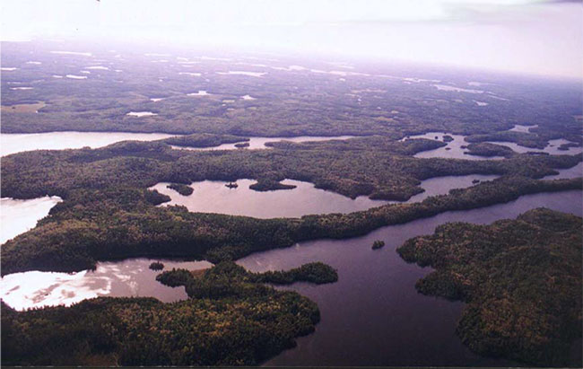
Figure 9: Pipestone and Helena Lakes with Gates Ajar at lower right and the Northwest Arm and Schistose Lake in the distance.
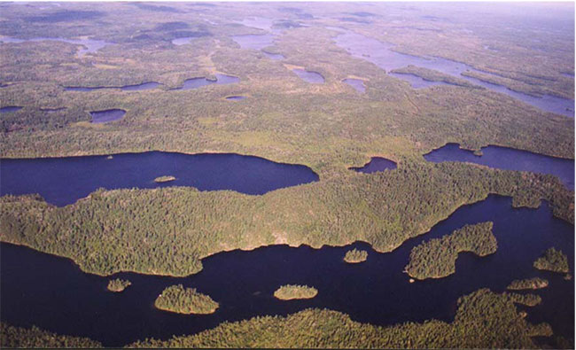
Figure 10: Looking north from Burditt Lake with Feather Lake Dam in the foreground.
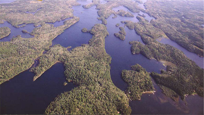
Figure 11: Peninsula between Northwest Arm, Pipestone Lake and Schistose Lake on the left, and connecting channel in the foreground.
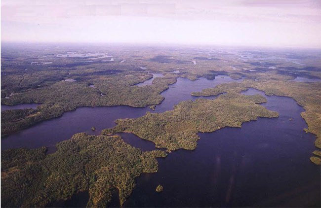
Figure 12: Rocky shoreline on west side of Pipestone Lake.
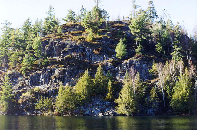
Figure 13: Portage through cedar into Helena Lake.
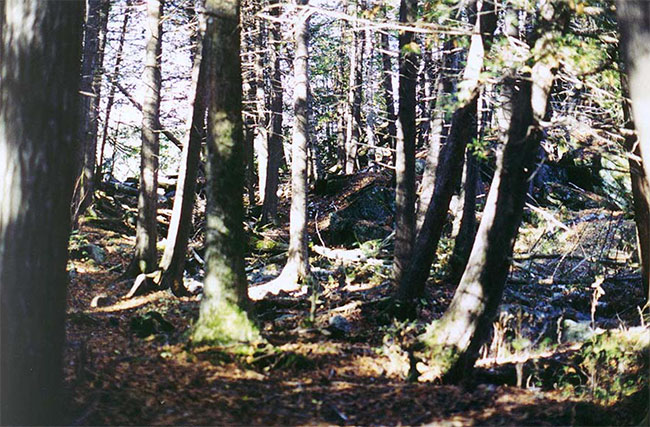
Figure 14: Sandy shoreline at Sand Point, Pipestone Lake.
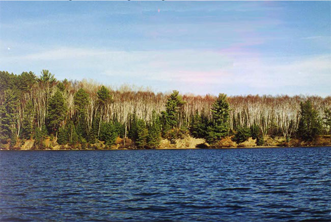
Figure 15: Entrance to channel to Stonedam Lake from Pipestone Lake
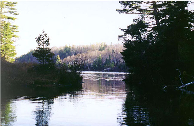
Footnotes
- footnote[1] Back to paragraph Harris and Foster, 2002
- footnote[2] Back to paragraph Blackburn, 2002
- footnote[3] Back to paragraph Baycroft, 2001
- footnote[*] Back to paragraph Not applicable (use/value/facility does not currently exist within the site)