Universal Soil Loss Equation
Use the Universal Soil Loss Equation to predict the long-term average annual rate of erosion on a field slope based on rainfall pattern, soil type, topography, crop system and management practices.
ISSN 1198-712X, Published January 2023
Background
The Universal Soil Loss Equation (USLE) predicts the long-term average annual rate of erosion on a hillslope based on rainfall pattern, soil type, topography, crop system and management practices.
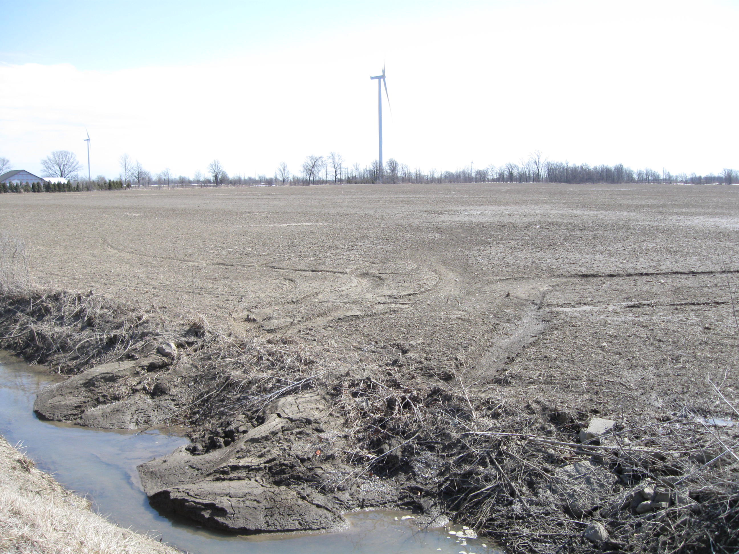
The USLE only predicts the amount of soil loss that results from sheet or rill erosion on a single slope and does not account for additional soil loss that might occur from gully, wind or tillage erosion.
This erosion model was created for use in agricultural landscape settings but has also been applied to non-agricultural settings such as forested land and construction sites. In agriculture, the USLE can be used to compare soil erosion rates, under existing management practices, with the “tolerable” soil erosion rate for a field of interest. Alternative cropping and tillage combinations can also be evaluated to determine the adequacy of planned soil conserving measures, as part of the conservation farm planning process.
Five major factors are used to calculate the soil loss for a given site. Each factor is the numerical estimate of a specific condition that affects the severity of soil erosion at a particular location. The erosion values reflected by these factors can vary considerably due to varying weather conditions. Therefore, regard the values obtained from the USLE as representing long-term averages.
A calculation of soil losses using the USLE may also be done in various nutrient management and soil and water conservation planning tools found in the Ministry of Agriculture, Food and Rural Affairs’ (OMAFRA) online software, AgriSuite. For example, the soil loss value generated by the USLE equation is the default approach used to calculate the “estimated soil erosion value” in PLATO (Phosphorus Loss Assessment Tool for Ontario).
Universal Soil Loss Equation
A = 2.24 × R × K × LS × C × P (metric: tonnes/ha/yr)
A = R × K × LS × C × P (imperial: tons/acre/yr)
A represents the potential long-term average annual soil loss in tonnes/ha/yr (metric), or tons/acre/yr (imperial), depending on which of the equations is used. This is the amount that is compared to the “tolerable soil loss” limits (Table 7).
R is the rainfall and runoff factor by geographic location as given in Table 1. The greater the intensity and duration of the rainstorm, the higher the erosion potential. Select the R factor from Table 1 based on the upper tier municipality designation and corresponding weather station where the calculation is to be made.
K is the soil erodibility factor (Table 2). K is a measure of the susceptibility of soil particles to detachment and transport by rainfall and runoff. Texture is the principal factor affecting K, but structure, organic matter and permeability also contribute.
LS is the slope length-gradient factor. The LS factor represents a ratio of soil loss under given conditions to that at a site with the “standard” slope steepness of 9% and slope length of 22.13 m (72.6 ft). The steeper and longer the slope, the higher the risk for erosion. Use either Table 3 or the equation for calculating LS included in this fact sheet to obtain LS.
C is the cropping practice or managment practice factor. It is used to represent the relative effectiveness of soil and crop management systems in controlling soil loss. The C factor is a ratio comparing the soil loss from land under a specific crop and tillage system to the corresponding loss from continuously fallow and tilled land. The C factor can be determined by selecting the crop type and tillage method (Table 4 and Table 5, respectively) that corresponds to the field and then multiplying these factors together.
The C factor resulting from this calculation is a generalized C factor value for a specific crop that does not account for crop rotations or climate and annual rainfall distribution for the different agricultural regions of the country. This generalized C factor, however, provides relative numbers for the different cropping and tillage systems, thereby helping to weigh the merits of each system.
P is the support practice factor. It reflects the effects of practices that will reduce the amount and rate of the water runoff and thus reduce the amount of erosion. The P factor represents the ratio of soil loss by a support practice to that of straight-row farming up and down the slope. The most commonly used supporting cropland practices are cross-slope cultivation, contour farming and strip cropping (Table 6).
Procedure for using the Universal Soil Loss Equation
To estimate sheet and rill water erosion rates along a hillslope, begin by selecting the units (metric or imperial) and corresponding USLE equation you want to work with. Then follow the steps:
- Determine the R Factor (Table 1).
- Based on the soil texture, determine the K value (Table 2). If there is more than one soil type in a field and the soil textures are not very different, use the soil type that represents the majority of the field. Repeat for other soil types as necessary.
- Divide the field into sections of uniform slope gradient and length. For more information on how to measure field slopes, read the OMAFRA fact sheet, Measuring field slopes for nutrient management and conservation planning. Assign an LS value to each section (Table 3).
- Choose the crop type factor (Table 4) and tillage method factor (Table 5) for the crop to be grown. Multiply these two factors together to obtain the C factor.
- Select the P factor based on the support practice used (Table 6).
- Multiply the five factors together, using the equation selected in step 1, to obtain the annual soil loss per hectare (acre).
| Weather station | Upper tier municipality designation | R factor |
|---|---|---|
| Brantford | County of Brant | 90 |
| Delhi | County of Oxford | 100 |
| Essex | County of Essex | 110 |
| Fergus | Counties of Dufferin and North Wellington | 120 |
| Glen Allen | County of Centre Wellington | 130 |
| Guelph | County of South Wellington | 100 |
| Hamilton | City of Hamilton, Regional Municipality of Halton | 100 |
| Kingston | City of Prince Edward County, Counties of Frontenac and Lennox and Addington | 90 |
| Kitchener | Regional Municipality of Waterloo | 110 |
| London | Counties of Lambton, Middlesex and Oxford | 100 |
| Mount Forest | Counties of Bruce, Grey, Haliburton and Simcoe, District of Muskoka | 90 |
| Niagara | Regional Municipality of Niagara | 90 |
| Northern Ontario | Districts of Algoma, Cochrane, Kenora, Manitoulin Island, Parry Sound, Rainy River, Sudbury, Thunder Bay and Timiskaming | 90 |
| Ottawa | City of Ottawa, Counties of Lanark and Renfrew, United Counties of Leeds and Grenville, Prescott and Russell, and Stormont, Dundas and Glengarry, District of Nipissing | 90 |
| Prospect Hill | Counties of Huron and Perth | 120 |
| Ridgetown | Municipality of Chatham-Kent | 110 |
| Simcoe | Counties of Haldimand and Norfolk | 120 |
| St. Catharines | Niagara Region | 100 |
| St. Thomas | County of Elgin | 90 |
| Toronto | City of Toronto, Regional Municipalities of Peel and York | 90 |
| Tweed | City of Kawartha Lakes, Counties of Hastings, Northumberland, and Peterborough, Regional Municipality of Durham | 90 |
| Textural class | K factor average OMC* | K factor less than 2% OMC | K factor more than 2% OMC |
|---|---|---|---|
| Clay | 0.22 | 0.24 | 0.21 |
| Clay loam | 0.30 | 0.33 | 0.28 |
| Coarse sandy loam | 0.07 | N/A | 0.07 |
| Fine sand | 0.08 | 0.09 | 0.06 |
| Fine sandy loam | 0.18 | 0.22 | 0.17 |
| Heavy clay | 0.17 | 0.19 | 0.15 |
| Loam | 0.30 | 0.34 | 0.26 |
| Loamy fine sand | 0.11 | 0.15 | 0.09 |
| Loamy sand | 0.04 | 0.05 | 0.04 |
| Loamy very fine sand | 0.39 | 0.44 | 0.25 |
| Sand | 0.02 | 0.03 | 0.01 |
| Sandy clay loam | 0.20 | N/A | 0.20 |
| Sandy loam | 0.13 | 0.14 | 0.12 |
| Silt loam | 0.38 | 0.41 | 0.37 |
| Silty clay | 0.26 | 0.27 | 0.26 |
| Silty clay loam | 0.32 | 0.35 | 0.30 |
| Very fine sand | 0.43 | 0.46 | 0.37 |
| Very fine sandy loam | 0.35 | 0.41 | 0.33 |
| Slope length: m (ft) | Slope (%) | LS factor |
|---|---|---|
| 15 (50) | 10 | 0.98 |
| 15 (50) | 8 | 0.70 |
| 15 (50) | 6 | 0.48 |
| 15 (50) | 5 | 0.38 |
| 15 (50) | 4 | 0.30 |
| 15 (50) | 3 | 0.22 |
| 15 (50) | 2 | 0.16 |
| 15 (50) | 1 | 0.10 |
| 15 (50) | 0 | 0.06 |
| 30.5 (100) | 10 | 1.38 |
| 30.5 (100) | 8 | 1.00 |
| 30.5 (100) | 6 | 0.67 |
| 30.5 (100) | 5 | 0.54 |
| 30.5 (100) | 4 | 0.40 |
| 30.5 (100) | 3 | 0.30 |
| 30.5 (100) | 2 | 0.20 |
| 30.5 (100) | 1 | 0.13 |
| 30.5 (100) | 0 | 0.07 |
| 46 (150) | 10 | 1.70 |
| 46 (150) | 8 | 1.22 |
| 46 (150) | 6 | 0.83 |
| 46 (150) | 5 | 0.66 |
| 46 (150) | 4 | 0.47 |
| 46 (150) | 3 | 0.35 |
| 46 (150) | 2 | 0.23 |
| 46 (150) | 1 | 0.15 |
| 46 (150) | 0 | 0.08 |
| 61 (200) | 10 | 1.95 |
| 61 (200) | 8 | 1.41 |
| 61 (200) | 6 | 0.95 |
| 61 (200) | 5 | 0.76 |
| 61 (200) | 4 | 0.53 |
| 61 (200) | 3 | 0.39 |
| 61 (200) | 2 | 0.25 |
| 61 (200) | 1 | 0.16 |
| 61 (200) | 0 | 0.08 |
| 122 (400) | 10 | 2.76 |
| 122 (400) | 8 | 1.99 |
| 122 (400) | 6 | 1.35 |
| 122 (400) | 5 | 1.07 |
| 122 (400) | 4 | 0.70 |
| 122 (400) | 3 | 0.52 |
| 122 (400) | 2 | 0.30 |
| 122 (400) | 1 | 0.20 |
| 122 (400) | 0 | 0.09 |
| 244 (800) | 10 | 3.90 |
| 244 (800) | 8 | 2.82 |
| 244 (800) | 6 | 1.91 |
| 244 (800) | 5 | 1.52 |
| 244 (800) | 4 | 0.92 |
| 244 (800) | 3 | 0.68 |
| 244 (800) | 2 | 0.37 |
| 244 (800) | 1 | 0.24 |
| 244 (800) | 0 | 0.11 |
| Crop type | Factor |
|---|---|
| Grain corn | 0.40 |
| Silage corn, beans and canola | 0.50 |
| Cereals (spring and winter) | 0.35 |
| Seasonal horticultural crops | 0.50 |
| Fruit trees | 0.10 |
| Hay and pasture | 0.02 |
| Tillage method | Factor |
|---|---|
| Fall plow | 1.0 |
| Spring plow | 0.90 |
| Mulch tillage | 0.60 |
| Ridge tillage | 0.35 |
| Zone tillage | 0.25 |
| No-till | 0.25 |
| Support practice | P factor |
|---|---|
| Up and down slope | 1.0 |
| Cross slope | 0.75 |
| Contour farming | 0.50 |
| Strip cropping, cross slope | 0.37 |
| Strip cropping, contour | 0.25 |
Soil loss tolerance rates
A tolerable soil loss is the maximum annual amount of soil that can be removed before the long-term natural soil productivity is adversely affected.
The impact of erosion on a given soil type, and hence the tolerance level, varies, depending on the type and depth of soil. Generally, soils with deep, uniform, stone-free topsoil materials that have not been previously eroded are assumed to have a higher tolerance limit than soils that are shallow or previously eroded.
Soil loss tolerance rates are included in Table 7.
The suggested tolerance level for most soils in Ontario is 6.7 tonnes/ha/yr (3 tons/acre/yr) or less. There is, however, much scientific debate over this tolerable rate. Some studies suggest the tolerable rate for soils in temperate climate regions like Ontario be set as low as 1.1–2.2 tonnes/ha/yr (0.5–1.0 tons/acre/yr).
| Soil erosion class | Potential soil loss tonnes/ha/yr (tons/acre/yr) |
|---|---|
| Very low (tolerable) | <6.7 tonnes/ha/yr (3 tons/acre/yr) |
| Low | 6.7–11.2 tonnes/ha/yr (3–5 tons/acre/yr) |
| Moderate | 11.2–22.4 tonnes/ha/yr (5–10 tons/acre/yr) |
| High | 22.4–33.6 tonnes/ha/yr (10–15 tons/acre/yr) |
| Severe | >33.6 tonnes/ha/yr (15 tons/acre/yr) |
Management strategies to reduce soil losses
Having obtained an estimate of the potential annual soil loss for a field, you may want to consider ways to reduce this loss to a tolerable level. Table 8 outlines management strategies to help you reduce soil erosion.
| Factor | Management strategies | Example |
|---|---|---|
| R | The R factor for a field (cannot be altered) | N/A |
| K | The K factor for a field (cannot be altered) | N/A |
| LS | Terraces may be constructed to reduce the slope length resulting in lower soil losses. | Terracing requires additional investment and will cause some inconvenience in farming. Investigate other soil conservation practices first. |
| C | The selection of crop types and tillage methods that result in the lowest possible C factor will result in less soil erosion. | Consider cropping systems that will provide maximum protection for the soil. Use minimum tillage systems where possible. |
| P | The selection of a support practice that has the lowest possible factor associated with it will result in lower soil losses. | Use support practices such as cross-slope farming and permanent vegetated strips that will cause deposition of sediment to occur close to the source. |
Equation for calculation of LS (if not using Table 3)
LS = [0.065 + 0.0456 (slope) + 0.006541 (slope)2] (slope length ÷ constant)NN
Where:
slope = slope steepness in %
slope length = length of slope in m (ft)
constant = 22.1 metric (72.5 imperial)
NN = see Table 9
| S | < 1 | 1 ≤ Slope < 3 | 3 ≤ Slope < 5 | ≥ 5 |
|---|---|---|---|---|
| NN | 0.2 | 0.3 | 0.4 | 0.5 |
Example calculation of soil erosion using USLE
A = 2.24 × R × K × LS × C × P (metric)
Rainfall and runoff factor (R)
The sample field is in Middlesex County. Therefore, the R factor is obtained in Table 1 from the London weather station.
R factor = 100
Soil erodibility factor (K)
The sample field consists of fine sandy loam soil with an average organic matter content. The K Factor is obtained from Table 2.
K factor = 0.18
Slope length-gradient factor (LS)
The sample field is 244 m (800 ft) long with a 6% slope. The LS factor can be obtained directly from Table 3 or may be calculated using the equation. The NN value from Table 9 to be used in the equation is 0.5.
LS factor = 1.91
Cropping practice or management practice factor (C)
The sample field was plowed in the spring and grain corn was planted. The C factor is obtained from the crop type factor (Table 4) and the tillage method factor (Table 5).
Crop type factor for grain corn = 0.4
Tillage method factor for spring plow = 0.9
C factor = 0.4 × 0.9 = 0.36
Support practice factor (P)
Cross-slope farming is used on this sample field. The P Factor was obtained from Table 6.
P factor = 0.75
Therefore,
A = 2.24 × R × K × LS × C × P
= 2.24 × 100 × 0.18 × 1.91 × 0.36 × 0.75
= 20.8 tonnes/ha/yr (9.3 tons/acre/yr)
Referring to Table 7 in this fact sheet, you will see that this soil loss rate of 20.8 tonnes/ha/yr (9.3 tons/acre/yr) is in the moderate range and considerably higher than the “tolerable loss level” of 6.7 tonnes/ha/yr (3 tons/acre/yr). To reduce the soil losses for this sample field below 6.7 tonnes/ha/yr (3 tons/acre/yr) we will make the following changes to the above example:
Change tillage method from “spring plow (0.9)” to “no-till (0.25)”
Therefore, C factor (revised) = 0.4 × 0.25 = 0.10
The adjusted annual soil loss value is:
A = 2.24 × R × K × LS × C × P
= 2.24 × 100 × 0.18 × 1.91 × 0.10 × 0.75
= 5.8 tonnes/ha/yr (2.6 tons/acre/yr)
Thus, by changing the tillage practice, the average annual predicted soil loss for this field is below the assumed “tolerable soil loss” of 6.7 tonnes/ha/yr (3 tons/acre/yr).
USLE vs. RUSLE2
Additional research, experiments and data have led the United States Department of Agriculture’s Agricultural Research Service (USDA-ARS) to develop and release the Revised Universal Soil Loss Equation, version 2 (RUSLE2), which is an updated version of USLE. RUSLE2 has incorporated more recent research resulting in improvements in many of the factor estimates and calculation methods. Given that RUSLE2 is software-based, it can also handle more complex combinations of tillage and cropping practices, including rotations and estimate soil loss or accumulation all along the slope, as opposed to just at the bottom of a slope segment where sedimentation begins. This detail can result in RUSLE2 being more complex to use for deriving quick approximations of sheet and rill soil erosion rates compared to the original USLE. RUSLE2 has been adapted for use in Ontario.
This fact sheet was updated by Kevin McKague, P. Eng., water quality engineer, OMAFRA.