Wabos South Conservation Reserve Management Statement
This document provides policy direction for the protection, development and management of the Wabos South Conservation Reserve and its resources.
(C286)
Statement of Conservation Interest
Ministry of Natural Resources
Sault Ste. Marie District
January 17th, 2003
Administrative update approval: July 24, 2017
Ce document est seulement disponsible en anglais.
Approval statement
I am pleased to approve this Statement of Conservation Interest (SCI) for the Wabos South Conservation Reserve (C286), prepared by Marjorie Hall.
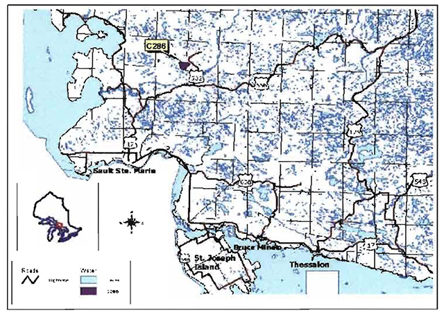
Wabos South Conservation Reserve captures spectacular rolling terrain covered by a dense forest canopy. The site protects mature sugar maple (Acer saccharum Marsh.) and yellow birch (Betula alleghaniensis Britt.) mixed-wood communities, in association with a bedrockdrift complex. Regulated on December 21, 2000, this 580-hectare conservation reserve is situated approximately 35 kilometres northeast of the City of Sault Ste. Marie, in Shields and Gaudette Townships.
Direction for establishing, planning and managing conservation reserves is defined under the Provincial Parks and Conservation Reserves Act (PPCRA) and associated regulations and guidelines. The direction for managing this conservation reserve is in the form of a SCI, which defines the area that is being planned, provides the purpose for which the conservation reserve has been proposed, and outlines the Ministry of Natural Resources and Forestry’s (MNRF) intent for the protected area. This SCI will provide both guidance for the management of the conservation reserve and the basis for ongoing monitoring of activities. More detailed direction at this time is not anticipated. However, should significant facility development be considered or complex issues arise requiring additional studies, more detailed management direction will be prepared with public consultation.
Public and Indigenous consultation occurred prior to the regulation of this conservation reserve during the planning for Ontario’s Living Legacy (OMNR 1999). Furthermore, there was a 15-day review period in November 2002 concerning a draft of this SCI. Comments from the review period have been considered in the development of this document.
This SCI will be implemented by the Sault Ste. Marie District Manager, and will be examined, updated or amended as required.
Submitted by:
Erin Nixon
Date: February 21, 2003
Recommended for approval signed by:
Serge Tenaglia R.P.F.
District Manager
Sault Ste. Marie District
Date: March 4, 2003
Signed and approved by:
Rob Galloway
Regional Director
Northeast Region
Date: May 30, 2003
Administrative update
Recommended for Approval by:
Wayne Fiset
Sault Ste. Marie District Manager
Date: June 27, 2017
Administrative Update Approved by:
Corrinne Nelson
Regional Director, Northeast Region
Date: July 24, 2017
1.0 Introduction
The following document is a Statement of Conservation Interest (SCI) for Wabos South Conservation Reserve (C286). The purpose of this SCI is to identify and describe the natural, recreational and cultural values of Wabos South Conservation Reserve and to outline the Ministry of Natural Resources and Forestry’s (MNRF) management intent for this area. The first portion of this document highlights the provincial context in which it was produced, states its goal and objectives, and summarizes the planning process for conservation reserves. The second portion of this document is specific to Wabos South Conservation Reserve. Management direction provided within this SCI will serve to protect the conservation reserve for the benefit of all Ontario residents. This direction complies with the land use intent stated in the Ontario’s Living Legacy Land Use Strategy (OMNR 1999) and the Provincial Parks and Conservation Reserves Act (PPCRA) (Statutes of Ontario 2006)..
1.1 Provincial context
Ontario’s network of natural heritage areas has been established to protect and conserve areas representative of the diversity of the natural regions of the province, including species, habitats, features and ecological systems which comprise that natural diversity. Protected natural heritage areas are a key component in the sustainable management of natural resources. They ensure that representative sites within the larger managed landscape are permanently retained in their natural state. Wabos South Conservation Reserve is part of Ontario’s network of natural heritage areas.
On July 16, 1999, the Ontario Government released the Ontario’s Living Legacy Land Use Strategy to guide the planning and management of Ontario’s Crown lands. Extensive consultation was conducted during the development of the Land Use Strategy (OMNR 1999). The objectives of the Land Use Strategy were to complete Ontario’s system of parks and protected areas; recognize the land use needs of the resource-based tourism industry; provide forestry, mining and other resource industries with greater certainty around land and resource use; and enhance hunting, angling and other Crown land recreation opportunities.
The Land Use Strategy (OMNR 1999) demonstrated the government’s commitment to completing Ontario’s system of protected natural heritage areas by designating 378 new areas to be protected. These areas are considered to be significant and require protection from incompatible activities in order for their values to endure over time. The addition of these 378 new areas marked the largest expansion of parks and protected areas in Ontario’s history. Wabos South Conservation Reserve was created as part of this expansion. It protects mature sugar maple (Acer saccharum Marsh.) and yellow birch (Betula alleghaniensis Britt.) mixed-wood communities, in association with a bedrock-drift complex.
The MNRF established conservation reserves as a tool to protect natural heritage areas on public lands, while permitting traditional public land uses to continue. These uses include recreational activities, such as hunting and fishing, and the traditional activities of Indigenous societies, as defined under applicable Aboriginal Treaties. Lands regulated as conservation reserves under the PPCRA (Statutes of Ontario 2006) are removed from the Sustainable Forest Licence, and mining and surface rights are withdrawn from staking under the Mining Act (RSO 1990 Chapter M.14).
Ontario’s Living Legacy Land Use Strategy (OMNR 1999) and the PPCRA (Statutes of Ontario 2006) and associated regulations outline the general land use policy and management direction for new conservation reserves; however, each conservation reserve has a planning document, such as this SCI, which details site-specific management direction.
2.0 Goal and objectives of the SCI
2.1 Goal
The goal of this SCI is to provide the framework and direction to guide management decisions affecting Wabos South Conservation Reserve.
2.2 Objectives
The following objectives are identified as the means to achieve the above stated goal.
- To describe the state of the resource with respect to the values identified in Section 5.0 and current land use activities
- To outline the MNRF's management intent for the protected area
- To determine the land use compatibility of current land uses, and to develop specific guidelines and prescriptions to manage these uses
- To create public awareness of the values within this conservation reserve, as mentioned in Section 5.0, by providing information on the resources that it contains and protects; and to promote responsible stewardship of the protected area through partnerships with local stakeholders
- To determine the long-term management goals for the conservation reserve by identifying research, client services, and marketing strategies necessary to position this conservation reserve among the system of parks and protected areas in Ontario
- To identify the scientific values on the site in relation to provincial benchmarks and identify any monitoring and/or research necessary to maintain the integrity of those values
- To provide direction for the evaluation of proposed new uses or economic ventures through the application of the PPCRA (Statues of Ontario 2006), the Protected Area Compatibility Test (Appendix A) and the Class Environmental Assessment for Provincial Parks and Conservation Reserves (OMNR 2005). These review processes will evaluate the impact of proposed use(s), either positive or negative, on the protected values of the conservation reserve.
3.0 Management planning
3.1 Planning for a conservation reserve
The planning process for establishing a new conservation reserve consists of defining site boundaries and preparing site-specific management direction. Public, Indigenous and industry consultations occur during the planning and regulation process. When the boundaries of the site are finalized the MNRF approval process is complete, a conservation reserve becomes regulated. Once a conservation reserve is regulated, the level of management planning required to fulfill the protection targets is determined, and management direction is prepared. When this conservation reserve was regulated, management direction took the form of either a basic or an enhanced SCI or a Resource Management Plan. A basic SCI wass prepared when no new decisions were made beyond those mentioned in the Ontario’s Living Legacy Land Use Strategy (OMNR 1999), whereas an enhanced SCI was prepared when one or more decisions were made beyond those mentioned in the Strategy. A Resource Management Plan is prepared in more complex situations where a number of issues have to be addressed. Whichever the determination, management direction for a new conservation reserve must be completed within five years of the conservation reserve’s regulation date. The guideline used for the preparation of this basic SCI was Procedural Guideline A - Resource Management Planning (Conservation Reserves Procedure PL3.03.05, Public Lands Act), which has since been replaced by Ontario’s Protected Areas Planning Manual (OMNR 2014).
A SCI is essentially a site-specific plan based on the management direction provided in the Land Use Strategy (OMNR 1999). The purpose of a SCI is to identify the state of the resource with respect to the values mentioned in Section 5.0 and current land use activities, and to outline the MNRF's management intent for the conservation reserve. When this SCI was prepared, basic SCIs went through a public review period of 15 days. Upon completion of this public review, the SCI is revised as appropriate and approved by the MNRF's Regional Director.
Existing permitted uses within conservation reserves may continue, unless they are shown to have a significant negative impact on the values protected by the site. Review/evaluation mechanisms are in place to address proposed new permitted uses, or land use proposals. The Protected Area Compatibility Test (Appendix A) and other standard MNRF environmental screening processes, such as Class Environmental Assessment for Provincial Parks and Conservation Reserves (OMNR 2004), are used to screen proposals. With respect to cultural resources, proposals are screened using A Technical Guideline for Cultural Heritage Resources for Projects Planned Under the Class Environmental Assessment for MNR Resource Stewardship and Facility Development Projects and the Class Environmental Assessment for Provincial Parks and Conservation Reserves (OMNR 2006).
Public comment may be solicited during a review of any land use proposals that require new decisions to be made. Appropriate environmental assessment requirements and amendment processes will apply to any future proposal and/or any significant change in management direction being considered for a site.
3.2 Planning Process for the Wabos South Conservation Reserve
Wabos South Conservation Reserve (C286) was proposed as a conservation reserve in the 1999 Ontario’s Living Legacy Land Use Strategy by the Ontario Ministry of Natural Resources. Public, Indigenous and industry consultation has taken place and the boundary of the site has been finalized. The site was formally regulated through an amendment to Ontario Regulation 805/94 of the Public Lands Act on December 21, 2000, by Ontario Regulation 686/00 and subsequently regulated under the PPCRA (Statutes of Ontario 2006) by Ontario Regulation 315/07 on June 9, 2008..
To date, no significant issues related to land use in this area have been identified. For this reason, it was determined that a basic SCI adequately identifies the conservation reserve’s significant features and address the management guidelines. Therefore, the Wabos South Conservation Reserve is managed under the auspices of a SCI. It should be noted that this SCI addresses only those issues or land use proposals currently known to the District Manager. The direction provided by this SCI, and future management decisions, will resolve any future land use conflicts and will ensure that identified values continue to be adequately protected.
3.2.1 Planning area
The planning area for this SCI consists of the regulated boundary for the Wabos South Conservation Reserve (see Section 10, Map 1c). However, to fully protect values within the conservation reserve, additional consideration within larger land use planning initiatives may be required. The forest management planning process is an example of how adjacent land management may consider sensitive features within the conservation reserve boundary.
3.3 Guiding principles
All current or planned activities within this conservation reserve will be in compliance with the following guiding principles. If a conflict between management guidelines exists, the following guiding principles will be used to discern management intent and resolve the issue.
- All management guidelines will be based on maintaining the long-term ecological integrity of the area
- No new or existing uses will be permitted if it is deemed that they compromise the protected values of the site
- All attempts will be made to maintain traditional uses while protecting the values identified in Section 5.0 and maintaining the long-term ecological integrity of the site
- This conservation reserve was chosen to represent vegetation and landscape types unique to this site district and Ontario. All efforts will be made to maintain those values identified in Section 5.0
- Overall, management strategies will focus on maintaining the conservation reserve in as natural a state as possible
4.0 Background information
4.1 Location and site description
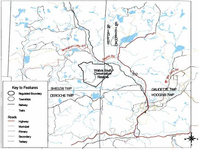
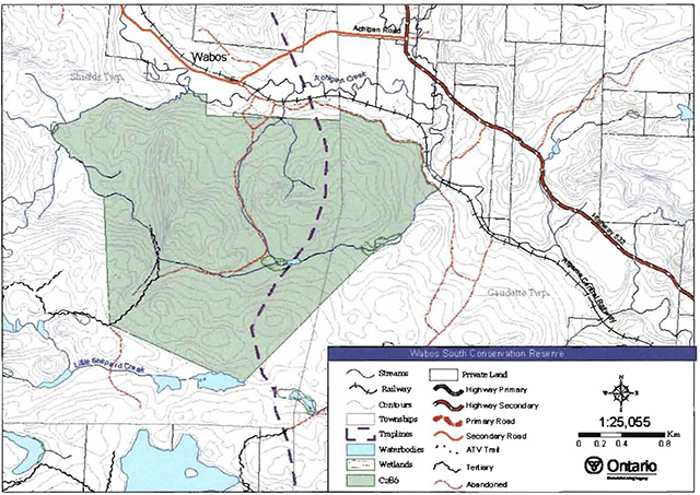
Wabos South Conservation Reserve is located approximately 40 km northeast of the City of Sault Ste. Marie, and approximately 5 km northwest of the community of Searchmont, in Shields and Gaudette Townships (Section 10, Map 1a). Whenever possible, natural and/or artificial features have been used to delineate site boundaries to facilitate easy on-the-ground identification of boundaries. The northeast section of the boundary of the conservation reserve follows an old tertiary road, while the western section follows a tributary of Achigan Creek. The portion of the boundary connecting the tributary and road sections, as well as the southern boundaries of this site are defined by straight lines between two established points (vectors).
An abandoned logging road bisects the conservation reserve from a point midway along the north boundary to the southwest corner. The northern portion of this road is overgrown and extremely difficult to follow (Hall 2002). The Algoma Central Railway tracks run very close to the northeast boundary of the site, and parallel to the old road that forms a section of this boundary. Public access from the north on these old roads is limited due to the existence of private land, and access from the south has not been assessed. It is possible to gain access to the northeast corner of the site via the Algoma Central Railway and walking a short distance from the tracks into the conservation reserve. (See Section 10, Map 1c). From this point, however, access to the interior is limited.
Table 1 describes the location and administrative details of the site.
Table 1. Location and administrative details for the Wabos South Conservation Reserve
| Name | Wabos South Conservation Reserve (C286) |
|---|---|
| Site region - Site district (Hills 1959) | 4E-2 Batchawana |
| Site region - Site district (Crins and Uhlig 2000) | 5E-13 |
| OMNR Administrative Region/ District | Northeast Region/Sault Ste. Marie District |
| UTM co-ordinates | 720500 E 5187500 N |
| SCI completed | January 17 2003 |
| SCI Examination(s) completed |
September 29, 2011 |
| SCI administrative update completed | July 24, 2017 |
| Regulated – Under PLA | December 21 2000 |
| Regulated – Under PPCRA | June 9, 2008 |
| Area | 580 ha |
| Nearest town/municipality | Approximately 40 km northeast of the City of Sault Ste. Marie/ approx. 5 km northwest of Searchmont |
| Township(s) | Shields and Gaudette |
| OBM Numbers | 2016710051800 2016720051800 |
| Topographical Map Name/Number | 41K/16 Searchmont |
| Wildlife Management Unit | 36 |
| Watershed | Lake Superior Basin |
| Forest Unit | Algoma |
4.2 History of the site
The small community of Wabos lends its name to the Wabos South Conservation Reserve. In 1902, 145 families were farming a total of 100 farms in the Wabos area (Vosper 2000). However, farming in this area of Algoma was a difficult endeavor, and many of the families that initially established themselves in Wabos subsequently moved elsewhere (Vosper 2000). Those that remained turned to the forest industry for work to subsidize their farming income. By 1912, extensive lumbering operations were active in the Wabos area (Vosper 2000).
Timber harvested from the area within and surrounding Wabos South Conservation Reserve, was skidded down to the Algoma Central Railway line and shipped by rail to a charcoal plant located in the community of Searchmont and to a lumber mill in the City of Sault Ste. Marie. The Searchmont charcoal plant required 25 acres (10 hectares) of forest to be harvested daily to fuel its operations (Vosper 2000). The charcoal created by these plants was shipped to Algoma Steel Inc. in Sault Ste. Marie for use in the blast furnaces. Thus, it is likely that Wabos South Conservation Reserve, along with the majority of the surrounding area, was cut over in the early 1900s to provide lumber for the charcoal plants (J. Miller, pers. comm.).
Fire also plays a role in shaping the landscape in this region. In 1947, fire claimed more than 1,700 hectares of forest just southwest of the boundaries of the present day conservation reserve (H. Barns, pers. comm.).
4.3 Inventories
Table 2 indicates the status of natural heritage inventories that have occurred for Wabos South Conservation Reserve.
Table 2: Inventory and survey information for the Wabos South Conservation Reserve
| Earth Science | Life Science | Cultural | Recreational | Site inspection |
|---|---|---|---|---|
| 2001 | 2001 | 2001 |
2001 |
2010 |
5.0 State of the resource
Site visits have indicated that Wabos South Conservation Reserve is in excellent condition. An aerial reconnaissance survey, completed in fall 2001 by the Ministry of Natural Resources, found no observable disturbances to the site. Currently, the condition of the surrounding land is also considered to be healthy. There is good connectivity to forest stands beyond the site’s boundaries to the southeast, south, west and northwest (Lajeunesse and Thompson 2002). The results of the examinations completed to date for Wabos South (MNRF 2016, OMNR 2011) confirmed these findings and did not identify any significant areas of concern. To the north and northeast, some ecological fragmentation is evident due to the Algoma Central Railway tracks, access roads, private land development and the small hamlet of Wabos. These features artificially separate Wabos South Conservation Reserve from the conservation reserve of Wabos North, located directly north of this site, and from the naturally established forest communities in the northeast.
The conservation reserve’s extensive artificial boundaries result in many of the landforms and forest communities extending beyond the site’s borders. In addition, the site’s small size and adjoining patent land could make the long-term management and protection of the core values problematic.
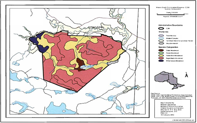
The key values (geological features and/or featured species), found within Wabos South Conservation reserve include the following:
- Extensive sugar maple and yellow birch forest communities that cover approximately 80 percent of the conservation reserve in a dense forest canopy
The key values are those values that make this site unique and have led to its designation as a conservation reserve. Their protection is paramount. Additional values as listed in Section 5.1 through to Section 5.5 are also important. This description is not necessarily complete. If new values are identified, they will be added to this section. If any new value is considered significant, management guidelines may be modified, if required, to ensure its protection.
5.1 Earth sciences
Wabos South Conservation Reserve is located within a scenic area of Ontario. Situated approximately 20 kilometres inland from the Lake Superior coastline, this site falls within the Batchawana Site District 4E-2 (Hills 1959). This site district is known for its rugged topography. The landform features are the result of numerous geological structures such as faults, joints, and diabase dikes that dissect the area (Lajeunesse and Thompson 2002). In this district, the bedrock uplands have a thin layer of sandy soil on the upper slopes and deeper soils in the valleys. Exposed bedrock is common, and dates back billions of years to the Precambrian and Cambrian periods (Lajeunesse and Thompson 2000).
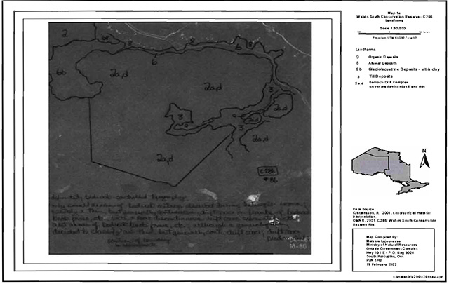
The majority of the conservation reserve is considered by Kristjansson (2001) to be bedrock drift complex. The drift is predominately thin and consists of relatively continuous till, with some alluvial and glaciolacustrine depositions associated with Achigan Creek. Till and organic deposits are present along the eastern and central portions of the site (Section 10, Map 2). There are five major landform features protected within this conservation reserve, including organic deposits, glaciolacustrine deposits of silt and clay, till deposits, bedrock-drift complex, and alluvial deposits (Lajeunesse and Thompson 2002).
5.2 Life sciences
Dense stands of mature forest cover approximately 80 percent of Wabos South Conservation Reserve. Mixed-wood stands dominated by yellow birch, and to a lesser extent sugar maple and white spruce (Picea glauca (Moench) Voss), cover the valley bottoms, while the uplands consist of a wide assortment of tree species (Section 10, Map 3). According to Lajeunesse and Thompson (2002), the bedrock-drift complex found throughout the site supports dense sugar maple and yellow birch mixed-wood communities, which include red maple (Acer rubrum L.), white cedar (Thuja occidentalis L.), white spruce, balsam fir (Abies balsamea (L.) Mill.), poplar (Populus spp.) and white birch (Betula papyrifera Marsh.). Mature sugar maple and yellow birch dominated communities, ranging in age from 100 to 150 years, are located in the southwestern section of the conservation reserve. Throughout the conservation reserve, stands are estimated to have between 70 and 100 percent stocking (Lajenuesse and Thompson 2002). Old-growth stands may exist within the conservation reserve, due to the absence of any natural or human caused disturbance. Uhlig et al. (2001) define old-growth stands of sugar maple and yellow birch as older than 150 years.
A portion of Achigan Creek crosses a short section of the conservation reserve’s north boundary and associated tributaries of Achigan Creek form segments of the boundary. Vegetation, growing along a tributary that forms part of the northwest boundary, consists mainly of alder (Alnus spp.) thickets, mixed with tall shrub fen (Lajeunesse and Thompson 2002). White spruce, yellow birch or sugar maple mixed wood communities dominate the bank vegetation. Located centrally within the conservation reserve, growing on organic and till deposits, is a wetland complex of meadow marsh and short shrub fen associated with lowland white cedar. This wetland area contains sedges (Carex spp.) and shallow pools of water with cattails (Typha spp.), leatherleaf (Chamaedaphne calyculata), and bluejoint grass (Calamagrostis canadensis). Further east, a second meadow marsh borders the site. Evidence suggests that both wetland areas were the result of former beaver activity.
While aquatic information for Achigan Creek is limited, it is known that the creek has a naturalized population of rainbow trout (Oncorhynchus mykiss) and a native population of brook trout (Salvelinus fontinalis) (R. Knudsen, pers. com.). There are no known human-constructed dams on Achigan Creek or its tributaries, upstream of the site.
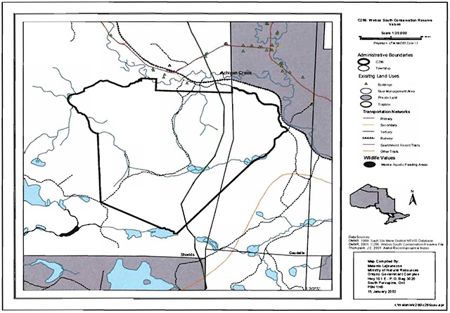
5.3 Recreational values
According to a local resident with private property adjacent to this conservation reserve, hunting is a common recreational activity within the site (Hall 2002). The aesthetic features of Wabos South Conservation Reserve, however, add to the recreational potential of the site. Features such as the feeder streams, wetlands, and extensive forests offer opportunities for photography, bird and wildlife viewing, hiking, snowshoeing, fishing and camping.
Access to the conservation reserve can be gained from the Algoma Central Railway line in the northeast corner where the tracks are in close proximity to the site boundary. An old road enters the conservation reserve midway along its northern boundary; however, the road starts on private land, limiting public access. Overtime the road has grown in and, as a result, is only be accessed by foot.
5.4 Cultural values
The Class Environmental Assessment for Provincial Parks and Conservation Reserves defines cultural heritage resources as any resource or feature of archaeological, historical, cultural or traditional use significance. This may include terrestrial or marine archaeological resources, built heritage or cultural heritage landscapes (OMNR 2006).
The Sault Ste. Marie District MNRF is not aware of any cultural heritage resources within this conservation reserve.
5.5 Research values
The only known research to have taken place within the Wabos South Conservation Reserve was a timber cruise, undertaken by students from the Sault College of Applied Arts and Technology, during the winter of 2001. Three temporary plots were studied in the southeast section of the site. Data collected included: species distribution, heights and diametres of trees, site class, basal area and regeneration. No additional research values have been identified.
6.0 Management guidelines
All management guidelines in this SCI are based on policy and direction outlined in the PPCRA (Statues of Ontario 2006) and associated regulations, as well as the Ontario Living Legacy Land Use Strategy (OMNR, 1999) and associated policy clarification statements. Management policies in this document may be subject to change and may be amended as necessary. These guidelines are specific to Wabos South Conservation Reserve and provide for protection of the site’s unique features.
New proposed uses and development as well as research and education will be reviewed on a case-by-case basis against the PPCRA (Statutes of Ontario 2006) and the Class Environmental Assessment for Provincial Parks and Conservation Reserves (OMNR 2005). In addition, all new proposals are subject to the Protected Area Compatibility Test (Appendix A).
The following management strategies have been created to achieve the goal and objectives of the Wabos South Conservation Reserve SCI.
6.1 Industrial activities
6.1.1 Commercial timber harvest
The area contained within this conservation reserve (580 ha) has been withdrawn from the Algoma Sustainable Forest License area and no commercial timber harvesting will be permitted. Please refer to Section 6.4.3 for information regarding non-commercial wood harvesting.
6.1.2 Mining and exploration
There are no known current mining interests within this conservation reserve. Mining and surface rights within the conservation reserve’s boundaries have been withdrawn from staking under the Mining Act (RSO 1990 Chapter M.14). Mineral exploration and mining are not permitted.
6.1.3 Extraction of peat, soil, aggregate and other material
Extraction of peat, soil, aggregate and other material is not permitted; limited exceptions are outlined in the PPCRA (Statutes of Ontario 2006).
6.1.4 Energy generation
The generation of electricity is not permitted within the conservation reserve; limited exceptions are outlined in the PPCRA (Statutes of Ontario 2006).
6.2 Existing and proposed development
6.2.1 Transportation corridors
6.2.1.1 Roads
According to the Land Use Strategy (OMNR 1999), new roads for resource extraction will not be permitted, except for those identified in Forest Management Plans prior to March 31, 1999. No new or existing roads for resource extractions were identified within this site.
At one point in time, an old road ran from the southwest corner of the conservation reserve through the site to a point midway along the north boundary. The north end of the old road crosses private land prior to entering the conservation reserve. This section of the road is overgrown, difficult to follow and only accessible by foot. The southern section of the old road is completely overgrown. MNRF is not responsible for the maintenance of the old road.
Applications by area users to improve the condition of the old road can be submitted to the Sault Ste. Marie District office. However, they will be subject to appropriate approvals under the PPCRA (Statutes of Ontario 2006) and associated regulations as well as the Class Environmental Assessment for Provincial Parks and Conservation Reserves (OMNR 2005) to ensure the values of the site are not compromised. Should the protected values of the site be compromised, the MNRF may consider appropriate provisions under the PPCRA (Statutes of Ontario 2006) to ensure their protection.
6.2.1.2 Trails
No Voyageur Trail Association or Ontario Federation of Snowmobile Clubs trails have been identified within this conservation reserve. Any future trail development must consider the conservation reserve’s protected values. Trail development in low-lying areas and wetlands will be discouraged. Any proposed new trails will be subject to the requirements outlined in the PPCRA (Statutes of Ontario 2006) and associated regulations, the Class Environmental Assessment for Provincial Parks and Conservation Reserves (OMNR 2005) and the Protected Area Compatibility Test (Appendix A). As a condition to any new trail development, all trail heads and trail routes must be identified using new technologies (i.e. global positioning systems) to ensure the most accurate record of the feature.
6.2.2 Other corridor development/maintenance
No communication, energy transmission, or other non-road corridors are located within this conservation reserve. New corridor developments will be actively discouraged through planning. Proposals for new corridors are subject to the PPCRA (Statutes of Ontario 2006) and associated regulations, the Class Environmental Assessment for Provincial Parks and Conservation Reserves (OMNR 2005) and the Protected Area Compatibility Test (Appendix A) and other applicable district policies.
6.2.3 Land disposition
No land will be sold within the boundaries of this conservation reserve.
6.2.4 Land tenure
No Land Use Permits (LUPs) or leases exist within this conservation reserve.
Except for private non-commercial purposes (e.g. recreation camps), new leases, land use permits and licenses of occupation may be issued for other approved uses, subject to the Provincial Parks and Conservation Reserves Act (Statues of Ontario 2006) and associated regulations, the Class Environmental Assessment for Provincial Parks and Conservation Reserves (OMNR 2005), and the Protected Area Compatibility Test (Appendix A). Renewals of leases or land use permits are permitted. These forms of land tenure will neither be patented nor phased out but may be eligible for enhanced tenure or transfer. Enhanced tenure is defined as anything beyond the term and form of current tenure. All requests for transfer or enhanced tenure will be subject to the following screening criteria:
- Is the transfer or enhanced tenure consistent with the conservation reserve’s land use intent, which is the protection and enhancement of the site’s natural, recreational and cultural values?
- Is it consistent with the land disposition policies outlined in the PPCRA (Statues of Ontario 2006) and associated regulations, this SCI and any other applicable document?
- Does it adversely affect the values as identified in Section 5.0, and/or conflict with other uses?
- Is land needed by the Crown to protect significant natural or recreational values outlined in this SCI?
- Does the transfer or enhanced tenure clash with Indigenous traditional uses, land claims or agreements?
- Are all rents, taxes, fees, rates or charges paid up for the existing LUP or lease?
6.3 Commercial activities
6.3.1 Commercial bait harvesting
At the time this conservation reserve was established, no active baitfish harvest operations or licences existed within the site. However, Shields and Gaudette Townships were set aside for Indigenous commercial bait harvest. For information on the current status of commercial bait harvesting within the conservation reserve, please contact the Sault Ste. Marie District MNRF Office.
New operations can be considered within the conservation reserve subject to the Protected Area Compatibility Test (Appendix A) and applicable district policies and screening processes.
In conjunction with PL 3.03.08 "Buildings for Bait Harvesting Management", cabins for the purposes of bait harvesting may be constructed on Crown land. However, the approval of such buildings within this conservation reserve should be avoided, and Crown land outside of the protected area used wherever possible. Should a bait cabin be proposed within the conservation reserve, it will be subject to all applicable screening processes.
6.3.2 Commercial fishing
There are no commercial fisheries within this conservation reserve.
6.3.3 Commercial fur trapping
At the time this conservation reserve was established, portions of Registered Trapline Areas SS22 and SS29 fell within the boundary of the site. These registered trapline areas were allocated to head trappers and considered existing operations. For information on the current status of registered trapline areas within this conservation reserve please contact the Sault Ste. Marie District MNRF Office.
Existing use is permitted to continue unless there are significant demonstrated conflicts. If a head trapper surrenders a registered trapline, or the head trapper’s privileges are revoked, the registered trapline may be transferred to another trapper following established allocation procedures. If the registered trapline is not transferred in due course, or remains unallocated for a significant period of time, reallocation of the trapline may occur following applicable district screening processes.
The establishment of new trapline trails will be considered following the procedure and criteria outlined for trails in Section 6.2.1.2. No trap cabins currently exist within the conservation reserve. The establishment of new trap cabins will not be permitted within the conservation reserve.
6.3.4 Bear management areas
At the time this conservation reserve was established it was located in Bear Management Area (BMA) SS-36-003. For information on the current status of the BMAs within this conservation reserve please contact the Sault Ste. Marie District MNRF Office.
Guided hunting activities associated with a BMA may continue within this conservation reserve. Transfer of the BMA within this conservation reserve may be permitted in cases where the current operator sells his/her bear hunting business to another operator and the BMA transfer is approved. If an operator surrenders the BMA or the BMA is revoked, reallocation of the BMA may occur following applicable district screening processes. New operations are not permitted.
6.3.5 Commercial food collection
There are no existing commercial food harvesting activities within this conservation reserve. New proposals will be subject to the PPCRA (Statues of Ontario 2006) and associated regulations, the Class Environmental Assessment for Provincial Parks and Conservation Reserves (OMNR 2005) and the Protected Area Compatibility Test (Appendix A), as well as the appropriate MNRF policies and procedures.
6.3.6 Commercial non-timber forest products
There are no existing commercial non-timber forest product activities within this conservation reserve. New proposals will be reviewed on a case-by-case basis, subject to the PPCRA (Ontario Statutes 2006) and associated regulations, as well as the Class Environmental Assessment for Provincial Parks and Conservation Reserves (OMNR 2005), Protected Area Compatibility Test (Appendix A) and applicable district policies.
6.3.7 Outpost camps/ main base lodges
There are no existing authorized outpost camps or main base lodges within this conservation reserve. New outpost camps and main base lodges may be considered through planning and will be subject to the PPCRA (Statues of Ontario 2006) and associated regulations, as well as the Class Environmental Assessment for Provincial Parks and Conservation Reserves (OMNR 2005), Protected Area Compatibility Test (Appendix A) and applicable district policies.
6.4 Non-commercial activities
6.4.1 Nature appreciation/recreation activities
Off-trail hiking, mountain biking, cross-country skiing, and other activities will be permitted within this conservation reserve. However, should the impact of these activities degrade the landscape of the conservation reserve, the MNRF will re-evaluate these permitted uses and determine a new strategy for this site. New trails to support these activities may be considered; see Section 6.2.1.2 For more details related to trail development.
Resident and non-resident camping within this conservation reserve is governed by Ontario Regulation 319/07, issued under the PPCRA (Statutes of Ontario 2006). While camping is permitted within the conservation reserve, subject to the requirements outlined in Ontario Regulation 319/07, campers should avoid sensitive areas such as wetlands.
6.4.2 Natural heritage appreciation facilities/recreational structures
Within this conservation reserve, there are no existing authorized natural heritage appreciation facilities or recreational structures such as boardwalks, bird viewing platforms, kiosks, ski shelters, or interpretative signs. New natural heritage appreciation facilities and recreation structures are permitted, subject to the requirements of the PPCRA (Statutes of Ontario 2006) and associated regulations, as well as the Class Environmental Assessment for Provincial Parks and Conservation Reserves and the Protected Area Compatibility Test (Appendix A).
6.4.3 Non-commercial consumptive resource use
Cutting of trees for non-commercial purposes within this conservation reserve may be authorized by permit issued by the local Ministry of Natural Resources' Office, subject to a review and determination of the impact that such cutting would have on the values identified in Section 5.0. This flexibility is intended only for leaseholders, Land Use Permit holders, cottagers and other property owners within the conservation reserve who do not have road access to their property and have no alternative wood source outside of the conservation reserve area. This permit is intended to cover fuelwood, dock stringers, and other occasional small scale uses.
It should be noted that the mature sugar maple and yellow birch mixed-wood communities found in the southwest section of this conservation reserve have been identified as significant features and harvesting in this area is prohibited.
In accordance with Ontario Regulation 319/07 issued under the PPCRA (Statutes of Ontario 2006), non-commercial harvesting of edible plants and fruit for personal consumption can continue to occur as long as the values of the site (Section 5.0) are not jeopardized and this activity is not contrary to law.
6.4.4 Hunting and fishing
Hunting is a traditional use and has been identified as an important value of this area. In conjunction with current hunting regulations and adherence to the guiding principles (Section 3.3) of this conservation reserve, hunting is permitted to continue.
Recreational fishing is also permitted to continue within this conservation reserve in compliance with current fishing regulations.
6.4.5 ATV and snowmobile use
No authorized snowmobile trails have been identified within this conservation reserve. Please refer to Section 6.2.1.2 for more information on trails. In general, off-trail use of ATVs and snowmobiles is not permitted within this conservation reserve. However, off-trail use is accepted for licenced trappers to access their traplines and for licenced bait harvest operators while conducting harvest operations; however, cutting of trees is prohibited without written authorization from the District Manager. Off-trail ATV and snowmobiling is also accepted for the direct retrieval of big game by hunters. In all cases, off-trail use is only permitted provided the protection of the site’s values, as per Section 5.0, is not compromised. Should the impact of off-trail ATV and snowmobile use degrade the landscape of the conservation reserve, the MNRF will re-evaluate these permitted uses and determine a new strategy.
6.5 Resource management activities
Resource management activities are tools used to protect and enhance the values of this conservation reserve. Some management activities may require the use of intrusive techniques. Some of these techniques, under normal circumstances, would not be permitted to occur in the conservation reserve; however, if they are found to be necessary, they may be applied under controlled conditions, to achieve a desired result, subject to the PPCRA (Statutes of Ontario 2006) and associated regulations, as well as the Class EA for Provincial Parks and Conservation Reserves (OMNR 2005). Infrastructure such as roads, trails and buildings may need to be constructed to perform activities such as prescribed burns, forest regeneration, wildfire control, and insect and disease control. Activities described in this section will be considered and assessed via the appropriate screening mechanisms to determine if the ultimate outcome is in compliance with the guiding principles of this SCI.
6.5.1 Fish stocking
No water bodies within this conservation reserve have been stocked, or are currently being considered for stocking.
6.5.2 Insect and disease control
In accordance with the guiding principles, this conservation reserve will be maintained in as natural a state as possible. Insect and disease control measures should only be considered if the identified values are significantly threatened. These measures will be subject to all applicable assessment processes.
6.5.3 Fire management
Fire protection will be carried out in accordance with the Wildland Fire Management Strategy (2014), which provides direction for how the MNRF manages wildland fire across Ontario. Fire response will ensure the protection of human life and property to minimize potential social and economic impacts. Where possible, light on the land fire management techniques will be utilized to minimize damage to the site; for example, activities such as heavy equipment use, trenching, camp construction, and tree cutting will be limited.
Prescribed burning may be considered if fire has not occurred for a sustained period of time and it is determined that the features of this site would benefit from controlled burning (e.g. to promote regeneration). Any future prescribed burns will follow approved MNRF policy and be consistent with the Class EA for Provincial Parks and Conservation Reserves (OMNR 2005).
6.5.4 Management for key values
Management that maintains or improves the conditions of the site’s key values is permitted on a case-by-case basis and is subject to the PPCRA (Statutes of Ontario 2006) and associated regulations, as well as the Class EA for Provincial Parks and Conservation Reserves (OMNR 2005) and the Protected Area Compatibility Test (Appendix A). Please refer to Section 5.0 for a list of the site’s key values. Management may also include habitat or ecosystem management.
6.5.5 Forest renewal
The preferred regeneration option after any natural disturbance is natural regeneration. In some cases, regeneration may be artificially assisted when it is deemed appropriate to mitigate against human disturbances (e.g. illegal occupation and trespass).
6.6 Research
Scientific research is encouraged, by qualified individuals or institutions, that contributes to a better understanding of the natural and cultural values protected by this conservation reserve or that advances the protection, planning and management of these values. The Sault Ste. Marie District Planner should be contacted for information on research and/or monitoring opportunities within this conservation reserve. Written authorization of the conservation reserve manager is required to conduct research in a conservation reserve as per O’Reg. 319/07.
Existing Forest Resource Inventory surveys and approved resource monitoring activities are permitted to continue.
Due to the presence of mature sugar maple communities, the Wabos South Conservation Reserve may have potential as a research and monitoring site.
Development, research and education proposals pertaining to this conservation reserve may be considered subject to the PPCRA (Statues of Ontario 2006) and associated regulations, the Class Environmental Assessment for Provincial Parks and Conservation Reserves (OMNR 2005) and the Protected Area Compatibility Test (Appendix A), as well as applicable protected areas research policy and procedure.
6.7 Marketing
No active marketing of this conservation reserve is anticipated.
6.8 Aboriginal and Treaty Rights
This site falls within the Robinson-Huron treaty area.
Nothing in this SCI shall be construed so as to abrogate or derogate from the protection provided for the existing Aboriginal and treaty rights of the Aboriginal peoples of Canada as recognized and affirmed in section 35 of the Constitution Act, 1982. 2006, c. 12, s. 4.
7.0 Recommendations
7.1 Additions to the reserve
Many of the significant landforms and forest communities present within Wabos South Conservation Reserve extend beyond the site’s boundaries onto surrounding Crown and private land. Additional protection of the site’s forest communities may result from their consideration within a broader planning process. This may also be accomplished by the addition of adjacent Crown lands into the conservation reserve, although no specific areas have been identified to date.
7.2 Future needs and considerations
The following recommendations should be considered in any future planning initiatives for this conservation reserve:
- Efforts should be made to work with partners (such as the Ontario Forest Research Institute and Sault College of Applied Arts and Technology) to gather baseline data on this site. This data will be used for future monitoring and inspection activities when required. Baseline data should include, but not be limited to:
- A field assessment to determine the level of site disturbance beneath the forest canopy
- Boundaries of the conservation reserve should be clearly marked as well as identified using Global Positioning System technology, specifically along the vectored boundaries and the old road which forms the northeast boundary, to ensure core values are protected. It is also recommended that adjacent private properties be identified to prevent incursions
- The values of the site should be considered in land use management activities on Crown lands adjacent to the site to ensure sufficient protection of the site’s core values.
- Recognizing that community and species diversity in wetlands is maintained by fluctuating water levels, efforts should be made to ensure natural water level fluctuations continue undisturbed within this site
- It is recommended that the conservation reserve be considered as a potential research and/or monitoring site, by the MNRF or its partners. This is due to the presence of a mature sugar maple and yellow birch mixed-wood community
- A detailed life science inventory should be completed to evaluate the overall significance of the site within the district, region and province. This information will assist with placement of the conservation reserve within the provincial parks and protected areas system
- If there are further inventory, monitoring, assessment, research, or inspection requirements for this site, efforts will be made to complete these needs
7.3 Monitoring
Periodic monitoring of human activities within this conservation reserve will be conducted on an as needed basis and as resources permit. The District Manager will oversee these activities.
If at any time human activities are deemed to be negatively impacting the protected features, the activities will be reviewed and measures taken to mitigate any disturbance.
Approved inventory, monitoring, assessment or research activities that are compatible with protection objectives are encouraged. Any area that is disturbed during research activities is to be rehabilitated as closely as possible to its original condition. The District Manager may apply additional conditions.
8.0 Implementation, review and revisions
8.1 Responsibility
The Sault Ste. Marie District will be responsible for implementing the management policies and guidelines for Wabos South Conservation Reserve (C286). The primary role will be to provide public information and compliance monitoring to ensure adherence to current policies and guidelines.
8.2 Review and revisions
The Wabos South Conservation Reserve SCI will be examined, as per the schedule outlined in the PPCRA (Statues of Ontario), to determine if the management direction is relevant, effective, and current, as well as to identify what information may require updating or amending to ensure adequate protection the site’s values.
Revisions to this document will be subject to the requirements as specified in the Protected Areas Planning Manual (OMNR 2014) and associated guidelines. If changes in management direction are needed at any time, the significance of the changes will be evaluated. Administrative updates to the SCI may be considered and approved by the Sault Ste. Marie District Manager and Regional Director without further consultation. In assessing amendments, public and Indigenous consultation will occur. All updates and amendments will follow the process outlined in the Protected Areas Planning Manual (OMNR 2014)
9.0 Literature cited
Hall, M. 2002. Wabos South Conservation Reserve Site Visit Report. Ministry of Natural Resources. Sault Ste. Marie District. Unpublished information.
Hills, G.A. 1959. A Ready Reference for the Description of the Land of Ontario and its Productivity. Preliminary Report. Ontario Department of Lands and Forests. Maple. Ontario.
Kristjansson, R. 2001. (Draft) Earth Science Checksheet, and aerial landform/surficial deposit photo interpretation for Wabos North Conservation Reserve. Unpublished Information.
Lajeunesse, M. and J.E. Thompson. 2002. Wabos South Conservation Reserve, Natural Heritage Area - Life Science Checksheet. Unpublished information. OMNR.
Nathwani, N. 2001. Recreation Inventory Checklist for Wabos South Conservation Reserve. Unpublished information. Ontario Ministry of Natural Resources. Sault Ste. Marie District.
Ontario Ministry of Natural Resources (OMNR). 1999. Ontario’s Living Legacy Land Use Strategy. Queen’s Printer for Ontario. Ontario.
OMNR, 2005. A Class Environmental Assessment for Provincial Parks and Conservation Reserves. Queen’s Printer for Ontario. Ontario. 120pp.
OMNR. 2006. A Technical Guideline for Cultural Heritage Resources for Projects Planned Under the Class Environmental Assessment for MNR Resource Stewardship and Facility Development Projects and the Class Environmental Assessment for Provincial Parks and Conservation Reserves. 45pp.
OMNR, 2014. Ontario’s Protected Areas Planning Manual. Queen’s Printer for Ontario. Peterborough, Ontario. 33pp.
OMNR, 2016. Protected Areas Examination Report – Wabos North Conservation Reserve (C284). Unpublished information.
OMNRF, 2014. Wildland Fire Management Strategy. Queen’s Printer for Ontario. Ontario. 28pp.
Statutes of Ontario, 2006. Provincial Parks and Conservation Reserves Act. S.O. 2006, Chapter 12
Uhlig, P., A. Harris, G. Craig, C. Bowling, B. Chambers, B. Naylor and G. Beemer. 2001. Old growth forest definitions for Ontario. Ontario Ministry of Natural Resources Report.
Vosper, R. 2000. Forest Tracks: Mile by Mile. Produced in partnership by The Algoma Forest Coalition, the Algoma Central Railway, the Ontario Ministry of Natural Resources, and the Canadian Forest Service.
10.0 Maps
Map 1a: Location of the Wabos South Conservation Reserve (C286)
Enlarge map 1a: Location of the Wabos South Conservation Reserve (C286) (PDF, 455KB)
Map 1b: Location of Wabos South Conservation Reserve (C286)
Enlarge map 1b: Location of Wabos South Conservation Reserve (C286)
Map 1c: Location of Wabos South Conservation Reserve (C286)
Enlarge map 1c: Location of Wabos South Conservation Reserve (C286) (PDF, 455KB)
Map 2: Aerial photograph showing Landforms in Wabos South Conservation Reserve (C286)
Map 3: Wabos South Conservation Reserve (C286): Species Composition Map
Enlarge map 3: Wabos South Conservation Reserve (C286): Species Composition Map (PDF, 416KB)
Map 4: Wabos South Conservation Reserve (C286): Recreational Values map
Enlarge map 4: Wabos South Conservation Reserve (C286): Recreational Values map (PDF, 385KB)
11.0 Photos
Photo 1: View of wetland area in Wabos South Conservation Reserve.
(Photo taken by N. Nathwani during aerial reconnaissance
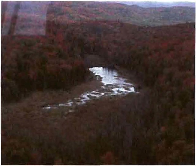
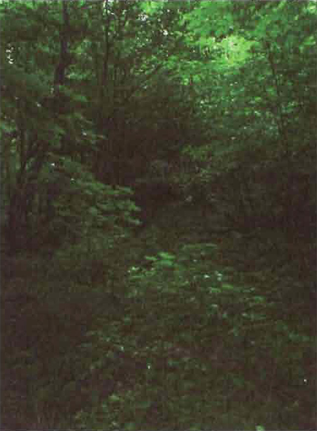
Photo 2: View of wetland area in Wabos South Conservation Reserve.
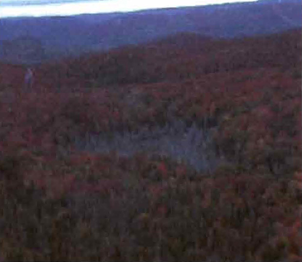
Photo 3: View of wetland area in Wabos South Conservation Reserve.
(Photo taken by N. Nathwani during aerial reconnaissance survey, OMNR; 26 Sep 2001)
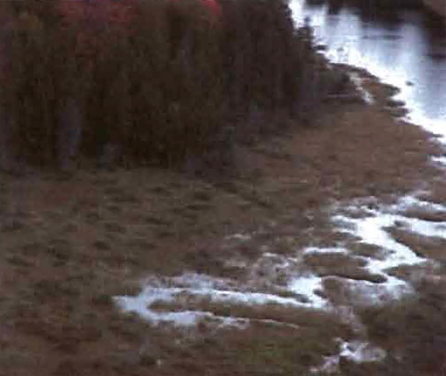
Photo 4: Northern portion of the overgrown abandoned road in Wabos South Conservation Reserve.
(Photo taken by M. Hall, OMNR; 21 Aug 2002)
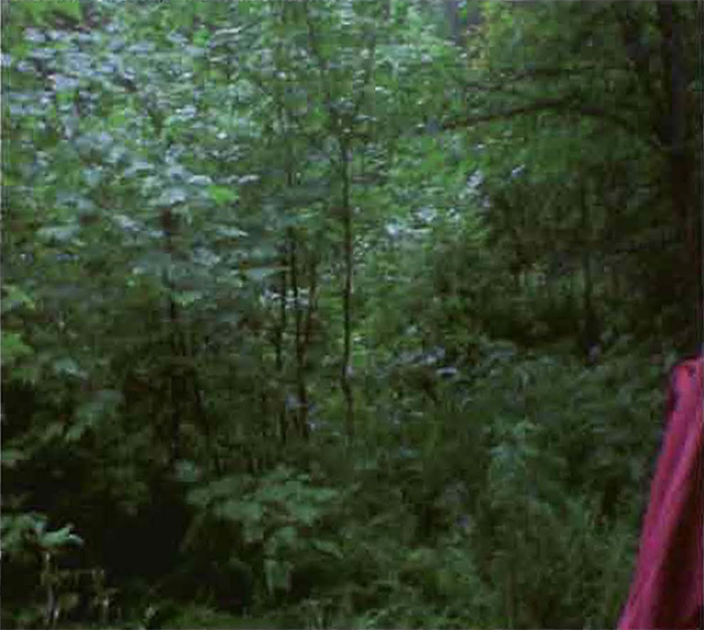
Photo 5: Section of a timber cruse line in Wabos South Conservation Reserve.
(Photo taken by M. Croft, Sault College; 02 Aug 2001)
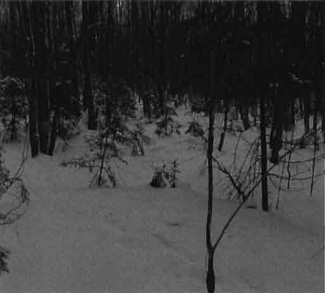
Photo 6: Section of a timber cruse line in Wabos South Conservation Reserve.
(Photo taken by M. Croft, Sault College; 02 Aug 2001)
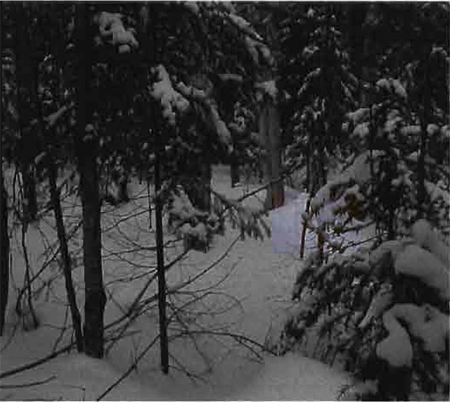
Photo 7: Section of a timber cruse line in Wabos South Conservation Reserve.
(Photo taken by M. Croft, Sault College; 02 Aug 2001)
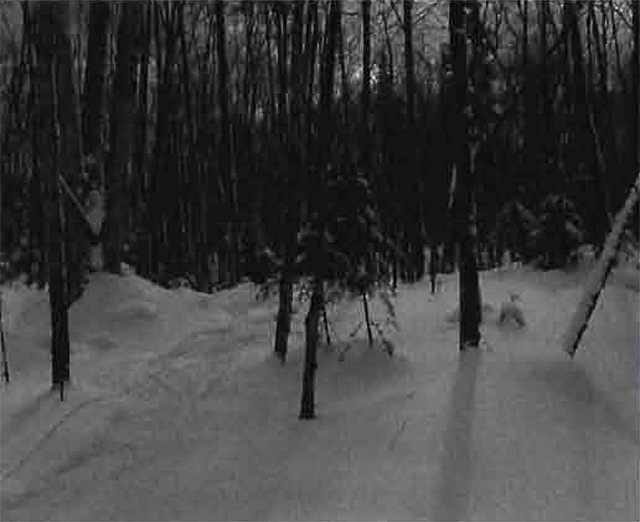
Photo 8: Northern portion of the abandoned road in Wabos South Conservation Reserve.
(Photo taken by M. Hall, OMNR; 21 Aug 2002)
Appendix A: Protected Area of Compatibility Test
-
Procedural Guideline B - Land Uses - Test of Compatibility
Conformity to SCI/RMP- SCI describes values for which an area has been set aside and the range of appropriate uses that will be permitted in the area. SCI may also speak to the acceptability of other 'new' uses currently not occurring in the area. - The first 'test' is: "do proposed new land uses and/or commercial activities conform to the direction of the SCI/RMP for the conservation reserve? Would the new use(s) depart from the spirit of appropriate indicator land uses in the SCI/RMP?" Impact Assessment: If the proposed use(s) pass test one it is important to determine their impact on the area before they are approved. This should include the following:
- impact on natural heritage values: "will the new use(s) impact any natural values in
- the area? If so how and to what degree? Is it tolerable?"
- impact on cultural values: "will the new use(s) impact any historical or archaeological values in the area?"
- impact on research activities: "will the new use(s) affect any research activities in the area?"
- impact on current uses: "will the new use(s) have any negative impact on the array of current uses?"
- impact on area administration: "will the new use(s) increase administrative costs and/or complexity?" (For example, the cost of area monitoring, security and enforcement).
- impact of accommodating the use outside the conservation reserve: "Could the use(s) be accommodated as well or better outside the conservation reserve?"
- impact on socio-economics of the area: "will the new use(s) affect the community(ies) surrounding the area in a positive or negative way?" (For example, will the new use make the area less remote thereby affecting a local tourism industry that is dependent on the area’s remoteness for its appeal)?
- impact on area accessibility: "does the new use(s) give someone exclusive rights to the area or a portion of the area to the exclusion of other existing uses?"
Appendix B: Summary of Permitted Uses
Policy Report (revised May 10, 2002)
New ID: C286/SM2
District: Sault Ste. Marie
Region: Northeast
Identification:
ID: C286
Area name: Wabos South
Area (ha): 580
Land Use: Conservation Reserve (Ontario 's Living Legacy)
Category:
Description:
Red maple, sugar maple and yellow birch dominate the steep hills and pockets of flat lacustrine deposits of this landscape in Site District 4E-2.
Waboa South was regulated as a conservation reserve on December 21, 2000.
Land use intent:
Management of this area is also governed by the general policies contained in the Land Use Strategy (1999).
Management direction:
Those uses and management activities not listed in the following table are governed by existing Conservation Reserve policy. Over time the management direction will be elaborated in a Statement of Conservation Interest or Resource Management Plan. Any new uses, and commercial activities associated with Conservation Reserves, will be considered on a case by case basis, and they must pass a test of compatibility to be acceptable. Compatibility is normally determined through a planning process.
Commercial activities
| Activity | Permitted | Guidelines |
|---|---|---|
| Aggregate extraction | No | |
| Bait fishing - Existing: | Yes | Existing use permitted to continue, unless there are significant demonstrated conflicts. |
| Bait fishing - New: | Maybe | New operations can be considered, subject to the "test of compatibility". |
| Commercial fishing - Existing: | Yes | Existing use permitted to continue, unless there are significant demonstrated conflicts. |
| Commercial fishing - New: | Maybe | New operations can be considered, subject to the "test of compatibility". |
| Commercial fur harvesting - Existing: | Yes | Existing use permitted to continue, unless there are significant demonstrated conflicts. Existing trap cabins can continue; new cabins are not permitted. |
| Commercial fur harvesting - New: | Maybe | New operations can be considered, subject to the "test of compatibility". |
| Commercial hydro development | No | |
| Commercial timber harvest | No | |
| Commercial tourism - Existing: | Yes | Existing authorized facilities can continue, unless there are significant demonstrated conflicts. |
| Commercial tourism - New: | Maybe | New tourism facilities can be considered during the planning for an individual reserve. |
| Bear hunting by non-residents (guided) - Existing: | Yes | Existing authorized operations permitted to continue. |
| Bear hunting by non-residents (guided) - New: | No | New operations not permitted. |
| Outfitting services - Existing: | Yes | Existing authorized operations permitted to continue. |
| Outfitting services - New: | Maybe | New operations can be considered during the planning for an individual reserve. |
| Outpost camps - Existing: | Yes | Existing authorized operations permitted to continue. |
| Outpost camps - New: | Maybe | New operations can be considered during the planning for an individual reserve. |
| Resorts/lodges - Existing: | Yes | Existing authorized facilities permitted to continue. |
| Resorts/lodges - New: | Maybe | New facilities can be considered during the planning for an individual reserve. |
| Energy transmission and communications corridors - Existing: | Yes | These facilities should avoid conservation reserve lands wherever possible. |
| Energy transmission and communications corridors - New: | No | |
| Food harvesting (commercial) - Existing: | Maybe | |
| Food harvesting (commercial) - New: | Maybe | |
Mineral exploration and development: |
Maybe | Mineral exploration may occur under controlled conditions in portions of new conservation reserves that an: identified through further analysis and consultation as having provincially-significant mineral potential. If a site is to be developed for a mine, it would be deregulated as part of the reserve, and a replacement area added to the reserve. |
| Peat extraction: | No | |
| Wild rice harvesting - Existing: | Yes | |
| Wild rice harvesting - New: | Maybe |
Land and resource management activities
| Activity | Permitted | Guidelines |
|---|---|---|
| Crown land disposition - Private use: | Maybe | Sale of lands is not permitted, except for minor dispositions in support existing use (e.g. reconstruction of a septic system). Renewals of existing leases and land use permitted are permitted. Requests for transfer of tenure will be considered in the context of the Statement of Conservation Interest or Resource Management Plan. |
| Crown land disposition - Commercial use: | Maybe | New leases or land use permits permitted for approved activities. Tourism facilities can apply to upgrade tenure from LUP to lease. |
| Fire suppression | Yes | Fire suppression policies are similar to adjacent Crown lands, unless alternative fire policies have been developed through a planning process. |
| Fish habitat management | Maybe | |
| Fish stocking | Maybe | Conservation Reserves policy indicates that "featured species management" may be permitted. |
| Insect/disease suppression: | Maybe | |
| Inventory/monitoring: | Yes | |
| Personal use permits for wood harvesting: | Maybe | Existing permits may continue on an interim basis for properties that do not have road access. The long term status will be determined through management planning. |
| Prescribed burning: | Maybe | |
| Roads (resource access) - Existing: | Yes | Existing roads con continue to be used. Continued use will include maintenance and may include future upgrading. |
| Roads (resource access) - New: | Maybe | New roads for resource extraction will not be permitted, with the exception of necessary access to existing forest reserve for mineral exploration and development, or where part of a conservation reserve has been formally identified as having provincially significant mineral potential that is open for controlled exploration. |
| Vegetation management: | Maybe | Conservation Reserves policy indicates that Featured Species Management and Natural Systems Management may be permitted. Vegetation management can be considered in a planning process. |
| Wildlife population management | Maybe |
Science, education and heritage appreciation
| Activity | Permitted | Guidelines |
|---|---|---|
| Collecting: | No | |
| Historical appreciation: | Yes | |
| Nature appreciation: | Yes | |
| Photography and painting: | Yes | |
| Research: | Yes | |
| Wildlife viewing: | Yes |
Recreation activities and facilities
| Activity | Permitted | Guidelines |
|---|---|---|
| All-terrain vehicle use - On trails: | Yes | Existing use permitted to continue where it does not adversely affect the values being protected. ATV use off trails is not permitted except for direct retrieval of game. |
| All-terrain vehicle use - Off trails: | No | |
| Campgrounds: | Maybe | |
| Food gathering: | Yes | |
| Horseback riding (trail) | Yes | Existing use on trails permitted. |
| Hunting: | Yes | |
| Mountain bike use: | Yes | Existing use on trails permitted. |
| Motor boat use - Commercial: | Yes | |
| Motor boat use - Private: | Yes | |
| Non-motorized recreation travel: | Yes | |
| Private recreation camps (hum camps) - Existing: | Yes | Existing camps permitted to continue, and may be eligible for enhanced tenure, but not purchase of land. |
| Private recreation camps (hum camps) - New: | No | |
| Rock climbing: | Maybe | |
| Snowmobiling - On trails: | Yes | Existing use permitted to continue where it does not adversely affect the values being protected. |
| Snowmobiling - Off trails: | Maybe | Snowmobiling off trails is not permitted, except that snowmobiles may be used for direct retrieval of game. |
| Sport Fishing: | Yes | |
| Trail development - New: | Maybe | Development of trails for a variety of activities (e.g. hiking, cross-country skiing, cycling, horseback riding, snowmobiling) can be considered as part of planning for an individual reserve. |
Note: The policies outlined in this table do not supersede any Aboriginal or treaty rights that may exist, or other legal obligations.
Appendix C: Public consultation handouts
64 Church Street
Sault Ste. Marie, ON P6A3H3
Telephone: (705) 949-1231 x 210
Facsimile: (705) 949-6450
E-mail:
November 10, 1999
To: Ontario Living Legacy Stakeholders
Dear Sir/Madam:
On July 16, 1999, the Ontario Government released Ontario Living Legacy Strategy, a broad land use strategy for the planning and management of much of me Crown lands in central and parts of northern Ontario. A major part of Ontario’s Ontario Living Legacy Strategy was a government commitment to the biggest expansion of provincial parks and conservation reserves in Ontario’s history. Ontario intends to add 378 new areas to its protected area’s system. Ontario Living Legacy is a momentous achievement that will be recognized around the world as a significant contribution to sustaining our natural environment. A copy of the Land Use Strategy is available from our office upon request.
In accordance with the recommendations in Ontario’s Living Legacy Land Use Strategy, the Ministry of Natural Resources is now beginning the process of establishing the first set of 64 protected areas from the Land Use Strategy.
The first step in this process is consultation on the boundaries of these 64 areas. The remaining 314 proposed protected areas will be consulted upon in the future.
As stated in the Land Use Strategy, the boundary refinement process will consider local ecological information and will attempt to locate regulated boundaries along features that can be identified on the ground. This boundary refinement process may result in modest increases or decreases in the sizes of the areas. Any existing commitments for the areas which were considered during the land use planning process, will be considered in defining the final boundary.
This list of 64 areas includes the proposed Wabos North and Wabos South Conservation Reserves.
The Land Use Strategy established the Ministry’s intent to add these Crown lands to Ontario’s protected area' system. Following the extensive public consultation associated with Ontario’s Living Legacy and the Lands for Life land use planning initiatives between 1997 and 1999. Prior to the finalization of me boundary of these conservation reserves proposed for regulation under the Public Lands Act, the Ministry is inviting public comment on the proposed boundaries.
Your name and address have been included within a Ministry mailing list to advise potentially Interested persons about these new conservation reserves. This mailing list includes a broad group such as nearby landowners, resource users, persons with other rights or tenure (e.g. land use permit, Mining Act rights), municipalities and others who may have an interest in these areas.
Information describing these proposed areas is attached. More detailed mapping and information about the proposed boundaries are available from this office.
In the future and subject to the intended regulation of these areas as conservation reserves, the Ministry of Natural Resources will undertake a management planning process to determine the long-term management of these protected areas. Depending upon the complexity of issues related to conservation reserves, management planning may rake the form of a simple Statement of Conservation Interest or a more detailed Resource Management Plan. Please let us know if you would like to be notified when planning begins.
Planning, management and permitted uses within these conservation reserves would be consistent with the commitment of Ontario’s Living Legacy Strategy.
The Ministry is collecting comments and information regarding these proposed conservation reserve boundary reviews under the authority of the Public Lands Act to assist in making decision determining further public consultation needs. Comments and opinions will be kept on file and may be included in study documentation that is made available for public review. Under the Freedom of Information and Privacy Act (1987), personal information will remain confidential unless prior consent is obtained. However, the Ministry may use this information as public input on other resource management surveys or projects. For further information regarding this Act, please contact Wayne Fiset, Information Management Supervisor, Ministry of Natural Resources, Sault Ste, Marie District (705-949-1231 ext. 288).
If you would like to discuss the proposed boundaries and the protection of these areas under the Public Lands Act, please contact Erin Nixon, Community Planner, Ministry of Natural Resources, 64 Church St., Sault Ste. Marie, P6A 3H3, tel: 705-949-1231, fax: 705-949-6450, by December 15, 1999. Further information on Ontario’s Living Legacy is available in our office or by visiting the Ministry’s Internet website at www.ontario.ca/page/ministry-natural-resources-and-forestry
Thank you for your interest.
Yours sincerely,
Signed by:
Serge Tenaglia
District Manager
Wabos South Conservation Reserve (C286) Fact Sheet
January, 2001
Background
On July 16, 1999, the Ontario Government released Ontario’s Living Legacy Land Use Strategy to guide the planning and management of Crown lands in central and parts of northern Ontario. A major part of Ontario’s Living Legacy Land Use Strategy (OMNR 1999) was a government intent to establish 378 new protected areas. This commitment marks the biggest expansion of provincial parks and conservation reserves in Ontario’s history.
The Wabos South Conservation Reserve is part of this significant expansion of Ontario’s protected areas system. Following public and Aboriginal consultation in late 1999 and early 2000 on refining the boundary of this protected area, Ontario Regulation 805/94 of the Public Lands Act was amended on January 6, 2001, by Ontario Regulation 686/00, to formally establish this conservation reserve.
Size and location
The Wabos South Conservation Reserve is comprised of 580 ha of tolerant hardwood forests in an area approximately 40-km northeast of the city of Sault Ste. Marie. Located in the townships of Shields and Gaudette, the reserve is west of Highway 532, east of Leaf Lake, and south of Wabos.
Area highlights
The Wabos South Conservation Reserve is located in a scenic area of Ontario along the Lake Superior coastline between Agawa Bay and Gros Cap that is known by resource managers as "ecological site district 4E-2". Extending inland for approximately 60-90 km, this ecological unit has a rugged topography and elevations exceeding 450 metres. The topography is the result of numerous geological structures such as faults, joints, and diabase dikes that disect the area. The bedrock uplands have a thin layer of sandy soil on the upper slopes and thicker soils in the valleys. Exposed bedrock is common, and dates back billions of years to the Precambrian and Cambrian periods. Pockets of "lacustrine deposits", soils that were formed long ago in a lake, are also found in the area.
Located within the Algoma Forest Section of the Great Lakes-St. Lawrence Forest Region, the reserve is characterized by a high proportion of tolerant hardwood trees. Sugar maple, mixed sugar maple/red maple, and yellow birch stands of all ages are present, dominating the area’s steep hills and valleys. Tributaries of Achigan Creek, which is just to the north of the reserve, also cut through the area.
While a detailed biological study has not been conducted within the conservation reserve, a number of significant species are known to be present within site district 4E-2. The provincially significant wood turtle has been recorded here, while the increasingly rare snapping turtle reaches the northern limits of its range. The endangered bald eagle breeds here as well as the provincially significant least bittern, red-shouldered hawk, American coot, and long-eared and short-eared owls. Many rare vascular plants have been recorded, including Braun’s holly fern, the limestone oak fern, the lance-leaved coreopsis, and the monkey flower.
Land use intent
Conservation reserves are areas of Crown land set aside by regulation under the Public Lands Act.
Conservation reserves complement provincial parks in protecting representative natural areas and special landscapes. Most recreational activities (e.g. hiking, skiing, tourism related uses, nature appreciation) and non-industrial activities (e.g. fur harvesting, commercial fishing and bait harvesting) that have traditionally been enjoyed in the area will continue, provided that these uses do not impact on the natural features needing protection. Hunting and fishing are also permitted within all new conservation reserves proposed through Ontario’s Living Legacy.
Commercial timber harvesting, mining, aggregate extraction and commercial hydroelectric development are prohibited in conservation reserves. Careful mineral exploration may occur in specific new conservation reserves proposed through Ontario’s Living Legacy, in areas that have provincially significant mineral potential. If a portion of a new conservation reserve is to be developed for a mine, it would be removed from the reserve, and appropriate replacement lands would be placed into regulation. Please refer to Table 4 from the Land Use Strategy (OMNR 1999) for a detailed summary of permitted uses in conservation reserves.
Next steps
This regulated area has been withdrawn and protected from resource extraction activities such as timber harvesting, hydroelectric development, aggregate extraction and new mineral exploration.
In the future, the Ministry of Natural Resources will prepare a long term management plan for this area. Depending upon the complexity of issues within this conservation reserve, management planning may take the form of a simple SCI or a more detailed Resource Management Plan. Please let us know if you would like to be notified when planning begins.
Planning, management and the uses permitted within this conservation reserve would be consistent with the commitments of Ontario’s Living Legacy Land Use Strategy (OMNR 1999).
For more information
For further information on the Wabos South Conservation Reserve, please contact Erin Nixon, District Planner, Ministry of Natural Resources, Sault Ste. Marie District (705-949-1231 ext. 247). You may also visit the Ministry’s Internet website at www.ontarioslivinglegacy.com [link no longer active] for information on Ontario’s Living Legacy.
64 Church Street
Sault Ste. Marie, ON P6A 3H3
August 22, 2001
Regulation of Ontario’s Living Legacy Protected Areas in Sault Ste. Marie District
In July 1999, the Ontario Government released the Ontario’s Living Legacy Land Use Strategy, a broad land use approach to the planning and management of Crown lands in central and parts of northern Ontario. A large component of the Ontario’s Living Legacy Land Use Strategy (OMNR 1999) was a government commitment to add 378 new provincial parks and conservation reserves to Ontario’s protected areas system.
In November 1999 and again in September 2000, we provided you with the opportunity to comment on the proposed boundaries for the park and the conservation reserves in Sault Ste. Marie District. I am pleased to inform you that, as of January 2001, the park and fifteen of these conservation reserves have been regulated. The new park and conservation reserves in the District are:
- P285 Sandy Islands Provincial Nature Reserve
- C243 Wagong Lake Forest Conservation Reserve
- C244 Rawhide Lake Conservation Reserve
- C245 Jollineau Conservation Reserve Conservation Reserve
- C246 Echo River Hardwoods Conservation Reserve
- C258 Thessalon River Delta/Rock Lake Red Oak Conservation Reserve
- C260 Rose Lake Dune Peat/and Complex Conservation Reserve
- C262 Stuart Lake Wetland Conservation Reserve
- C263 Garden Lake Forest Conservation Reserve
- C281Tilley Creek West Conservation Reserve
- C284 Wabos North Conservation Reserve
- C286 Wabos South Conservation Reserve
- C289 Searchmont South Forest Conservation Reserve
- C294 O'Connor Conservation Reserve
- C298 Harmony Forest Conservation Reserve
- C307 Ile Parisienne Conservation Reserve
Regulation means the park and conservation reserves are now legally mapped and recognized as protected areas of crown land under the jurisdiction of the provincial government. As such, these areas will be protected from industrial activities, including commercial forestry, hydroelectric development, mining, and aggregate and peat extraction. Traditional recreational and resource uses such as hunting, fishing, hiking, canoeing, boating, and fur trapping, will generally be permitted to continue within the Wabos South Conservation Reserve Statement of Conservation Interest conservation reserves. In nature reserve class provincial parks (e.g. P285, Sandy Islands), hunting and fur trapping are not permitted; other traditional recreational uses (fishing, hiking, canoeing, boating) may continue.
Ontario Parks staff is responsible for the planning and management of Sandy Islands Provincial Nature Reserve and they will prepare an Interim Management Statement to guide the management of this property. Sault Ste. Marie District is responsible for the management of the conservation reserves and will develop Statements of Conservation Interest (SCI) to guide the management of each new conservation reserve. There will be opportunity for the public to review and comment on draft SCIs for each conservation reserve. Depending upon the complexity of issues related to the sites and their management, more detailed Management Plans may, in due course, be required.
Detailed maps of the regulated boundaries for these new protected areas are available for viewing in the Sault Ste. Marie District office and the Blind River Area office of the Ministry of Natural Resources.
If you have any questions or concerns about the management of Sandy Islands Provincial Nature Reserve, please contact Chris Caldwell, Ontario Parks at the Sault Ste. Marie District Office. Concerns regarding any of the conservation reserves should be addressed to Sheila Walsh (OLL Resource Planner) also at the Sault Ste. Marie District Office.
Thank you for your interest in Ontario’s Living Legacy.
Yours truly,
Tom Mispel-Beyer
A/District Manager
Sault Ste. Marie District
Telephone: 705-949-1231
Facsimile: 705-949-6450
E-mail: tom.mispelbeyer@mnr.gov.on.ca
TMB/gm