Agricultural land base
Learn about Ontario’s agricultural land base including prime agricultural areas, specialty crop areas and rural lands.
- Provincial policy requires that prime agricultural areas be protected for long-term use for agriculture.
- Official plan schedules must ensure prime agricultural areas are identified and mapped with an appropriate agricultural designation.
- Mapping of the agricultural land base helps municipalities make informed land-use planning and economic development decisions that strengthen the agri-food sector.
- OMAFRA's Rural Planners are available to assist municipalities with agricultural land base matters.
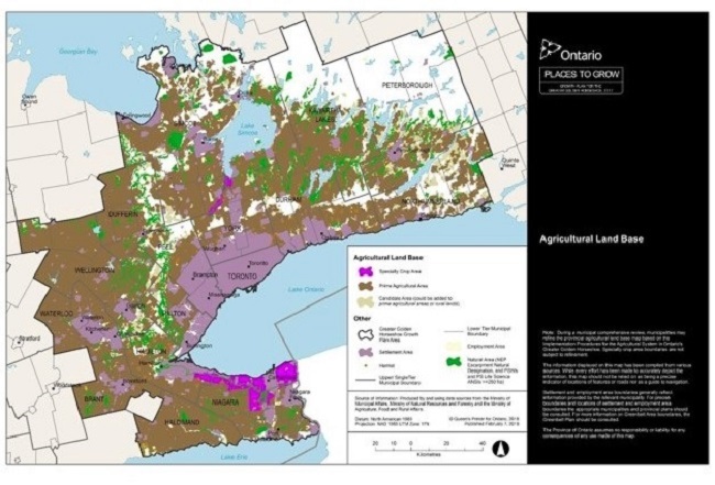
Implementation in the Greater Golden Horseshoe
- OMAFRA identified the agricultural land base consistently across all municipalities.
- Municipalities are required to bring their official plan into conformity with the A Place to Grow: Growth Plan for the Greater Golden Horseshoe and the Greenbelt Plan by July 1, 2022, in part, by incorporating the agricultural land base into their official plan.
- OMAFRA is inviting municipalities to come forward with refinements to their agricultural land base mapping.
- See details in the Implementation Procedures for the Agricultural System in Ontario's Greater Golden Horseshoe.
- Mapping of the agricultural land base may be viewed or downloaded from the Ontario GeoHub and the Agricultural System Portal.
Implementation outside the Greater Golden Horseshoe
- The Provincial Policy Statement requires prime agricultural areas to be protected and designated.
- In Southwestern Ontario, it is common for all land outside of settlement areas to be designated as prime agricultural areas because all the land is of high quality for agriculture.
- In other areas with a broader mix of prime agricultural land and lower-capability land, a study may be conducted to help identify and designate lands with prime agricultural area characteristics:
- Land Evaluation and Area Review (LEAR), or
- Agricultural Land Evaluation System (ALES)
- Please contact an OMAFRA Rural Planner to determine the need for a study and the most suitable methodology, based on local conditions and available resources.
- Both LEAR and ALES studies use a combination of variables and data such as Canada Land Inventory (CLI) land capability for agriculture, current land use (agricultural and non-agricultural), and parcel fragmentation. The main difference is that LEAR uses Geographic Information System (GIS) technology to digitally analyze the data, resulting in quantitative scores for land within the study area
- Any methodology used to designate prime agricultural areas is to be applied consistently across the jurisdiction.
- Once a LEAR or ALES is complete, additional analysis is done to validate and confirm the study's outcomes. This may include:
- field verification,
- consultation between upper and lower-tier municipalities, neighbouring municipalities, and Agricultural Advisory Committees, and
- identification and consideration of the agri-food network
- Please note that LEAR and ALES analyses are to be applied across a municipality, preferably at the upper-tier municipal level. They are unsuitable for site-specific analysis (for example, site-specific official plan or zoning by-law amendments).
Updated: March 27, 2025
Published: May 25, 2022