North Spirit Lake First Nation terms of reference
Terms of reference for North Spirit Lake First Nation community-based land use planning.
Prepared by: Claudette Tookata, Arnold Thompson and Soloman Rae
North Spirit Lake First Nation
Contact Info:
Corey Rae,
Land Use Planning Coordinator
North Spirit Lake
MNRF Contact:
Mike Sanders
Far North Planner
Ontario Ministry of Natural Resources and Forestry
North Spirit Lake First Nation and the Ministry of Natural Resources and Forestry are pleased to sign the Terms of Reference for the North Spirit Lake First Nation Community Based Land Use Plan. Approvals have been provided by:
- North Spirit Lake First Nation Band Council Resolution; and
- Ontario, by the Minister of Natural Resources and Forestry administering the Far North Act, 2010.
As we begin this planning process, North Spirit Lake First Nation and the Ministry of Natural Resources affirm our commitment to work together with mutual respect and in good faith.
On behalf of North Spirit Lake First Nation
Chief Caroline Keesick
North Spirit Lake First Nation
January 17, 2018

On behalf of Ontario
Honourable Nathalie Des Rosiers
Minister of Natural Resources and Forestry
January 29, 2018
Acknowledgments
This document was created through great teamwork. The planning team would like to acknowledge the valued participation of the Maymayquayshwak and the Elders of North Spirit Lake First Nation. Their willingness to share their knowledge and visions has helped our team understand the challenges and value of planning for the future of those who are a part of this land.
This document could not have been created without the financial and technical support of the Keewaytinook Okimakanak Tribal Council, the Ontario Ministry of Natural Resources and Forestry, Dan Duckert at the Faculty of Natural Resources Management at Lakehead University and Gail Murray at Ed Hoshizaki Development Consulting.
The Maymayquayshwak and the planning team would especially like to extend a heart-felt thank you to Joe Kakegamic for starting this project on the path of success. We dedicate this document to him. His leadership and vision provided our focus to ensure, that to the best of our abilities, planning activities will keep the Maymayquayshwak and all their relations at the forefront of development.
1. Introduction
North Spirit Lake First Nation (NSLFN) is working with the Province of Ontario, represented by the Ontario Ministry of Natural Resources and Forestry (OMNRF) to develop a Community Based Land Use Plan (CBLUP). North Spirit Lake First Nation believes that sharing the land means respecting the land and honouring the traditional knowledge of its original inhabitants in all future land use and potential economic development.
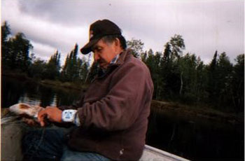
The people of North Spirit Lake First Nation call themselves the Maymayquayshwak. The name Maymayquayshwak (cliff-dweller) is derived from legendary beings which lived in the area around North Spirit Lake who had mystical powers. They were here before the people and lived in the cliffs on the lakes in the territory. They are closely tied with fishing. This is how the people identify themselves, as a fishing community and as a group who are dependent on the land and know how to survive on the land. Survival comes through the powers people have; the powers of knowledge and will. The vision, will and hope of the people is that this land use plan can help regain and build these powers so North Spirit Lake can become an independent and self-determining nation.

Since 2012, North Spirit Lake First Nation has been involved in gathering information about its peoples’ relationships to the land and how these relationships have allowed the Maymayquayshwak to live life well. The information is vital to develop a vision that will allow their community to prosper in the future. The Maymayquayshwak desire to stay connected to the land and they believe the land use plan should accomplish this goal. The plan will empower the people to work with Ontario, interested parties, stakeholders and adjacent communities in a respectful and equal relationship. The Terms of Reference identifies an Area of Interest for Planning and directs the preparation of a Community Based Land Use Plan for the area. Planning will be led by Maymayquayshwak working together with OMNRF through a joint planning team, which is comprised of NSLFN and OMNRF representatives.
It is the intent of the planning team to prepare a land use plan that can clearly communicate guiding principles and future land use direction in the planning area of interest. This Terms of Reference document is written with the expectations that the land use plan will provide one means of improving the well-being of all humans and non-humans who interact and share the Maymayquayshoo Saagheguning (North Spirit Lake) territories.
2. Background
North Spirit Lake First Nation is an Oji-Cree Community in Ontario’s Far North, or the Ni da tak keem nahm (our land) as it is known by the Maymayquayshwak. NSLFN is accessible by driving 220 kilometres on the ice road north of Red Lake, Ontario. For most of the year, it is only accessible by air. The total registered population is 494 band members with approximately 300 people on reserve. North Spirit Lake First Nation is a signatory to Treaty 5.
The First Nation and Area of Interest for Planning is located in Treaty 5 and Treaty 9. Maymayquayshwak exercise Aboriginal and Treaty Rights throughout the Area of Interest for Planning, as well as within their broader, self-described traditional territory, situated within both Treaty 5 and 9. North Spirit Lake First Nation is one of six member communities of Keewaytinook Okimakanak Tribal Council (KO). Current economic pursuits are hunting, fishing, trapping, firewood collection and trade, resource-based tourism, employment in various community service areas and involvement in the mineral exploration and economic development fields.
NSLFN has had recognized reserve status since 1985. However, the Maymayquayshwak have been here since time immemorial, creating a natural and cultural landscape for their future generations. The Maymayquayshwak feel deeply responsible for protecting their homeland through traditional activities and customs. The landscape of North Spirit Lake was created and kept through these activities and the customs are the mechanisms that teach people how to be successful in living with the land.
There is an abundance of physical and spiritual evidence that demonstrate that the Maymayquayshwak have been part of, and shaped, this land. These heritage values need to be preserved because they tell the story of who the Maymayquayshwak are. Maymayquayshwak future generations will rely on this evidence so they are able to understand their past and shape their future in a continued relationship to the land. In essence, the Maymayquayshwak are part of the land, not managers (in a western sense) of it. Their customs and traditions manage their own actions and responsibilities to keep their connection to the land.
NSLFN wishes to develop and maintain lasting and positive relationships with Ontario, all interested parties and stakeholders by involving them in the Maymayquayshwak ways of seeing the land so they may respect the traditional ways and be part of creating a future for all our people. In that way we can all share the responsibility to the land that we all desire to sustain and protect.
3. Purpose of land use planning
Maymayquayshwak vision
The future generations of the Maymayquayshwak will be strong, healthy and respectful to the territory of Maymayquayshoo Saagheguning. They will know their language and the knowledge of the land that created this language. The Maymayquayshwak culture will grow with a respect for traditional knowledge and new technologies that are available. The future people will develop skills through life-long learning in a way that will connect them to Mother Earth, keep the land as their respected home and enable sustainable prosperity for the Maymayquayshwak.
The Community Based Land Use Plan will be designed as one means to achieve this vision. The plan will focus on re-invigorating the relationship with the land that all Maymayquayshwak once had. This will be a process of reconciliation between the Maymayquayshwak and the land by encouraging future Maymayquayshwak to be active participants in land-based activities. The plan will also build on positive relations between the Maymayquayshwak and others who are new to the territory and unfamiliar with the customs of the original inhabitants. The Maymayquayshwak people have strongly stated that it is the Maymayquayshwak inherent right to lead development with respectful partnerships in the Maymayquayshoo Saagheguning territory. NSLFN and Ontario intend to prepare a Community Based Land Use Plan that identifies economic development opportunities that can benefit NSLFN and Ontario.
The purpose of this land use plan is to: a) create an awareness of the value of traditional knowledge; b) to understand how its practice keeps this land in balance; and c) keep all that use and are a part of the land, healthy, growing and thriving. The plan will focus on designating land use areas that are strategically placed on the landscape to promote the opportunities and freedoms of the Maymayquayshwak to live a life they value.
According to Anishininiwug worldviews, relationships are the key to living life well and being well. The CBLUP will promote good relationships between the Maymayquayshwak and the land so as to keep people connected and knowledgeable about the land. The plan will also invite other stakeholders and partners to work with the Maymayquayshwak in equal and respectful relationships to benefit from the gifts the land can provide, but also working under customary stewardship guidance from the Maymayquayshwak Elders and users of the land.
The Maymayquayshwak are interested in understanding, learning and developing new technology and science and applying this new knowledge in a way that complements traditional ethical and moral actions on the land. This Community Based Land Use Plan can be more than a plan about the physical, geographic land use and its natural resources; it should be a plan about land in a holistic sense (Aki) that builds relationships and facilitates learning together. It recognizes humans and their capabilities that work within the natural laws of Aki as a valuable natural resource.
The interests of Maymayquayshwak are compatible with those of Ontario and the Far North Act, 2010, provided the community based land use planning processes respect the Maymayquayshwak having a lead role in decision making. This plan is to facilitate the formation of a planning team, see Figure 3, which includes both the Maymayquayshwak and the OMNRF. A consensus-based decision-making approach between NSLFN and OMNRF will be used to prepare the land use plan. This approach will be used to ensure the First Nation and Ontario are in agreement with each step being taken in planning as it moves along.
The Far North Act, 2010 objectives for land use planning are:
- a significant role for First Nations in the planning
- the protection of areas of cultural value and protection of ecological systems by including at least 225,000 square kilometres of the Far North in an interconnected network of protected areas designated in community based land use plans
- the maintenance of biological diversity, ecological processes and ecological functions, including the storage and sequestration of carbon in the Far North
- enabling sustainable economic development that benefits the First Nations
The Maymayquayshwak feel these objectives will be met if planning were to:
- recognize and promote First Nations’ views in the planning
- protect traditional cultural landscapes and social-ecological systems in the Far North
- maintain and promote diversity (biological and social), social-ecological processes and the well-being of all entities in the Far North
- enable customary use that allows all Anishininiwug to share the land respectfully and benefit from the gifts it has to offer in order to live a life they value
The objectives of both NSLFN and the Far North Act, 2010 will be taken into account in the preparation of these Terms of Reference and will be taken into account in the preparation of the land use plan.
4. Guiding principles
- Acknowledgement of Aboriginal and Treaty rights, community interests, and the interests of all others in use of the land.
- Planning is focused on promoting good relationships between people and this land.
- Planning will consider, promote and continue the development of traditional knowledge throughout the implementation of the plan – “seeing, doing and learning”.
- The Oji-Cree language will be promoted and applied where possible in planning so future generations can understand and keep their relations to the land.
- Planning will be guided by Elders and users of the land.
- The planning team will sustain meaningful dialogue with the Maymayquayshwak and their neighbouring communities.
- Decisions are made by consensus in the community.
5. Expected outcomes of planning
- Documenting the people’s knowledge of the land through family mapping and creating a GIS database.
- Re-affirming and documenting the Maymayquayshwak’s relationship to the land, what it means, and how it is communicated.
- Interviewing Elders and users of the land to provide guidance to the plan’s vision, goals and objectives.
- Identifying and describing current land uses.
- Documenting hopes and desires for our future generations’ connection to the land.
- Assembling all relevant information about the land and how it is used in a Geographic Information Systems database.
- Conducting community meetings to gain input throughout the planning processes.
- Planning team meetings to communicate expectations of OMNRF and North Spirit Lake.
- Engaging regularly with Chief and Council.
- Continually updating the GIS database of all relevant land features and uses.
6. Expected outcomes of the plan
- Mutually respectful relationships with all interest groups (i.e. neighbouring communities, tourist outfitters, exploration and mining, energy sector, communications and hydro transmission interests) in the planning area.
- Improved relationships between the Maymayquayshwak and Ontario in making decisions with respect to land use activities.
- Clearer direction for other interest groups in how to engage the Maymayquayshwak about their proposed activities in the planning area.
- Protection of nipih (waterways) and the integrity of the cultural value of nipih
- Security for the Maymayquayshwak’s view, language and spiritual beliefs.
- Identification of land use areas and categories within the Area of Interest for Planning.
- Direction on land use activities within each land use category.
The outcomes will provide more opportunities and freedoms for the people who share this land.
7. Land use categories
It is understood that land use planning in the Far North has been based on three general land use areas: Dedicated Protected Area; Enhanced Management Area; and General Use Area. However, these land use areas may create hard boundaries that are not part of the Maymayquayshwak traditional view of land use. It is understood that the Far North Land Use Strategy (FNLUS) can offer guidance on categories of land use areas. As planning continues, the planning team will take the guidance of FNLUS into account as it exists during the preparation of the draft and final plan, as well as explore new, innovative categories, such as transition zones or family zones.
8. Scope of planning
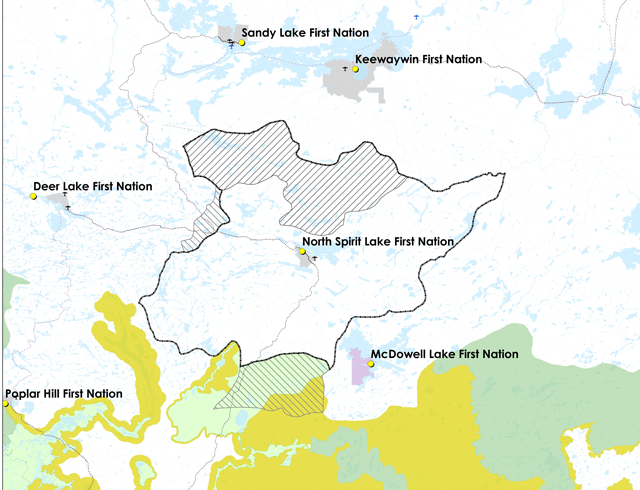
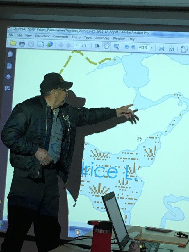
North Spirit Lake First Nation’s Area of Interest for Planning is shown in Figure 1 below. The Area of Interest is 439,202 hectares in size and is located:
- East of Deer Lake and the Proposed Planning Area identified in the Deer Lake Draft Community Based Land Use Plan
- West of North Caribou Lake First Nation
- Northeast of Pikangikum and the Whitefeather Forest Planning Area
- Northwest of McDowell Lake First Nation
- Southeast of Sandy Lake First Nation
- South of Keewaywin First Nation
The Area of Interest for Planning is based on four family traplines (RL121, RL141, RL158 and RL137) that are held by NSLFN band members. Areas of shared use and interest are also identified and shown in Figure 1. The Area of Interest for Planning is identified in the Terms of Reference with the following understandings.
A final Planning Area will be confirmed at the Draft Plan stage, following additional communication and dialogue with neighboring communities.
Trapline RL135, which is reflected as a Dialogue Area, is held by a Sandy Lake First Nation Band member, who originally came from North Spirit Lake. This dialogue area is also in close proximity to Keewaywin First Nation. Discussions about this area have been initiated and will continue to confirm a respectful planning approach.
The south end of trapline RL141, which is part of a NSLFN trapline, is included in the Pikangikum Community Based Land Use Plan. NSLFN is aware of the existing land use direction for the southern part of RL141 as laid out in the Whitefeather Forest Land Use Strategy. The area includes Pahngwahshahshk Ohweemushkeeg Dedicated Protected Area, which was regulated through the Provincial Parks and Conservation Reserves Act in 2011. Maymayquayshwak commercial trapping, traditional use connections and exercise of Aboriginal and Treaty Rights in the area are respected in the Whitefeather Strategy and through protected area and other planning and decision-making processes.
North Spirit Lake First Nation has confirmed an Area of Shared Use and Interest within the proposed Deer Lake Planning Area, encompassing an area to the east of Kennedy and Kember Lakes, including Loree, Pakeagama and Mechita Lake areas. North Spirit Lake First Nation people use the area for a variety of traditional activities, for example, hunting, fishing, harvesting resources and trapping for subsistence. Deer Lake First Nation and North Spirit Lake First Nation have a customary understanding of the area; both communities have and will continue to use the area for traditional activities and do so with respect for one another. Deer Lake and NSLFN maintain a commitment to continue a dialogue with respect to future decision-making in the area.
Figure 1: North Spirit Lake First Nation Area of Interest for Planning, with Areas of Shared Use and Interest, a Dialogue Area, and land use designations for neighbouring completed plans
9. Planning subjects
The planning subjects below were derived through engagement with the Maymayquayshwak people and Elders, and through various texts available through the OMNRF stating their priorities and objectives.
9.1. Knowing the past and using traditional knowledge
Knowledge of the historical use and meaning of the land is important for the Maymayquayshwak’s ability to protect the land. The land use plan should not only protect areas of traditional use and meaning (e.g. burial sites), but promote and apply the knowledge of the Maymayquayshwak Elders to all categories of land use in the Area of Interest for Planning.
9.2. Cultural development and adaptation
Sustaining the well-being of the people and the land means the continued use of the land by the Maymayquayshwak. The land of Ni da tak keem nahm is in constant change through natural and human-caused disturbances. Being part of a connected network of beings on the land, the Maymayquayshwak are an adaptable people and can know and understand the changes on the land and adapt their practices in order to keep the people and land healthy. The design of land use areas in the CBLUP will promote learning and the development of a worldview and culture that respects the land and the sustainability of life on the land.
9.3. Water
9.3.1. Nipih (open bodies of water)
The Maymayquayshwak are nipih people. Their resources and lifestyle revolve around the seasonal flow and changes to water. The protection of water quality and quantity are vital to maintain the use of water for: a) the health of the people and the land; b) continuing the practice of Aboriginal and Treaty rights (hunting, fishing, gathering, ceremony, etc.) and; c) transportation (both waterways and ice road). Waterway connections and flow will have a great influence on land use designation patterns in the planning area of interest. Stewardship and protection of water will be a high priority in planning.
9.3.2. Muskeg (wetlands and ground water)
Both the Maymayquayshwak and the OMNRF understand the ecological importance of wetlands. The protection of wetland functions is vitally important for the well-being of the land. Wetlands are also an important source for gathering medicines and other non-timber forest products. The CBLUP will consider the function and connections of wetlands and groundwater when designating land use areas and prescribing activities in those lands.
9.3.3. Nanaowayhe Shorelines (riparian zones)
Most of the evidence of the Maymayquayshwak’s historical use and occupancy of the land can be found along the shorelines of the lakes and rivers of the planning area of interest. Also the importance of Nanaowayhe for maintaining the ecological integrity of nipih and for providing habitat for a diversity of animals and plants is understood. Land use designations will ensure the preservation of the structure and function (both social and ecological importance) of Nanaowayhe.
9.4. Traditional medicines
Traditional medicines are collected and made by those who know. The NSLFN planning team will include traditional medicines in the information-gathering process. The passing down of traditional knowledge related to traditional medicine will be up to the Elders and will be supported as a goal of the NSLFN Lands Office for continuing traditional practices. The knowledge of the locations of the medicines will be kept with the NSLFN Lands Office.
9.5. Moose
Not only is moose is a staple food supply for the Maymayquayshwak, but it is a culturally significant being. Moose hunting activities and the associated sharing of stories and bounty throughout the community bond the Maymayquayshwak to each other and their past and future generations. Access to traditional moose hunting opportunities is of the utmost importance to this plan. Planning will consider the protection of moose habitat in all land use areas.
9.6. Species at risk
Through planning, the planning team will consider species at risk and their habitats, such as adtik - woodland caribou and geengohongay - wolverine. The Maymayquayshwak have always cared for the land. They see and know the changes in the land. They are healthy when the land is healthy. Species at risk will be considered through planning in a meaningful way and in coordination with the Maymayquayshwak to benefit everyone in Ontario.
9.7. Infrastructure development
9.7.1. Roads
Planning will respect existing road corridors, such as the current winter road network. Land use designations and plan direction will be developed with considerations for future potential road developments for North Spirit Lake First Nation and neighboring communities, in a manner appropriate to the social and ecological objectives of the plan.
9.7.2. Hydro transmission
Planning will consider potential hydro transmission corridor routing through land use designations and directions that respect the community and neighboring needs and regional initiatives.
9.8. Economic activities
9.8.1. Tourism
The Maymayquayshwak have had a long relationship with the family that runs North Spirit Lake Lodge. The lodge was established in the 1970s. Members of the community helped to build and maintain the lodge and have been hired as guides. North Spirit Lake First Nation would like to keep this relationship and will consider the needs of North Spirit Lake Lodge in their land use planning process.
As planning proceeds, other tourism opportunities may be identified where community members may be able to establish an entrepreneurial venture.
9.8.2. Community forestry
The Maymayquayshwak and OMNRF will work together to explore the forest potential and NSLFN interests in community-based forest management within the Area of Interest for Planning. A community forest managed under customary stewardship principles and guidance from the Elders, land users and forestry professionals, could provide sustainable opportunities and benefits for the Maymayquayshwak.
9.8.3. Renewable energy
NSLFN and OMNRF will review information on renewable energy potential in the Area of Interest for Planning and renewable energy opportunities will be identified in the plan.
Energy generation fueled by harvesting wood products is another potential opportunity to make NSLFN more energy independent. The planning team is aware that other First Nations are planning or considering this in their CBLUPs. This potential will be carefully considered in the planning process as the Maymayquayshwak learn more about the scope of operations, and can evaluate the success of other First Nation case studies.
9.8.4. Non-timber forest products
There are a number of traditional areas that have been identified for the collection of non-timber forest products. Most are berries and traditional medicines. Sustaining these opportunities will be stressed in the CBLUP.
9.8.5. Geoscience and the mineral sector
North Spirit Lake First Nation is aware of the existing mining lands (i.e., claims, leases, and patents) in their planning area of interest, and the present exploration work in an area of shared interest with Deer Lake First Nation. The Maymayquayshwak will consider the designated land use direction for these areas. Continued dialogue with mining interests and visits to the mining work sites will help bring a greater awareness of the benefits to and impacts of mining on the people and the land.
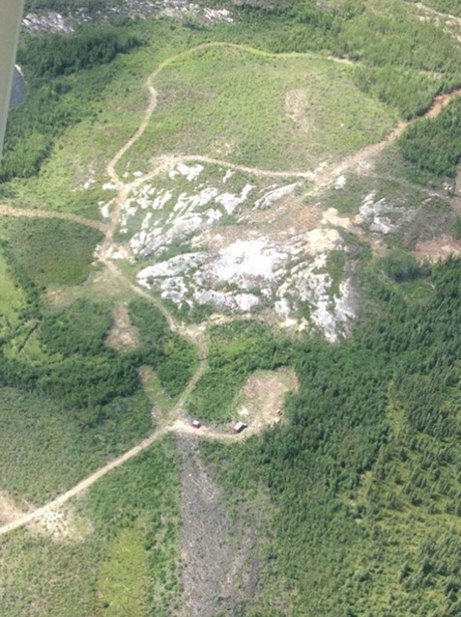
The CBLUP process will support review of geoscience information including surficial geology (e.g., landforms, aggregate resources), and mineral potential and existing interests (e.g., claims) within the planning area of interest. Maymayquayshwak and Ontario will build consensus on areas where mineral exploration and development may be supported and areas where it is excluded.
9.8.6. Other resource uses
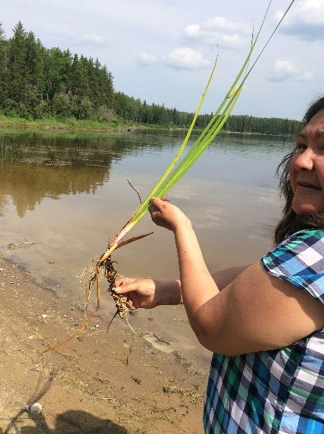
NSLFN and OMNRF will explore the potential for other economic opportunities, such as commercial fishing and wild rice harvesting in the area of interest for planning. Through planning, the community and MNRF will also work together to continue a tradition of commercial trapping by community members.
9.9. Protected areas
As stipulated in the Far North Act, 2010 and as part of the OMNRF’s and Maymayquayshwak’s interests, areas will be considered for interconnected areas of protection from certain natural resource extraction, and infrastructure developments. These areas will protect the ecological integrity of the land created by the Maymayquayshwak’s traditional land use. Aboriginal and Treaty rights will be respected and tourism and recreation approaches will be considered. At least one or more protected areas will be identified.
9.10. Climate change
NSLFN and OMNRF will work together to share information and knowledge on climate change and opportunities for climate change mitigation and adaptation that contribute to the future well-being of the community and Ontario. Opportunities for adaptation may include exploring options for winter and all-season road alignments. Maymayquayshwak will bring forward knowledge of changes in animal, plant and bird species. Planning will consider direction for areas that serve as carbon sinks (e.g. muskeg, peatlands).
10. Planning process
In 2012, North Spirit Lake First Nation Chief and Council submitted a letter to OMNRF expressing their interest in proceeding with community based land use planning. Since that time the planning team has been collecting land information and attending meetings and training to help understand and formulate a way forward in planning.
Based on the above activities and looking forward as to why NSLFN would want a plan, the planning team believes a CBLUP is not worth the paper it is written on unless the plan can be implemented. Throughout the planning process, implementation will be at the forefront of the discussions. “Can we actually accomplish the objectives of the plan given the people, resources and the regulating policies that exist today?” The capacity for both planning partners (NSLFN and OMNRF) to understand each other’s views of land use and the abilities of each to work toward a consensus of planning direction will require consistent and respectful dialogue and learning.
Both long-term visions and shorter-term objectives will be incorporated into the CBLUP. As the paths to meeting objectives are monitored, the plan will need to be reviewed and possibly amended to a) apply any new knowledge about the land or; b) to reconsider other, or changing, objectives due to a changing physical and social environment. Timelines for review and amendment will be established in the Draft Plan Phase.
The plan preparation process and timelines are shown below in Figure 2. These timelines are dependent on both human and fiscal resources available to North Spirit Lake First Nation that will allow them to work effectively through the planning process. Each stage of the process and a preliminary work schedule are presented below.
Figure 2: Planning stages and timelines for the North Spirit Lake CBLUP

10.1. Preparing for the plan
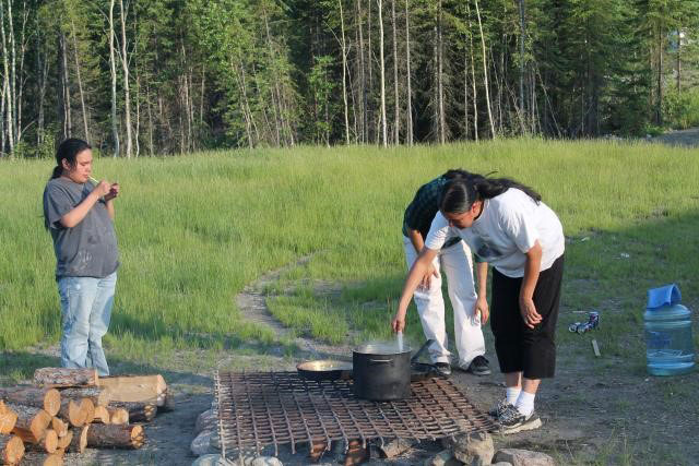
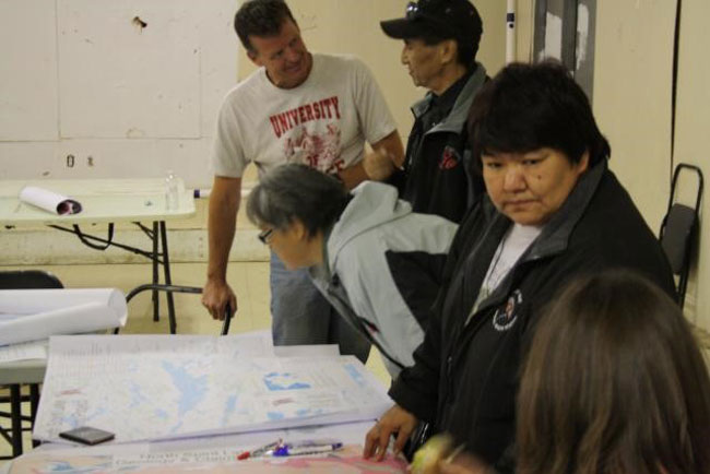
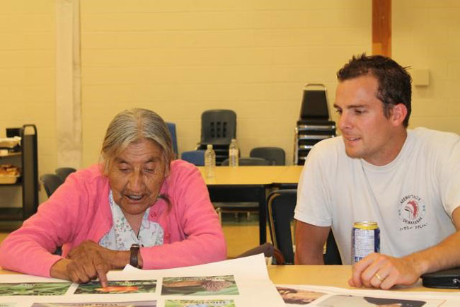
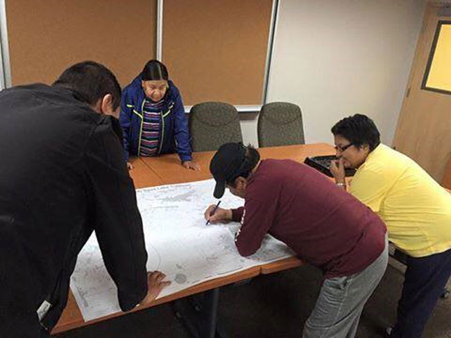
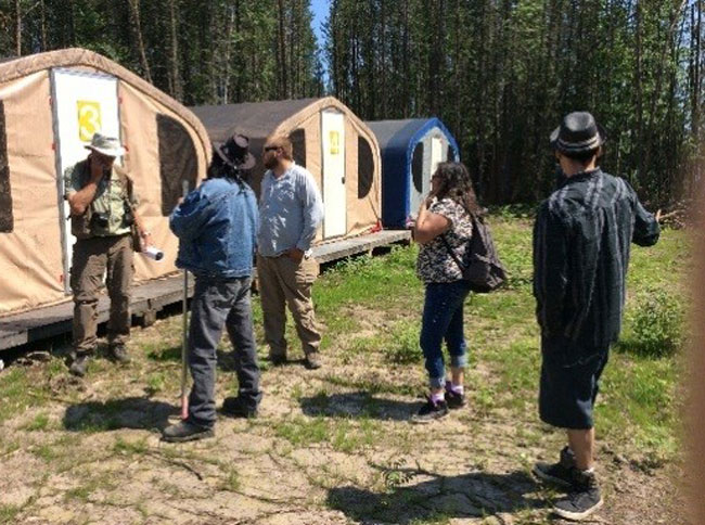
Much of the work involved in this stage was gathering information about the land from the Maymayquayshwak and OMNRF. In the community of North Spirit Lake, family mapping exercises were held where important natural and cultural areas, values, sites and features were identified, and the stories of those places were documented. These points were entered into a community-owned geographic information system database. The place-based stories provided the context of “place”, or a sense of belonging to the land, that is vital to the Maymayquayshwak spirit and way of life. Community meetings provide an opportunity to talk about community based land use planning and get more insight about the relationship between people and the land. The Area of Interest for Planning was also discussed and defined.
There have been several regular meetings and workshops where NSLFN learned and shared with neighboring KO communities regarding their respective community based land use planning processes.
10.2. Terms of Reference
The Terms of Reference, as prepared by the NSLFN-OMNRF joint planning team, lays out an agreed upon process for Maymayquayshwak to lead the preparation of a CBLUP working with Ontario. It guides future planning activities and provides direction to the planning team. It was imperative that the Maymayquayshwak were consulted. Interviews and conversations with the people provided most of the context for this document. Other activities include: a) community meetings about the planning process and activities happening on the land; b) visits with other communities and their planning teams; and c) engagement with the mineral sector and tour of a mineral exploration site.
The Terms of Reference document will be shared through information centres and be posted on Ontario’s Environmental Registry. It will also be available on the OMNRF Far North website after it is approved.
10.3. Begin planning
After the Terms of Reference is approved, the planning team will begin to assemble all relevant information for planning, explore the various planning subjects and identify land use areas and direction within the Area of Interest for Planning. The planning team will seek advisory group and technical support group input and assistance in the process. Maymayquayshwak community involvement will be essential throughout the course of CBLUP development.
10.4. Draft plan
The joint planning team will prepare the Draft Plan. When ready, NSLFN and OMNRF will jointly endorse the Draft CBLUP and share the document for the second public consultation opportunity, including information centres and posting on the Environmental Registry.
10.5. Final plan
After reviewing and considering all input and comments received at Draft Plan stage, Maymayquayshwak and OMNRF will work through the planning team to prepare a Final Plan for approval by NSLFN and OMNRF. The public will be notified of the Final Plan and approval through an EBR Decision Notice.
11. Planning structure
Figure 3 illustrates the reporting and communication structure of those who will be involved in planning. The primary role of the planning team is to work together to prepare the land use plan and to prepare amendments to the plan if needed once completed. Advisors are brought to the process to share information on a variety of topics to support planning. North Spirit Lake planning team leads facilitate community involvement and community advisors contribute to the planning process at meetings, community workshops and through other events and dialogue. North Spirit Lake First Nation Chief and Council are accountable to the Maymayquayshwak, the Minister of Natural Resources and Forestry is ultimately accountable to the People of Ontario, which includes the Maymayquayshwak.
Figure 3: Structure of the North Spirit Lake First Nation Community Based Land Use Planning Team
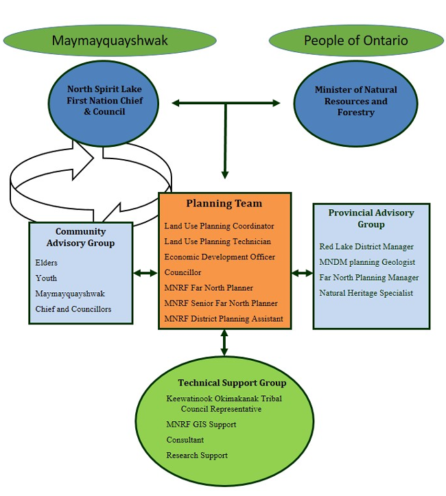
In the activities involving land use planning, the planning team is central to communication about all land use planning and implementation activities. It is the planning team’s responsibility to ensure that all parties interested in the land are aware of the broad scope of the peoples’ needs and desires regarding the land. At the same time, they must respect and understand the traditional and scientific knowledge these people hold so they may use the best available information. The planning team understands that people’s interests are varied and their knowledge of the land is deep, encompassing and sometimes contradicting. The planning team will maintain a circle of expertise from the community (Elders, trappers, guides etc.), government, other practitioners and stakeholders and technical/scientific personnel. Information and knowledge on cultural values and ecological systems will be gathered to contribute to the planning process.
12. Approval mechanisms
In order to provide a significant role for the First Nations in planning, the Terms of Reference, the planning area and the final land use plan shall be presented to the Maymayquayshwak by the NSLFN planning team and Chief and Council.
North Spirit Lake First Nation identifies requirements and authority for community approvals that stem back to:
- The needs of all people and the land, and
- The abilities of the Maymayquayshwak to embark effectively on the implementation of the plan.
The Far North Act, 2010 identifies requirements and authority for approvals, including for:
- Terms of Reference
- Planning Area
- Final Land Use Plan
Joint approvals for each of the above are required by:
- North Spirit Lake First Nation Chief and Council
- Minister of Natural Resources and Forestry
Approval of the final plan will be by First Nation Band Council Resolution and Minister’s Order under the Far North Act, 2010. Before the final plan is approved, the planning area of interest will be designated with joint endorsement by a First Nation Band Council Resolution and under the Far North Act, 2010 via Minister’s Order. A written record of all decisions will be maintained and agreed to for decisions pertaining to the land use plan.
Upon endorsement of a final land use plan, the partners will implement the direction in good faith.
13. First Nations and stakeholder involvement in planning
All interested people and organizations will be invited to engage in a dialogue on land use planning through a variety of mechanisms that include; meetings, environmental registry postings, open houses and mail outs.
The planning team will use social media and direct notification to invite community members to the open houses in Red Lake, and North Spirit Lake. The planning team will also provide notices to other First Nations and stakeholders through links on relevant local Facebook pages and websites, notices on the Environmental Registry, direct notification of stakeholders and/or other means.
Initial efforts to invite consultation with other local First Nation communities, stakeholders (tourist operators, mining claim holders), resource users (anglers, hunters, forest industry, and mineral exploration/mining industry), government, municipalities and the general public having an interest in the planning area will occur by giving direct written notice of the intent to prepare this strategic land use direction. Persons not included in the initial mailing list but who wish to become involved in the planning process will at their request have their names added to the mail out list.
Mail outs will be sent out and meetings held to provide resource values information at each phase of the planning process in order to solicit input into the land use plan.
A general Public Notice will be placed in local newspapers.
The North Spirit Lake Land Use Plan will be posted on the Environmental Registry as a policy with notice at the Terms of Reference stage, an updated notice with the Draft Plan and decision notice when the Final Plan is completed.
Notice of open houses will be mailed to all names on the mail out list at least fifteen (15) days prior to the open house. Documents that are produced through the planning exercise will be made available for public review and comment. A summary of comments will be available to the public. Open houses will be held, providing both local and regional access to the consultation opportunity.
Comments and submissions will be collected, addressing the requirements of the Far North Act, 2010, the Environmental Bill of Rights, 1993, and the Freedom of Information and Protection of Privacy Act. Ontario respects and will address its requirements for consultation with First Nations.
14. Interim measures
The intent of the Far North Act, 2010 is that community based land use plans must be completed before most major development begins. The Act does allow certain types of development to proceed in advance of a plan, provided that certain criteria are met. A development project may also be allowed to proceed if it is determined, through consensus, to be predominantly for community use or if it contributes directly to meeting community needs of the First Nation and takes into account the objectives of the Maymayquayshwak and the Act (see section 3 of this document).
For proposals that may come forward during the planning process OMNRF and North Spirit Lake expect that proper consultation will occur and that the joint planning team input would be invited to review development proposals and advise on their viability in relation to the planning process. Consultation processes may be informed by Ontario’s Duty to Consult and NSLFN’s consultation protocol.
Upon plan completion, all decisions regarding allocations, dispositions, or use must be consistent with the land use designations and permitted land uses specified in the plan and the permitted activities prescribed for the purpose of the plan (Sect 14(1) Far North Act, 2010).
15. Dispute resolution process
Disputes may occur at two levels; a) within the planning team, and b) with other First Nations and interested stakeholders. Disputes on land use planning direction that occur within the planning team will be approached through a facilitated discussion based on the principles identified in the terms of reference document (section 4 of this document). Where consensus cannot be met through these discussions, the dispute will then be bumped up to the Council member who holds the lands portfolio and OMNRF senior management. North Spirit Lake First Nation may decide that a quorum of council will be necessary for these discussions.
Disputes between the planning team and other parties can be addressed directly to North Spirit Lake First Nation Chief and Council and OMNRF District Manager, who represents Ontario. Parties bringing forward a dispute or issue shall provide it in writing along with any proposed resolution. North Spirit Lake First Nation Chief will deliberate with OMNRF District Manager, as appropriate, in an effort to reach agreement on a resolution. Disputes may be assessed according to how they address the principles in this document (section 4 of this document). The respective parties may also seek advice from North Spirit Lake Elders and community members and provincial advisory groups in reviewing the issue. North Spirit Lake First Nation Chief (or designates) and OMNRF resolution District Manager (or designates) will deliberate, as appropriate, in an effort to reach a resolution and will communicate any resolution to the planning team within 30 days.
16. Information management
Information is an important element of the Community Based Land Use Planning process.
The planning process will require consideration of all available information to help support and inform joint planning discussions while respecting and protecting Indigenous Knowledge. The community and OMNRF will outline what information will be brought forward by each party and how it will be used in the Community Based Land Use Planning process.
All community information used to support the planning process is the intellectual property of North Spirit Lake First Nation and will remain with the community unless the community deems it shareable with the Province of Ontario.
OMNRF will provide and support the planning team with their best available information and data, to be used for the purpose of Community Based Land Use Planning.
The primary source of information on current mining claims is MNDM’s CLAIMaps Internet site. This site maps all mining claims within Ontario. Use of information from this site is an essential part of the land use planning process. MNDM will also contribute relevant information about mineral exploration and development, and the uses of available geoscience data to support the land use planning initiative.
OMNRF will provide information and offer advice on landform/vegetation types, natural heritage features and areas to support ecological considerations for protected areas (e.g., representation, biodiversity, ecological functions and special features).
The planning team may invite members of the community advisory group, the provincial advisory group, or others to planning team meetings, open houses, etc. as needed to provide information or other technical support to the planning team.
In addition, the joint planning team will identify appropriate information management strategies for the information used to support the development of the CBLUP. The joint planning team will oversee communications and delegate as required, including developing and ensuring public notices are submitted as required, compiling a mailing list, initiating mailings of planning phase information, notices of meetings, and any other information deemed appropriate.
The joint planning team will ensure compliance with requirements for information under the authority of the Freedom of Information and Protection of Privacy Act, the Far North Act, 2010 and the Archives and Recordkeeping Act, 2006. Notices required for consultation purposes under the Environmental Bill of Rights, 1993 will be the primary responsibility of the OMNRF. The subjects and results of consultation will be considered by the planning team and incorporated into the planning process.
All formal input and comments received during the planning process will be documented and available as an official planning record. Copies of all formal input and comments received during the process will be provided to the joint planning team.